Hill of Cobrigdale

Hill, Mountain in Aberdeenshire

Scotland

Hill of Cobrigdale

View from a layby Towards the Bennachie range of hills
View from a layby Credit: Ralph Greig

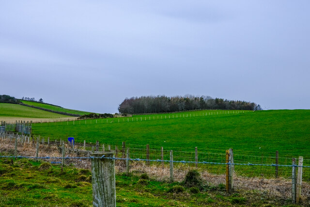
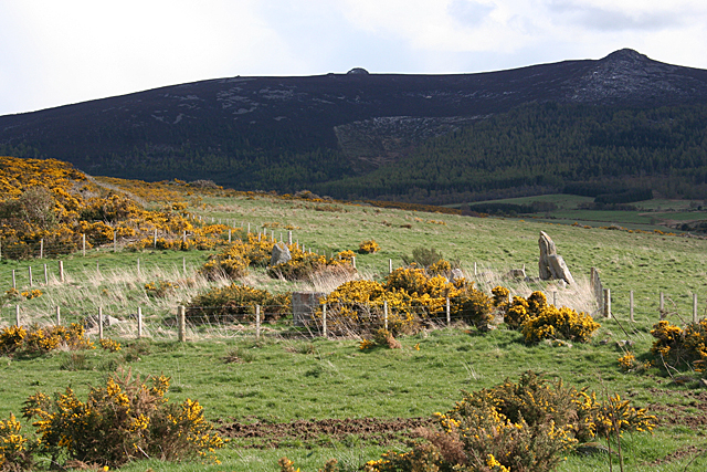
Hill of Cobrigdale is a prominent landmark located in Aberdeenshire, Scotland. It is a picturesque hill situated near the village of Rhynie, approximately 40 miles northwest of Aberdeen. Rising to an elevation of 1,600 feet, it is classified as a hill rather than a mountain.

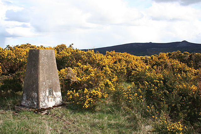
The hill is known for its distinctive shape, featuring a gently sloping southern side and a steep northern face. It is primarily composed of granite, which gives it a rugged and durable appearance. The hill is covered in heather and grass, creating a vibrant and colorful landscape, particularly during the summer months.

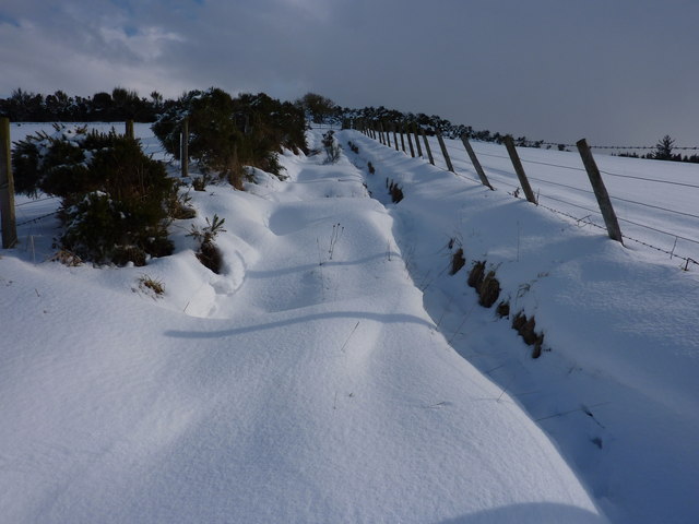
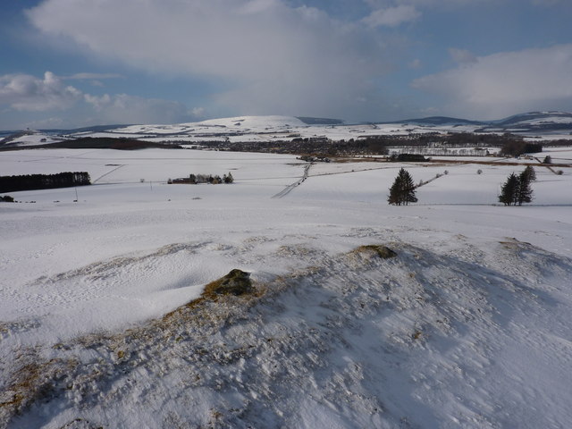
Hill of Cobrigdale offers breathtaking panoramic views of the surrounding countryside. From its summit, visitors can enjoy sweeping vistas of the rolling Aberdeenshire hills, with glimpses of distant mountains on clear days. The hill is also home to a variety of wildlife, including red deer, mountain hares, and several species of birds, making it a popular spot for nature enthusiasts and birdwatchers.

For those seeking outdoor activities, Hill of Cobrigdale provides a range of opportunities. Hiking and hillwalking are popular pursuits, with a well-established trail leading to the summit. The hill's challenging terrain and steep gradients make it a suitable destination for experienced walkers and climbers.

Overall, Hill of Cobrigdale is a captivating natural landmark that offers both scenic beauty and recreational opportunities. Its unique geological features and stunning views make it a must-visit destination for visitors to Aberdeenshire.

If you have any feedback on the listing, please let us know in the comments section below.

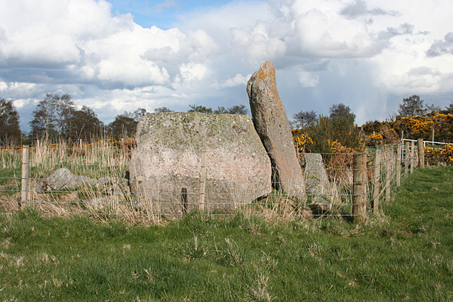
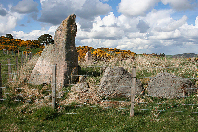
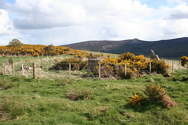
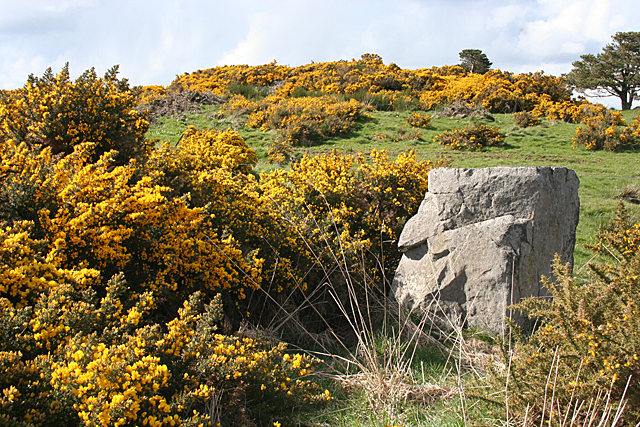
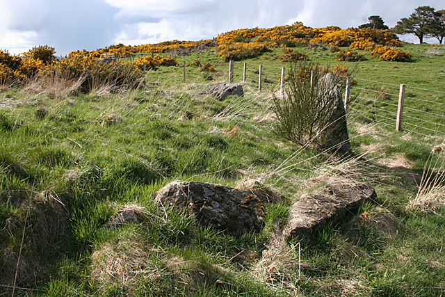
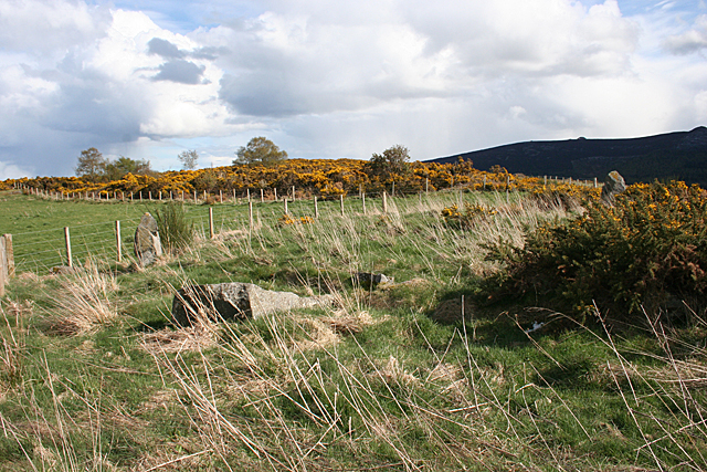
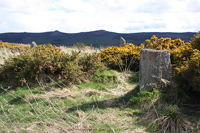
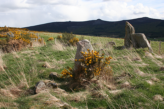
Hill of Cobrigdale Images

Images are sourced within 2km of 57.315764/-2.5780647 or Grid Reference NJ6525. Thanks to Geograph Open Source API. All images are credited.

View from a layby Towards the Bennachie range of hills
View from a layby
Towards the Bennachie range of hills
Over the fields Up towards a small wooded area from a layby
Over the fields
Up towards a small wooded area from a layby
Achreolink when still open
The village of Oyne from the slopes of Bennachie This view is from the narrow and muddy footpath that runs along the north side of the hill, parallel to the Old Aberdeen Turnpike.
The village of Oyne from the slopes of Bennachie
This view is from the narrow and muddy footpath that runs along the north side of the hill, parallel to the Old Aberdeen Turnpike.
The Iron Age Roundhouse, Archaeolink, Oyne
Looking up the snowy track And yes I carried on. To get to the top of the hill it is best to go round the back and then it is an easy hike up. You will also find a path heading straight on that takes you down to join the road at Kirkton.
Looking up the snowy track
And yes I carried on. To get to the top of the hill it is best to go round the back and then it is an easy hike up. You will also find a path heading straight on that takes you down to join the road at Kirkton.
The top of the Hill of Netherhall, 203m above sea level Nearly bare of snow, as it has blown down into the hollows. Insch in the distance. On the skyline in the extreme left is Dunnideer with its ruin.
The top of the Hill of Netherhall, 203m above sea level
Nearly bare of snow, as it has blown down into the hollows. Insch in the distance. On the skyline in the extreme left is Dunnideer with its ruin.
Hatton of Ardoyne Recumbent Stone Circle (1) The circle is in an enclosure between Candle Hill and Roup Hill. Nine of the stones survive, but they are rather hemmed in by the fence, and becoming overgrown with grass and whins. See <span class="nowrap"><a title="http://canmore.rcahms.gov.uk/en/site/18125/details/hatton+of+ardoyne/" rel="nofollow ugc noopener" href="http://canmore.rcahms.gov.uk/en/site/18125/details/hatton+of+ardoyne/">Link</a><img style="margin-left:2px;" alt="External link" title="External link - shift click to open in new window" src="https://s1.geograph.org.uk/img/external.png" width="10" height="10"/></span> for a full description. <a href="https://www.geograph.org.uk/photo/4452825">NJ6526 : Hatton of Ardoyne Recumbent Stone Circle (2)</a>
Hatton of Ardoyne Recumbent Stone Circle (1)
The circle is in an enclosure between Candle Hill and Roup Hill. Nine of the stones survive, but they are rather hemmed in by the fence, and becoming overgrown with grass and whins. See LinkExternal link for a full description. NJ6526 : Hatton of Ardoyne Recumbent Stone Circle (2)
Hatton of Ardoyne Recumbent Stone Circle (2) The recumbent and one flanker are two of the nine main stones still surviving. There are also several kerb stones, some of which are to either side of the two main stones. See <span class="nowrap"><a title="http://canmore.rcahms.gov.uk/en/site/18125/details/hatton+of+ardoyne/" rel="nofollow ugc noopener" href="http://canmore.rcahms.gov.uk/en/site/18125/details/hatton+of+ardoyne/">Link</a><img style="margin-left:2px;" alt="External link" title="External link - shift click to open in new window" src="https://s1.geograph.org.uk/img/external.png" width="10" height="10"/></span> for a full description. <a href="https://www.geograph.org.uk/photo/4452834">NJ6526 : Hatton of Ardoyne Recumbent Stone Circle (3)</a>
Hatton of Ardoyne Recumbent Stone Circle (2)
The recumbent and one flanker are two of the nine main stones still surviving. There are also several kerb stones, some of which are to either side of the two main stones. See LinkExternal link for a full description. NJ6526 : Hatton of Ardoyne Recumbent Stone Circle (3)
Hatton of Ardoyne Recumbent Stone Circle (3) On the left is the flanker, with the recumbent behind it. The stones in the foreground may be part of a kerb. One of the other stones still standing is in front of the nearest whin bushes.  See <span class="nowrap"><a title="http://canmore.rcahms.gov.uk/en/site/18125/details/hatton+of+ardoyne/" rel="nofollow ugc noopener" href="http://canmore.rcahms.gov.uk/en/site/18125/details/hatton+of+ardoyne/">Link</a><img style="margin-left:2px;" alt="External link" title="External link - shift click to open in new window" src="https://s1.geograph.org.uk/img/external.png" width="10" height="10"/></span> for a full description. <a href="https://www.geograph.org.uk/photo/4452845">NJ6526 : Hatton of Ardoyne Recumbent Stone Circle (4)</a>
Hatton of Ardoyne Recumbent Stone Circle (3)
On the left is the flanker, with the recumbent behind it. The stones in the foreground may be part of a kerb. One of the other stones still standing is in front of the nearest whin bushes. See LinkExternal link for a full description. NJ6526 : Hatton of Ardoyne Recumbent Stone Circle (4)
Hatton of Ardoyne Recumbent Stone Circle (4) Looking in from outside the circle. The tallest stone, the flanker is to the right, with the recumbent beside it. Just inside the fence is one of the other stones still standing, and further to the left is a fallen stone. The tip of another standing stone can be seen above the nearest standing stone. <a href="https://www.geograph.org.uk/photo/4452850">NJ6526 : Hatton of Ardoyne Recumbent Stone Circle (5)</a>
Hatton of Ardoyne Recumbent Stone Circle (4)
Looking in from outside the circle. The tallest stone, the flanker is to the right, with the recumbent beside it. Just inside the fence is one of the other stones still standing, and further to the left is a fallen stone. The tip of another standing stone can be seen above the nearest standing stone. NJ6526 : Hatton of Ardoyne Recumbent Stone Circle (5)
Hatton of Ardoyne Recumbent Stone Circle (5) This is the reciprocal of <a href="https://www.geograph.org.uk/photo/4452845">NJ6526 : Hatton of Ardoyne Recumbent Stone Circle (4)</a>, showing the other side of the stone nearest to the north of the circle.  See <span class="nowrap"><a title="http://canmore.rcahms.gov.uk/en/site/18125/details/hatton+of+ardoyne/" rel="nofollow ugc noopener" href="http://canmore.rcahms.gov.uk/en/site/18125/details/hatton+of+ardoyne/">Link</a><img style="margin-left:2px;" alt="External link" title="External link - shift click to open in new window" src="https://s1.geograph.org.uk/img/external.png" width="10" height="10"/></span> for a full description. <a href="https://www.geograph.org.uk/photo/4452851">NJ6626 : Hatton of Ardoyne Recumbent Stone Circle (6)</a>
Hatton of Ardoyne Recumbent Stone Circle (5)
This is the reciprocal of NJ6526 : Hatton of Ardoyne Recumbent Stone Circle (4), showing the other side of the stone nearest to the north of the circle. See LinkExternal link for a full description. NJ6626 : Hatton of Ardoyne Recumbent Stone Circle (6)
Hatton of Ardoyne Recumbent Stone Circle (6) These are the stones on the east side of the circle. One still stands but the rest have fallen over.  See <span class="nowrap"><a title="http://canmore.rcahms.gov.uk/en/site/18125/details/hatton+of+ardoyne/" rel="nofollow ugc noopener" href="http://canmore.rcahms.gov.uk/en/site/18125/details/hatton+of+ardoyne/">Link</a><img style="margin-left:2px;" alt="External link" title="External link - shift click to open in new window" src="https://s1.geograph.org.uk/img/external.png" width="10" height="10"/></span> for a full description. <a href="https://www.geograph.org.uk/photo/4452858">NJ6526 : Hatton of Ardoyne Recumbent Stone Circle (7)</a>
Hatton of Ardoyne Recumbent Stone Circle (6)
These are the stones on the east side of the circle. One still stands but the rest have fallen over. See LinkExternal link for a full description. NJ6526 : Hatton of Ardoyne Recumbent Stone Circle (7)
Hatton of Ardoyne Recumbent Stone Circle (7) The north-east arc of the circle, with one standing and at least one fallen stone. Another standing one is to the right, and the east end of Bennachie is on the skyline.  See <span class="nowrap"><a title="http://canmore.rcahms.gov.uk/en/site/18125/details/hatton+of+ardoyne/" rel="nofollow ugc noopener" href="http://canmore.rcahms.gov.uk/en/site/18125/details/hatton+of+ardoyne/">Link</a><img style="margin-left:2px;" alt="External link" title="External link - shift click to open in new window" src="https://s1.geograph.org.uk/img/external.png" width="10" height="10"/></span> for a full description. <a href="https://www.geograph.org.uk/photo/4452865">NJ6526 : Hatton of Ardoyne Recumbent Stone Circle (8)</a>
Hatton of Ardoyne Recumbent Stone Circle (7)
The north-east arc of the circle, with one standing and at least one fallen stone. Another standing one is to the right, and the east end of Bennachie is on the skyline. See LinkExternal link for a full description. NJ6526 : Hatton of Ardoyne Recumbent Stone Circle (8)
Hatton of Ardoyne Recumbent Stone Circle (8) Just to the right of <a href="https://www.geograph.org.uk/photo/4452858">NJ6526 : Hatton of Ardoyne Recumbent Stone Circle (7)</a>, with the same standing stone at the far side of the circle, the flanker to the right, and another standing stone in the foreground. Bennachie is on the skyline. <a href="https://www.geograph.org.uk/photo/4452868">NJ6526 : Hatton of Ardoyne Recumbent Stone Circle (9)</a>
Hatton of Ardoyne Recumbent Stone Circle (8)
Just to the right of NJ6526 : Hatton of Ardoyne Recumbent Stone Circle (7), with the same standing stone at the far side of the circle, the flanker to the right, and another standing stone in the foreground. Bennachie is on the skyline. NJ6526 : Hatton of Ardoyne Recumbent Stone Circle (9)
Hatton of Ardoyne Recumbent Stone Circle (9) A small standing stone is in the foreground, and a larger one on the far side of the circle is at left. The flanker and recumbent are on the right, and several kerb stones are visible in the grass. On the skyline is Bennachie.  See <span class="nowrap"><a title="http://canmore.rcahms.gov.uk/en/site/18125/details/hatton+of+ardoyne/" rel="nofollow ugc noopener" href="http://canmore.rcahms.gov.uk/en/site/18125/details/hatton+of+ardoyne/">Link</a><img style="margin-left:2px;" alt="External link" title="External link - shift click to open in new window" src="https://s1.geograph.org.uk/img/external.png" width="10" height="10"/></span> for a full description. <a href="https://www.geograph.org.uk/photo/4452873">NJ6526 : Hatton of Ardoyne Recumbent Stone Circle (10)</a>
Hatton of Ardoyne Recumbent Stone Circle (9)
A small standing stone is in the foreground, and a larger one on the far side of the circle is at left. The flanker and recumbent are on the right, and several kerb stones are visible in the grass. On the skyline is Bennachie. See LinkExternal link for a full description. NJ6526 : Hatton of Ardoyne Recumbent Stone Circle (10)
Hatton of Ardoyne Recumbent Stone Circle (10) Looking down on the circle from part way up Roup Hill. The flanker and recumbent are prominent on the right, but the rest of the stones are partly hidden by whins and other vegetation. Candle Hill is to the left and on the skyline is Bennachie.  See <span class="nowrap"><a title="http://canmore.rcahms.gov.uk/en/site/18125/details/hatton+of+ardoyne/" rel="nofollow ugc noopener" href="http://canmore.rcahms.gov.uk/en/site/18125/details/hatton+of+ardoyne/">Link</a><img style="margin-left:2px;" alt="External link" title="External link - shift click to open in new window" src="https://s1.geograph.org.uk/img/external.png" width="10" height="10"/></span> for a full description. <a href="https://www.geograph.org.uk/photo/4452821">NJ6526 : Hatton of Ardoyne Recumbent Stone Circle (1)</a>
Hatton of Ardoyne Recumbent Stone Circle (10)
Looking down on the circle from part way up Roup Hill. The flanker and recumbent are prominent on the right, but the rest of the stones are partly hidden by whins and other vegetation. Candle Hill is to the left and on the skyline is Bennachie. See LinkExternal link for a full description. NJ6526 : Hatton of Ardoyne Recumbent Stone Circle (1)
Triangulation Pillar Not quite engulfed by the whins on Roup Hill. Yet. See also <a href="https://www.geograph.org.uk/photo/4452889">NJ6526 : Bracket on Trig Point</a>.
Triangulation Pillar
Not quite engulfed by the whins on Roup Hill. Yet. See also NJ6526 : Bracket on Trig Point.
Show me another place!

Hill of Cobrigdale is located at Grid Ref: NJ6525 (Lat: 57.315764, Lng: -2.5780647)

Unitary Authority: Aberdeenshire

Police Authority: North East

What 3 Words

///finest.incorrect.creeps. Near Insch, Aberdeenshire

Nearby Locations

Hill of Cobrigdale

Related Wikis

Buchanstone railway station

Buchanstone railway station is a former railway station in Aberdeenshire. On the Great North of Scotland Railway, the station was on the north side of...

Ardoyne, Aberdeenshire

Ardoyne is a rural area near Insch in Aberdeenshire, Scotland. == References ==

Oyne

Oyne is a small village in rural Aberdeenshire at the bottom of Bennachie in Scotland. == Locality == The village has limited local resources. It once...

Oyne railway station

Oyne railway station is a former railway station serving the small village of Oyne, Aberdeenshire. == History == Oyne station was built by the Great North...

Westhall Castle

Westhall Castle, also known as Westhall House, is a country house located to the north of Oyne, in Aberdeenshire, Scotland. The house includes a 16th-century...

Bennachie

Bennachie ( ben-ə-HEE; Scottish Gaelic: Beinn na Cìche) is a range of hills in Aberdeenshire, Scotland. It has several tops, the highest of which, Oxen...

Lickleyhead Castle

Lickleyhead Castle is a well-restored L-plan castle, dating from around 1600, a little south of Auchleven, by the banks of the Gadie Burn, in Aberdeenshire...

Insch railway station

Insch railway station is a railway station serving the village of Insch, Aberdeenshire, Scotland. The station is managed by ScotRail and is on the Aberdeen...

Nearby Amenities

Located within 500m of 57.315764,-2.5780647
Power: pole
Lat/Long: 57.3181142/-2.5847359
Power: pole
Lat/Long: 57.3180101/-2.5833689
Power: pole
Lat/Long: 57.3179157/-2.582049
Power: pole
Lat/Long: 57.3178504/-2.5811728
Power: pole
Lat/Long: 57.3191131/-2.5824916
Power: pole
Lat/Long: 57.3185226/-2.5822787
The data included in this document is from www.openstreetmap.org. The data is made available under ODbL.

Have you been to Hill of Cobrigdale?

Leave your review of Hill of Cobrigdale below (or comments, questions and feedback).