Baron's Hill

Hill, Mountain in Cumberland Eden

England

Baron's Hill

Grazing land near Kirkland Grazing land near Kirkland, the track leads to Cross Fell.
Grazing land near Kirkland Credit: Colin Kinnear

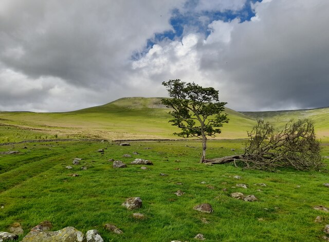
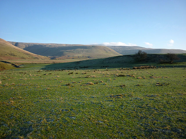
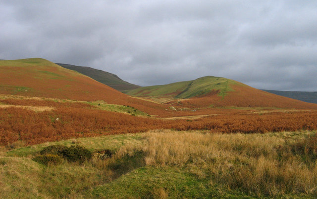
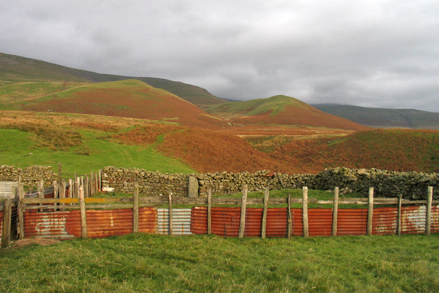
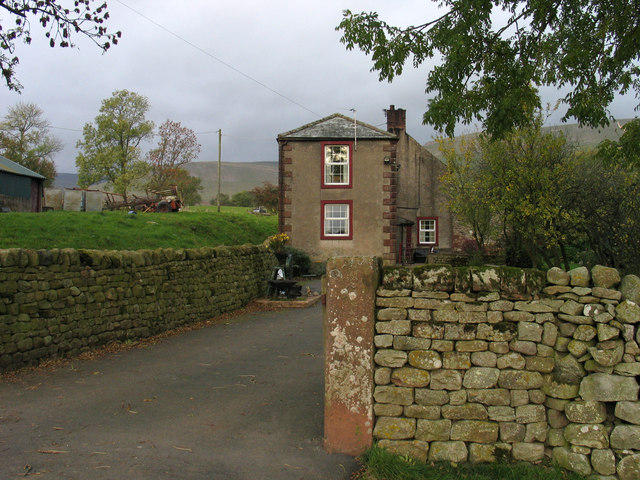
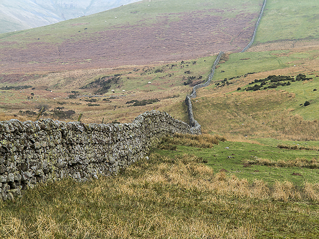
Baron's Hill is a prominent geographical feature located in Cumberland, a historic county in northwest England. Rising majestically on the border of the Lake District National Park, it is classified as a hill due to its elevation of approximately 1,320 feet (402 meters) above sea level. Often referred to as Baron's Mountain due to its commanding presence, it offers breathtaking panoramic views of the surrounding countryside.

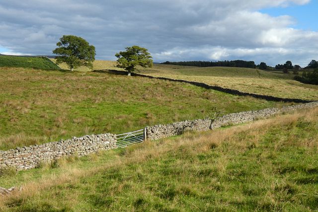
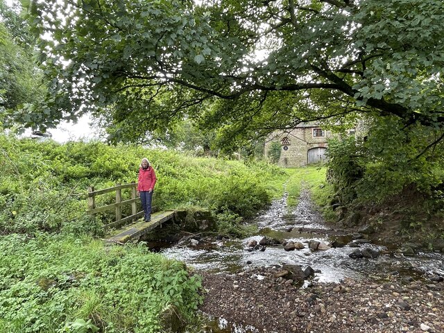
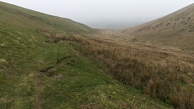
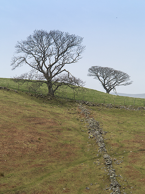
Situated in a remote and pristine area, Baron's Hill is a popular destination for hikers, nature enthusiasts, and photographers. Its distinctive shape, characterized by steep slopes and rugged terrain, adds to its allure and makes it an appealing challenge for adventurous climbers.

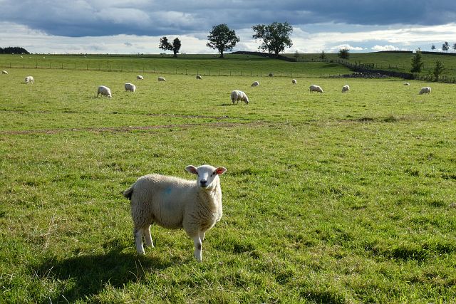
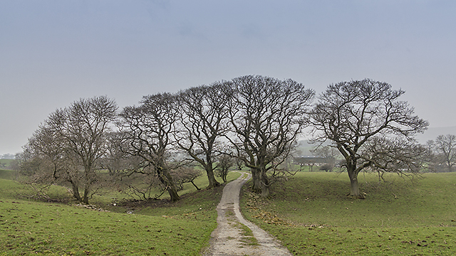
The hill is covered in dense vegetation, including heather, grasses, and scattered trees, which provide a habitat for various wildlife species. Rare birds such as peregrine falcons and golden eagles have been spotted in the area, making it a haven for birdwatchers. Additionally, the hill is home to several species of small mammals, including rabbits and hares.

Baron's Hill boasts a rich history, with evidence of human habitation dating back thousands of years. Archaeological finds, including ancient tools and artifacts, have been discovered on its slopes, offering insights into the lives of early settlers in the region.

Overall, Baron's Hill in Cumberland is a captivating natural landmark that combines stunning landscapes, diverse wildlife, and intriguing historical significance. Whether exploring its challenging trails, admiring the vistas, or uncovering its past, visitors to Baron's Hill are guaranteed an unforgettable experience in the heart of England's picturesque countryside.

If you have any feedback on the listing, please let us know in the comments section below.
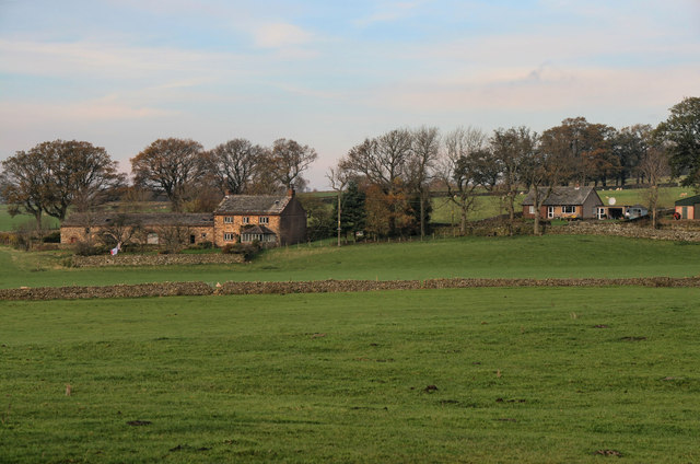
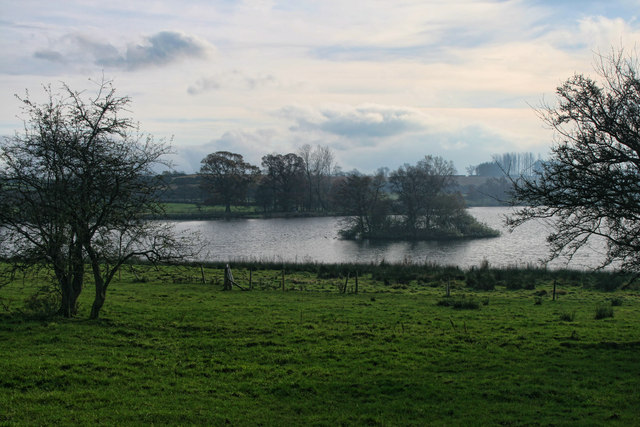
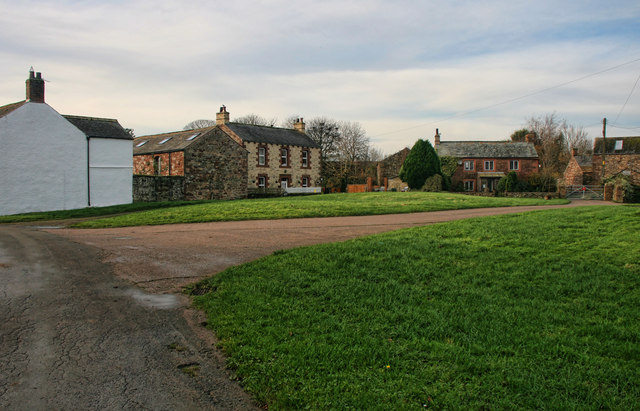
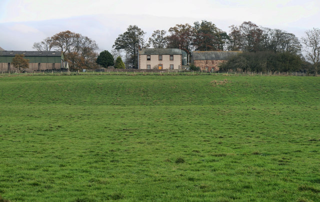
Baron's Hill Images

Images are sourced within 2km of 54.683852/-2.54031 or Grid Reference NY6532. Thanks to Geograph Open Source API. All images are credited.

Grazing land near Kirkland Grazing land near Kirkland, the track leads to Cross Fell.
Grazing land near Kirkland
Grazing land near Kirkland, the track leads to Cross Fell.
Pasture, Culgaith Sheep beside the bridleway between Blencarn and Wythwaite.
Pasture, Culgaith
Sheep beside the bridleway between Blencarn and Wythwaite.
Pasture, Milburn Viewed from just outside of the access land crossed by the footpath south of Wythwaite.
Pasture, Milburn
Viewed from just outside of the access land crossed by the footpath south of Wythwaite.
Kirkland Hall Ford This ford is found beside Beck Cottage at Kirkland.
Kirkland Hall Ford
This ford is found beside Beck Cottage at Kirkland.
The Flosh House at Kirkland.
The Flosh
House at Kirkland.
Bank Wood Barn beneath Bank Wood near Kirkland.
Bank Wood
Barn beneath Bank Wood near Kirkland.
Blencarn Lake Blencarn fishing lake.
Blencarn Lake
Blencarn fishing lake.
Blencarn Houses in Blencarn village.
Blencarn
Houses in Blencarn village.
Lounthwaite Lounthwaite Farm.
Lounthwaite
Lounthwaite Farm.
Pasture above Acorn Sike Looking towards the shadowed valleys of Ardale (left) and Kirkdale in the North Pennines.
Pasture above Acorn Sike
Looking towards the shadowed valleys of Ardale (left) and Kirkdale in the North Pennines.
Valley of Littledale Beck Grumply Hill lies to the right of the valley of Littledale; the green line of the bridleway descending the hill can be seen.
Valley of Littledale Beck
Grumply Hill lies to the right of the valley of Littledale; the green line of the bridleway descending the hill can be seen.
Sheep pens at foot of Littledale Littledale is the valley descending through the centre of the image where Grumply Hill lies to the right. The main slope above is the south-western flank of Cross Fell.
Sheep pens at foot of Littledale
Littledale is the valley descending through the centre of the image where Grumply Hill lies to the right. The main slope above is the south-western flank of Cross Fell.
Baron's Hill Baron's Hill lies close to the small settlement of Kirkland at the western foot of Cross Fell.
Baron's Hill
Baron's Hill lies close to the small settlement of Kirkland at the western foot of Cross Fell.
Drystone wall near Kirkland Beck A drystone wall on the lower slopes of Wildboar Nook. Cloud and smog have blanketed much of the UK when this image was taken, limiting visibility. Land use here is predominantly agricultural.
Drystone wall near Kirkland Beck
A drystone wall on the lower slopes of Wildboar Nook. Cloud and smog have blanketed much of the UK when this image was taken, limiting visibility. Land use here is predominantly agricultural.
Path north west of Grumply Hill A path above Littledale Beck skirting the north west flank of Grumply Hill - this leads from Wythwaite to the coll between Little Dun Fell and Cross Fell.
Path north west of Grumply Hill
A path above Littledale Beck skirting the north west flank of Grumply Hill - this leads from Wythwaite to the coll between Little Dun Fell and Cross Fell.
Farmland near Kirkland A drystone wall on rough pasture near Kirkland.
Farmland near Kirkland
A drystone wall on rough pasture near Kirkland.
Path near Wythwaite A path leading from Wythwaite to Kirkland, viewed here south of the farm at Ranbeck.
Path near Wythwaite
A path leading from Wythwaite to Kirkland, viewed here south of the farm at Ranbeck.
Farmland at Littledale Rough pasture at Littledale, with the remains of last year's bracken growth much in evidence. Low cloud and smog has covered much of the UK when this image was taken, limiting visibility.
Farmland at Littledale
Rough pasture at Littledale, with the remains of last year's bracken growth much in evidence. Low cloud and smog has covered much of the UK when this image was taken, limiting visibility.
Show me another place!

Baron's Hill is located at Grid Ref: NY6532 (Lat: 54.683852, Lng: -2.54031)

Administrative County: Cumbria

District: Eden

Police Authority: Cumbria

What 3 Words

///happy.represent.pounds. Near Appleby-in-Westmorland, Cumbria

Nearby Locations

Ladypark Wood Baron's Hill

Related Wikis

Kirkland, Culgaith

Kirkland is a village in the Eden district of the English county of Cumbria. It is in the historic county of Cumberland. There is a fell called Kirkland...

Blencarn

Blencarn is a small village located in the Eden District of Cumbria, England. The village is situated at the foot of the Pennines. In Blencarn there is...

Milburn, Cumbria

Milburn is a small village and civil parish in the Eden district of Cumbria, England. It is located on the northern side of the Eden Valley, about 9 miles...

Ousby

Ousby is a village and civil parish in Eden district, in the English county of Cumbria. It is a Thankful Village, one of 52 parishes in England and Wales...

Skirwith

Skirwith is a village and former civil parish, now in the parish of Culgaith, in the Eden district, in the county of Cumbria, England. In 1931 the parish...

Skirwith Abbey

Skirwith Abbey is a country house in Skirwith, Cumbria, England. The House is a two-storey house of five by three bays, built by Thomas Addison, mason...

Cross Fell

Cross Fell is the highest mountain in the Pennines of Northern England and the highest point in England outside the Lake District. It is located in the...

Newbiggin, Kirkby Thore

Newbiggin is a village and civil parish near the larger village of Temple Sowerby, in the Eden District of the English county of Cumbria. In 2001 it had...

Nearby Amenities

Located within 500m of 54.683852,-2.54031
Ranbeck
Place: farm
Source: NPE
Lat/Long: 54.6840457/-2.5388663
Board Type: map
Information: board
Tourism: information
Lat/Long: 54.6869891/-2.5432363
Barons Hill
Ele: 220
Natural: peak
Lat/Long: 54.6838311/-2.5404828
Hanging Walls Of Mark Anthony
Archaeological Site: earthwork
Historic: archaeological_site
Website: https://historicengland.org.uk/listing/the-list/list-entry/1007135?section=official-listing
Lat/Long: 54.6831843/-2.5405861
Information: guidepost
Tourism: information
Lat/Long: 54.6869621/-2.5426708
Information: route_marker
Tourism: information
Lat/Long: 54.6850529/-2.5389687
Information: route_marker
Tourism: information
Lat/Long: 54.6840096/-2.538112
Information: route_marker
Tourism: information
Lat/Long: 54.6837648/-2.5384339
Power: pole
Lat/Long: 54.6797902/-2.5380442
Power: pole
Lat/Long: 54.6807331/-2.5392207
Power: pole
Lat/Long: 54.681487/-2.540187
Power: pole
Lat/Long: 54.682371/-2.5412722
Power: pole
Lat/Long: 54.6828928/-2.5403059
Power: pole
Lat/Long: 54.6836957/-2.5388257
Power: pole
Lat/Long: 54.6840112/-2.538316
Power: pole
Lat/Long: 54.683142/-2.5464753
Power: pole
Lat/Long: 54.6828866/-2.5447445
Power: pole
Lat/Long: 54.682587/-2.5427524
The data included in this document is from www.openstreetmap.org. The data is made available under ODbL.

Have you been to Baron's Hill?

Leave your review of Baron's Hill below (or comments, questions and feedback).