Black Fell

Hill, Mountain in Cumberland Eden

England

Black Fell

Moorland close to A686 The cloud-shadowed moorland in the foreground lies to the north of the A686 climbing to, (or descending from), Hartside Pass. The sunlit hill in the distance is Thack Moor.
Moorland close to A686 Credit: Trevor Littlewood

Black Fell is a prominent hill located in the county of Cumberland, England. Situated in the Lake District National Park, it is part of the larger Blencathra range. Standing at an elevation of 720 meters (2,362 feet), Black Fell offers breathtaking panoramic views of the surrounding landscape.

The hill is predominantly composed of slate and volcanic rocks, resulting in a rugged and rocky terrain. Its slopes are covered with grasses, heather, and bracken, creating a diverse and picturesque landscape. It is a popular destination for hikers and nature enthusiasts due to its stunning vistas and tranquil atmosphere.

Black Fell can be accessed through various hiking trails, with the most popular route starting from the village of Threlkeld. The ascent to the summit is moderate in difficulty, making it suitable for both experienced and novice hikers. Along the way, visitors are treated to stunning views of the nearby valleys, including the Keswick and St. John's in the Vale.

Once at the summit, hikers are rewarded with panoramic views that stretch as far as the eye can see. On a clear day, the Irish Sea and the Isle of Man can be seen to the west, while the majestic peaks of Skiddaw and Helvellyn dominate the eastern skyline.

In conclusion, Black Fell in Cumberland is a magnificent hill that offers visitors a chance to immerse themselves in the natural beauty of the Lake District National Park. With its striking landscape and breathtaking views, it is a must-visit destination for outdoor enthusiasts and nature lovers.

If you have any feedback on the listing, please let us know in the comments section below.
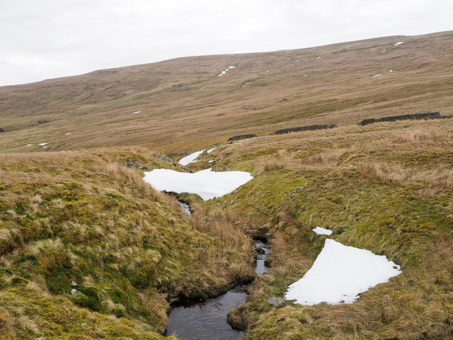
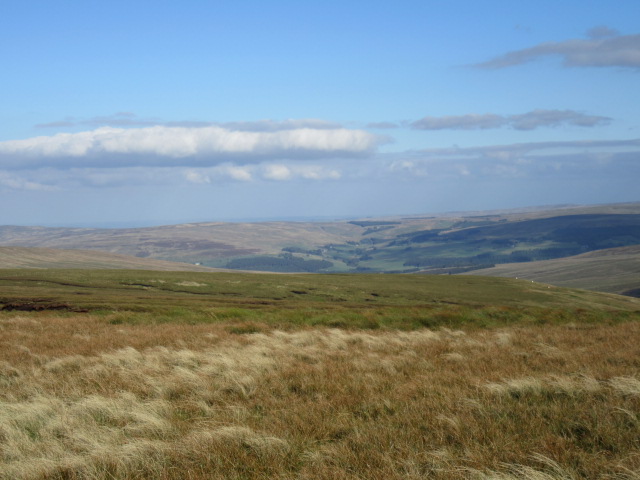
Black Fell Images

Images are sourced within 2km of 54.793318/-2.5486593 or Grid Reference NY6444. Thanks to Geograph Open Source API. All images are credited.

Moorland close to A686 The cloud-shadowed moorland in the foreground lies to the north of the A686 climbing to, (or descending from), Hartside Pass. The sunlit hill in the distance is Thack Moor.
Moorland close to A686
The cloud-shadowed moorland in the foreground lies to the north of the A686 climbing to, (or descending from), Hartside Pass. The sunlit hill in the distance is Thack Moor.
Upper reaches of Croglin Water
Fence and wall line along moorland ridge The broad ridge connects Black Fell to which it rises behind the camera location, and Watch Hill which lies in the distance occupying the left side of the image.
Changes between walling and fencing are common in the uplands and often occur frequently along a single stretch of ground. Typically, walling, being more sturdy and permanent, would be preferred but where the ground is soft and wet fencing is likely to be used as such ground would not offer the required level of stability for heavier stonework.
Fence and wall line along moorland ridge
The broad ridge connects Black Fell to which it rises behind the camera location, and Watch Hill which lies in the distance occupying the left side of the image. Changes between walling and fencing are common in the uplands and often occur frequently along a single stretch of ground. Typically, walling, being more sturdy and permanent, would be preferred but where the ground is soft and wet fencing is likely to be used as such ground would not offer the required level of stability for heavier stonework.
Snow patches along course of Longtongue Beck Longtongue Beck drains the west side of Black Fell. The rising slope in the image reaches the summits of Thack Moor and Watch Hill.
Snow patches along course of Longtongue Beck
Longtongue Beck drains the west side of Black Fell. The rising slope in the image reaches the summits of Thack Moor and Watch Hill.
Boundary Stone At Hartside Height. End of wall.
Boundary Stone
At Hartside Height. End of wall.
The head of Gilderdale, Alston The view from the northern flank of Benty Hill with trees in Coal Cleugh.
The head of Gilderdale, Alston
The view from the northern flank of Benty Hill with trees in Coal Cleugh.
Gilderdale, Alston The slopes of Scarberry Hill form the backdrop.
Gilderdale, Alston
The slopes of Scarberry Hill form the backdrop.
Moorland in Gilderdale, Alston Candlesieve Sike is seen descending in the foreground, reaching the valley of Woldgill Burn, which joins Gilderdale Burn before it reaches the South Tyne valley beyond.
Moorland in Gilderdale, Alston
Candlesieve Sike is seen descending in the foreground, reaching the valley of Woldgill Burn, which joins Gilderdale Burn before it reaches the South Tyne valley beyond.
Black Fell Looking SE.
Black Fell
Looking SE.
Deserted building on Skelling Moor in 1980 Skelling Moor is a broad rounded ridge of moorland that merges with Haresceugh Fell higher on the slope, all of that ground is north of Loo Gill. The building is un-named on OS maps at any scale. It was clearly not occupied in 1980, but then was apparently intact; recent aerial images suggest that it remains that way.
Deserted building on Skelling Moor in 1980
Skelling Moor is a broad rounded ridge of moorland that merges with Haresceugh Fell higher on the slope, all of that ground is north of Loo Gill. The building is un-named on OS maps at any scale. It was clearly not occupied in 1980, but then was apparently intact; recent aerial images suggest that it remains that way.
Deserted building in upper Gilderdale The building has been considered to have had mining associations and certainly there has been mining in Gilderdale but there are sheep pens too so a farming connection is also possible. Whatever the case, the building was deserted when it was photographed in September 1989.
Deserted building in upper Gilderdale
The building has been considered to have had mining associations and certainly there has been mining in Gilderdale but there are sheep pens too so a farming connection is also possible. Whatever the case, the building was deserted when it was photographed in September 1989.
(Former) mine shop and sheepfold by Gilderdale Burn Lead miners often lodged in these remote "shops" during the working week, returning to their smallholdings at weekends.
(Former) mine shop and sheepfold by Gilderdale Burn
Lead miners often lodged in these remote "shops" during the working week, returning to their smallholdings at weekends.
The southern slopes of Watcher's Hill
Sheep pens and ruined sheepfold by Gilderdale Burn The sheepfold can also be seen in <a href="https://www.geograph.org.uk/photo/2704637">NY6644 : (Former) mine shop and sheepfold by Gilderdale Burn</a>.
Sheep pens and ruined sheepfold by Gilderdale Burn
(Former) mine shop in upper Gilderdale
The cleugh of Stormy Sike It's just possible to see the <a href="https://www.geograph.org.uk/photo/119610">NY6644 : Sheepfold, Gilderdale</a> photographed by Andrew Smith on the left bank of the cleugh.
The cleugh of Stormy Sike
It's just possible to see the NY6644 : Sheepfold, Gilderdale photographed by Andrew Smith on the left bank of the cleugh.
Confluence of burns in Upper Gilderdale
Gilderdale Forest east of Black Fell
Show me another place!

Black Fell is located at Grid Ref: NY6444 (Lat: 54.793318, Lng: -2.5486593)

Administrative County: Cumbria

District: Eden

Police Authority: Cumbria

What 3 Words

///foreheads.friends.jokes. Near Alston, Cumbria

Nearby Locations

Black Fell

Related Wikis

Black Fell (Pennines)

Black Fell is a hill in the North Pennines, England. It is located just north of the A686 road, west of Alston and is one of the most northerly parts of...

Busk, Cumbria

Busk is a hamlet in Cumbria, England. It is located 3.7 miles (6.0 km) by road to the east of Kirkoswald. == See also == List of places in Cumbria ��2...

Renwick, Cumbria

Renwick, formerly known as Ravenwick, is a small village and former civil parish, now in the parish of Kirkoswald, in the Eden district, in the county...

Unthank, Glassonby

Unthank is a village near Gamblesby in the civil parish of Glassonby in Cumbria, England. It is first mentioned in writing as Unthanke in 1332. == See... ==

Nearby Amenities

Located within 500m of 54.793318,-2.5486593
Black Fell
Ele: 664
Natural: peak
Wikidata: Q4920758
Lat/Long: 54.7933132/-2.5486953
Man Made: survey_point
Lat/Long: 54.7933228/-2.5486935
Barrier: stile
Lat/Long: 54.7932604/-2.5488007
The data included in this document is from www.openstreetmap.org. The data is made available under ODbL.

Have you been to Black Fell?

Leave your review of Black Fell below (or comments, questions and feedback).