Hazel Hill

Hill, Mountain in Gloucestershire Forest of Dean

England

Hazel Hill

Former brewery, Mitcheldean I was very surprised to find this unexpectedly while passing through. Initially owned by the Wintle family this brewery became the largest in the Forest of Dean in the 19th century. It was acquired by Cheltenham and Hereford Breweries in 1930. After 1930 it housed the wartime base of British Acoustic Films, later Rank Precision Industries. By 1960 manufacture of Rank Xerox photocopiers led to rapid expansion but decline followed in the 1980s-1990s. The site is now a large business village with these two buildings from the original brewery on the edge of a complex with multiple large buildings.
Former brewery, Mitcheldean Credit: Chris Allen

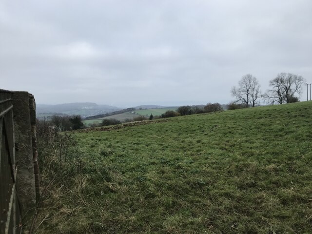
Hazel Hill is a small hill located in the county of Gloucestershire, England. Situated close to the village of Chalford, it forms part of the picturesque Cotswold Hills, renowned for their natural beauty and charming landscapes. The hill rises to a modest height of around 200 meters (656 feet) above sea level, offering visitors and locals alike stunning panoramic views of the surrounding countryside.

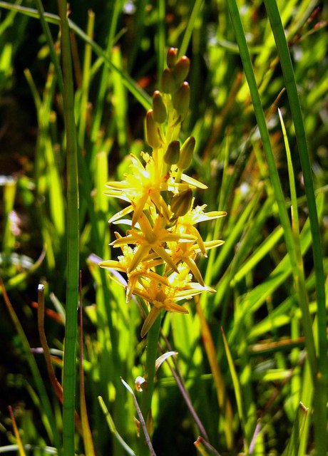
Covered in a rich tapestry of greenery, Hazel Hill is predominantly adorned with a variety of hazel trees, from which it derives its name. These trees contribute to the hill's unique character and provide a haven for wildlife, including birds, squirrels, and other small mammals.

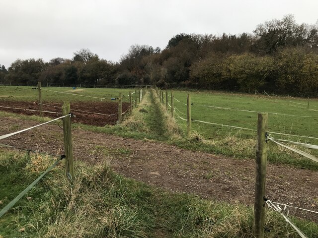
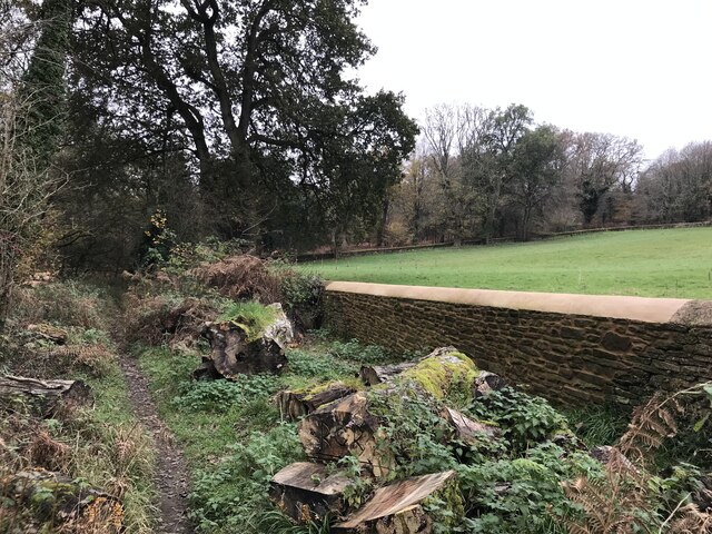
An extensive network of footpaths and trails crisscross the hill, making it a popular destination for hikers, nature enthusiasts, and those seeking peace and tranquility in a natural setting. These paths offer visitors the opportunity to explore the hill's diverse flora and fauna, as well as discover hidden gems such as ancient stone walls and remnants of historical settlements.

Hazel Hill also boasts a rich cultural heritage, with nearby villages and towns showcasing traditional Cotswold architecture and a vibrant local community. Visitors can explore charming pubs, quaint shops, and historic landmarks, immersing themselves in the region's history and traditions.

Overall, Hazel Hill is a captivating destination that combines natural beauty, outdoor activities, and a sense of history. Whether it be a leisurely stroll, an adventurous hike, or simply taking in the breathtaking views, this Gloucestershire hill offers something for everyone to enjoy.

If you have any feedback on the listing, please let us know in the comments section below.

Hazel Hill Images

Images are sourced within 2km of 51.861792/-2.5154653 or Grid Reference SO6418. Thanks to Geograph Open Source API. All images are credited.

Former brewery, Mitcheldean I was very surprised to find this unexpectedly while passing through. Initially owned by the Wintle family this brewery became the largest in the Forest of Dean in the 19th century. It was acquired by Cheltenham and Hereford Breweries in 1930. After 1930 it housed the wartime base of British Acoustic Films, later Rank Precision Industries. By 1960 manufacture of Rank Xerox photocopiers led to rapid expansion but decline followed in the 1980s-1990s. The site is now a large business village with these two buildings from the original brewery on the edge of a complex with multiple large buildings.
Former brewery, Mitcheldean
I was very surprised to find this unexpectedly while passing through. Initially owned by the Wintle family this brewery became the largest in the Forest of Dean in the 19th century. It was acquired by Cheltenham and Hereford Breweries in 1930. After 1930 it housed the wartime base of British Acoustic Films, later Rank Precision Industries. By 1960 manufacture of Rank Xerox photocopiers led to rapid expansion but decline followed in the 1980s-1990s. The site is now a large business village with these two buildings from the original brewery on the edge of a complex with multiple large buildings.
Town Hall, Mitcheldean Listed Grade II.
Town Hall, Mitcheldean
Listed Grade II.
Parish Church of St Michael and All Angels, Mitcheldean
Mitcheldean Library
Mitcheldean Library
Co-Operative food store and Post Office, Mitcheldean
Old town Hall  and The White Horse public house, Mitcheldean
Old town Hall and The White Horse public house, Mitcheldean
Former brewery, Mitcheldean I was very surprised to find this unexpectedly while passing through. Initially owned by the Wintle family this brewery became the largest in the Forest of Dean in the 19th century. It was acquired by Cheltenham and Hereford Breweries in 1930. After 1930 it housed the wartime base of British Acoustic Films, later Rank Precision Industries. By 1960 manufacture of Rank Xerox photocopiers led to rapid expansion but decline followed in the 1980s-1990s. The site is now a large business village with two buildings from the original brewery on the edge of a complex with multiple large buildings.
Former brewery, Mitcheldean
I was very surprised to find this unexpectedly while passing through. Initially owned by the Wintle family this brewery became the largest in the Forest of Dean in the 19th century. It was acquired by Cheltenham and Hereford Breweries in 1930. After 1930 it housed the wartime base of British Acoustic Films, later Rank Precision Industries. By 1960 manufacture of Rank Xerox photocopiers led to rapid expansion but decline followed in the 1980s-1990s. The site is now a large business village with two buildings from the original brewery on the edge of a complex with multiple large buildings.
Church of St Michael and All Angels, Mitcheldean A large parish church with origins stretching back to 14th century and showing subsequent changes and restorations the last being in the 19th century.
The importance of this church was recognised with Grade I listing dating all the way back to 1955 by English Heritage.
Church of St Michael and All Angels, Mitcheldean
A large parish church with origins stretching back to 14th century and showing subsequent changes and restorations the last being in the 19th century. The importance of this church was recognised with Grade I listing dating all the way back to 1955 by English Heritage.
Grassy hillside
Grassy hillside
Between paddocks
Between paddocks
Overgrown pathway
Overgrown pathway
Repaired wall
Repaired wall
Deansway Road, Mitcheldean The village housing is dominated by the former Rank Xerox buildings which are now a huge sprawling business park.
Deansway Road, Mitcheldean
The village housing is dominated by the former Rank Xerox buildings which are now a huge sprawling business park.
Carisbrooke Road, Mitcheldean Two posh new bus shelters on the edge of the village.
Carisbrooke Road, Mitcheldean
Two posh new bus shelters on the edge of the village.
Toll House, Gloucester Road A Toll House, now an extension of Forest House. At the junction of Gloucester Road, Merrin Street, New Road and Abbenhall Road. Served Huntley and Mitcheldean Turnpike Trust.
In the wall next to the lamppost is the milestone see <a href="https://www.geograph.org.uk/photo/6035328">SO6618 : Old Milestone by the A4136, Gloucester Road, Mitcheldean</a>. Gloucestershire HER Nᴼ. 5863 see <span class="nowrap"><a title="https://www.heritagegateway.org.uk/Gateway/Results_Single.aspx?uid=5863&resourceID=108" rel="nofollow ugc noopener" href="https://www.heritagegateway.org.uk/Gateway/Results_Single.aspx?uid=5863&resourceID=108">Link</a><img style="margin-left:2px;" alt="External link" title="External link - shift click to open in new window" src="https://s1.geograph.org.uk/img/external.png" width="10" height="10"/></span>

Milestone Society National ID: GL.MDE01
Toll House, Gloucester Road
A Toll House, now an extension of Forest House. At the junction of Gloucester Road, Merrin Street, New Road and Abbenhall Road. Served Huntley and Mitcheldean Turnpike Trust. In the wall next to the lamppost is the milestone see SO6618 : Old Milestone by the A4136, Gloucester Road, Mitcheldean. Gloucestershire HER Nᴼ. 5863 see LinkExternal link Milestone Society National ID: GL.MDE01
Toll House, Townend The Old Pike House in Mitcheldean on the B4224. Originally guarding the Mitcheldean to Lea Turnpike, opened in 1769. Served Huntley and Mitcheldean Turnpike Trust.

Milestone Society National ID: GL.MDE02
Toll House, Townend
The Old Pike House in Mitcheldean on the B4224. Originally guarding the Mitcheldean to Lea Turnpike, opened in 1769. Served Huntley and Mitcheldean Turnpike Trust. Milestone Society National ID: GL.MDE02
Toll House, A4136, Plump Hill Within the parish of Mitcheldean. The frontage was replaced in 1893 when the building was re-named Grove Cottage. The visible parts of the side and rear are clearly much older and would have been the building depicted on 1877 maps as the Plumphill Gate (TP) when it had a part of the building extending to the road. The flat roof extension is modern. Served the Huntley and Mitcheldean Turnpike Trust.

Inscription: Grove Cottage / 1893

Milestone Society National ID: GL.MIT
Toll House, A4136, Plump Hill
Within the parish of Mitcheldean. The frontage was replaced in 1893 when the building was re-named Grove Cottage. The visible parts of the side and rear are clearly much older and would have been the building depicted on 1877 maps as the Plumphill Gate (TP) when it had a part of the building extending to the road. The flat roof extension is modern. Served the Huntley and Mitcheldean Turnpike Trust. Inscription: Grove Cottage / 1893 Milestone Society National ID: GL.MIT
Show me another place!

Hazel Hill is located at Grid Ref: SO6418 (Lat: 51.861792, Lng: -2.5154653)

Administrative County: Gloucestershire

District: Forest of Dean

Police Authority: Gloucestershire

What 3 Words

///barstool.fulfilled.stroke. Near Drybrook, Gloucestershire

Nearby Locations

Hazel Hill Hom Wood

Related Wikis

Puddlebrook Quarry

Puddlebrook Quarry (grid reference SO646183) is a 0.7-hectare (1.7-acre) geological Site of Special Scientific Interest in Gloucestershire, near Drybrook...

Mitcheldean Meend Marsh

Mitcheldean Meend Marsh (grid reference SO647180) is a 0.7-hectare (1.7-acre) nature reserve in Gloucestershire in the Forest of Dean. The site is listed...

Drybrook Halt railway station

Drybrook Halt railway station served the village of Drybrook, Gloucestershire, England, from 1907 to 1930 on the Mitcheldean Road & Forest of Dean Junction...

Scully Grove Quarry

Scully Grove Quarry (grid reference SO657186) is a 0.4-hectare (0.99-acre) geological Site of Special Scientific Interest in Gloucestershire, England,...

Nearby Amenities

Located within 500m of 51.861792,-2.5154653
Puddlebrook
Is In: Gloucestershire, England, UK
Place: village
Lat/Long: 51.8640932/-2.5177082
Bus Stop
Hawthorns Cross
Naptan AtcoCode: 1600GL2421
Naptan Bearing: N
Naptan CommonName: Hawthorns Cross
Naptan NaptanCode: gloajdgd
Naptan Street: Hawthorns Rd
Naptan Verified: no
Source: naptan_import
Lat/Long: 51.863428/-2.5183046
Bus Stop
Hawthorns Cross
Naptan AtcoCode: 1600GL2422
Naptan Bearing: S
Naptan CommonName: Hawthorns Cross
Naptan NaptanCode: gloajdgj
Naptan Street: Hawthorns Rd
Naptan Verified: no
Source: naptan_import
Lat/Long: 51.8633474/-2.5182165
Cafe
Woodgreen Cafe
Lat/Long: 51.8631955/-2.5166537
Woodgreen Campsite
Tourism: camp_site
Lat/Long: 51.8634654/-2.5167545
Generator Method: photovoltaic
Generator Output Electricity: yes
Generator Source: solar
Generator Type: solar_photovoltaic_panel
Location: ground
Power: generator
Lat/Long: 51.8599639/-2.5183126
Power: substation
Lat/Long: 51.8573753/-2.5154867
Post Box
Operator: Royal Mail
Post Box Type: wall
Ref: GL17 9D
Royal Cypher: EIIR
Royal Cypher Wikidata: Q33102113
Lat/Long: 51.8639674/-2.5181913
The data included in this document is from www.openstreetmap.org. The data is made available under ODbL.

Have you been to Hazel Hill?

Leave your review of Hazel Hill below (or comments, questions and feedback).