Stower Hill
Hill, Mountain in Northumberland
England
Stower Hill

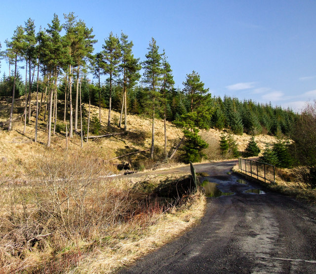
Stower Hill is a prominent hill located in the county of Northumberland, England. Situated near the village of Longframlington, it is part of the stunning Northumberland National Park, renowned for its natural beauty and diverse landscapes.
Rising to an elevation of approximately 345 meters (1,132 feet), Stower Hill offers breathtaking panoramic views of the surrounding countryside. Its strategic location makes it a popular destination for hikers, walkers, and nature enthusiasts seeking a challenging but rewarding climb. The summit provides an excellent vantage point, allowing visitors to marvel at the picturesque vistas of rolling hills, lush meadows, and dense woodlands that stretch as far as the eye can see.
The hill's terrain is predominantly composed of grassy slopes, adorned with an array of wildflowers and heather, creating a vibrant and colorful landscape, especially during the summer months. The area is also home to a rich variety of wildlife, including birds of prey, deer, and smaller mammals, making it a haven for nature lovers and photographers alike.
Stower Hill is easily accessible, with several well-marked footpaths and trails guiding visitors to the summit. The climb can be moderately challenging, but the stunning scenery and sense of tranquility make it well worth the effort. It is advisable to wear appropriate footwear and carry essential supplies, especially during inclement weather conditions.
Whether you are a seasoned hiker seeking an adventure or simply looking to immerse yourself in the beauty of the Northumberland countryside, Stower Hill promises an unforgettable experience for all who venture to its peak.
If you have any feedback on the listing, please let us know in the comments section below.
Stower Hill Images
Images are sourced within 2km of 55.166717/-2.5625207 or Grid Reference NY6485. Thanks to Geograph Open Source API. All images are credited.


Stower Hill is located at Grid Ref: NY6485 (Lat: 55.166717, Lng: -2.5625207)
Unitary Authority: Northumberland
Police Authority: Northumbria
What 3 Words
///moderated.unless.poetry. Near Bellingham, Northumberland
Nearby Locations
Related Wikis

Kielder Water
Kielder Water is a large man-made reservoir in Northumberland in North East England. It is the largest artificial lake in the United Kingdom by capacity...

Plashetts railway station
Plashetts railway station is a closed stone built railway station that served the mining hamlet of Plashetts, in Northumberland, England, which is now...
HMS Standard (shore establishment)
HMS Standard was a British Royal Navy shore establishment between 1942 and 1945. Situated well away from the sea near Kielder in Northumberland, the base...

Kielder Forest
Kielder Forest is a large forestry plantation in Northumberland, England, surrounding Kielder village and the Kielder Water reservoir. It is the largest...
Lewiefield Halt railway station
Lewiefield Halt was a wooden-built halt that served the hamlet of Lewie, and a Ministry of Labour training camp, in Northumberland, England. == History... ==
Plashetts
Plashetts is a small settlement in Northumberland, in England south east of Kielder, Northumberland. It is about 22 miles (35 km) north west of Hexham...

Sighty Crag
Sighty Crag is a hill in the southern part of the Kielder Forest region in northern England, a region which also includes its fellow Marilyns of Peel Fell...
Devil's Lapful
Devil's Lapful is an archaeological site in Northumberland, England, in Kielder Forest about 0.8 miles (1.3 km) south-east of Kielder. The site, a Neolithic...
Have you been to Stower Hill?
Leave your review of Stower Hill below (or comments, questions and feedback).