Friar Waddon Hill

Hill, Mountain in Dorset

England

Friar Waddon Hill

Direction Sign - Signpost on Cheese Lane near Coryates Located south of Coryates on the southwest side of the junction of Cheese Lane and the road to East Shilvinghampton Farm in Portesham parish. 3 arms and annulus & bar finial. See <a title="https://www.geograph.org.uk/photo/6099271" href="https://www.geograph.org.uk/photo/6099271">Link</a> to compare with its condition in 2013, and <a title="https://www.geograph.org.uk/photo/3308110" href="https://www.geograph.org.uk/photo/3308110">Link</a> and <a title="https://www.geograph.org.uk/photo/1092395" href="https://www.geograph.org.uk/photo/1092395">Link</a> for alternative views

Milestone Society National ID: DO_SY6284
Direction Sign - Signpost on Cheese Lane near Coryates Credit: C Payne

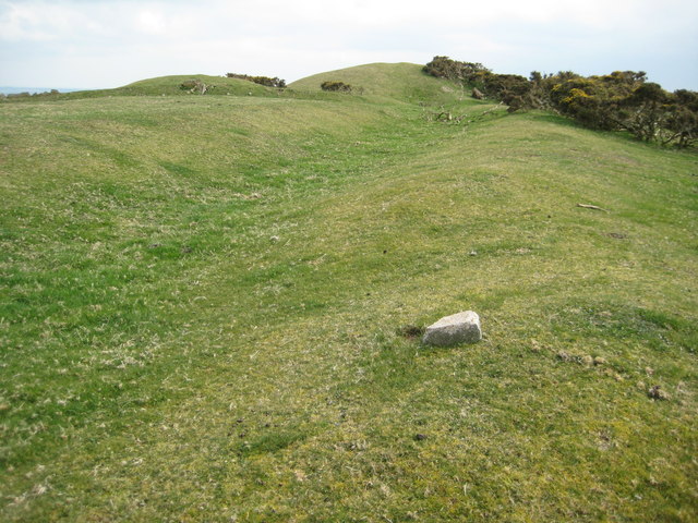
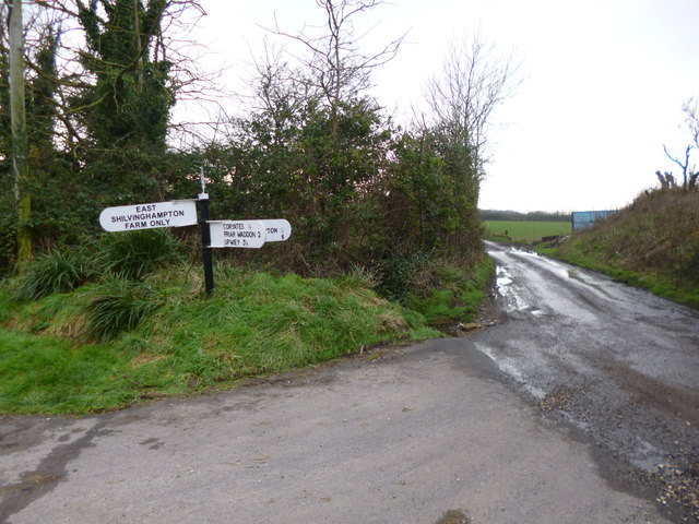
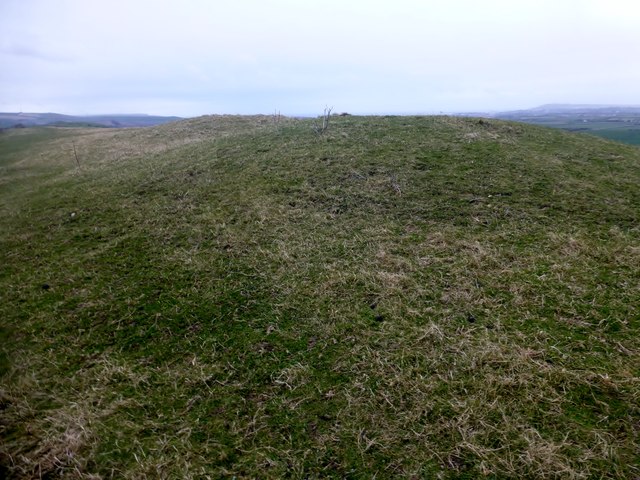
Friar Waddon Hill, located in the picturesque county of Dorset, England, is a prominent hill rising to an elevation of 219 meters (719 feet). Situated near the village of Friar Waddon, the hill offers spectacular panoramic views of the surrounding countryside, making it a popular destination for hikers and nature enthusiasts alike.

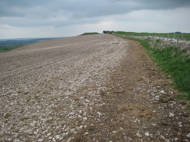
The hill is part of the larger chalk ridge known as the South Dorset Downs, which stretches across several counties. Its distinctive shape and prominent position make it a recognizable landmark in the region. Covered in lush green vegetation, the slopes are adorned with wildflowers during the spring and summer months, adding to its natural beauty.

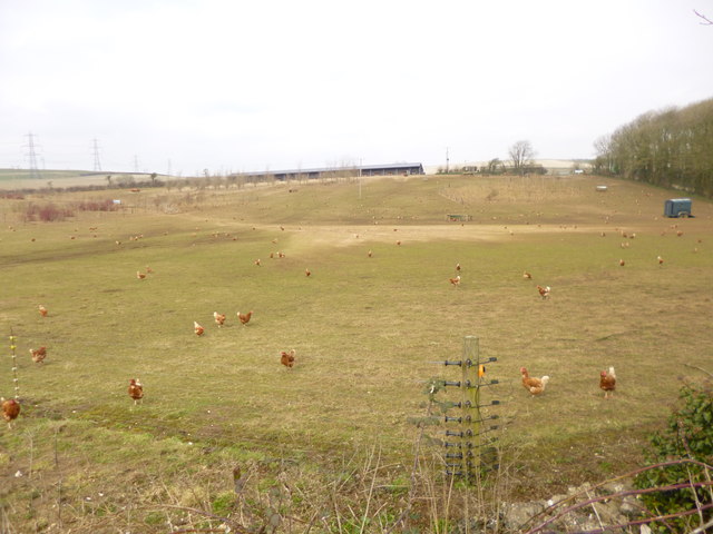
The hill is home to a diverse range of flora and fauna, including various species of birds, butterflies, and small mammals. The area is also known for its rich archaeological heritage, with traces of prehistoric settlements and ancient burial mounds found nearby. These historical features add an intriguing element to the hill, attracting history enthusiasts and researchers.

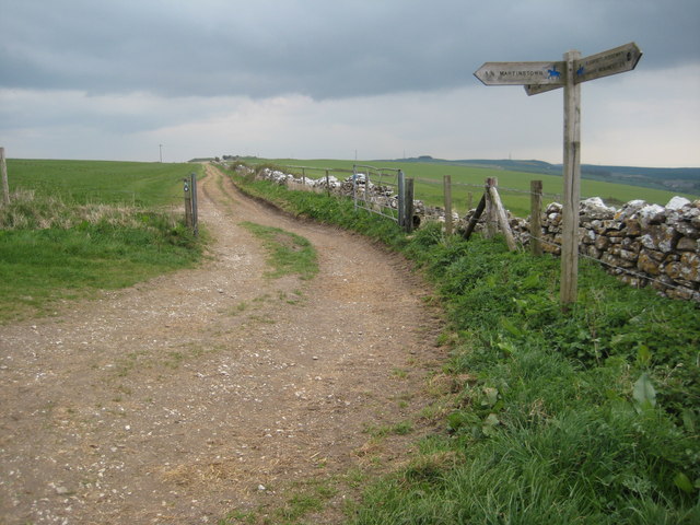
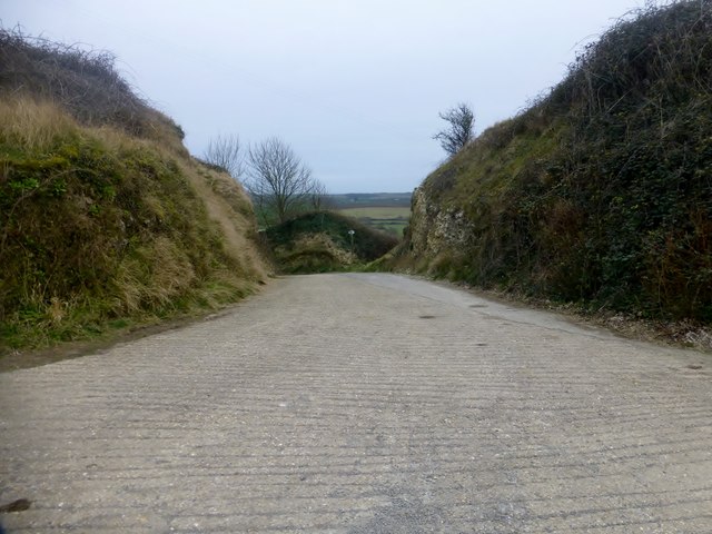
For outdoor enthusiasts, Friar Waddon Hill offers a network of footpaths and trails, providing opportunities for leisurely walks and challenging hikes. The trails wind their way through rolling hills, woodlands, and open fields, offering breathtaking vistas at every turn.

Whether it's the captivating views, the abundance of wildlife, or the historical significance, Friar Waddon Hill is a must-visit destination for anyone seeking to immerse themselves in the natural beauty and rich history of Dorset.

If you have any feedback on the listing, please let us know in the comments section below.

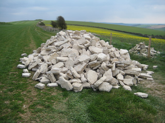
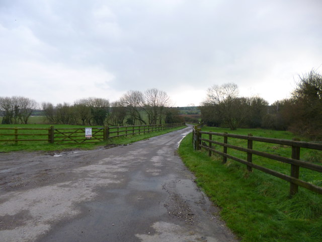
Friar Waddon Hill Images

Images are sourced within 2km of 50.667933/-2.5101416 or Grid Reference SY6485. Thanks to Geograph Open Source API. All images are credited.

Direction Sign - Signpost on Cheese Lane near Coryates Located south of Coryates on the southwest side of the junction of Cheese Lane and the road to East Shilvinghampton Farm in Portesham parish. 3 arms and annulus & bar finial. See <a title="https://www.geograph.org.uk/photo/6099271" href="https://www.geograph.org.uk/photo/6099271">Link</a> to compare with its condition in 2013, and <a title="https://www.geograph.org.uk/photo/3308110" href="https://www.geograph.org.uk/photo/3308110">Link</a> and <a title="https://www.geograph.org.uk/photo/1092395" href="https://www.geograph.org.uk/photo/1092395">Link</a> for alternative views

Milestone Society National ID: DO_SY6284
Direction Sign - Signpost on Cheese Lane near Coryates
Located south of Coryates on the southwest side of the junction of Cheese Lane and the road to East Shilvinghampton Farm in Portesham parish. 3 arms and annulus & bar finial. See Link to compare with its condition in 2013, and Link and Link for alternative views Milestone Society National ID: DO_SY6284
Pylons on Corton Down Pylons carrying power cables over Corton Down, viewed from the inland route of the South West Coast Path.
Pylons on Corton Down
Pylons carrying power cables over Corton Down, viewed from the inland route of the South West Coast Path.
Tumuli on Bronkham Hill There are a number of tumuli on Bronkham Hill such as the two pictured here.  The South Dorset Ridgeway and the inland option of the South West Coast Path follow a bridleway passing nearby.
Tumuli on Bronkham Hill
There are a number of tumuli on Bronkham Hill such as the two pictured here. The South Dorset Ridgeway and the inland option of the South West Coast Path follow a bridleway passing nearby.
Pylons on Corton Hill Pylons carrying electricity cables over Corton Hill, the Isle of Portland can be seen in the distance.
Pylons on Corton Hill
Pylons carrying electricity cables over Corton Hill, the Isle of Portland can be seen in the distance.
Stones for wall building A pile of stones for drystone wall building beside the South Dorset Ridgeway/South West Coast Path on Corton Hill.
Stones for wall building
A pile of stones for drystone wall building beside the South Dorset Ridgeway/South West Coast Path on Corton Hill.
Meeting of footpaths The South Dorset Ridgeway/South West Coast Path (inland alternative) meet a footpath to Martinstown.
Meeting of footpaths
The South Dorset Ridgeway/South West Coast Path (inland alternative) meet a footpath to Martinstown.
Ridge Hill A very stony ploughed field on Ridge Hill above Martinstown, the South Dorset Ridgeway/South West Coast Path long distance paths follow the wall on the right.
Ridge Hill
A very stony ploughed field on Ridge Hill above Martinstown, the South Dorset Ridgeway/South West Coast Path long distance paths follow the wall on the right.
St Laurence, Upwey: churchyard (8)
Coryates, farm road Farm road and footpath, from the Portesham to Shilvinghampton road; leading to East Shilvinghampton Farm.
Coryates, farm road
Farm road and footpath, from the Portesham to Shilvinghampton road; leading to East Shilvinghampton Farm.
Coryates, fingerpost Dorset gridded fingerpost, at the junction of the Portesham to Broadwey road, and the road to East Shilvinghampton Farm; bearing grid number "628 847".
Coryates, fingerpost
Dorset gridded fingerpost, at the junction of the Portesham to Broadwey road, and the road to East Shilvinghampton Farm; bearing grid number "628 847".
Corton, Blackacre Farm
Abandoned farmstead, Hell Bottom
Row of tumuli near Eweleaze Barn
Dry Stone Walling Batter frames are in place to ensure that the wall is built to the correct profile. The wall on the right is finished but for the addition of copestones.
Dry Stone Walling
Batter frames are in place to ensure that the wall is built to the correct profile. The wall on the right is finished but for the addition of copestones.
Tumuli on Great Hill Taken from the bridleway to Martinstown; the SWCP  (inland route) follows the fence on the right.
Tumuli on Great Hill
Taken from the bridleway to Martinstown; the SWCP (inland route) follows the fence on the right.
Friar Waddon Hill Walked up the track from the west to the second of two tululi with Alex and Smudge.
Name: Friar Waddon Hill
Hill number: 18233
Height: 132m / 433ft
Parent (Ma/M): 2896  Lewesdon Hill
Section: 41: South Central England
County/UA: Dorset (CoU)
Class: Tump (100-199m))
Grid ref: SY640854 (est)
Drop: 36m
Col: 96m  SY631856
Friar Waddon Hill
Walked up the track from the west to the second of two tululi with Alex and Smudge. Name: Friar Waddon Hill Hill number: 18233 Height: 132m / 433ft Parent (Ma/M): 2896 Lewesdon Hill Section: 41: South Central England County/UA: Dorset (CoU) Class: Tump (100-199m)) Grid ref: SY640854 (est) Drop: 36m Col: 96m SY631856
Entrance to Corton Farm A route hub for roads and paths near the entrance to Corton Farm between Friar Waddon Hill and Corton Hill.
Entrance to Corton Farm
A route hub for roads and paths near the entrance to Corton Farm between Friar Waddon Hill and Corton Hill.
Benchmark on property, Corton Hill Ordnance Survey benchmark which has survived extensive renovation work. For description, see <span class="nowrap"><a title="http://www.bench-marks.org.uk/bm69091" rel="nofollow ugc noopener" href="http://www.bench-marks.org.uk/bm69091">Link</a><img style="margin-left:2px;" alt="External link" title="External link - shift click to open in new window" src="https://s1.geograph.org.uk/img/external.png" width="10" height="10"/></span> and for context photo, see <a href="https://www.geograph.org.uk/photo/4574627">SY6385 : Scaffolding on property, Corton Hill</a>.
Benchmark on property, Corton Hill
Ordnance Survey benchmark which has survived extensive renovation work. For description, see LinkExternal link and for context photo, see SY6385 : Scaffolding on property, Corton Hill.
Show me another place!

Friar Waddon Hill is located at Grid Ref: SY6485 (Lat: 50.667933, Lng: -2.5101416)

Unitary Authority: Dorset

Police Authority: Dorset

What 3 Words

///viewing.courage.conducted. Near Chickerell, Dorset

Related Wikis

Corton Cutting

Corton Cutting (grid reference SY637855) is a 0.24 hectare geological Site of Special Scientific Interest in Dorset, England, notified in 1997. The site...

St Bartholomew's Chapel, Corton

St Bartholomew's Chapel is a Church of England chapel in Corton, near Weymouth, Dorset, England. The chapel has early 13th century origins, with later...

Coryates Halt railway station

Coryates Halt was a small railway station on the Abbotsbury branch railway in the west of the English county of Dorset. It consisted of a single platform...

Upwey, Dorset

Upwey is a suburb of Weymouth in south Dorset, England. The suburb is situated on the B3159 road in the Wey valley. The area was formerly a village until...

Nearby Amenities

Located within 500m of 50.667933,-2.5101416
Design: barrel
Power: tower
Lat/Long: 50.6655304/-2.5132624
Power: tower
Lat/Long: 50.6636012/-2.5112803
Friar Waddon
Place: hamlet
Lat/Long: 50.6716178/-2.5073269
Design: barrel
Power: tower
Lat/Long: 50.6682069/-2.514318
Power: pole
Source: Bing
Lat/Long: 50.6678785/-2.5125382
Power: pole
Source: Bing
Lat/Long: 50.6686835/-2.5127781
Power: pole
Source: Bing
Lat/Long: 50.6709747/-2.5133812
Power: tower
Lat/Long: 50.6654375/-2.5139969
Power: pole
Source: Bing
Lat/Long: 50.6664268/-2.5121077
Power: tower
Lat/Long: 50.6682318/-2.5149572
Power: tower
Lat/Long: 50.6649929/-2.5118027
Post Box
Post Box Type: wall
Ref: DT3 71
Ref GB Uprn: 10015451492
Royal Cypher: VR
Royal Cypher Wikidata: Q33102356
Lat/Long: 50.670667/-2.5095183
Corton
Note: attested in domesday book
Place: locality
Source: local_knowledge
Lat/Long: 50.6677287/-2.5156332
Friar Wadden Hill
Natural: peak
Lat/Long: 50.6672184/-2.5075605
Power: pole
Source: bing
Lat/Long: 50.6656772/-2.5160354
Power: pole
Source: bing
Lat/Long: 50.6665026/-2.5166161
Power: pole
Source: bing
Lat/Long: 50.6714232/-2.5118136
Power: pole
Source: bing
Lat/Long: 50.6707585/-2.5123152
Power: pole
Source: bing
Lat/Long: 50.6716246/-2.5089866
Power: pole
Source: bing
Lat/Long: 50.6720904/-2.508835
Direction: S
Generator Method: photovoltaic
Generator Output Electricity: yes
Generator Solar Modules: 16
Generator Source: solar
Generator Type: solar_photovoltaic_panel
Location: roof
Power: generator
Lat/Long: 50.6674321/-2.5169296
Power: pole
Source: bing
Lat/Long: 50.6690313/-2.5133492
Power: pole
Source: bing
Lat/Long: 50.6683131/-2.5155433
Power: pole
Source: bing
Transformer: distribution
Lat/Long: 50.6680419/-2.5166912
Power: pole
Source: bing
Lat/Long: 50.6701032/-2.5128007
The data included in this document is from www.openstreetmap.org. The data is made available under ODbL.

Have you been to Friar Waddon Hill?

Leave your review of Friar Waddon Hill below (or comments, questions and feedback).