Black Hill
Hill, Mountain in Aberdeenshire
Scotland
Black Hill

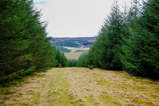
Black Hill is a prominent hill located in Aberdeenshire, Scotland. Standing at an elevation of 643 meters (2,110 feet), it is a part of the larger Cairngorms mountain range. The hill is situated approximately 8 kilometers (5 miles) southeast of Aboyne and is a popular destination for hikers and outdoor enthusiasts.
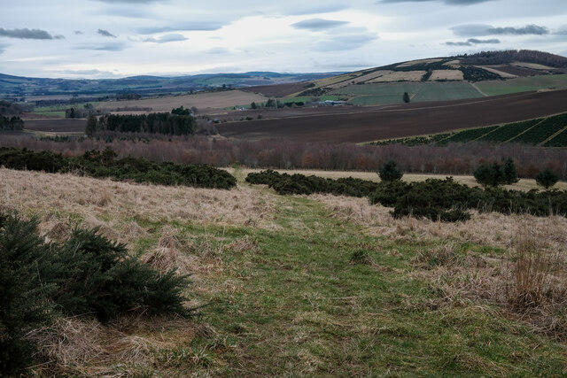
The summit of Black Hill offers breathtaking panoramic views of the surrounding landscape, including the picturesque Royal Deeside valley and the rolling hills of Aberdeenshire. On clear days, it is even possible to catch a glimpse of the distant Grampian Mountains. The hill is predominantly covered in heather and grass, giving it a distinctively rugged and wild appearance.
Access to Black Hill is relatively straightforward, with a well-maintained path leading from the nearby village of Tarland to the summit. The hike is moderately challenging, with some steep sections, but the reward of the stunning views makes it worthwhile. Additionally, the path allows visitors to explore the diverse flora and fauna of the area, including various bird species and small mammals.
Black Hill is also known for its historical and archaeological significance. The surrounding area contains remnants of prehistoric settlements, including stone circles and burial cairns. These ancient sites provide insight into the rich history of the region and attract archaeology enthusiasts.
Overall, Black Hill offers a captivating experience for nature lovers, history enthusiasts, and those seeking a challenging yet rewarding hike in the beautiful Scottish countryside.
If you have any feedback on the listing, please let us know in the comments section below.
Black Hill Images
Images are sourced within 2km of 57.286072/-2.6074588 or Grid Reference NJ6321. Thanks to Geograph Open Source API. All images are credited.


Black Hill is located at Grid Ref: NJ6321 (Lat: 57.286072, Lng: -2.6074588)
Unitary Authority: Aberdeenshire
Police Authority: North East
What 3 Words
///cadet.mimed.choirs. Near Insch, Aberdeenshire
Nearby Locations
Related Wikis
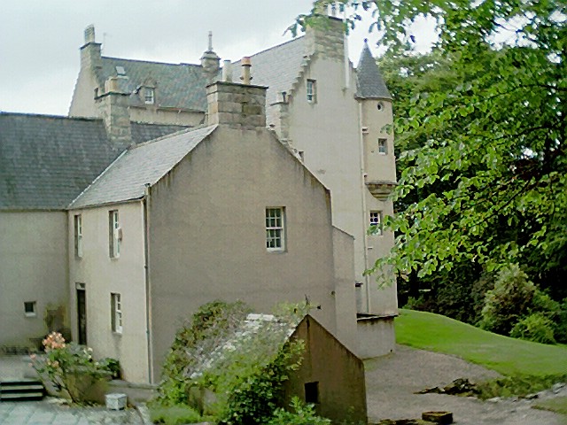
Lickleyhead Castle
Lickleyhead Castle is a well-restored L-plan castle, dating from around 1600, a little south of Auchleven, by the banks of the Gadie Burn, in Aberdeenshire...

Auchleven
Auchleven (Scottish Gaelic: Achadh Leamhan) is a village in Aberdeenshire, Scotland. Located approximately 4 miles (6 kilometres) south of Insch, 17 mi...

Gordon Way
The Gordon Way is a waymarked hiking trail in Aberdeenshire, Scotland. It runs for 11+1⁄2 miles (18.5 km) through the Bennachie Forest. The route was one...

Bennachie
Bennachie ( ben-ə-HEE; Scottish Gaelic: Beinn na Cìche) is a range of hills in Aberdeenshire, Scotland. It has several tops, the highest of which, Oxen...
Nearby Amenities
Located within 500m of 57.286072,-2.6074588Have you been to Black Hill?
Leave your review of Black Hill below (or comments, questions and feedback).