Tooth Hill

Hill, Mountain in Yorkshire Ribble Valley

England

Tooth Hill

Ford at upstream end of Whitendale intake
Ford at upstream end of Whitendale intake Credit: shikari

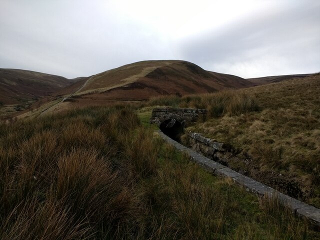
Tooth Hill, located in Yorkshire, is a prominent hill within the region known for its picturesque surroundings and natural beauty. Standing at an elevation of approximately 325 meters (1,066 feet), it is considered one of the notable hills in Yorkshire and attracts both locals and tourists alike.

Situated in the North York Moors National Park, Tooth Hill offers stunning panoramic views of the surrounding countryside. Its distinctive shape, resembling a tooth or fang, gives it its unique name. The hill is covered in lush greenery, with diverse vegetation that includes heather, grasses, and scattered trees. The area is known for its rich biodiversity, with various bird species and small mammals calling it their home.

Hiking enthusiasts are drawn to Tooth Hill due to its well-maintained trails, which provide an opportunity to explore the hill's scenic beauty. The trails offer different levels of difficulty, accommodating both experienced hikers and beginners. In addition to hiking, visitors can also enjoy activities such as birdwatching, photography, and nature walks.

Tooth Hill is easily accessible by road, with nearby parking facilities available for those traveling by car. The hill is located in close proximity to several charming villages, providing opportunities for visitors to explore the local culture and enjoy traditional Yorkshire hospitality.

Overall, Tooth Hill in Yorkshire offers an idyllic escape to nature, showcasing the region's natural beauty and providing a peaceful retreat for outdoor enthusiasts.

If you have any feedback on the listing, please let us know in the comments section below.
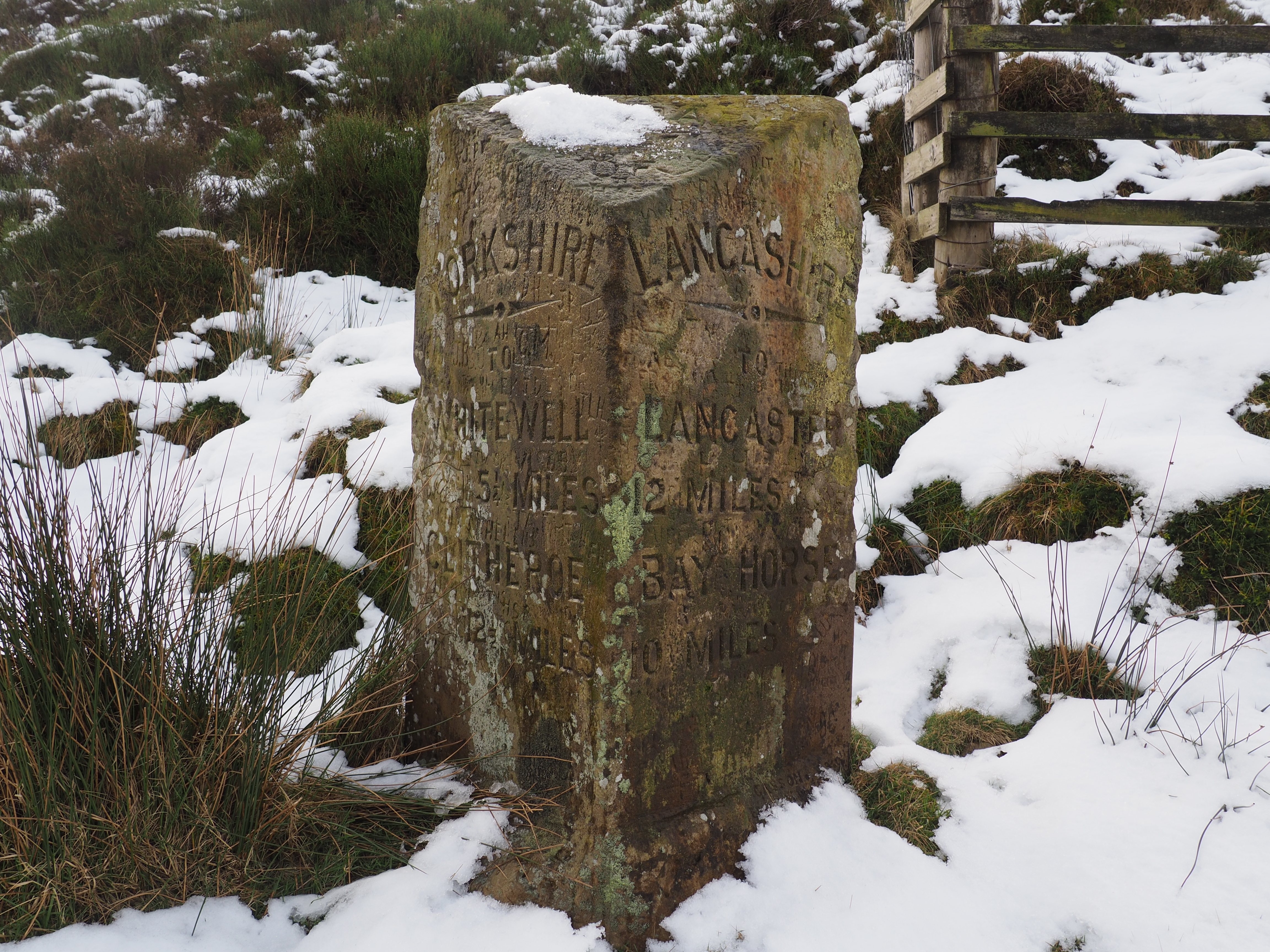
Tooth Hill Images

Images are sourced within 2km of 53.995569/-2.5603676 or Grid Reference SD6355. Thanks to Geograph Open Source API. All images are credited.

Ford at upstream end of Whitendale intake
Well Springs Clough intake and contour conduit from Far Pasture Clough intake Well Springs Clough intake is in the right middleground
Well Springs Clough intake and contour conduit from Far Pasture Clough intake
Well Springs Clough intake is in the right middleground
Drainage channel coming from Far Pasture Clough intake
Drainage channel coming from Far Pasture Clough intake The intake is in the trees
Drainage channel coming from Far Pasture Clough intake
The intake is in the trees
Covered drainage channel near Far Pasture Clough intake
Well Springs Clough intake
Drainage channel coming from Far Pasture Clough intake
Sluice valve at Well Springs Clough intake
Overgrown weir and spillway at Well Springs Clough intake
Backfilled intake well grating at Well Springs Clough intake
Overgrown and still-functioning weirs at Well Springs Clough intake
View down below the weirs at Well Springs Clough intake
Looking along the aqueduct connecting to Well Springs Clough intake
Land used for game trapping above Well Springs Clough intake The intake is now disused.
Land used for game trapping above Well Springs Clough intake
The intake is now disused.
Looking at the aqueduct connected to Well Springs Clough intake
Looking at the aqueduct near to to Well Springs Clough intake
Looking at the aqueduct as it goes underground towards Well Springs Clough intake
View down the Brennand Valley from the aqueduct near Well Springs Clough intake
Show me another place!

Tooth Hill is located at Grid Ref: SD6355 (Lat: 53.995569, Lng: -2.5603676)

Division: West Riding

Administrative County: Lancashire

District: Ribble Valley

Police Authority: Lancashire

What 3 Words

///galaxy.following.clattered. Near Caton, Lancashire

Nearby Locations

Tooth Hill

Related Wikis

Brennand Farm

Brennand Farm is often claimed to be the true centre of Great Britain. The centre, as calculated by Ordnance Survey as the centroid of the two-dimensional...

Wolfhole Crag

Wolfhole Crag is an isolated and seldom-visited hill in the Forest of Bowland in Lancashire, England. It has an elevation of 527 m (1,729 ft) and a prominence...

Grey Stone of Trough

The Grey Stone of Trough is an historic boundary marker in Bowland Forest High, in the Trough of Bowland, Lancashire, England. A Grade II listed structure...

Trough of Bowland

The Trough of Bowland is a valley and high pass in the Forest of Bowland Area of Outstanding Natural Beauty, Lancashire, England. The pass, reaching 968...

Nearby Amenities

Located within 500m of 53.995569,-2.5603676
Waterway: waterfall
Lat/Long: 53.9927119/-2.5636704
Hunting Stand
Hunting Stand: grouse_butt
Lat/Long: 53.9964968/-2.5534547
Hunting Stand
Hunting Stand: grouse_butt
Lat/Long: 53.9966473/-2.5540802
Hunting Stand
Hunting Stand: grouse_butt
Lat/Long: 53.996802/-2.5546985
Hunting Stand
Hunting Stand: grouse_butt
Lat/Long: 53.9969923/-2.5554375
Hunting Stand
Hunting Stand: grouse_butt
Lat/Long: 53.9971711/-2.5561596
Hunting Stand
Hunting Stand: grouse_butt
Lat/Long: 53.9973387/-2.5568358
Hunting Stand
Hunting Stand: grouse_butt
Lat/Long: 53.9975048/-2.5575145
Hunting Stand
Hunting Stand: grouse_butt
Lat/Long: 53.9976666/-2.5581497
Hunting Stand
Hunting Stand: grouse_butt
Lat/Long: 53.9978242/-2.5587993
Tooth Hill
Natural: peak
Lat/Long: 53.995683/-2.5609278
Waterway: waterfall
Lat/Long: 53.9963028/-2.5667302
Natural: stone
Lat/Long: 53.9957057/-2.5647164
Waterway: waterfall
Lat/Long: 53.9955502/-2.5652926
Natural: stone
Lat/Long: 53.9927658/-2.5621786
Waterway: waterfall
Lat/Long: 53.9922935/-2.5641732
Natural: stone
Lat/Long: 53.9950367/-2.5591907
Waterway: waterfall
Lat/Long: 53.9957947/-2.5653392
Ford: yes
Lat/Long: 53.9995311/-2.5598777
The data included in this document is from www.openstreetmap.org. The data is made available under ODbL.

Have you been to Tooth Hill?

Leave your review of Tooth Hill below (or comments, questions and feedback).