Longside Hill

Hill, Mountain in Kincardineshire

Scotland

Longside Hill

Brunt Hill A view towards forestry plantations on Brunt Hill (left of image), with the patchwork field pattern of the Howe of the Mearns visible in the distance. Oil-seed rape fields are particularly prominent. Visibility is limited by extensive haze in a period of unusually warm weather.
Brunt Hill Credit: William Starkey

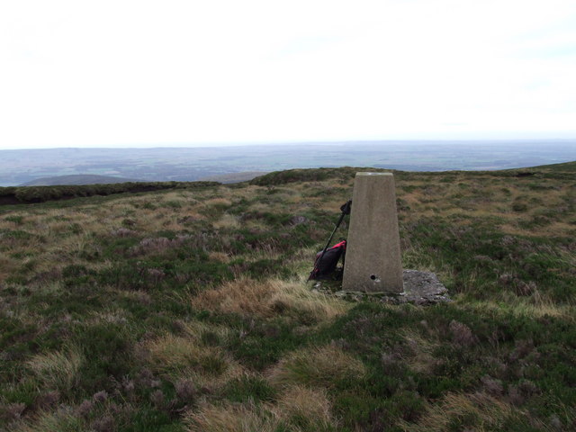
Longside Hill, located in Kincardineshire, Scotland, is a prominent hill that offers breathtaking views and a range of outdoor activities for nature enthusiasts. With an elevation of approximately 438 meters (1,437 feet), it stands as a notable landmark in the region.

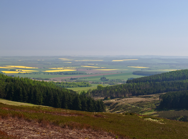
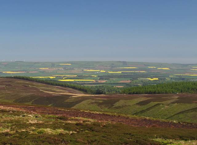
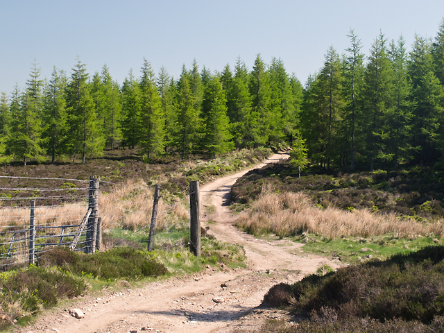
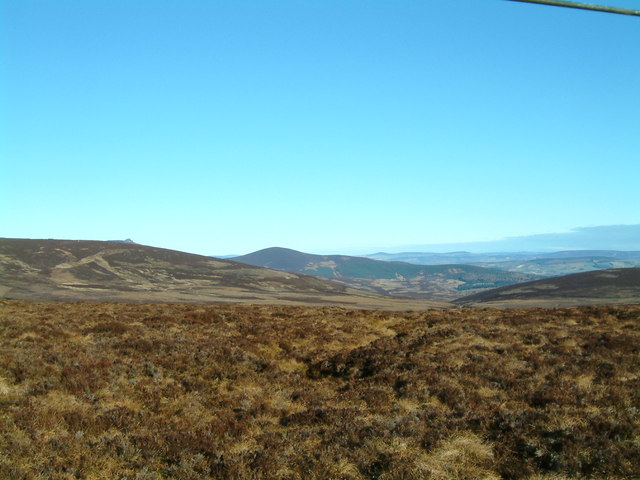
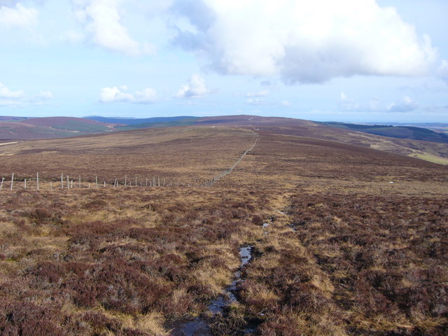
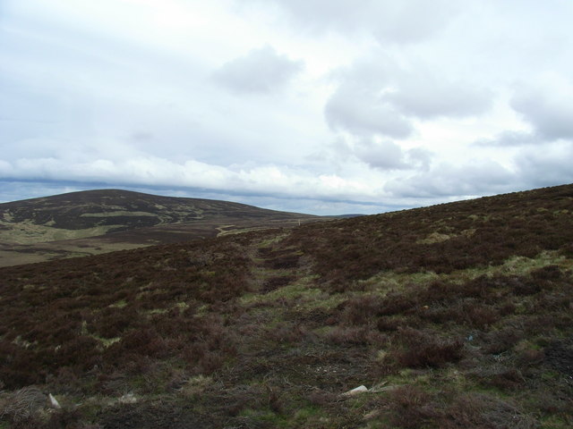
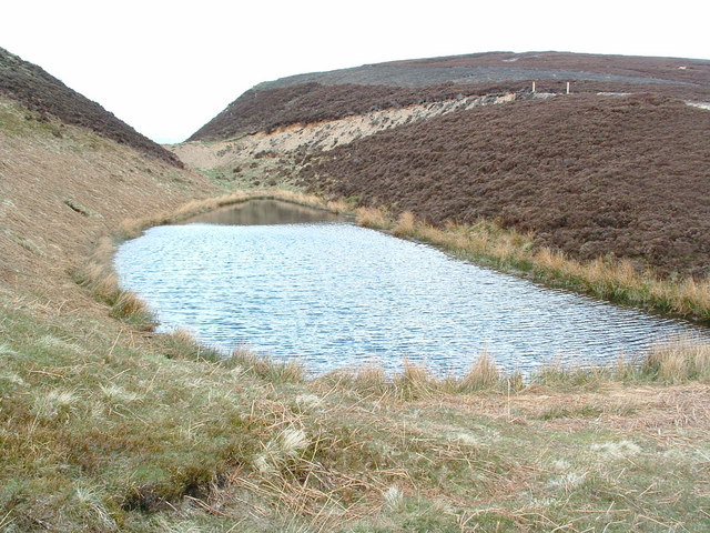
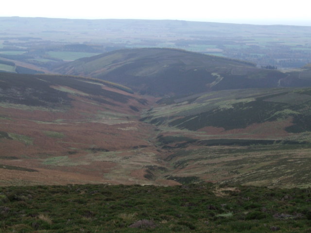
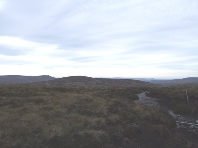
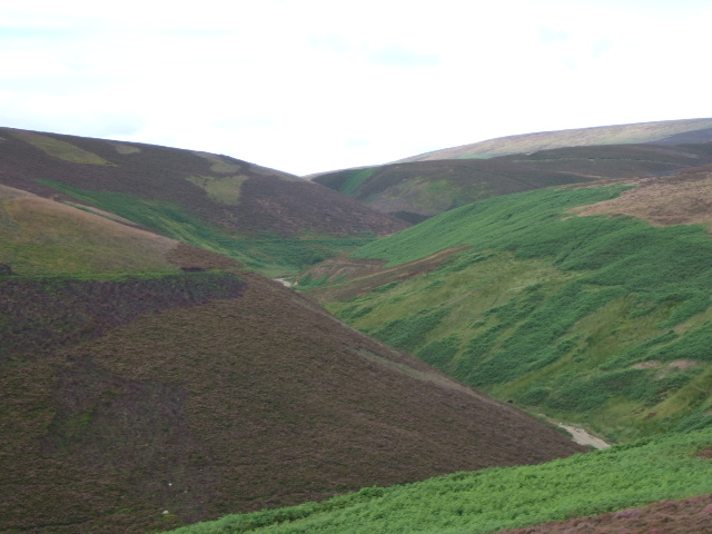
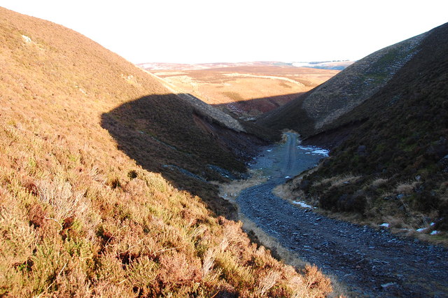
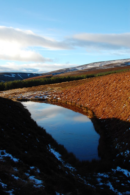
Surrounded by picturesque landscapes, Longside Hill is covered in heather and grass, adding to its natural charm. The hill provides ample opportunities for hikers and walkers to explore its slopes and take in the stunning vistas. A well-defined path leads to the summit, making it accessible for both experienced and novice hikers.

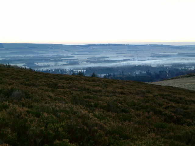
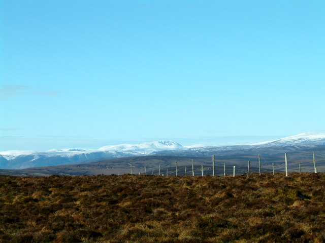
From the top of Longside Hill, visitors are rewarded with panoramic views of the surrounding countryside, including the rolling hills, meandering rivers, and nearby towns. On clear days, it is even possible to see the distant coastline.

The hill is also a popular spot for birdwatchers, as it attracts a variety of bird species. The open moorland provides an ideal habitat for birds such as grouse, lapwings, and curlews. Keen observers may also spot birds of prey soaring overhead, including buzzards and kestrels.

For those interested in history, Longside Hill is located near the site of an ancient hill fort, suggesting human activity in the area dating back centuries. This adds an extra dimension to the hill, allowing visitors to connect with the past while enjoying the natural beauty of the present.

Overall, Longside Hill in Kincardineshire is a captivating destination that offers stunning views, opportunities for outdoor activities, and a glimpse into the region's rich history.

If you have any feedback on the listing, please let us know in the comments section below.

Longside Hill Images

Images are sourced within 2km of 56.899211/-2.6045941 or Grid Reference NO6378. Thanks to Geograph Open Source API. All images are credited.

Brunt Hill A view towards forestry plantations on Brunt Hill (left of image), with the patchwork field pattern of the Howe of the Mearns visible in the distance. Oil-seed rape fields are particularly prominent. Visibility is limited by extensive haze in a period of unusually warm weather.
Brunt Hill
A view towards forestry plantations on Brunt Hill (left of image), with the patchwork field pattern of the Howe of the Mearns visible in the distance. Oil-seed rape fields are particularly prominent. Visibility is limited by extensive haze in a period of unusually warm weather.
Above the Shank of Cardowan A view from the hillside above the Shank of Cardowan, with cultivated fields in the Howe of the Mearns visible in the distance.
Above the Shank of Cardowan
A view from the hillside above the Shank of Cardowan, with cultivated fields in the Howe of the Mearns visible in the distance.
Track on Brunt Hill A track to the north of Brunt Hill - this leads onto the hillside in the vicinity of Hound Hillock 2km distant.
Track on Brunt Hill
A track to the north of Brunt Hill - this leads onto the hillside in the vicinity of Hound Hillock 2km distant.
View from Hound Hillock A view to the east from the summit of Hound Hillock. This image was taken on an unusually hot day, with extensive haze limiting visibility. Farm-fields in the Howe of the Mearns can be seen in the distance - beyond these lies the North Sea.
View from Hound Hillock
A view to the east from the summit of Hound Hillock. This image was taken on an unusually hot day, with extensive haze limiting visibility. Farm-fields in the Howe of the Mearns can be seen in the distance - beyond these lies the North Sea.
Back Burn of Arnbarrow
View from Cairn o' Mount Track Looking north from hill track leading from Cairn o' Mount. Summit of Clachnaben can be seen on left side of picture.
View from Cairn o' Mount Track
Looking north from hill track leading from Cairn o' Mount. Summit of Clachnaben can be seen on left side of picture.
Looking towards Cairn o'Mount from Whitelaws
Hound Hillock towards Meluncart Looking North East across the lower Northern slopes of Hound Hillock towards Meluncart (2 km).
Hound Hillock towards Meluncart
Looking North East across the lower Northern slopes of Hound Hillock towards Meluncart (2 km).
Loch of Muchrae This loch near to Arnbarrow Hill has a sombre history. The story goes that some
men were herding deer at night when they slid off the side of the hill and into
the loch. Some never made it out.
Loch of Muchrae
This loch near to Arnbarrow Hill has a sombre history. The story goes that some men were herding deer at night when they slid off the side of the hill and into the loch. Some never made it out.
Trig Point Standing just off the top of Hound Hillock. Photo taken after a very boggy 
trek from the Cairn-o-Mount
Trig Point
Standing just off the top of Hound Hillock. Photo taken after a very boggy trek from the Cairn-o-Mount
Shank of Cardowan Photo taken above where the Well of Cardowan lies, looking down
to the Shank with Garrol Hill just beyond.
Shank of Cardowan
Photo taken above where the Well of Cardowan lies, looking down to the Shank with Garrol Hill just beyond.
Whitelaws From a muddy track on the hill from the Cairn o Mount with a view to Meluncart and Clachnaben
Whitelaws
From a muddy track on the hill from the Cairn o Mount with a view to Meluncart and Clachnaben
View over the Mearns from hill above Fasque
Lochnagar & Mount Keen from Cairn 'O' Mount View taken from track that leads from Cairn 'O' Mount.
Lochnagar & Mount Keen from Cairn 'O' Mount
View taken from track that leads from Cairn 'O' Mount.
View up Back Burn of Arnbarrow From Cairn O'Mount road.
View up Back Burn of Arnbarrow
From Cairn O'Mount road.
Quarry at side of dirt road On the way up to Muchrae loch and Kings Deer Park
Quarry at side of dirt road
On the way up to Muchrae loch and Kings Deer Park
Glen Muchrae Glen Muchrae is separated from Loch of Muchrae by the Deer Dyke at the watershed.
Glen Muchrae
Glen Muchrae is separated from Loch of Muchrae by the Deer Dyke at the watershed.
Loch Muchrae Loch Muchrae taken from top of Deer Dyke - more a lochan than a loch!
Loch Muchrae
Loch Muchrae taken from top of Deer Dyke - more a lochan than a loch!
Show me another place!

Longside Hill is located at Grid Ref: NO6378 (Lat: 56.899211, Lng: -2.6045941)

Unitary Authority: Aberdeenshire

Police Authority: North East

What 3 Words

///fattening.touched.extension. Near Laurencekirk, Aberdeenshire

Nearby Locations

Longside Hill

Related Wikis

Cairn O' Mounth

Cairn O' Mounth/Cairn O' Mount (Scottish Gaelic: Càrn Mhon) is a high mountain pass in Aberdeenshire, Scotland. The place name is a survival of the ancient...

Fasque House

Fasque, also known as Fasque House or Fasque Castle, is a mansion in Aberdeenshire, Scotland, situated near the village of Fettercairn, in the former county...

Fettercairn distillery

Fettercairn distillery is a whisky distillery in Fettercairn. Situated under the Grampian foothills in the Howe of Mearns, Fettercairn town’s name is...

Kincardine, Aberdeenshire

Kincardine was a burgh in Scotland, near the present-day village of Fettercairn. It served as the first county town of Kincardineshire. The settlement...

Nearby Amenities

Located within 500m of 56.899211,-2.6045941
Longside Hill
Ele: 394
Natural: peak
Lat/Long: 56.8991707/-2.6036531
The data included in this document is from www.openstreetmap.org. The data is made available under ODbL.

Have you been to Longside Hill?

Leave your review of Longside Hill below (or comments, questions and feedback).