Muirhouselaw

Hill, Mountain in Roxburghshire

Scotland

Muirhouselaw

Farm track near Pirnie
Farm track near Pirnie Credit: JThomas

Muirhouselaw, located in Roxburghshire, Scotland, is an impressive hill and mountain that attracts outdoor enthusiasts and nature lovers alike. Standing at an elevation of 536 meters (1,759 feet), it offers breathtaking panoramic views of the surrounding countryside.

The hill, composed mainly of sandstone and shale, is part of the Southern Uplands, a range known for its rugged beauty and rich history. Muirhouselaw is covered in heather, grasses, and scattered patches of woodland, creating a diverse and picturesque landscape.

The ascent of Muirhouselaw is relatively gentle, making it accessible for hikers of all levels. Several well-marked trails lead to the summit, providing an opportunity to explore its natural wonders. Along the way, visitors may encounter various wildlife species, including red deer, rabbits, and a variety of bird species.

At the top, hikers are rewarded with awe-inspiring views of the rolling hills and valleys that stretch as far as the eye can see. On clear days, it is even possible to catch a glimpse of the distant Cheviot Hills and the Northumberland National Park.

Muirhouselaw is a popular destination for outdoor activities such as hillwalking, birdwatching, and photography. Its tranquil and unspoiled environment offers a peaceful retreat from the hustle and bustle of everyday life. Whether it's a challenging hike or a leisurely stroll, Muirhouselaw promises a memorable experience for those seeking a connection with nature.

If you have any feedback on the listing, please let us know in the comments section below.
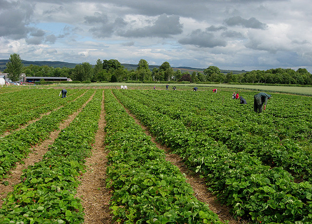
Muirhouselaw Images

Images are sourced within 2km of 55.550234/-2.5845986 or Grid Reference NT6328. Thanks to Geograph Open Source API. All images are credited.

Farm track near Pirnie
Grazing near Pirnie
Grazing near Pirnie
Minor road near Pirnie Towards Fairnington.
Minor road near Pirnie
Towards Fairnington.
Ploughed field near Fairnington Towards Major's Plantation.
Ploughed field near Fairnington
Towards Major's Plantation.
Ploughed field near Fairnington Towards distant woodland and the Waterloo Monument on Peniel Heugh.
Ploughed field near Fairnington
Towards distant woodland and the Waterloo Monument on Peniel Heugh.
Minor road Fairnington
Prepared field and woodland near Fairnington
Minor beside woodland near Fairnington Towards Muirhouselaw.
Minor beside woodland near Fairnington
Towards Muirhouselaw.
Border Berries at Rutherford Farm Two large fields on the south side of the main farm buildings are used during the summer months as a pick your own fruit farm. The main fruits are strawberries, raspberries, gooseberries, red currants and black currants. On this occasion I was picking strawberries.
Border Berries at Rutherford Farm
Two large fields on the south side of the main farm buildings are used during the summer months as a pick your own fruit farm. The main fruits are strawberries, raspberries, gooseberries, red currants and black currants. On this occasion I was picking strawberries.
Riddletonhill View across waterlogged winter crops to Riddletonhill.
Riddletonhill
View across waterlogged winter crops to Riddletonhill.
Abandoned loop, Ploughlands The A699 has been straightened out leaving many loops. These are popular for farm use, like storing round bales, but also attract the dumpers. This one seems to have been left alone.  
There is a good crop of hawthorn berries for the thrushes.
Abandoned loop, Ploughlands
The A699 has been straightened out leaving many loops. These are popular for farm use, like storing round bales, but also attract the dumpers. This one seems to have been left alone. There is a good crop of hawthorn berries for the thrushes.
A699 heading for Kelso Between Riddletonhill and Ploughlands.
A699 heading for Kelso
Between Riddletonhill and Ploughlands.
The A699 at ploughlands
Farmland towards Ploughlands Off the A699.
Farmland towards Ploughlands
Off the A699.
A699 towards Kelso  Looking east.
A699 towards Kelso
Looking east.
A699 near Ploughlands Heading east towards Kelso.
A699 near Ploughlands
Heading east towards Kelso.
Field off the A699
Field off the A699
Farmland towards woodland, Broomhouse Off the A699.
Farmland towards woodland, Broomhouse
Off the A699.
Show me another place!

Muirhouselaw is located at Grid Ref: NT6328 (Lat: 55.550234, Lng: -2.5845986)

Unitary Authority: The Scottish Borders

Police Authority: The Lothians and Scottish Borders

What 3 Words

///ribcage.shock.abacus. Near Saint Boswells, Scottish Borders

Related Wikis

Maxton railway station

Maxton railway station served the hamlet of Maxton, Roxburghshire, Scotland from 1851 to 1964 on the Kelso Line. == History == The station opened in June...

Battle of Ancrum Moor

The Battle of Ancrum Moor was fought during the War of the Rough Wooing in 1545. The Scottish victory put a temporary end to English incursions in the...

Maxton, Roxburghshire

Maxton is a hamlet and civil parish in Roxburghshire, Scotland, and part of the Scottish Borders region. Maxton lies just off the A68, south of St. Boswells...

Monteath Mausoleum

The Monteath Mausoleum is a large landmark in the Scottish Borders near the village of Ancrum. The listed building can be seen from the A68 road just north...

Nearby Amenities

Located within 500m of 55.550234,-2.5845986
Post Box
Brand: Royal Mail
Brand Wikidata: Q638098
Mapillary: 196596062886750
Operator: Royal Mail
Operator Wikidata: Q638098
Post Box Mounting: building
Post Box Type: wall
Ref: TD6 76
Survey Date: 2023-05-18
Lat/Long: 55.5491403/-2.589597
Kill Law
Natural: peak
Lat/Long: 55.5515452/-2.5861718
Muirhouselaw
Place: hamlet
Lat/Long: 55.549617/-2.589426
Power: pole
Lat/Long: 55.5468528/-2.5812264
Power: pole
Lat/Long: 55.5476642/-2.5811337
Power: pole
Lat/Long: 55.548059/-2.5817105
Power: pole
Lat/Long: 55.5485878/-2.582501
Power: pole
Lat/Long: 55.5491093/-2.5832375
Power: pole
Lat/Long: 55.5496235/-2.583992
Power: pole
Lat/Long: 55.5501814/-2.5847747
Power: pole
Lat/Long: 55.5501187/-2.5853593
Power: pole
Lat/Long: 55.5500022/-2.5866055
Power: pole
Lat/Long: 55.549909/-2.5877205
Power: pole
Lat/Long: 55.5497007/-2.5881377
Power: pole
Lat/Long: 55.5494152/-2.588426
The data included in this document is from www.openstreetmap.org. The data is made available under ODbL.

Have you been to Muirhouselaw?

Leave your review of Muirhouselaw below (or comments, questions and feedback).