Little Calf Hill

Hill, Mountain in Kincardineshire

Scotland

Little Calf Hill

Water of Dye Looking downstream towards an area of weathered granite.
Water of Dye Credit: Richard Webb

Little Calf Hill is a prominent hill located in Kincardineshire, Scotland. Situated in the eastern part of the county, the hill forms part of the larger range known as the Mounth Hills. Little Calf Hill stands at an elevation of approximately 1,409 feet (429 meters) above sea level, making it a notable landmark in the area.

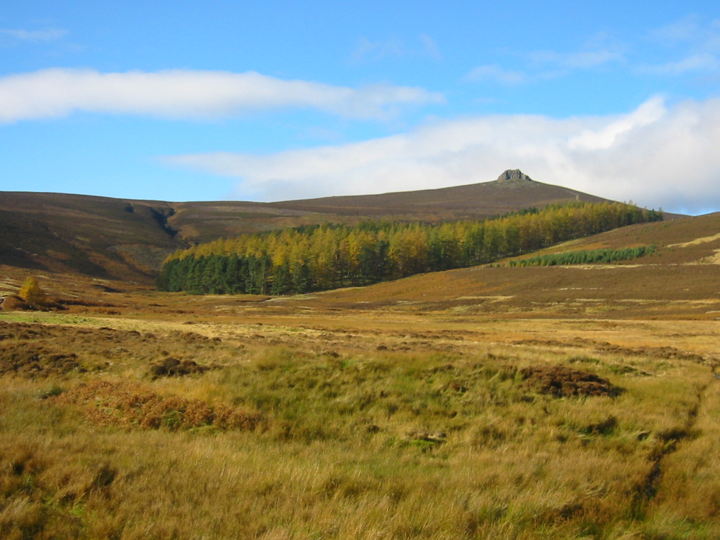
The hill is characterized by its gently sloping terrain, which gradually ascends to a rounded summit. The landscape surrounding Little Calf Hill is primarily composed of rolling hills, heather moorland, and scattered woodland, providing a picturesque and tranquil setting.

Little Calf Hill offers stunning panoramic views of the surrounding countryside, with vistas extending towards the North Sea to the east and the Cairngorms National Park to the west. On clear days, it is possible to see as far as the Grampian Mountains in the distance.

Due to its accessibility and moderate height, Little Calf Hill attracts a range of outdoor enthusiasts, including hikers, hillwalkers, and nature lovers. Several well-defined paths and trails traverse the hill, providing opportunities for exploration and enjoyment of the natural surroundings.

The area surrounding Little Calf Hill is rich in wildlife, with various bird species, such as red grouse and golden eagles, often spotted in the vicinity. The hill is also home to a diverse range of plant life, including heather, bilberry, and juniper.

Overall, Little Calf Hill is a picturesque and accessible hill in Kincardineshire, offering stunning views and opportunities for outdoor recreation in a tranquil setting.

If you have any feedback on the listing, please let us know in the comments section below.

Little Calf Hill Images

Images are sourced within 2km of 56.92989/-2.6335152 or Grid Reference NO6182. Thanks to Geograph Open Source API. All images are credited.

Water of Dye Looking downstream towards an area of weathered granite.
Water of Dye
Looking downstream towards an area of weathered granite.
Road by Water of Dye The local granite weathers into a good road surface gravel.
Road by Water of Dye
The local granite weathers into a good road surface gravel.
Kettock Burn Kettock Burn is immediately below.  Hazly Grain joins it below Wolf Hill.  Clouds are touching the summit of Mount Battock in the distance.  A few minutes earlier a lone deer had been startled by my arrival from downwind and had taken off at high speed.
Kettock Burn
Kettock Burn is immediately below. Hazly Grain joins it below Wolf Hill. Clouds are touching the summit of Mount Battock in the distance. A few minutes earlier a lone deer had been startled by my arrival from downwind and had taken off at high speed.
Glen Dye The landrover track & Water of Dye at Patons Heugh.  The landrover tracks in this area are very good probably put in place to service the hunting business on the estate.
Glen Dye
The landrover track & Water of Dye at Patons Heugh. The landrover tracks in this area are very good probably put in place to service the hunting business on the estate.
No room at the  inn An old stable block adjacent to the Water of Charr. Very wet inside on the day of my visit but would provide shelter if the need arose. The path shown leads to the summit of Meluncart.
No room at the inn
An old stable block adjacent to the Water of Charr. Very wet inside on the day of my visit but would provide shelter if the need arose. The path shown leads to the summit of Meluncart.
Charr At Charr in Glen Dye mid afternoon in January just before the sun went behind the hills.  The building on the right contains the bothy which walkers can use.
Charr
At Charr in Glen Dye mid afternoon in January just before the sun went behind the hills. The building on the right contains the bothy which walkers can use.
Beautiful wintery day in Glen Dye Approaching the confluence of Water of Dye and Water of Charr. The stand of pine trees, bridge and roof of the bothy are visible
Beautiful wintery day in Glen Dye
Approaching the confluence of Water of Dye and Water of Charr. The stand of pine trees, bridge and roof of the bothy are visible
Looking up Water of Charr from Charr Bothy Charr Bothy is a well maintained MBA managed bothy open to all for overnight use. The small building beyond is a rough animal shelter.
Looking up Water of Charr from Charr Bothy
Charr Bothy is a well maintained MBA managed bothy open to all for overnight use. The small building beyond is a rough animal shelter.
View from inside Charr Bothy Looking up the Water of Charr over the bridge and past the small stand of pine trees.
View from inside Charr Bothy
Looking up the Water of Charr over the bridge and past the small stand of pine trees.
Scots Pine near Charr Bothy One of the few areas of trees in the glen, which is almost exclusively grouse moor (and threatened by wind farm developers).
Scots Pine near Charr Bothy
One of the few areas of trees in the glen, which is almost exclusively grouse moor (and threatened by wind farm developers).
Glen Dyce scene The Burn of Waterhead flows past a majestic lone Scots pine with Clachnaben in the distance.
Glen Dyce scene
The Burn of Waterhead flows past a majestic lone Scots pine with Clachnaben in the distance.
Lone Scots pine, Glen Dye
Fresh growth of bracken, Glen Dye
Open gate and ladder stile, Glen Dye
Trees by the track What seems to be the remains of a larch plantation.
Trees by the track
What seems to be the remains of a larch plantation.
Improvised quarry, Glen Dye A number of these mini quarries provide gravel and sand for forestry tracks.
Improvised quarry, Glen Dye
A number of these mini quarries provide gravel and sand for forestry tracks.
Upland reservoir, Glen Dye
Looking down the Water of Dye
Show me another place!

Little Calf Hill is located at Grid Ref: NO6182 (Lat: 56.92989, Lng: -2.6335152)

Unitary Authority: Aberdeenshire

Police Authority: North East

What 3 Words

///discrepancy.duplicate.overgrown. Near Laurencekirk, Aberdeenshire

Nearby Locations

Little Calf Hill

Related Wikis

Cairn O' Mounth

Cairn O' Mounth/Cairn O' Mount (Scottish Gaelic: Càrn Mhon) is a high mountain pass in Aberdeenshire, Scotland. The place name is a survival of the ancient...

Clachnaben

Clachnaben (archaically "Cloch-na'bain"; Scottish Gaelic: "Clach na Beinne") is a 589-metre hill in Glen Dye, Aberdeenshire, Scotland. It is a distinctive...

Colmeallie stone circle

The Colmeallie stone circle is a recumbent stone circle in Glen Esk, Angus, Scotland. It is located 8 km north of Edzell at Colmeallie Farm, adjacent to...

Mount Battock

Mount Battock (778 m) is a mountain in the Mounth on the eastern edge of the Scottish Highlands, on the border between Aberdeenshire and Angus. A rounded...

Have you been to Little Calf Hill?

Leave your review of Little Calf Hill below (or comments, questions and feedback).