Clachnaben

Hill, Mountain in Kincardineshire

Scotland

Clachnaben

Peat hag in the upland landscape Clachnaben looms in the distance.
Peat hag in the upland landscape Credit: Bill Harrison

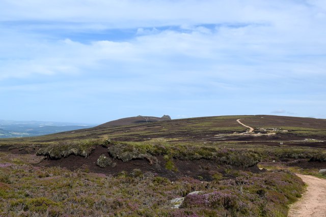
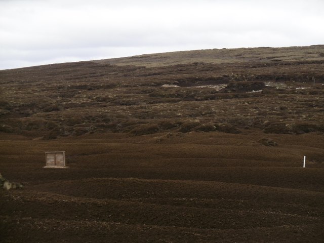
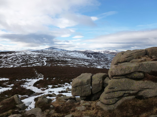
Clachnaben is a prominent hill located in Kincardineshire, Scotland. It is situated in the eastern part of the county, near the village of Fettercairn. With an elevation of 589 meters (1,932 feet), it is a popular destination for hikers and outdoor enthusiasts.

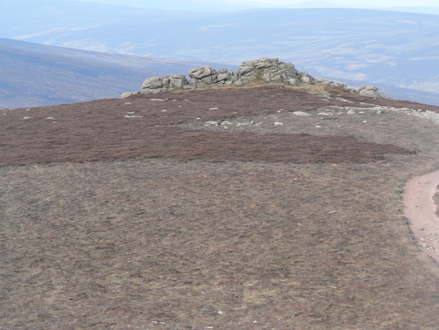
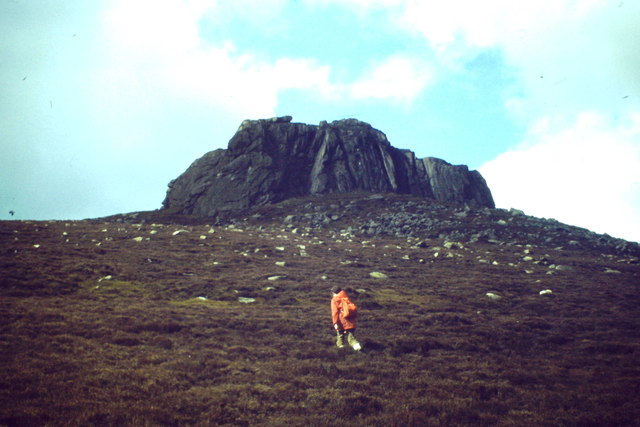
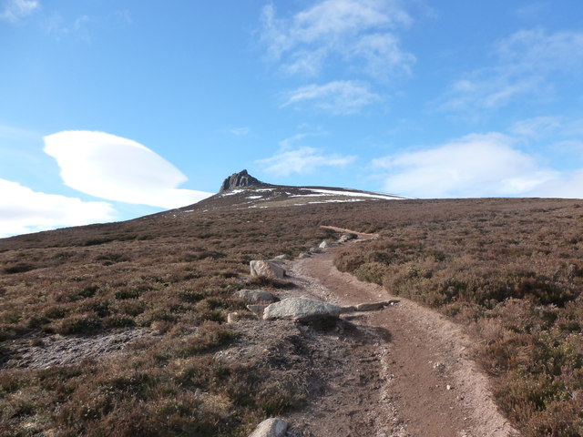
The hill is easily recognizable due to the distinctive rocky summit, which is said to resemble a clenched fist. This unique feature gives Clachnaben its name, as "clachnaben" roughly translates to "hill of the little fist" in Scottish Gaelic.

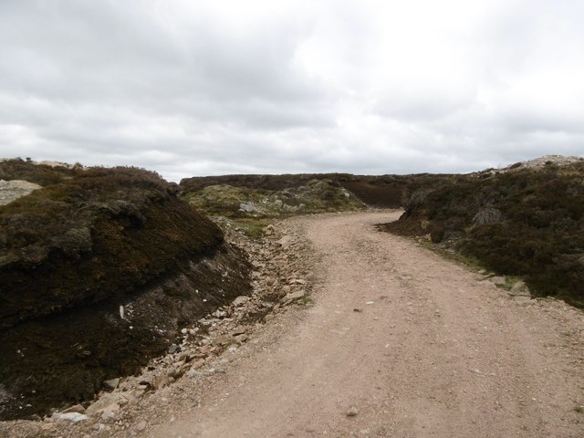
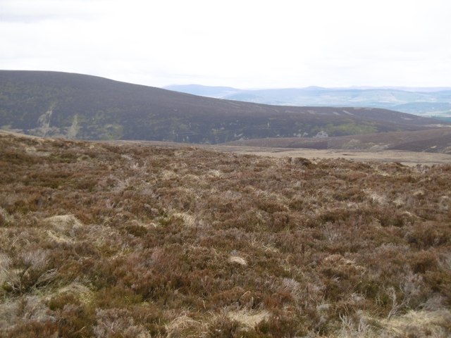
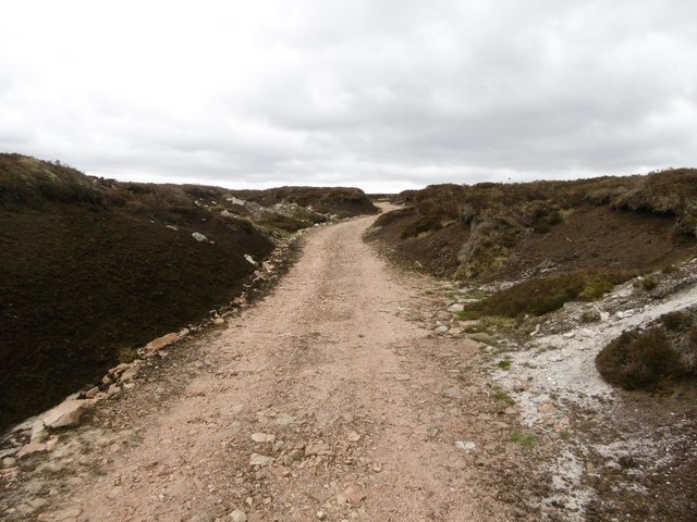
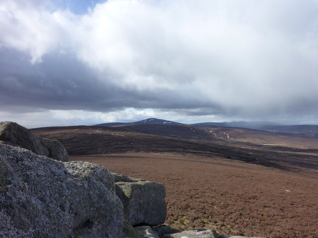
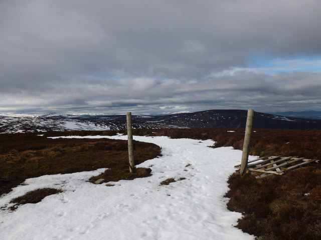
The trail leading to the summit of Clachnaben is well-marked and offers stunning panoramic views of the surrounding countryside. On a clear day, it is possible to see as far as the Cairngorms National Park and the North Sea coastline.

The hill is also known for its rich biodiversity, with a variety of plant and animal species inhabiting its slopes. Wildflowers such as bluebells, heather, and primroses can be seen in abundance during the summer months, adding vibrant colors to the landscape. Birdwatchers may spot species such as golden eagles, peregrine falcons, and red grouse.

Legend has it that Clachnaben was once the dwelling place of a giant known as Fionn. The giant would use the hill as a seat and throw stones into the distance, some of which can still be seen today as scattered boulders.

Overall, Clachnaben offers visitors a chance to immerse themselves in the natural beauty of the Scottish countryside while enjoying a rewarding hike to its summit.

If you have any feedback on the listing, please let us know in the comments section below.

Clachnaben Images

Images are sourced within 2km of 56.968184/-2.6341981 or Grid Reference NO6186. Thanks to Geograph Open Source API. All images are credited.

Peat hag in the upland landscape Clachnaben looms in the distance.
Peat hag in the upland landscape
Clachnaben looms in the distance.
Eroded peat No vegetation, just tonnes of peat oxidising and blowing away.
Eroded peat
No vegetation, just tonnes of peat oxidising and blowing away.
Bulldozed road, Sandy Hill The road runs along the ridge west of Hill of Edendocher and has been cut deeply into the peat.
Bulldozed road, Sandy Hill
The road runs along the ridge west of Hill of Edendocher and has been cut deeply into the peat.
Dried peat A dried out pool in the bogs with the customary pattern of cracks.
Dried peat
A dried out pool in the bogs with the customary pattern of cracks.
Peat lands, Sandy Hill The northern side of Sandy Hill, with Peter Hill in the background.
Peat lands, Sandy Hill
The northern side of Sandy Hill, with Peter Hill in the background.
Bulldozed road, Sandy Hill Cut deep into already eroding peat.
Bulldozed road, Sandy Hill
Cut deep into already eroding peat.
Clachnaben to Mount Battock Looking toward distant Mount Battock from the small rocky outcrop west of the Clachnaben trig pillar.
Clachnaben to Mount Battock
Looking toward distant Mount Battock from the small rocky outcrop west of the Clachnaben trig pillar.
Clachnaben Tors The Tors on the lesser summit of 579m on the Clachnaben summit plateau.  This hill track leads to the Hill of Edendocher.
My 5th Highland 5

A Highland Five is a hill in the Scottish Highlands between 500m and 609m high with a drop of at least 30m on all sides. from The Mountains of Scotland site
Clachnaben Tors
The Tors on the lesser summit of 579m on the Clachnaben summit plateau. This hill track leads to the Hill of Edendocher. My 5th Highland 5 A Highland Five is a hill in the Scottish Highlands between 500m and 609m high with a drop of at least 30m on all sides. from The Mountains of Scotland site
Clachnaben from the East Distinctive lower Deeside hilltop with its large tor at a height of about 590 metres amsl.
<span class="nowrap"><a title="http://en.wikipedia.org/wiki/Clachnaben" rel="nofollow ugc noopener" href="http://en.wikipedia.org/wiki/Clachnaben">Link</a><img style="margin-left:2px;" alt="External link" title="External link - shift click to open in new window" src="https://s1.geograph.org.uk/img/external.png" width="10" height="10"/></span>
Clachnaben from the East
Distinctive lower Deeside hilltop with its large tor at a height of about 590 metres amsl. LinkExternal link
Forest path above Black Hillocks A pleasant route to Clachnaben through the pine forest, but there are a few fallen trees to negotiate, so the lower route by the burn is probably easier.
Forest path above Black Hillocks
A pleasant route to Clachnaben through the pine forest, but there are a few fallen trees to negotiate, so the lower route by the burn is probably easier.
Clachnaben path below the Slack of Dye The name of this defile between the hills is the Slack of Dye - slack is a corruption of the Gaelic word slochd, which means a pass.
Clachnaben path below the Slack of Dye
The name of this defile between the hills is the Slack of Dye - slack is a corruption of the Gaelic word slochd, which means a pass.
Path to Clachnaben A good path crosses the heather moorland on its way to the massive granite tor which tops Clachnaben, a popular short hillwalk in its own right but also a way up onto the Mounth plateau.
Path to Clachnaben
A good path crosses the heather moorland on its way to the massive granite tor which tops Clachnaben, a popular short hillwalk in its own right but also a way up onto the Mounth plateau.
Collapsed gate, Hill of Edendocher The hill track across the grouse moor is picked out in snow.
Collapsed gate, Hill of Edendocher
The hill track across the grouse moor is picked out in snow.
Track junction, Hill of Edendocher Looking back towards Mount Battock as the sun sets.
Track junction, Hill of Edendocher
Looking back towards Mount Battock as the sun sets.
View towards Mount Battock from Clachnaben The granite rocks in the foreground lie to the west of the main summit tor.
View towards Mount Battock from Clachnaben
The granite rocks in the foreground lie to the west of the main summit tor.
Path between Hill of Edendocher and Clachnaben The path dips into a shallow col here as it crosses the grouse moor.  The tor on Clachnaben's summit is on the horizon.
Path between Hill of Edendocher and Clachnaben
The path dips into a shallow col here as it crosses the grouse moor. The tor on Clachnaben's summit is on the horizon.
Sun highlights the tor on Clachnaben The setting sun picks out the granite tor on the summit of Clachnaben.
Sun highlights the tor on Clachnaben
The setting sun picks out the granite tor on the summit of Clachnaben.
Evening light on Clachnaben The setting sun casts reddish light on the heather moorland and massive granite tor on the summit of Clachnaben.  Surprisingly, the smaller tor to the left hasn't been deemed worthy of inclusion on the map.
Evening light on Clachnaben
The setting sun casts reddish light on the heather moorland and massive granite tor on the summit of Clachnaben. Surprisingly, the smaller tor to the left hasn't been deemed worthy of inclusion on the map.
Show me another place!

Clachnaben is located at Grid Ref: NO6186 (Lat: 56.968184, Lng: -2.6341981)

Unitary Authority: Aberdeenshire

Police Authority: North East

What 3 Words

///awake.insolvent.used. Near Banchory, Aberdeenshire

Nearby Locations

Clachnaben

Related Wikis

Clachnaben

Clachnaben (archaically "Cloch-na'bain"; Scottish Gaelic: "Clach na Beinne") is a 589-metre hill in Glen Dye, Aberdeenshire, Scotland. It is a distinctive...

Easter Clune Castle

Easter Clune Castle is a ruined 16th-century tower house, about 6 miles (9.7 km) south-west of Banchory, Aberdeenshire, Scotland, and south of the Water...

Water of Aven

The Water of Aven (or A'an) (Scottish Gaelic: an t-Uisge Bàn) is a tributary of the Water of Feugh, itself the largest tributary of the River Dee, Aberdeenshire...

Finzean

Finzean (; Scottish Gaelic: Fìnnean) is a rural community, electoral polling district, community council area and former ecclesiastical parish, which forms...

Nearby Amenities

Located within 500m of 56.968184,-2.6341981
Clachnaben
Ele: 579
Natural: peak
Wikidata: Q5124867
Wikipedia: en:Clachnaben
Lat/Long: 56.9685433/-2.6363854
NO89S009
Ele: 579.424
Man Made: survey_point
Ref: NO80/9
Lat/Long: 56.9685122/-2.6364224
The data included in this document is from www.openstreetmap.org. The data is made available under ODbL.

Have you been to Clachnaben?

Leave your review of Clachnaben below (or comments, questions and feedback).