West Hill

Hill, Mountain in Berwickshire

Scotland

West Hill

A water trough at Knock Hill The trough is at the southeast corner of a large grazing field on the south side of the hill.
A water trough at Knock Hill Credit: Walter Baxter

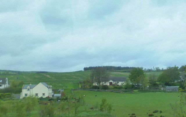
West Hill is a prominent hill located in Berwickshire, a historic county in the Scottish Borders region of Scotland. Rising to an elevation of around 267 meters (876 feet), it is considered a notable landmark in the area. The hill is situated near the village of Westruther, approximately 6 kilometers (3.7 miles) southwest of the town of Gordon.

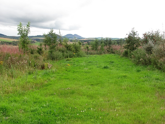
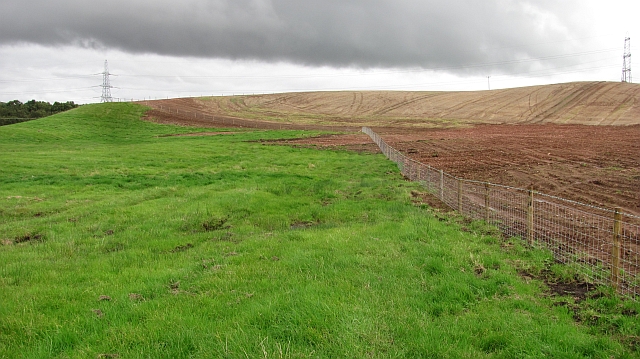
West Hill boasts a distinctive conical shape, with its summit offering breathtaking panoramic views of the picturesque surrounding countryside. The hill is primarily covered in grassland, interspersed with patches of heather and scattered trees. Its slopes are relatively gentle, making it accessible to hikers and walkers of different abilities.

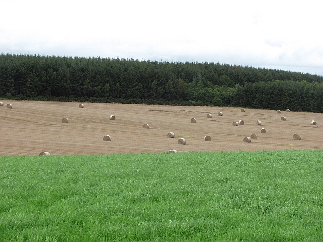
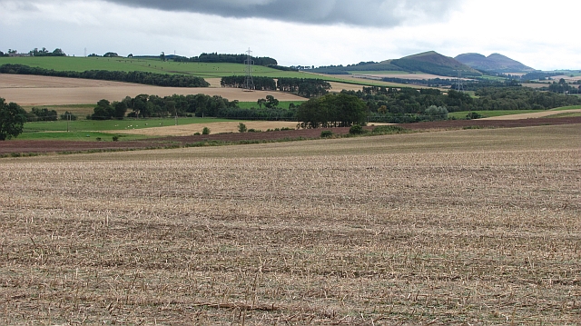
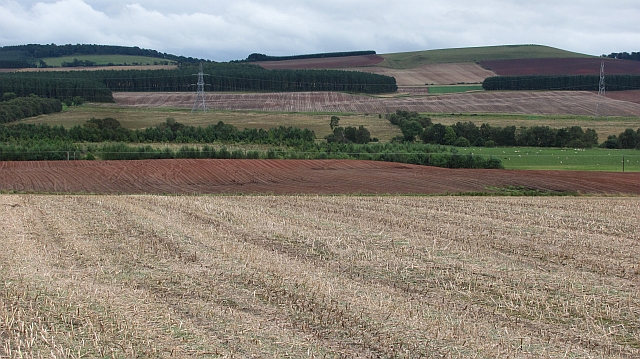
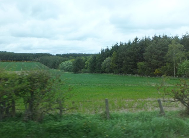
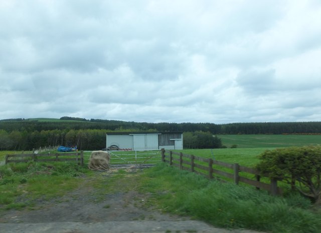
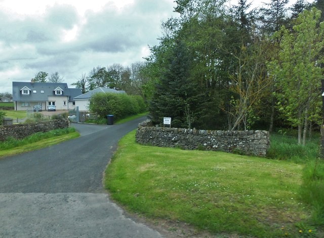
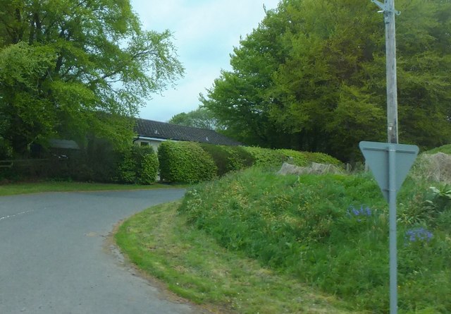
The area surrounding West Hill is rich in natural beauty, with rolling hills, fertile farmlands, and charming rural settlements. The hill itself is part of a larger network of walking trails, attracting outdoor enthusiasts who enjoy exploring the countryside on foot. The diverse flora and fauna found on and around the hill further enhance its natural appeal.

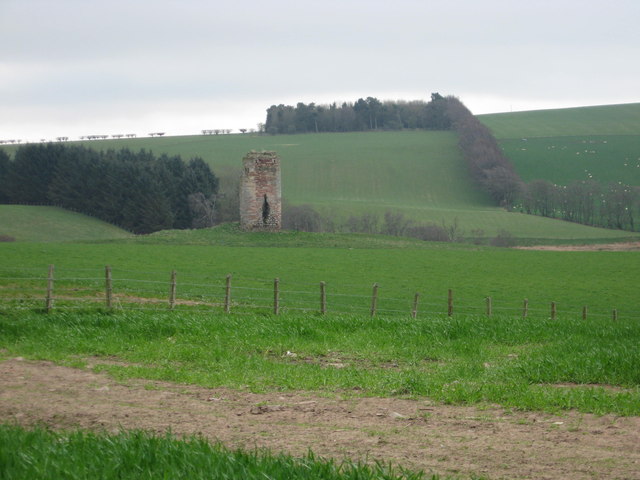
Historically, West Hill has been of significance, with traces of ancient settlements and archaeological sites discovered in the vicinity. These findings provide insights into the human habitation and activities in the region throughout different periods of history.

West Hill, Berwickshire, offers a tranquil and scenic retreat for those seeking to immerse themselves in the beauty of the Scottish Borders. Whether it be for a leisurely stroll, a challenging hike, or simply to enjoy the stunning vistas, this hill provides a captivating experience for nature lovers and history enthusiasts alike.

If you have any feedback on the listing, please let us know in the comments section below.
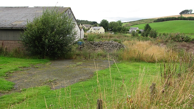
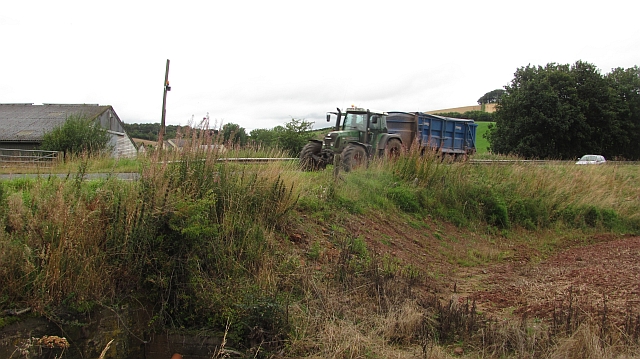
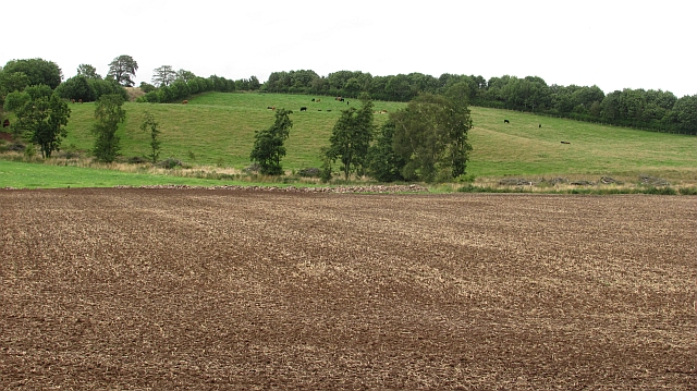
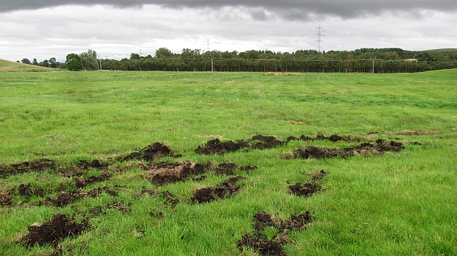
West Hill Images

Images are sourced within 2km of 55.679289/-2.6253562 or Grid Reference NT6043. Thanks to Geograph Open Source API. All images are credited.

A water trough at Knock Hill The trough is at the southeast corner of a large grazing field on the south side of the hill.
A water trough at Knock Hill
The trough is at the southeast corner of a large grazing field on the south side of the hill.
Stones on Knock Hill To the west of the trig point with Corsbie Farm in the distance on the left. Knock Hill is the site of an Iron Age hill fort.
Stones on Knock Hill
To the west of the trig point with Corsbie Farm in the distance on the left. Knock Hill is the site of an Iron Age hill fort.
A farm track on Knock Hill This track runs from Upper Huntlywood at the A6105 to the A6089 south of Bassendean.
A farm track on Knock Hill
This track runs from Upper Huntlywood at the A6105 to the A6089 south of Bassendean.
New woodland, Nether Huntlywood An area of young trees on former farmland.
New woodland, Nether Huntlywood
An area of young trees on former farmland.
Bales near Huntlywood Newly baled straw.
Bales near Huntlywood
Newly baled straw.
Nether Huntlywood Oilseed rape stubble with a view through to Black Hill and the distant Eildon Hills.
Nether Huntlywood
Oilseed rape stubble with a view through to Black Hill and the distant Eildon Hills.
Oilseed rape stubble, Nether Huntlywood View over wetland towards Fans Hill.
Oilseed rape stubble, Nether Huntlywood
View over wetland towards Fans Hill.
An old road alignment Tar showing through the moss at the edge of a farmyard. This would have been the route of the A6105 at one time, a bend has been straightened out with an embankment.
An old road alignment
Tar showing through the moss at the edge of a farmyard. This would have been the route of the A6105 at one time, a bend has been straightened out with an embankment.
Embankment,  A6105 The road has been straightened here. The tractor is hauling newly harvested grain.
Embankment, A6105
The road has been straightened here. The tractor is hauling newly harvested grain.
Cultivated field A flat field in former mossland.
Cultivated field
A flat field in former mossland.
Peaty soil, Gordon Moss Beyond this damp field with exposed black soil is an area of woodland on Gordon Moss.
Peaty soil, Gordon Moss
Beyond this damp field with exposed black soil is an area of woodland on Gordon Moss.
New fence Newly worked ground on hilly ground above Gordon Moss.
New fence
Newly worked ground on hilly ground above Gordon Moss.
Arable land near Huntlywood
Barn east of Huntlywood The hill in the left background is Knock Hill, which is one of those doubly-named places, 'cnoc' being Scots Gaelic for 'hill'. (Torpenhow in the Lake District <a href="https://www.geograph.org.uk/gridref/NY2039">NY2039</a> is possibly a triply-named place - Hill (Old English) + hill (Welsh) + hill (Danish)!)
Barn east of Huntlywood
The hill in the left background is Knock Hill, which is one of those doubly-named places, 'cnoc' being Scots Gaelic for 'hill'. (Torpenhow in the Lake District NY2039 is possibly a triply-named place - Hill (Old English) + hill (Welsh) + hill (Danish)!)
Private road "No access without permission" (intriguing ... can't help feeling a bit like Father Ted's Dougal standing by the "Do not press red button" sign!).
Private road
"No access without permission" (intriguing ... can't help feeling a bit like Father Ted's Dougal standing by the "Do not press red button" sign!).
Scattered housing by East Morriston
Road into East Morriston
Pasture lands at Corsbie 17th. century Corsbie Tower, built by the Cranstouns of Oxenfoord (north of Pathhead in Midlothian) can be seen in the background.
Pasture lands at Corsbie
17th. century Corsbie Tower, built by the Cranstouns of Oxenfoord (north of Pathhead in Midlothian) can be seen in the background.
Show me another place!

West Hill is located at Grid Ref: NT6043 (Lat: 55.679289, Lng: -2.6253562)

Unitary Authority: The Scottish Borders

Police Authority: The Lothians and Scottish Borders

What 3 Words

///mailing.unscathed.improve. Near Earlston, Scottish Borders

Nearby Locations

Everett Moss West Hill

Related Wikis

Corsbie Castle

Corsbie Castle is a ruined 16th-century tower house, about 2.5 miles (4.0 km) west of Gordon, Scottish Borders, Scotland, and north of the Eden Water....

Legerwood Kirk

Legerwood Kirk is an ancient and historic Church of Scotland church in the former county of Berwickshire, Scotland. It is situated half a mile east of...

Legerwood

Legerwood is a village by the Eden Water, in the Scottish Borders area of Scotland, near Lauder, near the Southern Upland Way. Legerwood Kirk is outside...

Gordon Moss

Gordon Moss is a nature reserve near Gordon, in the Scottish Borders area of Scotland, in the former Berwickshire. The moss is situated one mile west of...

Greenknowe Tower

Greenknowe Tower is a 16th-century tower house, located just west of the village of Gordon, in the Scottish Borders. Although a roofless ruin, the stonework...

Bassendean, Scottish Borders

Bassendean is a village in the Scottish Borders area of Scotland, 4 kilometres (2.5 mi) south of Westruther and 3 kilometres (1.9 mi) north-west of Gordon...

Gordon, Scottish Borders

Gordon is a village in the Scottish Borders area of Scotland, within the historic county of Berwickshire. The village sits on the crossroads of the A6105...

Gordon (NBR) railway station

Gordon railway station served the village of Gordon, Scottish Borders, Scotland from 1863 to 1948 on the Berwickshire Railway. == History == The station...

Nearby Amenities

Located within 500m of 55.679289,-2.6253562
West Hill
Natural: peak
Lat/Long: 55.6792274/-2.6254828
Power: pole
Lat/Long: 55.6783391/-2.6323253
Power: pole
Lat/Long: 55.6777795/-2.6314804
Power: pole
Lat/Long: 55.6768354/-2.6300866
Power: pole
Lat/Long: 55.6755608/-2.6287419
Power: pole
Lat/Long: 55.6762202/-2.6294097
Power: pole
Lat/Long: 55.6773182/-2.6307991
The data included in this document is from www.openstreetmap.org. The data is made available under ODbL.

Have you been to West Hill?

Leave your review of West Hill below (or comments, questions and feedback).