Hang Hill

Hill, Mountain in Gloucestershire Forest of Dean

England

Hang Hill

Church of St Paul, Parkend The Church of St Paul at Parkend was built in 1822 to a design by Henry Poole.  The church is unusual with an octagonal nave.  The church is Grade II listed, see: <span class="nowrap"><a title="https://historicengland.org.uk/listing/the-list/list-entry/1186362" rel="nofollow ugc noopener" href="https://historicengland.org.uk/listing/the-list/list-entry/1186362">Link</a><img style="margin-left:2px;" alt="External link" title="External link - shift click to open in new window" src="https://s1.geograph.org.uk/img/external.png" width="10" height="10"/></span>
Church of St Paul, Parkend Credit: Philip Halling

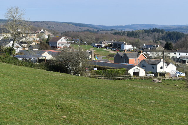
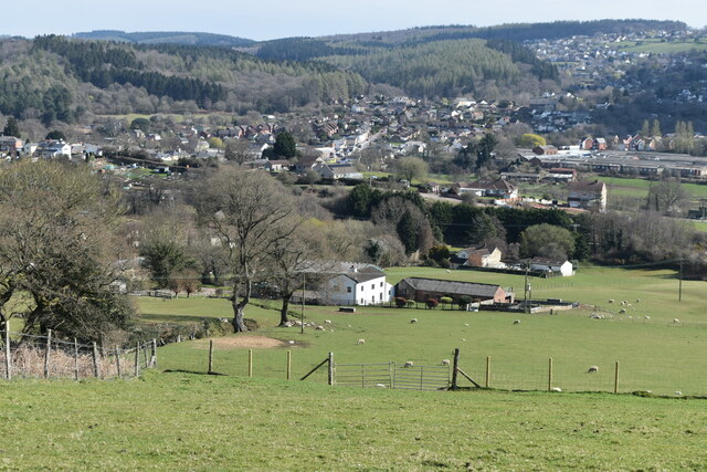
Hang Hill is a prominent hill located in the county of Gloucestershire, England. Rising to an elevation of 317 meters (1,040 feet), it is part of the Cotswold Hills, which stretch across several counties in the southwestern region of the country. Hang Hill is situated near the village of Painswick, approximately 10 kilometers (6 miles) southeast of the city of Gloucester.

The hill offers stunning panoramic views of the surrounding countryside, including the Severn Vale and the rolling hills of the Cotswolds. Its location within the Cotswold Area of Outstanding Natural Beauty makes it a popular destination for hikers, nature enthusiasts, and photographers.

Covered in lush green vegetation, Hang Hill is home to a diverse range of flora and fauna. The hillside is adorned with an abundance of wildflowers, including bluebells and primroses, which create a colorful display during the spring months. The area is also inhabited by various bird species, such as skylarks and buzzards, making it a haven for birdwatchers.

At the summit of Hang Hill, there is a trig point, which serves as a marker for Ordnance Survey mapping purposes. The trig point offers a vantage point to take in the breathtaking views of the surrounding landscape.

Access to Hang Hill is relatively easy, with footpaths and trails leading to the summit from Painswick and nearby villages. The hill provides a tranquil escape and an opportunity to immerse oneself in the natural beauty of Gloucestershire's countryside.

If you have any feedback on the listing, please let us know in the comments section below.
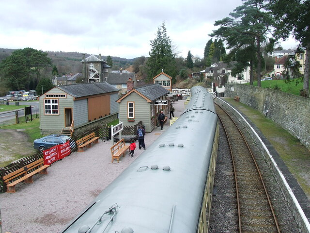
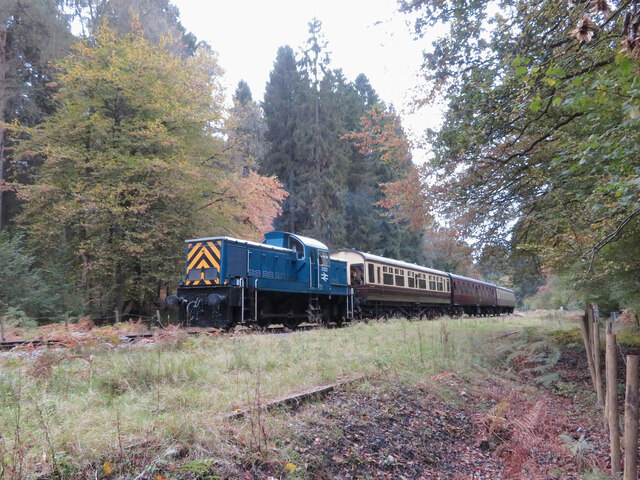
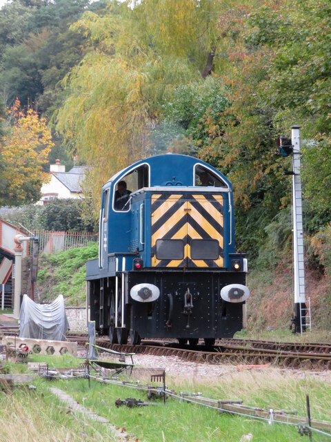
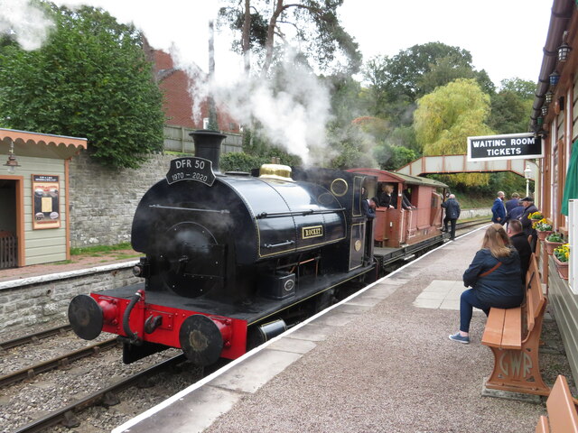
Hang Hill Images

Images are sourced within 2km of 51.756618/-2.5728985 or Grid Reference SO6006. Thanks to Geograph Open Source API. All images are credited.

Church of St Paul, Parkend The Church of St Paul at Parkend was built in 1822 to a design by Henry Poole.  The church is unusual with an octagonal nave.  The church is Grade II listed, see: <span class="nowrap"><a title="https://historicengland.org.uk/listing/the-list/list-entry/1186362" rel="nofollow ugc noopener" href="https://historicengland.org.uk/listing/the-list/list-entry/1186362">Link</a><img style="margin-left:2px;" alt="External link" title="External link - shift click to open in new window" src="https://s1.geograph.org.uk/img/external.png" width="10" height="10"/></span>
Church of St Paul, Parkend
The Church of St Paul at Parkend was built in 1822 to a design by Henry Poole. The church is unusual with an octagonal nave. The church is Grade II listed, see: LinkExternal link
Parkend Station Parkend Station on the Dean Forest Railway, a rail preservation railway.  The level crossing gate is reputedly the longest such gate in the country.
Parkend Station
Parkend Station on the Dean Forest Railway, a rail preservation railway. The level crossing gate is reputedly the longest such gate in the country.
Level crossing at Parkend The crossing gate is reputedly the longest in the country.
Level crossing at Parkend
The crossing gate is reputedly the longest in the country.
Parkend Station  Parkend Station, the northern terminus of the Dean Forest Railway.
Parkend Station
Parkend Station, the northern terminus of the Dean Forest Railway.
Dean Field Studies Centre Dean Field Studies Centre is owned by Bristol City Council.  The building was built in 1849 as the Blowing Engine House for the ironworks in Parkend and is one of the best surviving examples.
Dean Field Studies Centre
Dean Field Studies Centre is owned by Bristol City Council. The building was built in 1849 as the Blowing Engine House for the ironworks in Parkend and is one of the best surviving examples.
Former toll house The Pike House, built as a turnpike house.  A 19th century former toll house which was enlarged in the early 20th century.   The house stands on the junction of the B4431 and the road to Bream.  The house is Grade II listed, see: <span class="nowrap"><a title="https://historicengland.org.uk/listing/the-list/list-entry/1299231" rel="nofollow ugc noopener" href="https://historicengland.org.uk/listing/the-list/list-entry/1299231">Link</a><img style="margin-left:2px;" alt="External link" title="External link - shift click to open in new window" src="https://s1.geograph.org.uk/img/external.png" width="10" height="10"/></span>
Former toll house
The Pike House, built as a turnpike house. A 19th century former toll house which was enlarged in the early 20th century. The house stands on the junction of the B4431 and the road to Bream. The house is Grade II listed, see: LinkExternal link
The remains of the Titanic Steelworks The Titanic steelworks were so named because Robert Mushet the owner was experimenting with Titanium at that time.  Robert Mushet was working on solving the problems with the Bessemer steel making process.
The remains of the Titanic Steelworks
The Titanic steelworks were so named because Robert Mushet the owner was experimenting with Titanium at that time. Robert Mushet was working on solving the problems with the Bessemer steel making process.
Parkend railway station
Dean Forest Railway near Parkend Class 14 No. D9521 approaches Parkend during the Dean Forest Railway's delayed 50th anniversary gala.
Dean Forest Railway near Parkend
Class 14 No. D9521 approaches Parkend during the Dean Forest Railway's delayed 50th anniversary gala.
Class 14 at Parkend Class 14 No. D9521 runs around its train at Parkend station during the Dean Forest Railway's delayed 50th anniversary gala.
Class 14 at Parkend
Class 14 No. D9521 runs around its train at Parkend station during the Dean Forest Railway's delayed 50th anniversary gala.
Dean Forest Railway at Parkend Visiting Peckett W6 'Rocket' is seen on brake-van ride duties at Parkend station during the Dean Forest Railway's delayed 50th anniversary gala.
Dean Forest Railway at Parkend
Visiting Peckett W6 'Rocket' is seen on brake-van ride duties at Parkend station during the Dean Forest Railway's delayed 50th anniversary gala.
Dean Forest Railway gala at Parkend A variety of road and other engines are seen at Parkend station during the Dean Forest Railway's delayed 50th anniversary gala.
Dean Forest Railway gala at Parkend
A variety of road and other engines are seen at Parkend station during the Dean Forest Railway's delayed 50th anniversary gala.
St James’ Church Bream Sunday morning worshippers gathering outside the door.
St James’ Church Bream
Sunday morning worshippers gathering outside the door.
Wide verge beside Lyndsey Road
View over Pastor’s Hill, Bream
View over Whitecroft The station on the preserved Dean Forest Railway is in the centre of this image.
View over Whitecroft
The station on the preserved Dean Forest Railway is in the centre of this image.
Show me another place!

Hang Hill is located at Grid Ref: SO6006 (Lat: 51.756618, Lng: -2.5728985)

Administrative County: Gloucestershire

District: Forest of Dean

Police Authority: Gloucestershire

What 3 Words

///cactus.decoding.partly. Near Bream, Gloucestershire

Related Wikis

Bream, Gloucestershire

Bream (historically known as Breem) is a village in the Forest of Dean, west Gloucestershire, England. The population was around 3,170 in the 2011 census...

West Dean, Gloucestershire

West Dean is a civil parish, situated in the Forest of Dean district of Gloucestershire, England. == History == The Forest of Dean was an extra-parochial...

Nagshead

Nagshead is a woodland reserve, located on the western edge of Parkend, in the Forest of Dean, Gloucestershire, and is home to RSPB Nagshead. The site...

Mary Rose Young

Mary Rose Young is a ceramic artist who lives and works in the Forest of Dean, Gloucestershire, in the UK. == Early life == Mary Rose Young was born near...

Nearby Amenities

Located within 500m of 51.756618,-2.5728985
Bus Stop
Bowson Rd
Naptan AtcoCode: 1600GL617
Naptan Bearing: S
Naptan CommonName: Bowson Rd
Naptan NaptanCode: gloagmdj
Naptan Street: Parkend Rd
Naptan Verified: no
Source: naptan_import
Lat/Long: 51.7587741/-2.5696568
Bus Stop
Bowson Rd
Naptan AtcoCode: 1600GL618
Naptan Bearing: N
Naptan CommonName: Bowson Rd
Naptan Indicator: Opp
Naptan NaptanCode: gloagmda
Naptan Street: Parkend Rd
Naptan Verified: no
Source: naptan_import
Lat/Long: 51.7588723/-2.5697884
Bus Stop
The Hedgehog
Naptan AtcoCode: 1600GL625
Naptan Bearing: S
Naptan CommonName: The Hedgehog
Naptan Indicator: Opp
Naptan NaptanCode: gloagjwa
Naptan Street: High St
Naptan Verified: no
Source: naptan_import
Lat/Long: 51.7522389/-2.5730224
Bus Stop
The Hedgehog
Naptan AtcoCode: 1600GL626
Naptan Bearing: N
Naptan CommonName: The Hedgehog
Naptan NaptanCode: gloagjtw
Naptan Street: High St
Naptan Verified: no
Source: naptan_import
Lat/Long: 51.7523644/-2.5731109
Bus Stop
Bowson Square
Naptan AtcoCode: 1600GL637
Naptan Bearing: SW
Naptan CommonName: Bowson Square
Naptan NaptanCode: gloagmam
Naptan Street: Parkend Rd
Naptan Verified: no
Source: naptan_import
Lat/Long: 51.7562968/-2.5706108
Bus Stop
Bowson Square
Naptan AtcoCode: 1600GL638
Naptan Bearing: NE
Naptan CommonName: Bowson Square
Naptan Indicator: Opp
Naptan NaptanCode: gloagmaj
Naptan Street: Parkend Rd
Naptan Verified: no
Source: naptan_import
Lat/Long: 51.756404/-2.570757
Bus Stop
The Hedgehog
Naptan AtcoCode: 1600GL641
Naptan Bearing: W
Naptan CommonName: The Hedgehog
Naptan NaptanCode: gloagjwj
Naptan Street: Whitecroft Rd
Naptan Verified: no
Source: naptan_import
Lat/Long: 51.7525646/-2.5726209
Bus Stop
The Hedgehog
Naptan AtcoCode: 1600GL642
Naptan Bearing: E
Naptan CommonName: The Hedgehog
Naptan NaptanCode: gloagjwp
Naptan Street: Whitecroft Rd
Naptan Verified: no
Source: naptan_import
Lat/Long: 51.752673/-2.5725064
Bus Stop
Hang Hill Rd
Naptan AtcoCode: 1600GLF731
Naptan Bearing: SW
Naptan CommonName: Hang Hill Rd
Naptan Indicator: Opp
Naptan NaptanCode: gloagjwt
Naptan Street: Parkend Rd
Naptan Verified: no
Source: naptan_import
Lat/Long: 51.7538508/-2.5725213
Bus Stop
Hang Hill Rd
Naptan AtcoCode: 1600GLF732
Naptan Bearing: NE
Naptan CommonName: Hang Hill Rd
Naptan NaptanCode: gloagjwm
Naptan Street: Parkend Rd
Naptan Verified: no
Source: naptan_import
Lat/Long: 51.7538683/-2.5726374
Bus Stop
Bowson Rd
Naptan AtcoCode: 1600GLF735
Naptan Bearing: NW
Naptan CommonName: Bowson Rd
Naptan NaptanCode: gloagmgd
Naptan Street: Bowson Rd
Naptan Verified: no
Source: naptan_import
Lat/Long: 51.7573007/-2.5675519
Bus Stop
Bowson Rd
Naptan AtcoCode: 1600GLF736
Naptan Bearing: SE
Naptan CommonName: Bowson Rd
Naptan NaptanCode: gloagmgj
Naptan Street: Bowson Rd
Naptan Verified: no
Source: naptan_import
Lat/Long: 51.757391/-2.5674661
Turning Circle
Lat/Long: 51.7543072/-2.5759059
Power: pole
Lat/Long: 51.754734/-2.5793061
Power: pole
Lat/Long: 51.7555293/-2.5781514
Power: pole
Lat/Long: 51.7565853/-2.5765729
Power: pole
Lat/Long: 51.7571299/-2.5759372
Location Transition: yes
Power: pole
Lat/Long: 51.7579202/-2.5749703
Power: pole
Lat/Long: 51.7565197/-2.576483
Power: pole
Lat/Long: 51.7569257/-2.5759949
Power: pole
Lat/Long: 51.7571465/-2.5757575
Power: pole
Lat/Long: 51.7581443/-2.5743976
Power: pole
Lat/Long: 51.7587586/-2.573192
Power: pole
Lat/Long: 51.7592649/-2.5718938
Power: pole
Lat/Long: 51.7593438/-2.5717194
Power: pole
Lat/Long: 51.7599033/-2.5706412
Power: pole
Lat/Long: 51.7583128/-2.5794107
Power: pole
Lat/Long: 51.7580596/-2.5754075
Power: pole
Lat/Long: 51.7580638/-2.5755389
Power: pole
Lat/Long: 51.7581393/-2.5767861
Generator Method: photovoltaic
Generator Output Electricity: yes
Generator Source: solar
Generator Type: solar_photovoltaic_panel
Location: roof
Power: generator
Lat/Long: 51.7544028/-2.5778738
Generator Method: photovoltaic
Generator Output Electricity: yes
Generator Source: solar
Generator Type: solar_photovoltaic_panel
Location: roof
Power: generator
Lat/Long: 51.75425/-2.5781393
Generator Method: photovoltaic
Generator Output Electricity: yes
Generator Source: solar
Generator Type: solar_photovoltaic_panel
Location: roof
Power: generator
Lat/Long: 51.7542268/-2.5779596
Generator Method: photovoltaic
Generator Output Electricity: yes
Generator Source: solar
Generator Type: solar_photovoltaic_panel
Location: roof
Power: generator
Lat/Long: 51.754167/-2.5760794
Generator Method: photovoltaic
Generator Output Electricity: yes
Generator Source: solar
Generator Type: solar_photovoltaic_panel
Location: roof
Power: generator
Lat/Long: 51.7585403/-2.5704387
Generator Method: photovoltaic
Generator Output Electricity: yes
Generator Source: solar
Generator Type: solar_photovoltaic_panel
Location: roof
Power: generator
Lat/Long: 51.7528918/-2.5715974
Generator Method: photovoltaic
Generator Output Electricity: yes
Generator Source: solar
Generator Type: solar_photovoltaic_panel
Location: roof
Power: generator
Lat/Long: 51.7541554/-2.5694168
Generator Method: photovoltaic
Generator Output Electricity: yes
Generator Source: solar
Generator Type: solar_photovoltaic_panel
Location: roof
Power: generator
Lat/Long: 51.7541853/-2.5690466
Generator Method: photovoltaic
Generator Output Electricity: yes
Generator Source: solar
Generator Type: solar_photovoltaic_panel
Location: roof
Power: generator
Lat/Long: 51.7525979/-2.5698996
Crossing
Lat/Long: 51.7580432/-2.5676958
Crossing
Lat/Long: 51.7581074/-2.5676805
The data included in this document is from www.openstreetmap.org. The data is made available under ODbL.

Have you been to Hang Hill?

Leave your review of Hang Hill below (or comments, questions and feedback).