Hen Hill

Hill, Mountain in Kincardineshire

Scotland

Hen Hill

On the way up Glen Dye
On the way up Glen Dye Credit: Bill Harrison

Hen Hill is a prominent hill located in the region of Kincardineshire, Scotland. With an elevation of approximately 360 meters (1,181 feet), it stands as a notable feature in the landscape. Situated near the village of Fettercairn, Hen Hill offers breathtaking panoramic views of the surrounding area, including the Grampian Mountains to the west and the North Sea to the east.

The hill is easily accessible, with several footpaths leading to its summit. These paths are well-maintained, making it a popular destination for hikers and nature enthusiasts. The ascent to the top is relatively moderate, making it suitable for people of various fitness levels.

Hen Hill is known for its diverse flora and fauna, offering a unique habitat for various species. The hill's vegetation consists mainly of grasses, heather, and scattered trees, providing a haven for numerous bird species, including pheasants, partridges, and songbirds. The abundance of wildlife in the area makes Hen Hill an attractive spot for birdwatching.

In addition to its natural beauty, Hen Hill also holds historical significance. The hill is home to an ancient hillfort, believed to have been constructed during the Iron Age. The remains of the fort, including ditches and ramparts, can still be seen today, serving as a reminder of the region's rich heritage.

Overall, Hen Hill offers a captivating experience for those seeking outdoor adventures, stunning views, and a glimpse into the past. Whether it is for a leisurely stroll or a more challenging hike, this hill is a must-visit destination in Kincardineshire.

If you have any feedback on the listing, please let us know in the comments section below.
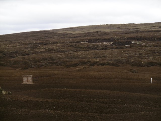
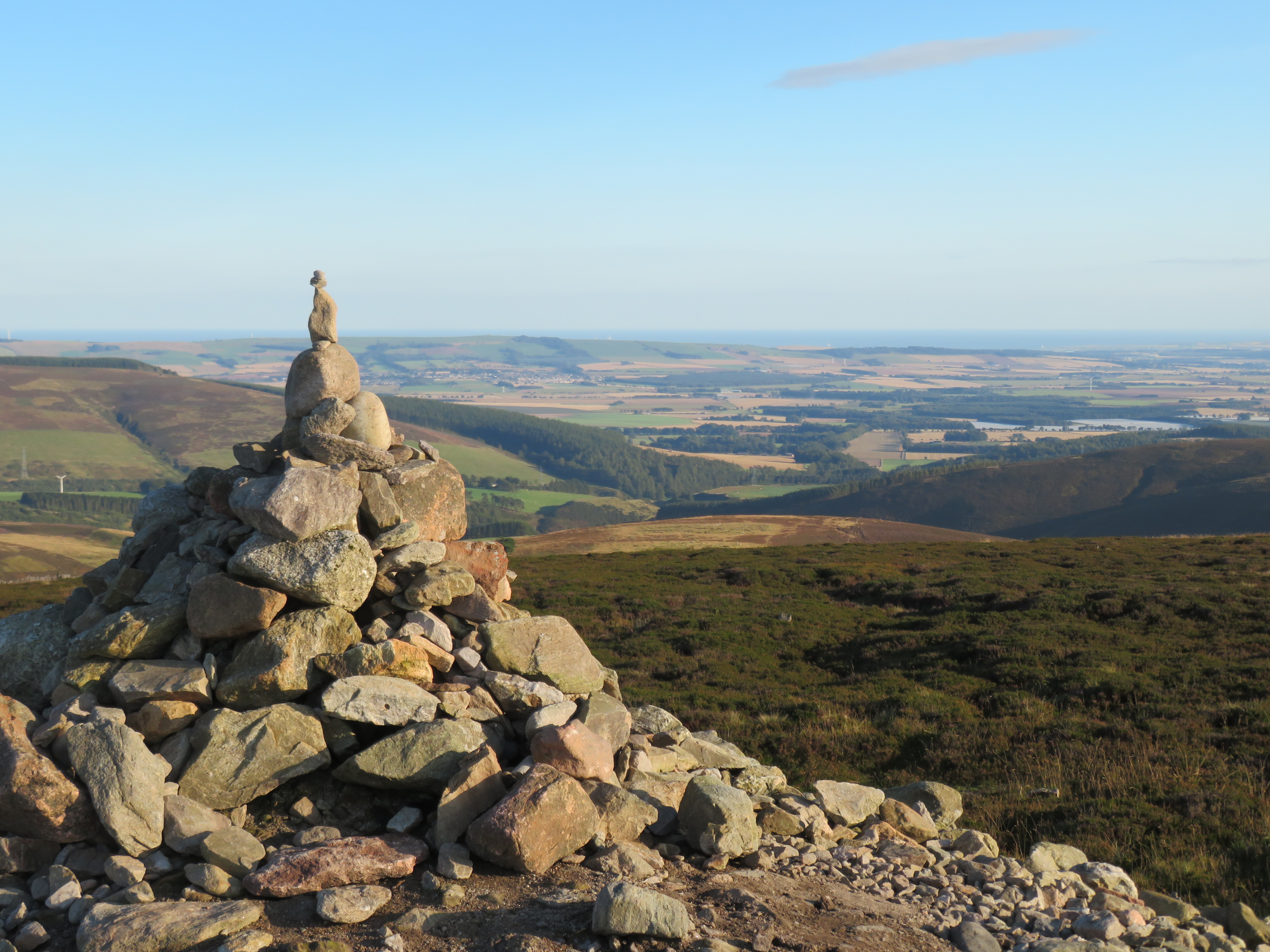
Hen Hill Images

Images are sourced within 2km of 56.945617/-2.6516002 or Grid Reference NO6084. Thanks to Geograph Open Source API. All images are credited.

On the way up Glen Dye
Walking past Water of Dye
Bridge over Burn of Edendocher The burn is about 2 km in length and meets Water of Dye to the left.
Bridge over Burn of Edendocher
The burn is about 2 km in length and meets Water of Dye to the left.
Parting of the paths The left-hand path follows Water of Dye and eventually reaches Glen Esk.   The right-hand path (which I took) heads up to the ridge leading to Mount Battock.
Parting of the paths
The left-hand path follows Water of Dye and eventually reaches Glen Esk. The right-hand path (which I took) heads up to the ridge leading to Mount Battock.
By the Burn of Badymicks... ...with Mount Battock in the distance.
By the Burn of Badymicks...
...with Mount Battock in the distance.
Ruined bridge The bridge over the Burn of Badymicks shown here <a href="https://www.geograph.org.uk/photo/417353">NO5883 : Foot bridge and Stable, Glen Dye.</a> has been swept away.
Ruined bridge
The bridge over the Burn of Badymicks shown here NO5883 : Foot bridge and Stable, Glen Dye. has been swept away.
Burn of Badymicks A road follows the burn on to Mount Battock.
Burn of Badymicks
A road follows the burn on to Mount Battock.
Roadworks, Glen Dye Regrading the road up Glen Dye.
Roadworks, Glen Dye
Regrading the road up Glen Dye.
Glen Dye By now the Burn of Badymicks and Burn of Saughs have joined to form the Water of Dye.
Glen Dye
By now the Burn of Badymicks and Burn of Saughs have joined to form the Water of Dye.
Water of Dye The road was built some time ago and has a very well constructed masonry wall protecting it from the river.
Water of Dye
The road was built some time ago and has a very well constructed masonry wall protecting it from the river.
Water of Dye Looking downstream towards an area of weathered granite.
Water of Dye
Looking downstream towards an area of weathered granite.
Road by Water of Dye The local granite weathers into a good road surface gravel.
Road by Water of Dye
The local granite weathers into a good road surface gravel.
Eroded peat No vegetation, just tonnes of peat oxidising and blowing away.
Eroded peat
No vegetation, just tonnes of peat oxidising and blowing away.
View up Glen Dye View from the road towards the flattish area where the Burn of Badymicks meets the Water of Dye.
View up Glen Dye
View from the road towards the flattish area where the Burn of Badymicks meets the Water of Dye.
Water of Dye Upper Glen Dye.
Water of Dye
Upper Glen Dye.
Upper Glen Dye A view of Mount Battock.
Upper Glen Dye
A view of Mount Battock.
Water of Dye On the right the road crosses the Burn of Edendocher.
Water of Dye
On the right the road crosses the Burn of Edendocher.
Foot bridge and Stable, Glen Dye. At the confluence of the Burn of Badymicks and the Water of Dye, the track fords the Burn and continues further up Glen Dye. Past a stable with no door but it is otherwise sound.
Foot bridge and Stable, Glen Dye.
At the confluence of the Burn of Badymicks and the Water of Dye, the track fords the Burn and continues further up Glen Dye. Past a stable with no door but it is otherwise sound.
Show me another place!

Hen Hill is located at Grid Ref: NO6084 (Lat: 56.945617, Lng: -2.6516002)

Unitary Authority: Aberdeenshire

Police Authority: North East

What 3 Words

///likening.costly.waltz. Near Banchory, Aberdeenshire

Nearby Locations

Hen Hill

Related Wikis

Clachnaben

Clachnaben (archaically "Cloch-na'bain"; Scottish Gaelic: "Clach na Beinne") is a 589-metre hill in Glen Dye, Aberdeenshire, Scotland. It is a distinctive...

Mount Battock

Mount Battock (778 m) is a mountain in the Mounth on the eastern edge of the Scottish Highlands, on the border between Aberdeenshire and Angus. A rounded...

Cairn o' Mount

The Cairn o' Mount or Cairn o' Mounth is a hill in Aberdeenshire, Scotland, rising to 455 metres (1,493 ft). The B974 road crosses its summit, connecting...

Colmeallie stone circle

The Colmeallie stone circle is a recumbent stone circle in Glen Esk, Angus, Scotland. It is located 8 km north of Edzell at Colmeallie Farm, adjacent to...

Have you been to Hen Hill?

Leave your review of Hen Hill below (or comments, questions and feedback).