Airy Muir

Hill, Mountain in Kincardineshire

Scotland

Airy Muir

Peat hag in the upland landscape Clachnaben looms in the distance.
Peat hag in the upland landscape Credit: Bill Harrison

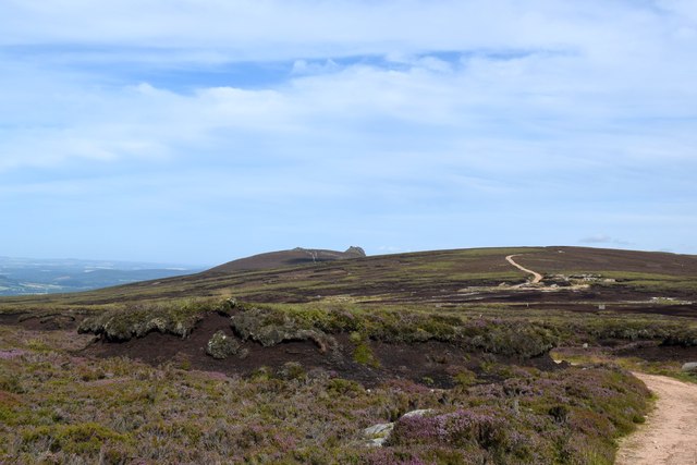
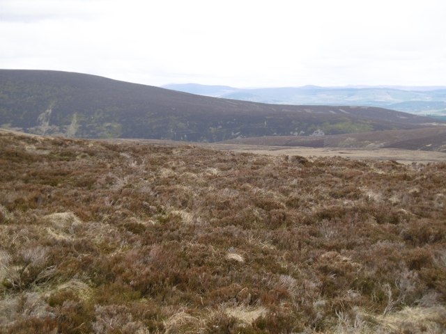
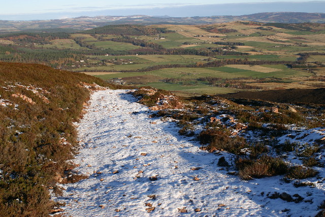
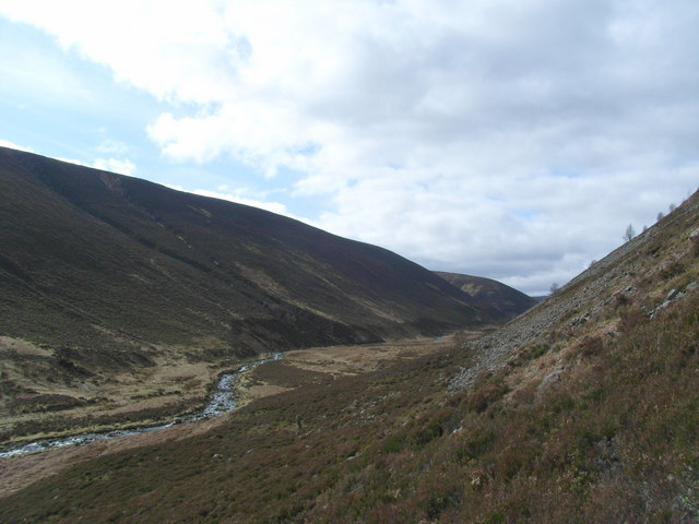
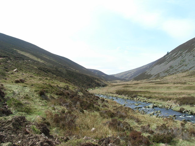
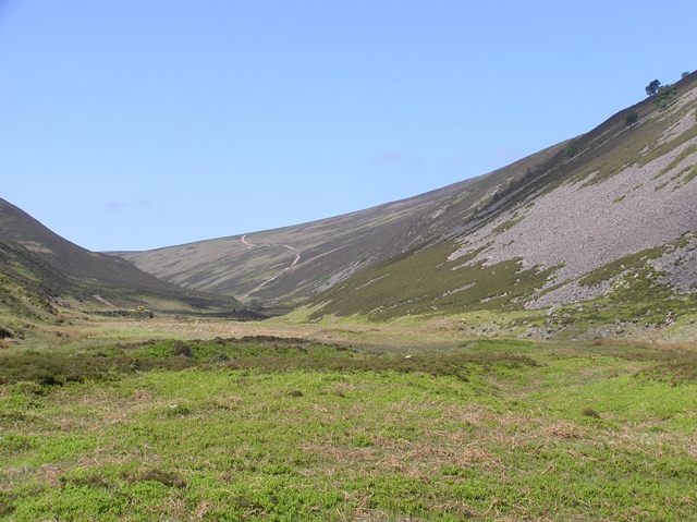
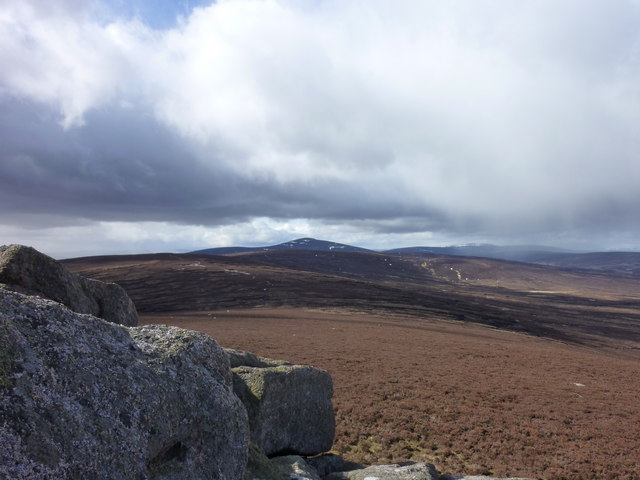
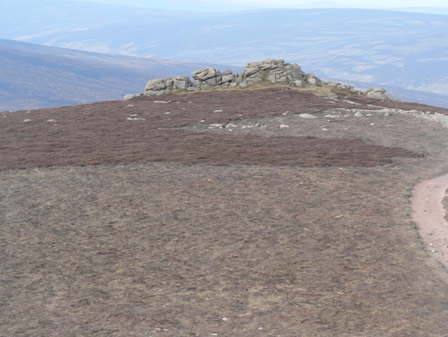
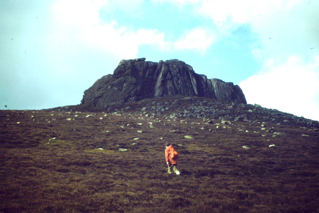
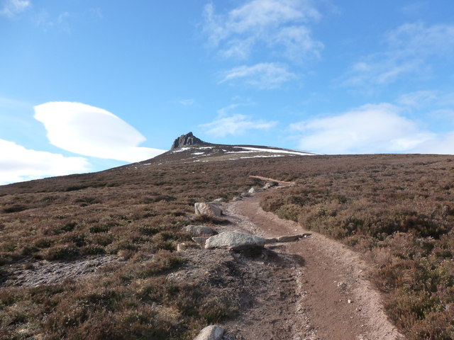
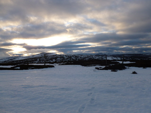
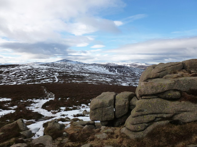
Airy Muir is a prominent hill located in Kincardineshire, Scotland. Situated in the eastern part of the country, it is part of the Mounth range, which forms the southern edge of the Grampian Mountains. Rising to an elevation of approximately 500 meters (1,640 feet), Airy Muir offers breathtaking panoramic views of the surrounding countryside.

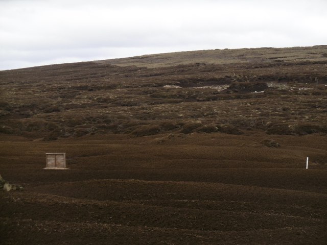
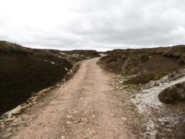
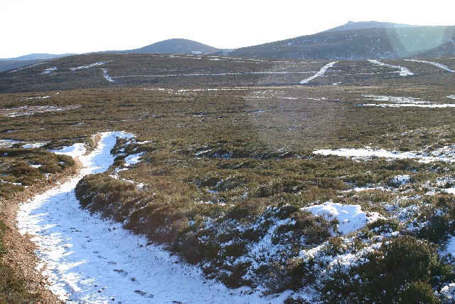
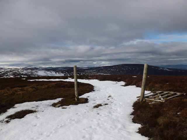
The hill is characterized by its gently sloping terrain, covered in heather and grasses. It is a popular destination for hikers and nature enthusiasts, offering a variety of walking trails that cater to different skill levels. The summit provides a vantage point from which visitors can admire the rolling hills, deep valleys, and distant peaks that make up the stunning Scottish landscape.

Airy Muir is also home to a diverse range of flora and fauna. The hill supports a variety of plant species, including heather, bracken, and wildflowers, which create a vibrant and colorful display during the summer months. Wildlife such as red deer, mountain hares, and various bird species can often be spotted in the area.

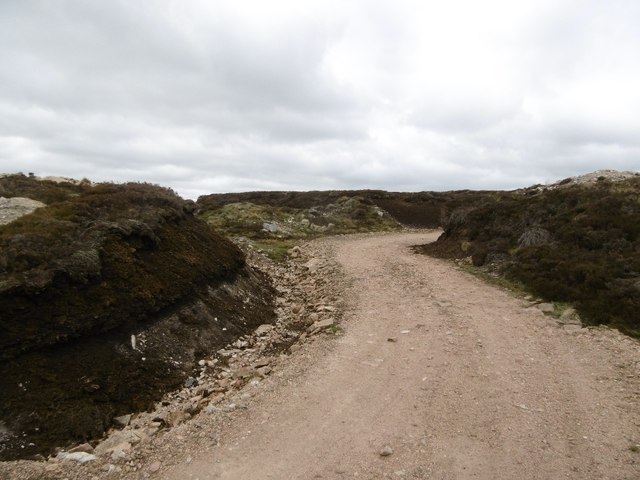
The hill is easily accessible by road, with parking available at the base for those wishing to explore its trails. It offers a peaceful and tranquil setting, allowing visitors to immerse themselves in the natural beauty of the Scottish Highlands. Whether it is for a leisurely stroll or a challenging hike, Airy Muir provides a captivating experience for all who venture to its summit.

If you have any feedback on the listing, please let us know in the comments section below.

Airy Muir Images

Images are sourced within 2km of 56.979302/-2.6522544 or Grid Reference NO6087. Thanks to Geograph Open Source API. All images are credited.

Peat hag in the upland landscape Clachnaben looms in the distance.
Peat hag in the upland landscape
Clachnaben looms in the distance.
Eroded peat No vegetation, just tonnes of peat oxidising and blowing away.
Eroded peat
No vegetation, just tonnes of peat oxidising and blowing away.
Bulldozed road, Sandy Hill The road runs along the ridge west of Hill of Edendocher and has been cut deeply into the peat.
Bulldozed road, Sandy Hill
The road runs along the ridge west of Hill of Edendocher and has been cut deeply into the peat.
Dried peat A dried out pool in the bogs with the customary pattern of cracks.
Dried peat
A dried out pool in the bogs with the customary pattern of cracks.
Peat lands, Sandy Hill The northern side of Sandy Hill, with Peter Hill in the background.
Peat lands, Sandy Hill
The northern side of Sandy Hill, with Peter Hill in the background.
Bulldozed road, Sandy Hill Cut deep into already eroding peat.
Bulldozed road, Sandy Hill
Cut deep into already eroding peat.
Moorland track on Peter Hill Looking N from position
Moorland track on Peter Hill
Looking N from position
Moorland on Peter Hill Looking SE from position
Moorland on Peter Hill
Looking SE from position
Water of Aven Looking South-West across the Water of Aven from the southern slope of Creaganducy.
Water of Aven
Looking South-West across the Water of Aven from the southern slope of Creaganducy.
Water of Aven Looking West upstream from the other bank.
Water of Aven
Looking West upstream from the other bank.
Glen Aven
Glen Aven
Clachnaben to Mount Battock Looking toward distant Mount Battock from the small rocky outcrop west of the Clachnaben trig pillar.
Clachnaben to Mount Battock
Looking toward distant Mount Battock from the small rocky outcrop west of the Clachnaben trig pillar.
Clachnaben Tors The Tors on the lesser summit of 579m on the Clachnaben summit plateau.  This hill track leads to the Hill of Edendocher.
My 5th Highland 5

A Highland Five is a hill in the Scottish Highlands between 500m and 609m high with a drop of at least 30m on all sides. from The Mountains of Scotland site
Clachnaben Tors
The Tors on the lesser summit of 579m on the Clachnaben summit plateau. This hill track leads to the Hill of Edendocher. My 5th Highland 5 A Highland Five is a hill in the Scottish Highlands between 500m and 609m high with a drop of at least 30m on all sides. from The Mountains of Scotland site
Clachnaben from the East Distinctive lower Deeside hilltop with its large tor at a height of about 590 metres amsl.
<span class="nowrap"><a title="http://en.wikipedia.org/wiki/Clachnaben" rel="nofollow ugc noopener" href="http://en.wikipedia.org/wiki/Clachnaben">Link</a><img style="margin-left:2px;" alt="External link" title="External link - shift click to open in new window" src="https://s1.geograph.org.uk/img/external.png" width="10" height="10"/></span>
Clachnaben from the East
Distinctive lower Deeside hilltop with its large tor at a height of about 590 metres amsl. LinkExternal link
Path to Clachnaben A good path crosses the heather moorland on its way to the massive granite tor which tops Clachnaben, a popular short hillwalk in its own right but also a way up onto the Mounth plateau.
Path to Clachnaben
A good path crosses the heather moorland on its way to the massive granite tor which tops Clachnaben, a popular short hillwalk in its own right but also a way up onto the Mounth plateau.
Collapsed gate, Hill of Edendocher The hill track across the grouse moor is picked out in snow.
Collapsed gate, Hill of Edendocher
The hill track across the grouse moor is picked out in snow.
Track junction, Hill of Edendocher Looking back towards Mount Battock as the sun sets.
Track junction, Hill of Edendocher
Looking back towards Mount Battock as the sun sets.
View towards Mount Battock from Clachnaben The granite rocks in the foreground lie to the west of the main summit tor.
View towards Mount Battock from Clachnaben
The granite rocks in the foreground lie to the west of the main summit tor.
Show me another place!

Airy Muir is located at Grid Ref: NO6087 (Lat: 56.979302, Lng: -2.6522544)

Unitary Authority: Aberdeenshire

Police Authority: North East

What 3 Words

///author.comic.serenade. Near Banchory, Aberdeenshire

Nearby Locations

Airy Muir

Related Wikis

Clachnaben

Clachnaben (archaically "Cloch-na'bain"; Scottish Gaelic: "Clach na Beinne") is a 589-metre hill in Glen Dye, Aberdeenshire, Scotland. It is a distinctive...

Easter Clune Castle

Easter Clune Castle is a ruined 16th-century tower house, about 6 miles (9.7 km) south-west of Banchory, Aberdeenshire, Scotland, and south of the Water...

Finzean

Finzean (; Scottish Gaelic: Fìnnean) is a rural community, electoral polling district, community council area and former ecclesiastical parish, which forms...

Water of Aven

The Water of Aven (or A'an) (Scottish Gaelic: an t-Uisge Bàn) is a tributary of the Water of Feugh, itself the largest tributary of the River Dee, Aberdeenshire...

Have you been to Airy Muir?

Leave your review of Airy Muir below (or comments, questions and feedback).