Inbhir Àiliginn

Settlement in Ross-shire

Scotland

Inbhir Àiliginn

The road to Canapress
The road to Canapress Credit: David Brown

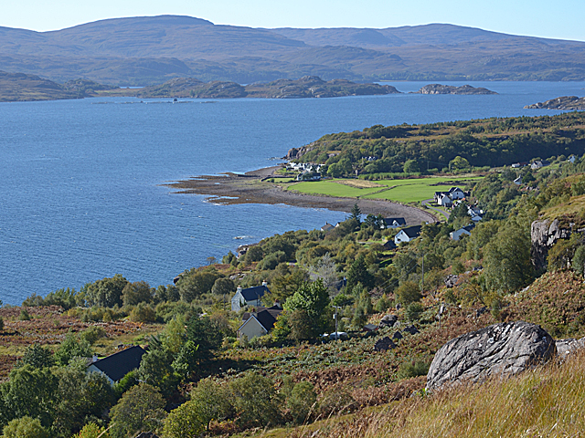
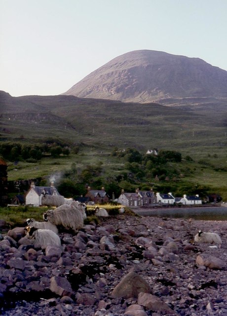
Inbhir Àiliginn, located in Ross-shire, Scotland, is a picturesque village nestled on the banks of the River Alness. With a population of around 2,500 residents, it offers a serene and tranquil environment for its inhabitants and visitors alike.

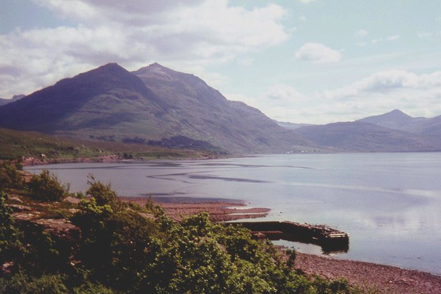
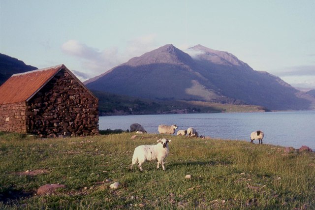
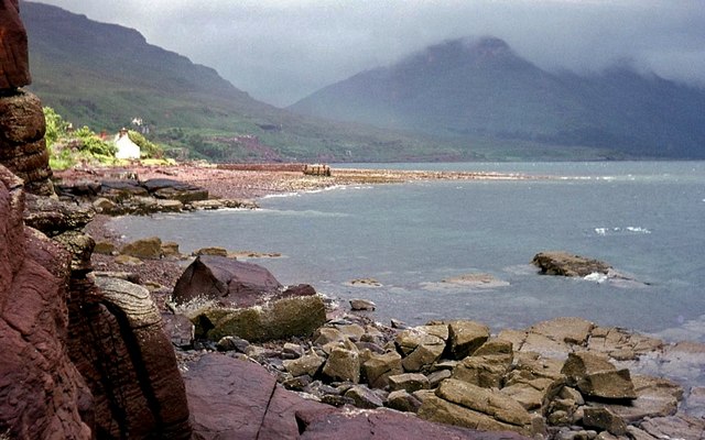
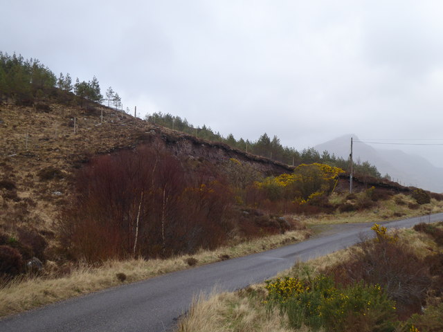
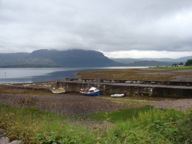
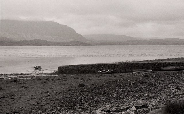
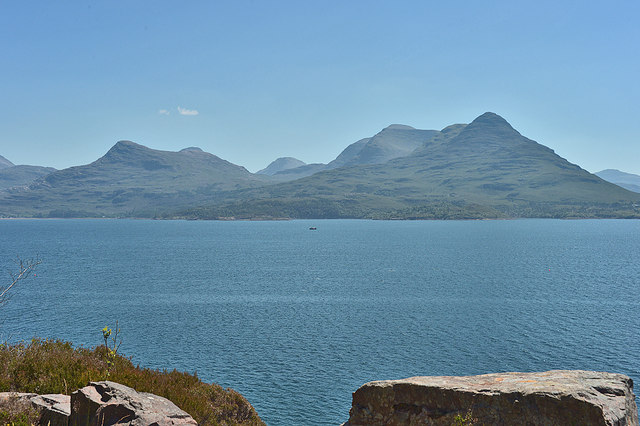
The village is known for its natural beauty, surrounded by rolling hills and stunning landscapes. The River Alness adds to the charm, attracting anglers from far and wide who come to fish for salmon and trout. The river also provides a scenic backdrop for leisurely walks along its banks.

Inbhir Àiliginn boasts a rich history, with evidence of human settlement dating back to prehistoric times. The village grew in importance during the Victorian era when it became a hub for the local fishing and farming industries. Today, remnants of its past can still be seen in the well-preserved architecture of its buildings, including the historic Invergordon Castle.

With its close proximity to the coast, Inbhir Àiliginn offers easy access to beautiful sandy beaches and rugged coastal cliffs. This makes it a popular destination for outdoor enthusiasts, who can enjoy activities such as hiking, birdwatching, and water sports.

In terms of amenities, the village provides a range of services, including a primary school, local shops, and a community center. It also hosts various events throughout the year, such as the annual Highland Games and traditional music festivals, which attract visitors from near and far.

Inbhir Àiliginn truly offers a peaceful retreat for those seeking a slower pace of life amidst breathtaking scenery and a close-knit community.

If you have any feedback on the listing, please let us know in the comments section below.

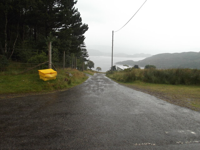
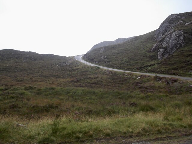
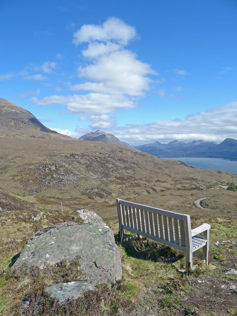
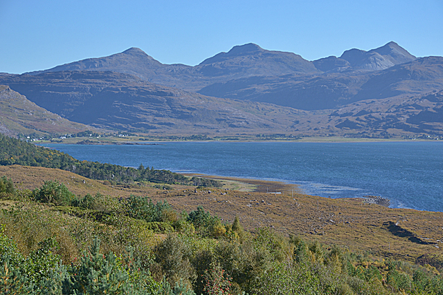
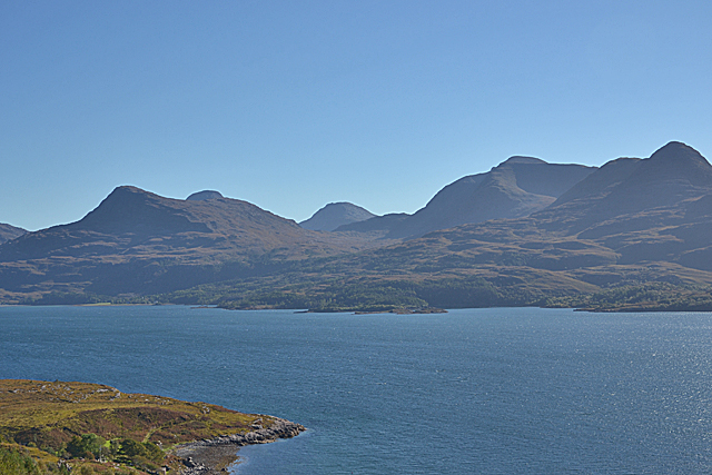
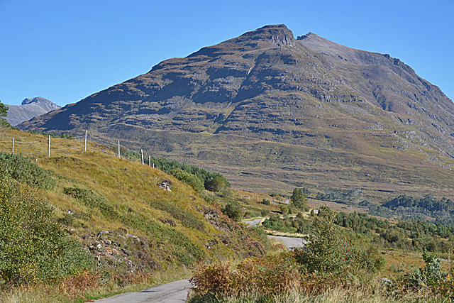
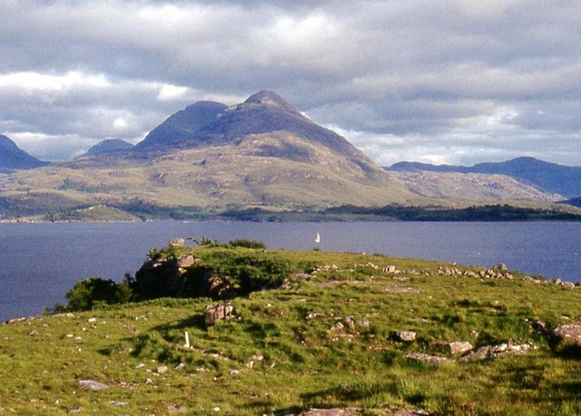
Inbhir Àiliginn Images

Images are sourced within 2km of 57.556018/-5.607284 or Grid Reference NG8457. Thanks to Geograph Open Source API. All images are credited.

The road to Canapress
The road to Diabeg
The road to Diabeg
Sit A While Not a bad place to sit and eat lunch and ponder. Liathach appears to be making smoke signals while to the right is Upper Loch Torridon.
Sit A While
Not a bad place to sit and eat lunch and ponder. Liathach appears to be making smoke signals while to the right is Upper Loch Torridon.
View over Inveralligin A stunningly-situated village.
View over Inveralligin
A stunningly-situated village.
View to the head of Loch Torridon, from above Inveralligin With the three superb peaks of Sgorr nan Lochan Uaine, Beinn Liath Mhòr and Sgorr Ruadh lining the horizon beyond.
View to the head of Loch Torridon, from above Inveralligin
With the three superb peaks of Sgorr nan Lochan Uaine, Beinn Liath Mhòr and Sgorr Ruadh lining the horizon beyond.
Looking across Loch Torridon With the peaks of the Ben-Damph Forest, Beinn na Eaglaise and Beinn Damh, on the other side, and the Munro of Maol Chean-dearg poking up in the distance between them.
Looking across Loch Torridon
With the peaks of the Ben-Damph Forest, Beinn na Eaglaise and Beinn Damh, on the other side, and the Munro of Maol Chean-dearg poking up in the distance between them.
The western end of Liathach, from the Diabeg road The peak this end is Sgorr a' Chadail; beyond can be seen Liathach's second Munro summit, Mullach an Rathain.
The western end of Liathach, from the Diabeg road
The peak this end is Sgorr a' Chadail; beyond can be seen Liathach's second Munro summit, Mullach an Rathain.
Loch Torridon at Alligin
The pier at Inveralligin The west end of Liathach rises beyond the bay.
The pier at Inveralligin
The west end of Liathach rises beyond the bay.
Inveralligin below Ben Alligin
Shed on the shore, Inveralligin Mullach an Rathain beyond.
Shed on the shore, Inveralligin
Mullach an Rathain beyond.
Torridon shore near Inveralligin
Roadside quarry above Rechullin
Inveralligin Pier
Inveralligin Pier
Inveralligin Pier Looking across Upper Loch Torridon.
Inveralligin Pier
Looking across Upper Loch Torridon.
Inveralligin foreshore With part of the pier visible on the left, and Beinn Damh looming across Loch Torridon.
Inveralligin foreshore
With part of the pier visible on the left, and Beinn Damh looming across Loch Torridon.
View across Loch Torridon Seen from the bit of road between Inveralligin and Rechullin which squeezes between cliff and shore. The mountains across the loch are Beinn na h-Eaglaise and Beinn Damh, with Moal Chean-dearg more distant between the two.
View across Loch Torridon
Seen from the bit of road between Inveralligin and Rechullin which squeezes between cliff and shore. The mountains across the loch are Beinn na h-Eaglaise and Beinn Damh, with Moal Chean-dearg more distant between the two.
View to the head of Loch Torridon With a fine array of peaks beyond. They are Sgorr nan Lochan Uaine, Beinn Liath Mhòr and Sgorr Ruadh.
View to the head of Loch Torridon
With a fine array of peaks beyond. They are Sgorr nan Lochan Uaine, Beinn Liath Mhòr and Sgorr Ruadh.
Show me another place!

Inbhir Àiliginn is located at Grid Ref: NG8457 (Lat: 57.556018, Lng: -5.607284)

Unitary Authority: Highland

Police Authority: Highlands and Islands

Also known as: Inveralligin

What 3 Words

///gained.skipped.weary. Near Lochcarron, Highland

Related Wikis

Inveralligin

Inveralligin (Scottish Gaelic: Inbhir Àiliginn) is a remote crofting township which lies on the north shore of Loch Torridon in Wester Ross and is in the...
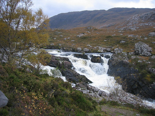
Falls of Balgy

Falls of Balgy is a waterfall near Torridon in Scotland. == See also == Waterfalls of Scotland == References ==

Beinn Alligin

Beinn Alligin (Scottish Gaelic: Beinn Àilleagan) is one of the classic mountains of the Torridon region of Scotland, lying to the north of Loch Torridon...
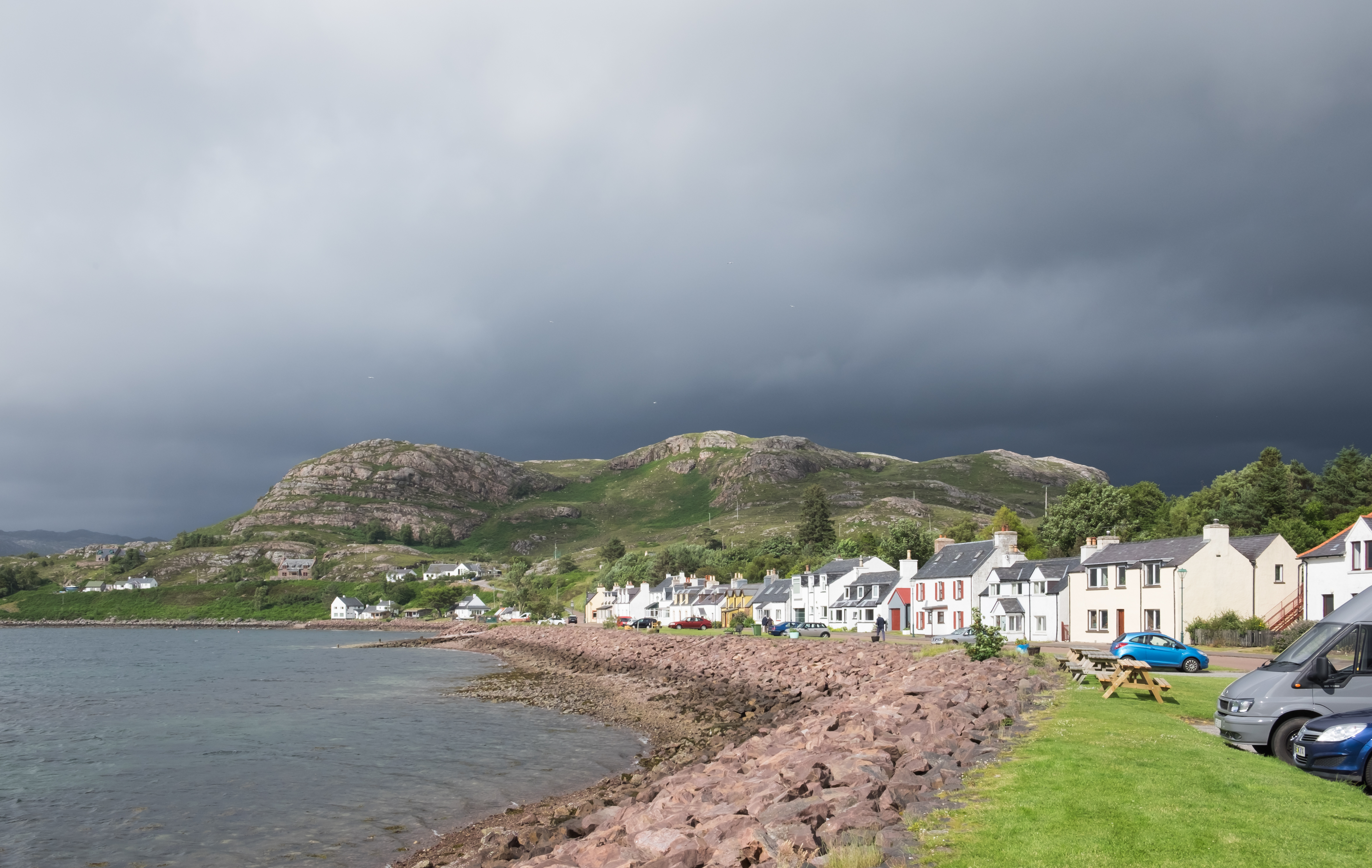
Shieldaig

Shieldaig (Scottish Gaelic: Sìldeag; Old Norse: síld-vík, lit. 'herring bay') is a village in Wester Ross in the Northwest Highlands, in the Scottish council...

Nearby Amenities

Located within 500m of 57.556018,-5.607284
Source: PGS
Lat/Long: 57.5527958/-5.6125862
Source: PGS
Lat/Long: 57.553254/-5.6109927
Source: PGS
Lat/Long: 57.5534778/-5.6094898
Source: PGS
Lat/Long: 57.5535226/-5.608946
Source: PGS
Lat/Long: 57.5536947/-5.6084203
Source: PGS
Lat/Long: 57.5537564/-5.60681
Source: PGS
Lat/Long: 57.5539808/-5.6067388
Source: PGS
Lat/Long: 57.5540198/-5.6066113
Source: PGS
Lat/Long: 57.5541492/-5.6062245
Source: PGS
Lat/Long: 57.5543125/-5.6062587
Source: PGS
Lat/Long: 57.555129/-5.6055575
Source: PGS
Lat/Long: 57.5555593/-5.6054269
Source: PGS
Lat/Long: 57.5562489/-5.6038702
Source: PGS
Lat/Long: 57.5561902/-5.603301
Source: PGS
Lat/Long: 57.5559134/-5.6019829
Source: PGS
Lat/Long: 57.5560004/-5.6017259
Source: PGS
Lat/Long: 57.5559484/-5.6015246
Source: PGS
Lat/Long: 57.5563026/-5.6006057
Source: PGS
Lat/Long: 57.5565094/-5.5989893
Inveralligin
Name En: Inveralligin
Name Gd: Inbhir Àiliginn
Place: village
Lat/Long: 57.5558929/-5.6150331
Passing Place
Lat/Long: 57.5556343/-5.6095018
Telephone
Booth: K6
Covered: booth
Phone: +44 1445 791225
Source: survey
Lat/Long: 57.5555439/-5.6089983
Post Box
Post Box Type: lamp
Royal Cypher: scottish_crown
Source: survey
Lat/Long: 57.5555773/-5.609004
Bus Stop
Alligin
Naptan AtcoCode: 6700712335
Naptan Bearing: NE
Naptan CommonName: Alligin
Naptan Indicator: o/s Post Office
Naptan Landmark: Post Office
Naptan NaptanCode: 45327674
Naptan Street: Alligin Road
Naptan Verified: no
Source: naptan_import
Lat/Long: 57.5554304/-5.6089756
Power: pole
Lat/Long: 57.5574963/-5.6011234
Power: pole
Lat/Long: 57.5582114/-5.6022475
Power: pole
Lat/Long: 57.5585482/-5.6027624
Power: pole
Lat/Long: 57.5576986/-5.5995947
Power: pole
Lat/Long: 57.5572808/-5.602077
Power: pole
Lat/Long: 57.5570497/-5.603101
Power: pole
Lat/Long: 57.5569486/-5.6035376
Power: pole
Lat/Long: 57.5566972/-5.6046428
Power: pole
Lat/Long: 57.5565432/-5.6053433
Power: pole
Lat/Long: 57.5565284/-5.606389
Power: pole
Lat/Long: 57.5564125/-5.6071055
Power: pole
Lat/Long: 57.5562833/-5.6078815
Power: pole
Lat/Long: 57.5553663/-5.6085494
Power: pole
Lat/Long: 57.5551321/-5.6087046
Power: pole
Lat/Long: 57.554494/-5.6091673
Power: pole
Lat/Long: 57.5540209/-5.6095052
Power: pole
Lat/Long: 57.5541758/-5.6103174
Power: pole
Lat/Long: 57.5544707/-5.6120144
Power: pole
Lat/Long: 57.554687/-5.6132501
Power: pole
Lat/Long: 57.5549889/-5.6149543
Passing Place
Lat/Long: 57.5558216/-5.6059134
Passing Place
Lat/Long: 57.5565054/-5.6011659
Passing Place
Lat/Long: 57.5559076/-5.6070628
Passing Place
Lat/Long: 57.5563301/-5.611641
Passing Place
Lat/Long: 57.55681/-5.6135911
The data included in this document is from www.openstreetmap.org. The data is made available under ODbL.

Have you been to Inbhir Àiliginn?

Leave your review of Inbhir Àiliginn below (or comments, questions and feedback).