Fair Snape Fell

Hill, Mountain in Lancashire Ribble Valley

England

Fair Snape Fell

On Holme House Fell From the steep cloughs in the north eastern corner of the square looking towards Fair Snape Fell. Should be last picture for Hectad SD54.
On Holme House Fell Credit: Michael Graham

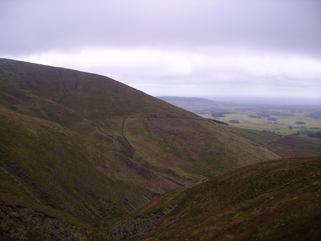
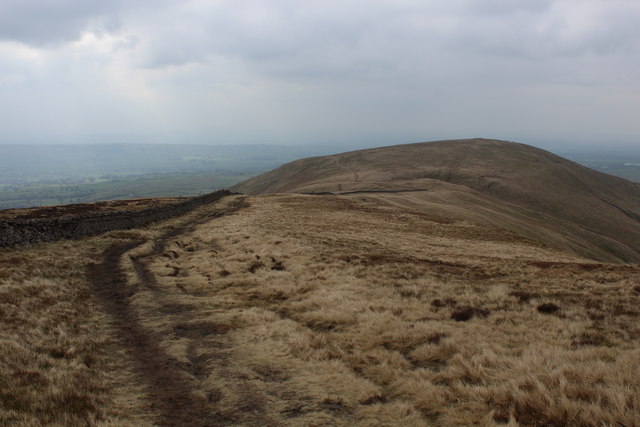
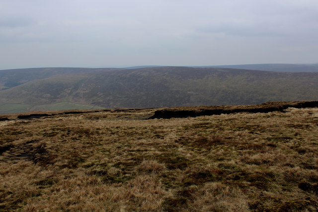
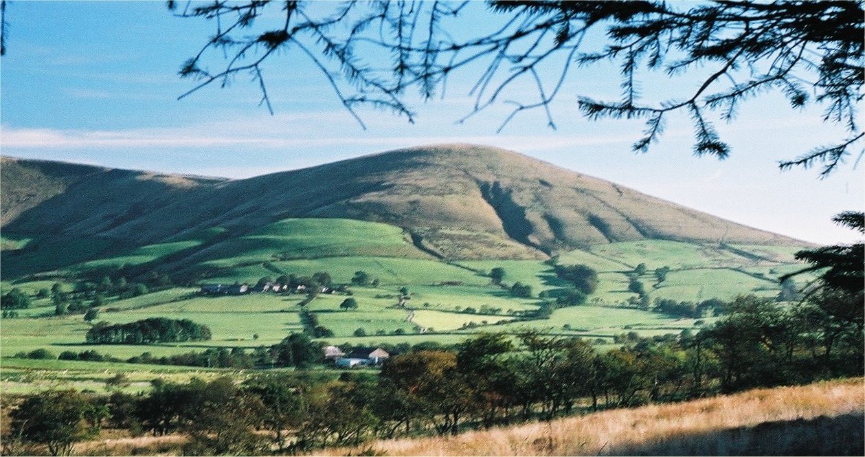
Fair Snape Fell is a prominent hill located in the county of Lancashire, England. It forms part of the Forest of Bowland Area of Outstanding Natural Beauty, renowned for its stunning landscapes and diverse wildlife. Rising to an elevation of 520 meters (1,706 feet), Fair Snape Fell offers breathtaking panoramic views of the surrounding countryside.

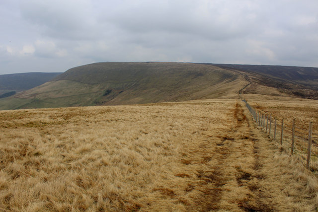
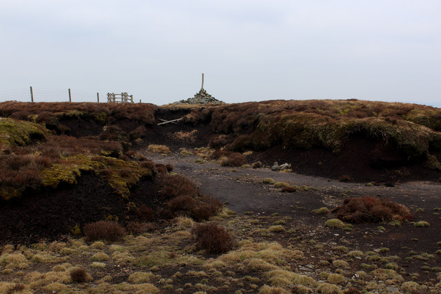
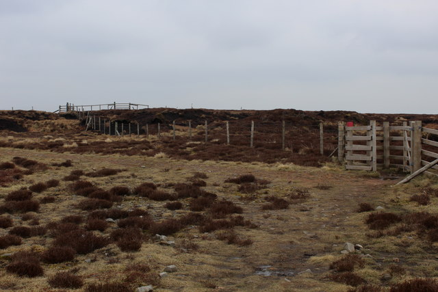
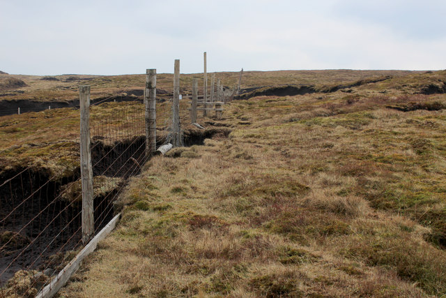
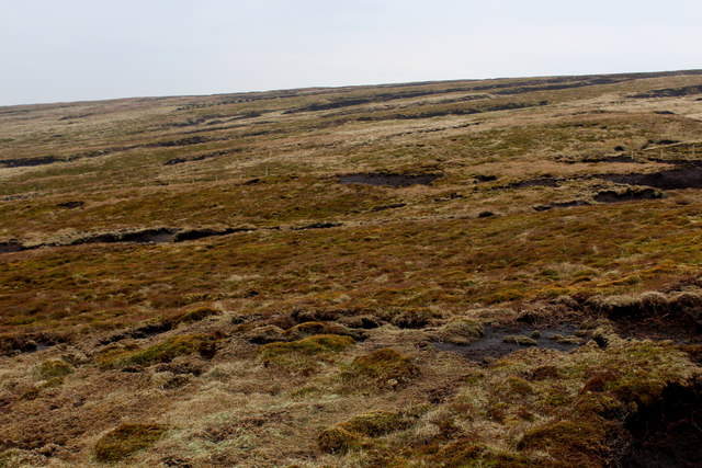
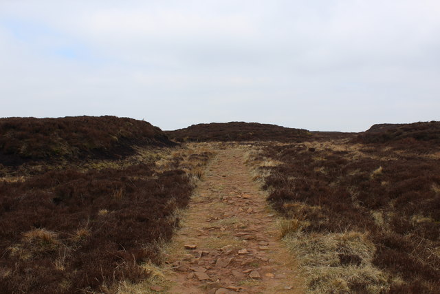
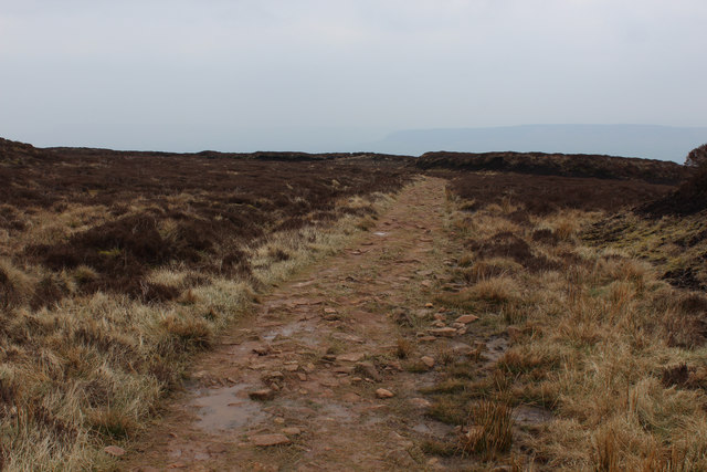
The hill is composed primarily of gritstone and is characterized by its distinct rounded shape. It is a popular destination for hikers and outdoor enthusiasts, offering a variety of walking routes that cater to different levels of experience. The ascent to the summit is relatively gentle, making it accessible to a wide range of visitors.

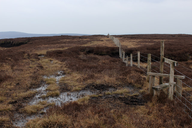
Fair Snape Fell is home to a rich array of flora and fauna. Its heather-clad slopes are particularly notable, providing a habitat for various species of birds, including the merlin, peregrine falcon, and golden plover. The hill also supports a diverse range of plant life, such as bilberry, cotton grass, and sphagnum moss.

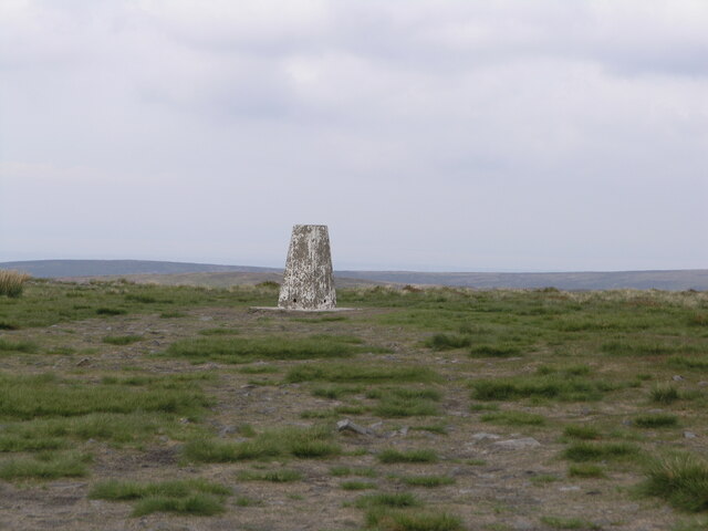
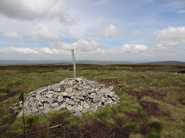
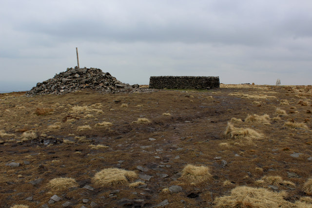
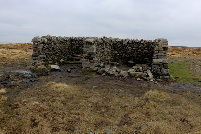
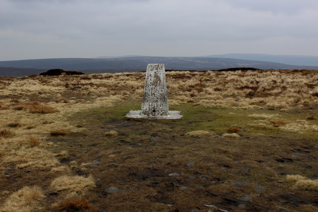
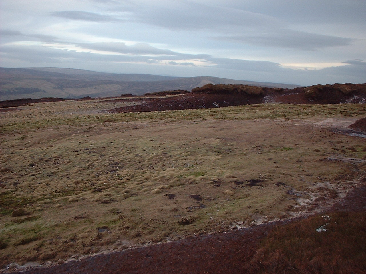
The summit of Fair Snape Fell is marked by a trig point, a concrete pillar used in surveying. This point serves as a landmark for visitors and offers a prime vantage point to admire the surrounding landscapes, which include the nearby Fylde Coast, the Forest of Bowland, and the Yorkshire Dales National Park.

Overall, Fair Snape Fell is a captivating natural feature of Lancashire, offering visitors the opportunity to immerse themselves in the beauty of the British countryside and experience the tranquility of this stunning hill.

If you have any feedback on the listing, please let us know in the comments section below.

Fair Snape Fell Images

Images are sourced within 2km of 53.919187/-2.6144769 or Grid Reference SD5947. Thanks to Geograph Open Source API. All images are credited.

On Holme House Fell From the steep cloughs in the north eastern corner of the square looking towards Fair Snape Fell. Should be last picture for Hectad SD54.
On Holme House Fell
From the steep cloughs in the north eastern corner of the square looking towards Fair Snape Fell. Should be last picture for Hectad SD54.
Fair Snape Fell trig
Cairn on the top With views across Bowland towards the Pennines
Cairn on the top
With views across Bowland towards the Pennines
Descending Northwards off Parlick towards Blindhurst Fell This is a splendid walk along a broad ridge that descends to Blindhurst Fell, before curving around to the west and the summit of Fair Snape Fell.
Views to the east encompass sections of the Bowland Fells, while on a clear day the panorama to the west includes the sparkling blue jewel of the Irish Sea.
Descending Northwards off Parlick towards Blindhurst Fell
This is a splendid walk along a broad ridge that descends to Blindhurst Fell, before curving around to the west and the summit of Fair Snape Fell. Views to the east encompass sections of the Bowland Fells, while on a clear day the panorama to the west includes the sparkling blue jewel of the Irish Sea.
North Face of Parlick Ascending from Blindhurst Fell
North Face of Parlick
Ascending from Blindhurst Fell
View from Nick's Chair Paragliding appears to be the favoured recreation in these parts - that explains the capacious rucksacks that are prevalent on many individuals' backs.
View from Nick's Chair
Paragliding appears to be the favoured recreation in these parts - that explains the capacious rucksacks that are prevalent on many individuals' backs.
Summit furnishings on Fair Snape Fell Constructions include Paddy's Pole Cairn, a well built shelter in 4 compartments and the obligatory trig point.
Summit furnishings on Fair Snape Fell
Constructions include Paddy's Pole Cairn, a well built shelter in 4 compartments and the obligatory trig point.
Shelter on Fair Snape Fell Recently rebuilt, this is a substantial shelter and resting spot from the wind, arranged into 4 compartments
Shelter on Fair Snape Fell
Recently rebuilt, this is a substantial shelter and resting spot from the wind, arranged into 4 compartments
Trip Point on Fair Snape Fell
On the Ridge between Fair Snape Fell and Parlick A really tremendous ridge walk between these two summits - looking south towards Parlick
On the Ridge between Fair Snape Fell and Parlick
A really tremendous ridge walk between these two summits - looking south towards Parlick
On the Upper Western Flanks of Fair Snape Fell A bleak area of acid moorland, with views towards the south western outposts of the Bowland Fells
On the Upper Western Flanks of Fair Snape Fell
A bleak area of acid moorland, with views towards the south western outposts of the Bowland Fells
Highest Point on Fair Snape Fell This lonely cairn marks the highest point on the Fair Snape Fell plateau, a good kilometre away from the trig point.
Highest Point on Fair Snape Fell
This lonely cairn marks the highest point on the Fair Snape Fell plateau, a good kilometre away from the trig point.
Boundary Fencing on the Fair Snape Fell Plateau
Fence on Fair Snape Fell
Peat Moor Landscape looking towards Holme House Fell Inhospitable landscape on the flanks of Fair Snape Fell
Peat Moor Landscape looking towards Holme House Fell
Inhospitable landscape on the flanks of Fair Snape Fell
Track on Wolf Fell (1) Well made narrow track on Wolf Fell, roughly heading west. It crosses inhospitable peaty terrain - without it progress would be slowed down to a crawl
Track on Wolf Fell (1)
Well made narrow track on Wolf Fell, roughly heading west. It crosses inhospitable peaty terrain - without it progress would be slowed down to a crawl
Track on Wolf Fell (2) Well made path heading roughly west over the peaty heather landscape at the top of Wolf Fell.
Track on Wolf Fell (2)
Well made path heading roughly west over the peaty heather landscape at the top of Wolf Fell.
Fenceline on Saddle Fell The path on the watershed beside the fence is a trial of fortitude, especially in wet conditions
Fenceline on Saddle Fell
The path on the watershed beside the fence is a trial of fortitude, especially in wet conditions
Show me another place!

Fair Snape Fell is located at Grid Ref: SD5947 (Lat: 53.919187, Lng: -2.6144769)

Administrative County: Lancashire

District: Ribble Valley

Police Authority: Lancashire

What 3 Words

///deck.enhances.duos. Near Longridge, Lancashire

Nearby Locations

Fair Snape Fell

Related Wikis

Parlick

Parlick (also known as Parlick Pike) is an approximately cone-shaped steep-sided hill at the extreme south of the main range of Bowland fells in Lancashire...

Bleasdale

Bleasdale is a village and civil parish in the Wyre district of Lancashire, England, in the Forest of Bowland Area of Outstanding Natural Beauty. The two...

Forest of Bowland

The Forest of Bowland, also known as the Bowland Fells and formerly the Chase of Bowland, is an area of gritstone fells, deep valleys and peat moorland...

Bowland Forest Gliding Club

Bowland Forest Gliding Club is a British gliding club near the village of Chipping, Lancashire. It was formed as the Blackpool and Fylde Gliding Club in...

Bowland-with-Leagram

Bowland-with-Leagram is a civil parish in the Ribble Valley district of Lancashire, England, covering part of the Forest of Bowland. According to the census...

Kirk Mill

Kirk Mill is an early example of an Arkwright-type cotton mill and a grade II listed building in Chipping, Lancashire, in Ribble Valley, to the north of...

St Bartholomew's Church, Chipping

St Bartholomew's Church is in the village of Chipping, Lancashire, England. It is an active Anglican parish church in the deanery of Whalley, the archdeaconry...

Hawthornthwaite Fell

Hawthornthwaite Fell is one of the larger hills in the Forest of Bowland in the north west of England. Hawthornthwaite Fell marks the extreme western limit...

Related Videos

Walking Parlick Fell and Paddy's Pole #ukhiking #lancashire #landscape

Spring walk on Parlick fell. A beautiful day walking in the spring sunshine. Lots of spring lambs in the fields. Fantastic to see plenty ...

MOUNTAIN WALKING WITH THE FAM

A GOOD DAY FOR MOUNTAIN WALKING ⛰ ⛰ ⛰ ⛰ Check out my Instagram: https://www.instagram.com/yoitsemma/ Check out ...

പത്തു പൈസ ചിലവില്ലാതെ പോകാൻ പറ്റിയ ഒരു കിടിലൻ സ്‌ഥലം.

Thank you for watching this video............... This is a travel vlog.. we introduce an amazing place in uk, that is parlick hills in ...

Wolf Fairsnape and Parlick Fells

A super, smashing, great walk up onto Parlick via Wolf Fell and Fairsnape fell today. Glorious sunshine all the way but a tad bit ...

Nearby Amenities

Located within 500m of 53.919187,-2.6144769
Fair Snape Fell
Ele: 520
Natural: peak
Source: npe
Wikidata: Q1393027
Wikipedia: en:Fair Snape Fell
Lat/Long: 53.919631/-2.6146836
Barrier: stile
Stile: stepover
Lat/Long: 53.9173386/-2.6189882
Barrier: kissing_gate
Lat/Long: 53.9195338/-2.6143332
Barrier: kissing_gate
Lat/Long: 53.9195125/-2.6143892
Barrier: stile
Material: wood
Stile: stepover
Lat/Long: 53.9171983/-2.6181551
Barrier: stile
Material: wood
Stile: stepover
Lat/Long: 53.9171653/-2.6180596
Barrier: stile
Material: wood
Stile: stepover
Lat/Long: 53.917192/-2.6180126
Historic: boundary_stone
Inscription: WD No. 26
Lat/Long: 53.916878/-2.618541
Barrier: kissing_gate
Lat/Long: 53.9224158/-2.6163352
Man Made: cairn
Lat/Long: 53.9202108/-2.6147717
Board Type: nature
Direction: 270
Information: board
Tourism: information
Lat/Long: 53.9201771/-2.6147607
Barrier: kissing_gate
Lat/Long: 53.9202525/-2.6148999
The data included in this document is from www.openstreetmap.org. The data is made available under ODbL.

Have you been to Fair Snape Fell?

Leave your review of Fair Snape Fell below (or comments, questions and feedback).