Hill of Stonyfield

Hill, Mountain in Aberdeenshire

Scotland

Hill of Stonyfield

Fence-lined minor road leading to Denend Looking south-westward.
Fence-lined minor road leading to Denend Credit: Peter Wood

The Hill of Stonyfield is a prominent summit located in Aberdeenshire, Scotland. Situated approximately 11 kilometers southwest of the town of Ellon, this hill is a part of the larger Mither Tap range. Rising to an elevation of around 267 meters (876 feet), it offers stunning panoramic views of the surrounding countryside.

The Hill of Stonyfield is characterized by its rugged and rocky terrain, which is ideal for hikers and climbers looking for a moderate challenge. The ascent to the summit is relatively straightforward, with well-defined paths leading visitors through heather-covered slopes and over scattered boulders. On a clear day, the summit provides breathtaking vistas of the Aberdeenshire landscape, including rolling hills, farmland, and distant coastal views.

The hill is also known for its historical significance, as it is home to an ancient hillfort believed to have been occupied during the Iron Age. This hillfort features the remains of stone walls and defensive ditches, providing insight into the region's past inhabitants.

Nature enthusiasts will appreciate the diverse flora and fauna found on the Hill of Stonyfield. The heather-covered slopes are a haven for various bird species, including buzzards and kestrels. Visitors may also spot rabbits, hares, and deer roaming the hillside.

Overall, the Hill of Stonyfield offers a rewarding outdoor experience for those seeking both natural beauty and historical intrigue. With its accessible location and stunning views, it continues to attract locals and tourists alike.

If you have any feedback on the listing, please let us know in the comments section below.

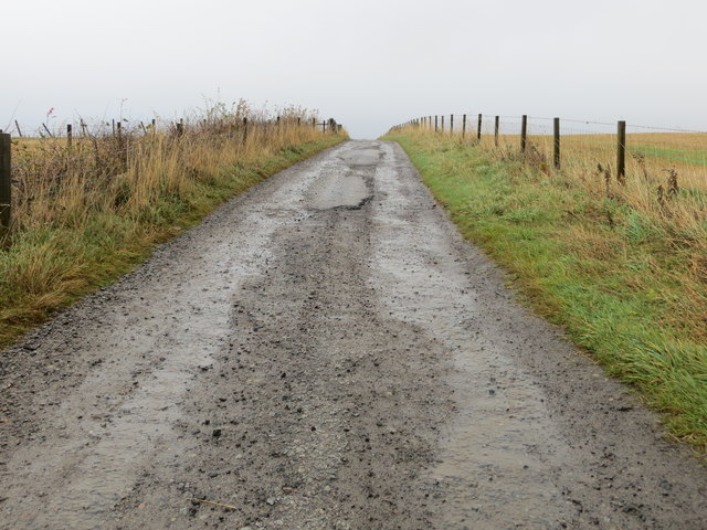
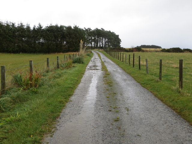
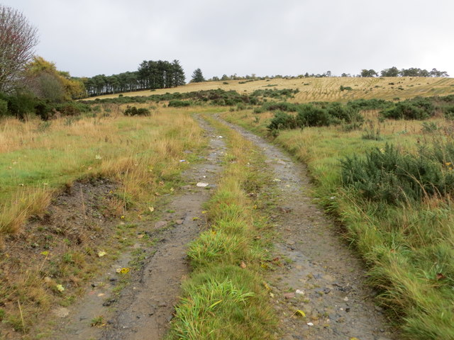
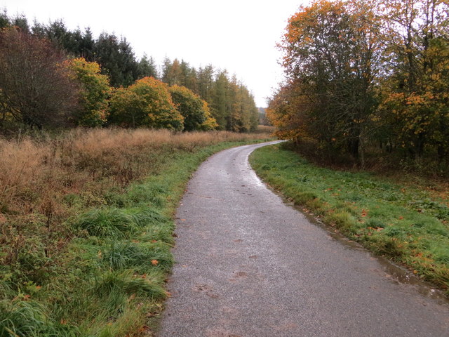
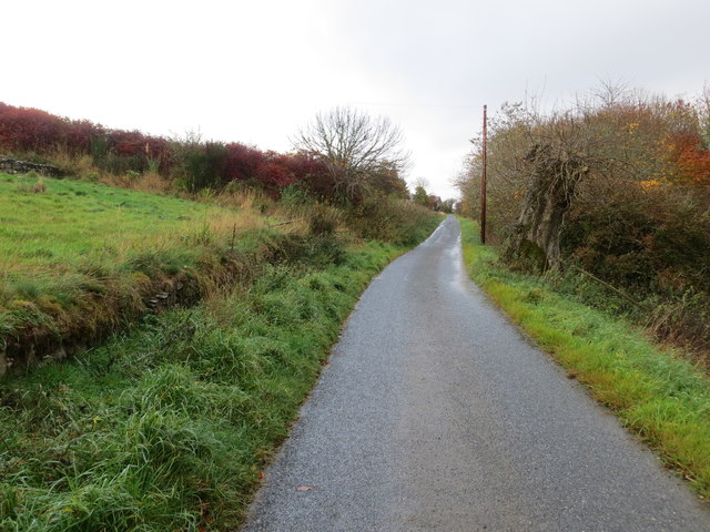
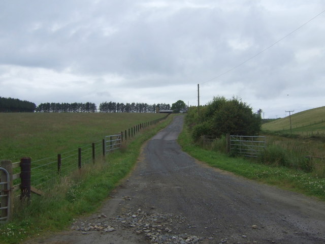
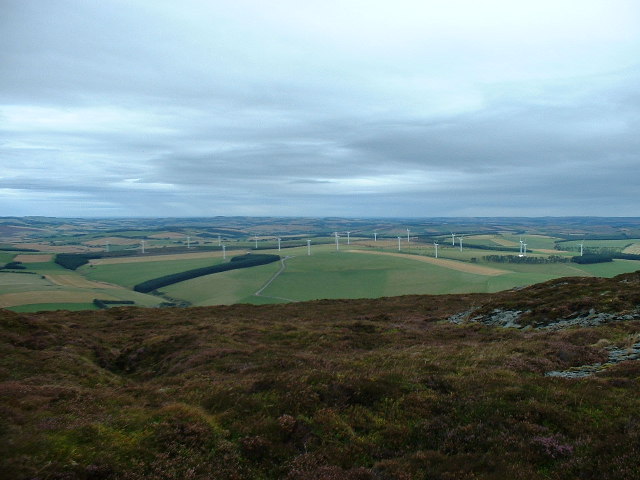
Hill of Stonyfield Images

Images are sourced within 2km of 57.416355/-2.6754239 or Grid Reference NJ5936. Thanks to Geograph Open Source API. All images are credited.

Fence-lined minor road leading to Denend Looking south-westward.
Fence-lined minor road leading to Denend
Looking south-westward.
Farm track that leads to Woodbank Looking eastward.
Farm track that leads to Woodbank
Looking eastward.
Fence-lined track that leads to Woodside Looking eastward.
Fence-lined track that leads to Woodside
Looking eastward.
Track onto Wood and Hill of Chapelton Looking south-eastward.
Track onto Wood and Hill of Chapelton
Looking south-eastward.
Minor road near Little Beggshill Looking south-westward.
Minor road near Little Beggshill
Looking south-westward.
Minor road near Little Beggshill Looking north-eastward.
Minor road near Little Beggshill
Looking north-eastward.
Track to Wedderburn North from the A96.
Track to Wedderburn
North from the A96.
A96 heading east  Towards Aberdeen.
A96 heading east
Towards Aberdeen.
Glens of Foudland
Glens of Foudland
Grazing, Braehead North of the A96.
Grazing, Braehead
North of the A96.
Sheep grazing, Braehead
Braehead
Braehead
A bend in the A96  Heading east towards Aberdeen.
A bend in the A96
Heading east towards Aberdeen.
Field beside Bisset Moss This large field was once <a href="https://www.geograph.org.uk/photo/4380644">NJ6136 : Crofts of Bissetmoss</a>.
Field beside Bisset Moss
This large field was once NJ6136 : Crofts of Bissetmoss.
Through a Peephole Walking along the edge of the forest, I could hear the swishing of the turbine blades and a gentle clanking, but until I came to this gap I could not see the turbines just a few tens of metres away.
Through a Peephole
Walking along the edge of the forest, I could hear the swishing of the turbine blades and a gentle clanking, but until I came to this gap I could not see the turbines just a few tens of metres away.
Glens of Foudland Wind Farm These are part of the Glens of Foudland Wind Farm (not, as named on the map, Glens of Fouland). It consists of 20 turbines. Each turbine, manufactured by the Danish company Bonus (now part of Siemens) can produce 1.3MW. Centrica, which also owns British Gas and the Automobile Association, acquired the land in 2004. Construction was completed the following year; the first power was produced in May 2005 and the wind farm was fully operation in July 2005. It is now operated by GLID, which id jointly owned by Centrica and by EIG, a subsidiary of TCW, an American investment company. It supplies enough power for 20% of the households in Aberdeenshire, and a community fund has been set up to direct some of the revenue into projects to benefit the local community.
Glens of Foudland Wind Farm
These are part of the Glens of Foudland Wind Farm (not, as named on the map, Glens of Fouland). It consists of 20 turbines. Each turbine, manufactured by the Danish company Bonus (now part of Siemens) can produce 1.3MW. Centrica, which also owns British Gas and the Automobile Association, acquired the land in 2004. Construction was completed the following year; the first power was produced in May 2005 and the wind farm was fully operation in July 2005. It is now operated by GLID, which id jointly owned by Centrica and by EIG, a subsidiary of TCW, an American investment company. It supplies enough power for 20% of the households in Aberdeenshire, and a community fund has been set up to direct some of the revenue into projects to benefit the local community.
Wind Turbines Two of the turbines of Play Hill, part of the <a href="https://www.geograph.org.uk/photo/4380712">NJ6036 : Glens of Foudland Wind Farm</a>.
Wind Turbines
Two of the turbines of Play Hill, part of the NJ6036 : Glens of Foudland Wind Farm.
Glens of Foudland Wind Farm One thing about wind farms is that they can make access easier. That new barn, and the road leading past it up to the hilltop, were not there before the wind farm.
Glens of Foudland Wind Farm
One thing about wind farms is that they can make access easier. That new barn, and the road leading past it up to the hilltop, were not there before the wind farm.
Show me another place!

Hill of Stonyfield is located at Grid Ref: NJ5936 (Lat: 57.416355, Lng: -2.6754239)

Unitary Authority: Aberdeenshire

Police Authority: North East

What 3 Words

///police.promoting.dentures. Near Huntly, Aberdeenshire

Nearby Locations

Hill of Stonyfield

Related Wikis

Bainshole

Bainshole is a farm in Aberdeenshire, Scotland. == References ==

Brideswell, Aberdeenshire

Brideswell (Scottish Gaelic: Tobar Bhrìde) is a village in Aberdeenshire, Scotland. It is named in honour of Brigid of Ireland.

Battle of Slioch

The Battle of Slioch was a minor skirmish in the First War of Scottish Independence. Although the encounter was inconclusive, the domestic enemies of the...

Drumblade

Drumblade is a hamlet in north-western Aberdeenshire, Scotland, which lies 4¾ miles east of the town of Huntly. == Schools == Drumblade Primary School...

Ythanwells

Ythanwells () is a village in the Marr area of Aberdeenshire, Scotland, lying 10.6 kilometres (6.6 mi) east of Huntly. The village is sometimes known...

Knichtland Burn

Knichtland Burn is a burn which marks the boundary of the parish of Huntly, Aberdeenshire, Scotland. == References ==

Lessendrum

Lessendrum is a ruinous fortified house situated 7.65 kilometres (4.75 mi) to the north of Huntly, Aberdeenshire, Scotland. It is on the Buildings at Risk...

Frendraught Castle

Frendraught Castle or House is a 17th-century house, about 6 miles (9.7 km) east of Huntly, Aberdeenshire, Scotland, and 1 mile (1.6 km) west of Largue...

Nearby Amenities

Located within 500m of 57.416355,-2.6754239
Parsonspool
Place: locality
Lat/Long: 57.4150132/-2.668814
The data included in this document is from www.openstreetmap.org. The data is made available under ODbL.

Have you been to Hill of Stonyfield?

Leave your review of Hill of Stonyfield below (or comments, questions and feedback).