Hill of Flinder

Hill, Mountain in Aberdeenshire

Scotland

Hill of Flinder

Law Quarry A disused,at least in the sense of extraction,quarry by Law Farm.
Law Quarry Credit: Andrew Wood

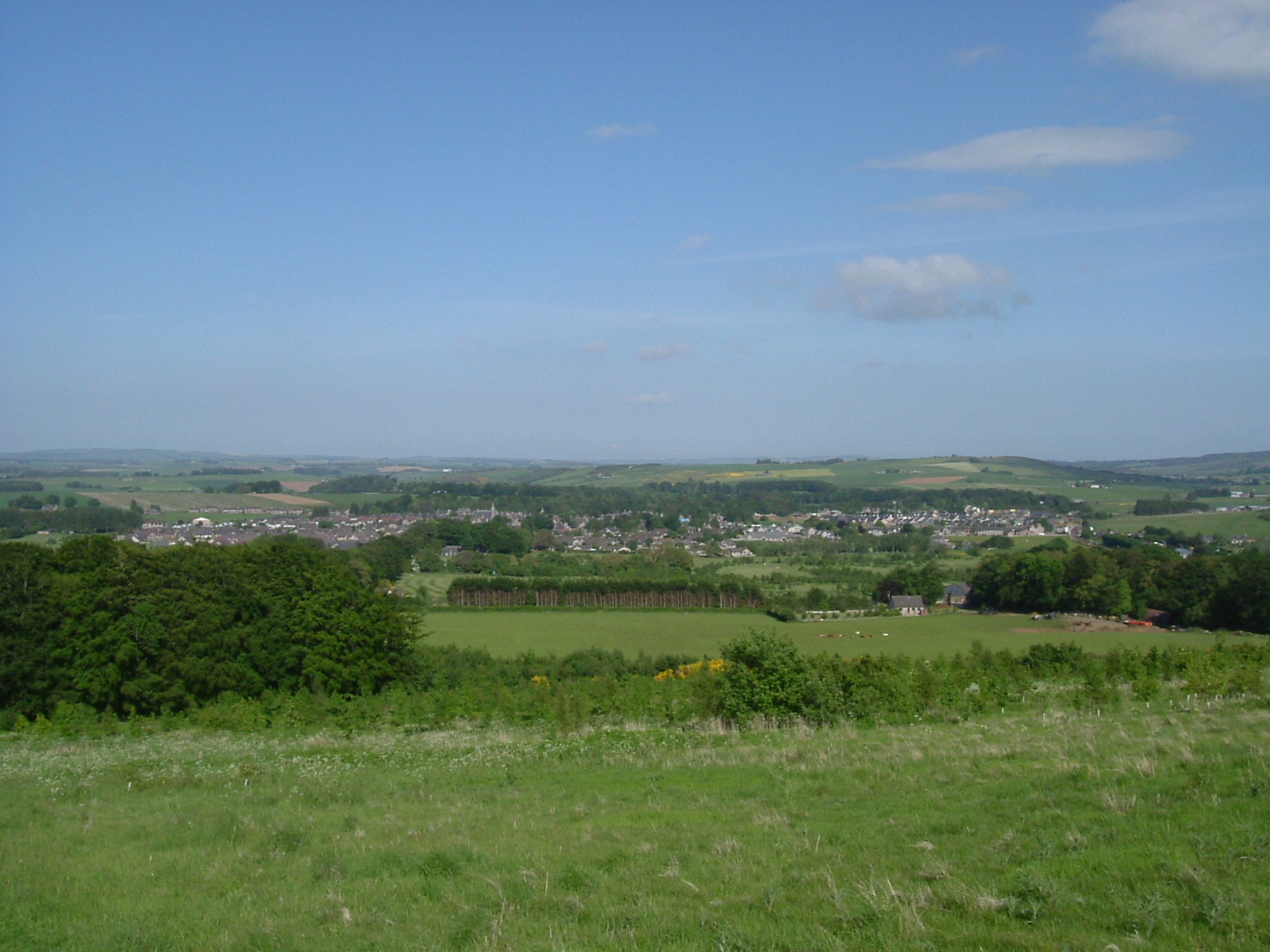
Hill of Flinder is an impressive natural landmark located in Aberdeenshire, Scotland. This hill, also known as a mountain due to its considerable height, stands at an elevation of approximately 781 meters (2562 feet) above sea level. It is situated in the Grampian Mountains, which are known for their rugged beauty and breathtaking landscapes.

The Hill of Flinder is a prominent feature in the region, attracting hikers, nature enthusiasts, and mountaineers alike. Its distinct shape and commanding presence make it a popular destination for outdoor activities such as hillwalking and climbing. The hill offers stunning panoramic views of the surrounding countryside, including the nearby towns of Tarland and Aboyne.

The terrain of the Hill of Flinder is characterized by steep slopes covered with heather and grass, interspersed with rocky outcrops. The ascent can be challenging, but the reward is worth the effort, as the summit offers breathtaking vistas of the picturesque Aberdeenshire landscape.

Flora and fauna are abundant in this area, with a variety of plant species, including wildflowers and heather, dotting the hillside. Wildlife enthusiasts may be fortunate enough to spot native Scottish wildlife, such as red deer, mountain hares, and various bird species, including golden eagles.

Overall, the Hill of Flinder in Aberdeenshire is a remarkable natural feature that offers outdoor enthusiasts a chance to immerse themselves in the beauty of the Scottish countryside while enjoying challenging physical activities and stunning views.

If you have any feedback on the listing, please let us know in the comments section below.

Hill of Flinder Images

Images are sourced within 2km of 57.338541/-2.6745095 or Grid Reference NJ5927. Thanks to Geograph Open Source API. All images are credited.

Law Quarry A disused,at least in the sense of extraction,quarry by Law Farm.
Law Quarry
A disused,at least in the sense of extraction,quarry by Law Farm.
Halls of Duncanstone What appears to be an old barn at Halls of Duncanstone.
Halls of Duncanstone
What appears to be an old barn at Halls of Duncanstone.
View south to Waulkmill by B9002 From minor road near Stonehead.
View south to Waulkmill by B9002
From minor road near Stonehead.
A shelterbelt hedgerow near Whitebrow
Road from Stonehead to Wardhouse
Stubble, Glanderstone A field between the B9002 and the Inverness to Aberdeen railway.
Stubble, Glanderstone
A field between the B9002 and the Inverness to Aberdeen railway.
2 Wind Turbines, Hill of Glanderston
Dunideer Castle
Dunideer Castle
Dunnideer Castle The remains of this castle on Dunnideer Hill overlooking Insch
Dunnideer Castle
The remains of this castle on Dunnideer Hill overlooking Insch
Not Made to Measure Two gates forming a barrier by Newseat Farm.The opening is larger than either but the two together don't fit either.The hill behind is Gallow Hill.
Not Made to Measure
Two gates forming a barrier by Newseat Farm.The opening is larger than either but the two together don't fit either.The hill behind is Gallow Hill.
Priestwells Road The access road to Priestwells Farm. Perhaps the priest officiated at the nearby Hill of Christ's Kirk, then again perhaps not. Priestwells and nearby Murriel are rouped together as the "Dawache of Murriel" a davoch was an old pictish centre of power or manor.
Priestwells Road
The access road to Priestwells Farm. Perhaps the priest officiated at the nearby Hill of Christ's Kirk, then again perhaps not. Priestwells and nearby Murriel are rouped together as the "Dawache of Murriel" a davoch was an old pictish centre of power or manor.
Dunnideer, with Tap o' Noth in the background
Hill of Dunnideer Viewed from The Belts car park, near Insch.
Hill of Dunnideer
Viewed from The Belts car park, near Insch.
Petersfield farmstead
Access to Petersfield From the public road.
Access to Petersfield
From the public road.
Aulton farmstead Seen across a field from the public road.
Aulton farmstead
Seen across a field from the public road.
Access lane to Whitebrow Gated track from minor road.
Access lane to Whitebrow
Gated track from minor road.
Stonehead farm And junction for Wardhouse.
Stonehead farm
And junction for Wardhouse.
Show me another place!

Hill of Flinder is located at Grid Ref: NJ5927 (Lat: 57.338541, Lng: -2.6745095)

Unitary Authority: Aberdeenshire

Police Authority: North East

What 3 Words

///yacht.quicksand.lush. Near Insch, Aberdeenshire

Nearby Locations

Hill of Flinder

Related Wikis

Nearby Amenities

Located within 500m of 57.338541,-2.6745095
Hill of Flinder
Ele: 293
Natural: peak
Lat/Long: 57.3385908/-2.6743568
The data included in this document is from www.openstreetmap.org. The data is made available under ODbL.

Have you been to Hill of Flinder?

Leave your review of Hill of Flinder below (or comments, questions and feedback).