Cribbs Law

Hill, Mountain in Berwickshire

Scotland

Cribbs Law

Corsbie Moor The head of the Eden Burn which later becomes the Eden Water, a tributary of the Tweed. The Cheviot can be seen on the horizon.
Corsbie Moor Credit: Richard Webb

Cribbs Law is a prominent hill located in Berwickshire, a historic county in the southeastern part of Scotland. Situated near the coastal town of Eyemouth, Cribbs Law stands at an elevation of approximately 275 meters (902 feet) above sea level. The hill is part of the Lammermuir Hills range, which stretches across the border between Scotland and England.

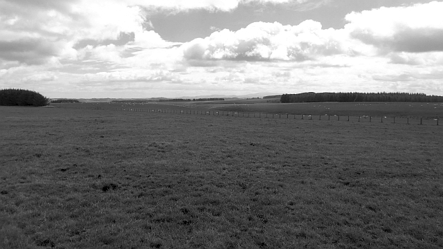
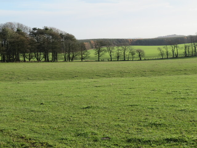
Cribbs Law offers breathtaking panoramic views of the surrounding countryside, including the picturesque Berwickshire coast and the North Sea. The hill is characterized by its gentle slopes covered with a variety of vegetation, including grasses, heather, and scattered shrubs. Its landscape is often dotted with grazing sheep, adding to the idyllic rural scenery.

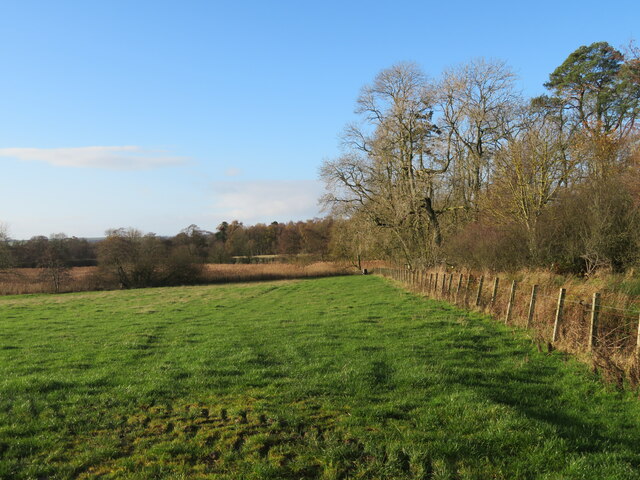
Access to Cribbs Law is relatively easy, with various footpaths and trails available for visitors to explore. Hiking enthusiasts can enjoy a leisurely ascent to the summit, which provides a rewarding vantage point to appreciate the natural beauty of the area. On clear days, it is possible to spot landmarks such as the distant Cheviot Hills and the Bass Rock, a volcanic rock formation in the Firth of Forth.

Cribbs Law is a popular destination for outdoor activities such as walking, picnicking, and nature photography. Its tranquil atmosphere and stunning vistas make it an appealing spot for locals and tourists alike, seeking a peaceful retreat amidst the Scottish countryside.

If you have any feedback on the listing, please let us know in the comments section below.

Cribbs Law Images

Images are sourced within 2km of 55.697491/-2.6634007 or Grid Reference NT5845. Thanks to Geograph Open Source API. All images are credited.
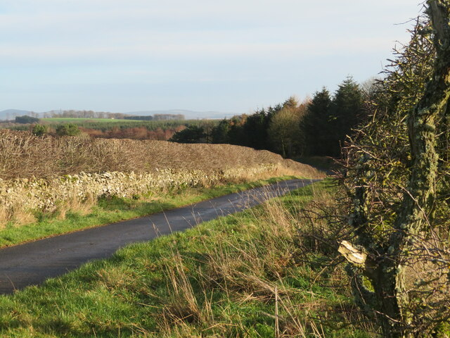
Corsbie Moor The head of the Eden Burn which later becomes the Eden Water, a tributary of the Tweed. The Cheviot can be seen on the horizon.
Corsbie Moor
The head of the Eden Burn which later becomes the Eden Water, a tributary of the Tweed. The Cheviot can be seen on the horizon.
Field access near Boon Through a shelter belt from the track between Boon and Legerwood. See two earlier images from the same location - <a href="https://www.geograph.org.uk/photo/526605">NT5744 : Barley field</a> from 2007, <a href="https://www.geograph.org.uk/photo/2848537">NT5744 : Field access track</a> from 2012.
Field access near Boon
Through a shelter belt from the track between Boon and Legerwood. See two earlier images from the same location - NT5744 : Barley field from 2007, NT5744 : Field access track from 2012.
Shelter belt near Boon A deciduous woodland strip between track and field between Boon and Legerwood.
Shelter belt near Boon
A deciduous woodland strip between track and field between Boon and Legerwood.
Country road by Old Boon With a right [left?]-angle bend and passing place, and good pasture.
Country road by Old Boon
With a right [left?]-angle bend and passing place, and good pasture.
Beech hedge and landscape Farmland near Boon, with a long view over the Leader Valley and beyond.
Beech hedge and landscape
Farmland near Boon, with a long view over the Leader Valley and beyond.
Old Boon A fine farm building and cattle feeding under cover.
Old Boon
A fine farm building and cattle feeding under cover.
National Grid gas installation Boon 4937 - presumably the ID. I was struck by the spelling of 'unodourised'; it did not look right, although odour is the normal British spelling. <span class="nowrap"><a title="https://www.gasodorizer.com/what-is-natural-gas-odorization/" rel="nofollow ugc noopener" href="https://www.gasodorizer.com/what-is-natural-gas-odorization/">Link</a><img style="margin-left:2px;" alt="External link" title="External link - shift click to open in new window" src="https://s1.geograph.org.uk/img/external.png" width="10" height="10"/></span>
National Grid gas installation
Boon 4937 - presumably the ID. I was struck by the spelling of 'unodourised'; it did not look right, although odour is the normal British spelling. LinkExternal link
National Grid gas installation Gas pipes at the installation on the country road between Dods and Legerwood.
National Grid gas installation
Gas pipes at the installation on the country road between Dods and Legerwood.
Field and shelterbelt near Boon On the road from Dods to Legerwood.
Field and shelterbelt near Boon
On the road from Dods to Legerwood.
Grass field at Old Boon Looking east to a small wood and roadside trees.
Grass field at Old Boon
Looking east to a small wood and roadside trees.
Country road near Old Boon A narrow road with wide verges, a dense hedge, and a gnarled Hawthorn. A small flock of Redwing left the hedge as I went by.
Country road near Old Boon
A narrow road with wide verges, a dense hedge, and a gnarled Hawthorn. A small flock of Redwing left the hedge as I went by.
Pasture near Legerwood Looking west from just north of Legerwood.
Pasture near Legerwood
Looking west from just north of Legerwood.
Legerwood Parish Church With an interesting stile, although the gate worked perfectly well.
Legerwood Parish Church
With an interesting stile, although the gate worked perfectly well.
Entrance to Legerwood Kirk With a smart information board - much refreshed from when it was recorded by Walter Baxter in 2008 <a href="https://www.geograph.org.uk/photo/902086">NT5943 : Legerwood Kirk signboard</a>.
Entrance to Legerwood Kirk
With a smart information board - much refreshed from when it was recorded by Walter Baxter in 2008 NT5943 : Legerwood Kirk signboard.
Legerwood Church - west gable window With an inscription below that says:- 
REPAIRED
17    17
It is not clear if that refers to the gable, the window or the bell chain leading to the belfry.
Legerwood Church - west gable window
With an inscription below that says:- REPAIRED 17 17 It is not clear if that refers to the gable, the window or the bell chain leading to the belfry.
Memorial stone bench at Legerwood Parish Church 1913    1988
in memory of
W-SELBY TULLOCH
beloved SURGEON in
the City of EDINBURGH

decorated with a Bishop's mitre at the top and a Swan and two Swifts to the left and right. He was born in Australia, but became an eminent Urologist in Edinburgh, specialising in male infertility. <span class="nowrap"><a title="https://ancestors.familysearch.org/en/LXWH-SPC/william-selby-tulloch-1913-1988" rel="nofollow ugc noopener" href="https://ancestors.familysearch.org/en/LXWH-SPC/william-selby-tulloch-1913-1988">Link</a><img style="margin-left:2px;" alt="External link" title="External link - shift click to open in new window" src="https://s1.geograph.org.uk/img/external.png" width="10" height="10"/></span>
Memorial stone bench at Legerwood Parish Church
1913 1988 in memory of W-SELBY TULLOCH beloved SURGEON in the City of EDINBURGH decorated with a Bishop's mitre at the top and a Swan and two Swifts to the left and right. He was born in Australia, but became an eminent Urologist in Edinburgh, specialising in male infertility. LinkExternal link
Legerwood Parish Church and burial ground A Church of Scotland church that has been active since 1127 <span class="nowrap"><a title="https://canmore.org.uk/site/55925/legerwood-parish-church," rel="nofollow ugc noopener" href="https://canmore.org.uk/site/55925/legerwood-parish-church,">Link</a><img style="margin-left:2px;" alt="External link" title="External link - shift click to open in new window" src="https://s1.geograph.org.uk/img/external.png" width="10" height="10"/></span> and medieval burial ground.
Legerwood Parish Church and burial ground
A Church of Scotland church that has been active since 1127 LinkExternal link and medieval burial ground.
Old gravestone at Legerwood An economical burial, with husband and wife with a twelve year gap, two[?] grandchildren [undated], and another burial a century later.

HERE : LAYS JAMES : GRA
HAM : LEAT : TENNANT : IN
THORNIDICK [*] : WHO:DIED
APRIL : 26 : 1758 : AGED : 66
YEARS : ALSO : JANET : PRING
LE : HIS : SPOUS : WHO : DIED
APRILE : 15 : 1770 : AGED : 61
YEARS : ALSO : ANDROU · &[?]
JANET : GRAHAMS : THERE
GRAND  : CHILDREN :
And
JAME HARDIE who died
7th Dec 1863 aged 67 years

*There is a Thornydykes 6km to the northeast in <a href="https://www.geograph.org.uk/gridref/NT6148">NT6148</a>
Old gravestone at Legerwood
An economical burial, with husband and wife with a twelve year gap, two[?] grandchildren [undated], and another burial a century later. HERE : LAYS JAMES : GRA HAM : LEAT : TENNANT : IN THORNIDICK [*] : WHO:DIED APRIL : 26 : 1758 : AGED : 66 YEARS : ALSO : JANET : PRING LE : HIS : SPOUS : WHO : DIED APRILE : 15 : 1770 : AGED : 61 YEARS : ALSO : ANDROU · &[?] JANET : GRAHAMS : THERE GRAND : CHILDREN : And JAME HARDIE who died 7th Dec 1863 aged 67 years *There is a Thornydykes 6km to the northeast in NT6148
Show me another place!

Cribbs Law is located at Grid Ref: NT5845 (Lat: 55.697491, Lng: -2.6634007)

Unitary Authority: The Scottish Borders

Police Authority: The Lothians and Scottish Borders

What 3 Words

///portfolio.blank.whispers. Near Lauder, Scottish Borders

Nearby Locations

Cribbs Law Deanpark Covert

Related Wikis

Boon Farm

Boon is a farm and former barony located near Lauder, Scotland. == History == === Name origins === Boon (aka "Boune" or "Bounn"), derives from the Breton...

Legerwood

Legerwood is a village by the Eden Water, in the Scottish Borders area of Scotland, near Lauder, near the Southern Upland Way. Legerwood Kirk is outside...
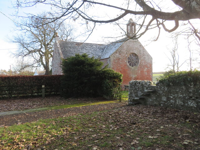
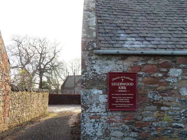
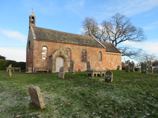
Legerwood Kirk

Legerwood Kirk is an ancient and historic Church of Scotland church in the former county of Berwickshire, Scotland. It is situated half a mile east of...

Corsbie Castle

Corsbie Castle is a ruined 16th-century tower house, about 2.5 miles (4.0 km) west of Gordon, Scottish Borders, Scotland, and north of the Eden Water....

Whitslaid Tower

Whitslaid Tower was an ancient Berwickshire seat of the Lauder family for over 300 years. It is today a ruin high above the eastern bank of the Leader...

Birkenside, Scottish Borders

Birkenside is a village in the Scottish Borders, Scotland.

Bassendean, Scottish Borders

Bassendean is a village in the Scottish Borders area of Scotland, 4 kilometres (2.5 mi) south of Westruther and 3 kilometres (1.9 mi) north-west of Gordon...

Houndslow

Houndslow is a hamlet in the Scottish Borders area of Scotland. It is situated on the A697, about 5 miles (8.0 km) west of Greenlaw, and 3 miles (4.8 km...

Nearby Amenities

Located within 500m of 55.697491,-2.6634007
Cribbs Law
Natural: peak
Lat/Long: 55.6978024/-2.6637006
The data included in this document is from www.openstreetmap.org. The data is made available under ODbL.

Have you been to Cribbs Law?

Leave your review of Cribbs Law below (or comments, questions and feedback).