Black Knowe
Hill, Mountain in Cumberland Carlisle
England
Black Knowe

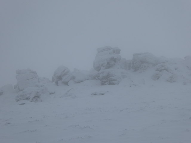
Black Knowe is a prominent hill located in the county of Cumberland in England. Rising to an elevation of 700 meters (2,297 feet), it forms part of the stunning Lake District National Park. Situated near the village of Mungrisdale, Black Knowe lies in the northern region of the park, offering breathtaking views of the surrounding landscape.
This hill is a popular destination for hikers and outdoor enthusiasts due to its relatively easy ascent and the rewarding views it offers at the summit. The terrain is mostly rocky, with patches of grass and heather covering the slopes. The hill is known for its steep eastern face, providing a challenging route for more experienced climbers.
Black Knowe is flanked by other notable peaks, including Bowscale Fell to the northeast and Carrock Fell to the northwest. These neighboring hills add to the scenic beauty of the region, making it a haven for nature lovers and photographers.
The summit of Black Knowe offers panoramic views of the Lake District, with vistas extending as far as the Solway Firth and the Scottish Borders on clear days. The hill is also home to a variety of wildlife, including red grouse, skylarks, and golden eagles, making it a paradise for birdwatchers.
Overall, Black Knowe is a captivating natural feature within the Lake District National Park, providing visitors with an opportunity to immerse themselves in the stunning beauty of the English countryside.
If you have any feedback on the listing, please let us know in the comments section below.
Black Knowe Images
Images are sourced within 2km of 55.13569/-2.6556011 or Grid Reference NY5882. Thanks to Geograph Open Source API. All images are credited.


Black Knowe is located at Grid Ref: NY5882 (Lat: 55.13569, Lng: -2.6556011)
Administrative County: Cumbria
District: Carlisle
Police Authority: Cumbria
What 3 Words
///wolf.pats.atlas. Near Greenhead, Northumberland
Nearby Locations
Related Wikis

Sighty Crag
Sighty Crag is a hill in the southern part of the Kielder Forest region in northern England, a region which also includes its fellow Marilyns of Peel Fell...

Scottish Marches
Scottish Marches was the term used for the Anglo-Scottish border during the late medieval and early modern eras, characterised by violence and cross-border...

Blackpool Gate
Blackpool Gate is a settlement in the civil parish of Bewcastle, which is in the district of the City of Carlisle in the county of Cumbria, England. It...

Bewcastle Castle
Bewcastle Castle is a ruined castle in the parish of Bewcastle in the English county of Cumbria, a few miles from the Scottish border. == History == The...
Nearby Amenities
Located within 500m of 55.13569,-2.6556011Have you been to Black Knowe?
Leave your review of Black Knowe below (or comments, questions and feedback).