Rubers Law

Hill, Mountain in Roxburghshire

Scotland

Rubers Law

Footbridge near Spital Tower A plank bridge crossing a small burn in the fields SE of Spital Tower farm. The waymarked route for the Borders Abbeys Way differs slightly from that shown on the 1:25,000 map in this area.
Footbridge near Spital Tower Credit: Jim Barton

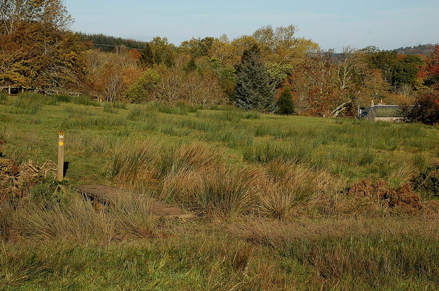
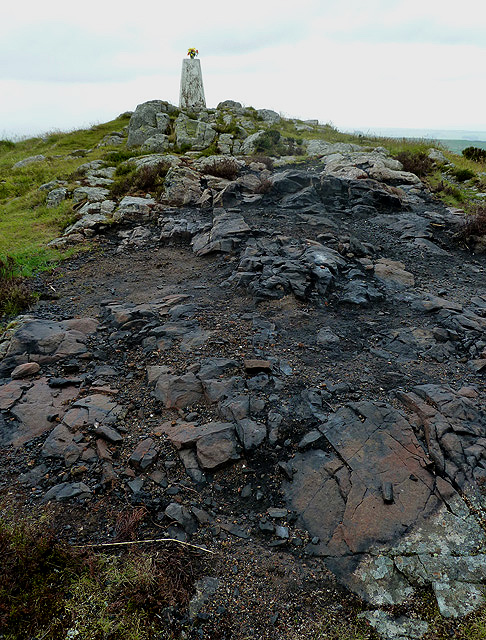
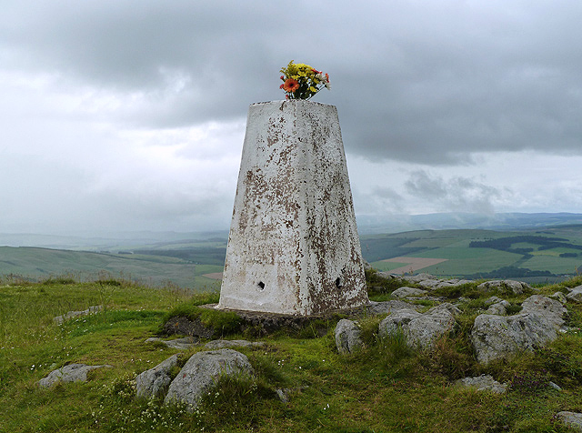
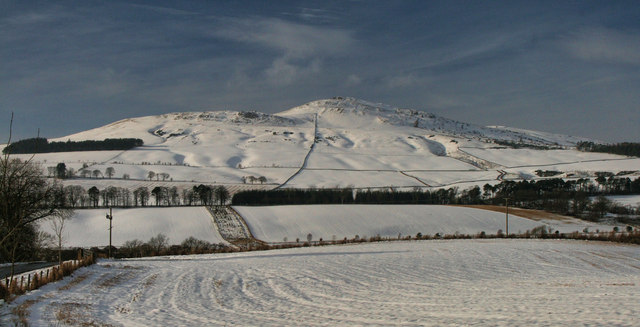
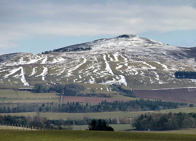
Rubers Law is a prominent hill located in Roxburghshire, a historic county in the Scottish Borders region of Scotland. Standing at an elevation of 422 meters (1,385 feet), it is a well-known landmark in the area.

The hill is characterized by its rounded summit and gentle slopes, making it easily accessible for hikers and outdoor enthusiasts. It is situated near the village of Denholm, approximately 6 kilometers (3.7 miles) southwest of Hawick, the largest town in the region.

Rubes Law offers breathtaking panoramic views of the surrounding countryside, including the Teviot Valley and the Cheviot Hills to the south. On a clear day, visitors can also spot other notable landmarks such as the Eildon Hills and the Scottish Borders countryside.

The hill is covered in grasses and heather, providing a diverse habitat for various wildlife species. Birdwatchers might be lucky enough to spot birds such as red grouse, skylarks, and meadow pipits in the area.

There are several walking routes and trails that lead to the summit of Rubers Law, varying in difficulty and length. The ascent typically takes around 1-2 hours, depending on the chosen route and individual fitness levels.

Overall, Rubers Law is a popular destination for outdoor enthusiasts seeking stunning views, a peaceful environment, and an opportunity to connect with nature in the heart of Roxburghshire.

If you have any feedback on the listing, please let us know in the comments section below.
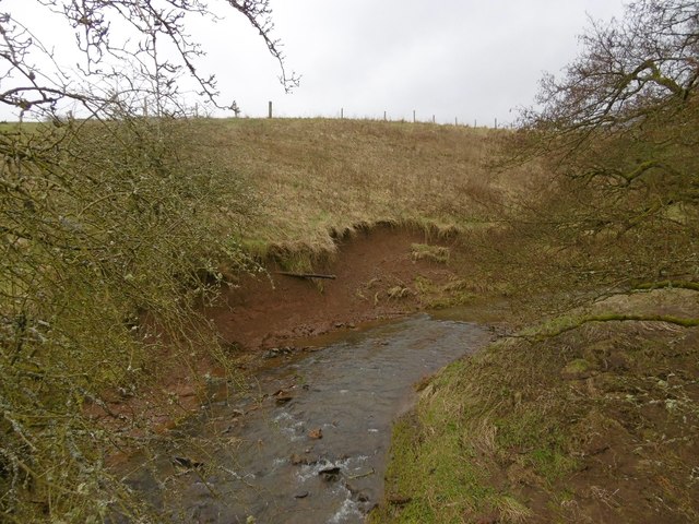
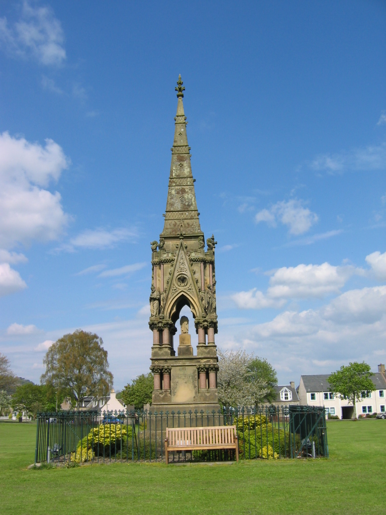
Rubers Law Images

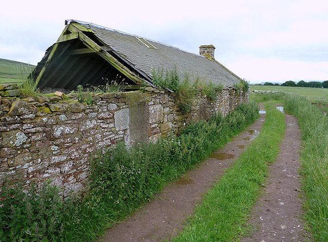
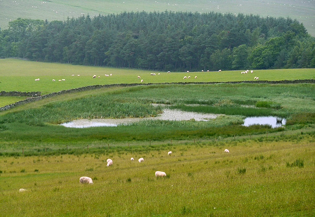
Images are sourced within 2km of 55.432186/-2.6646479 or Grid Reference NT5815. Thanks to Geograph Open Source API. All images are credited.

Footbridge near Spital Tower A plank bridge crossing a small burn in the fields SE of Spital Tower farm. The waymarked route for the Borders Abbeys Way differs slightly from that shown on the 1:25,000 map in this area.
Footbridge near Spital Tower
A plank bridge crossing a small burn in the fields SE of Spital Tower farm. The waymarked route for the Borders Abbeys Way differs slightly from that shown on the 1:25,000 map in this area.
Rubers Law from the northeast Although it has a striking conical shape, Rubers Law (424m) is not the direct remains of a volcano itself, but the remnants of the central plug of hard rock left behind after over the 340 million years of erosion have removed the outer layers.

The Borders Abbeys Way is routed slightly differently here from the line shown on the map, keeping N of the cottage at Blawearie.
Rubers Law from the northeast
Although it has a striking conical shape, Rubers Law (424m) is not the direct remains of a volcano itself, but the remnants of the central plug of hard rock left behind after over the 340 million years of erosion have removed the outer layers. The Borders Abbeys Way is routed slightly differently here from the line shown on the map, keeping N of the cottage at Blawearie.
A burnt area at the summit of Rubers Law A Jubilee beacon is likely to be the reason for this charred area – not a pretty sight.
A burnt area at the summit of Rubers Law
A Jubilee beacon is likely to be the reason for this charred area – not a pretty sight.
The triangulation pillar on Rubers Law The trig point marks the 424m summit of this interesting Border hill. Someone has placed some flowers in the pillar.
The triangulation pillar on Rubers Law
The trig point marks the 424m summit of this interesting Border hill. Someone has placed some flowers in the pillar.
Flowers on Rubers Law trig point Someone has left a nice bunch of flowers in the pillar. For a wider view of the trig point, see <a href="https://www.geograph.org.uk/photo/3036902">NT5815 : The triangulation pillar on Rubers Law</a>.
Flowers on Rubers Law trig point
Someone has left a nice bunch of flowers in the pillar. For a wider view of the trig point, see NT5815 : The triangulation pillar on Rubers Law.
Quarry Cottages These old ruined cottages on the south side of Denholm are near a disused quarry.
Quarry Cottages
These old ruined cottages on the south side of Denholm are near a disused quarry.
A pond at Ruberslaw Covert Aquatic vegetation has taken over this pond to the east of Denholmhill.
A pond at Ruberslaw Covert
Aquatic vegetation has taken over this pond to the east of Denholmhill.
Rubers Law Rubers Law seen from near Wester Fodderlee.
Rubers Law
Rubers Law seen from near Wester Fodderlee.
Rubers Law Parked on minor road at NT 56771 17259 then followed footpath, gates and fields to access summit path. Great little hill on grey windy morning with occasional rain.

Name: Rubers Law
Hill number: 1937
Height: 424m / 1391ft
Area: 28B: The River Tweed to the English Border
Class: Ma
Grid ref: NT 58032 15569
Summit feature: rock 1m E of trig
Drop: 196m
Col: 228m  NT567136
Rubers Law
Parked on minor road at NT 56771 17259 then followed footpath, gates and fields to access summit path. Great little hill on grey windy morning with occasional rain. Name: Rubers Law Hill number: 1937 Height: 424m / 1391ft Area: 28B: The River Tweed to the English Border Class: Ma Grid ref: NT 58032 15569 Summit feature: rock 1m E of trig Drop: 196m Col: 228m NT567136
Farm lane north-west from Hallrule The lane rises between fields towards less cultivated then uncultivated land. The hill on the skyline is Rubers Law.
Farm lane north-west from Hallrule
The lane rises between fields towards less cultivated then uncultivated land. The hill on the skyline is Rubers Law.
Cloon Craig Cloon Craig is a small cliff with associated other minor rock outcrops on the slopes south of the summit of the splendid if minor hill, Rubers Law.
Cloon Craig
Cloon Craig is a small cliff with associated other minor rock outcrops on the slopes south of the summit of the splendid if minor hill, Rubers Law.
Farm lane descending to Hallrule The lane descends through fields from Square Plantation on the southern slopes of Rubers Law. Faw Hill lies on the skyline left of the line of the descending lane.
Farm lane descending to Hallrule
The lane descends through fields from Square Plantation on the southern slopes of Rubers Law. Faw Hill lies on the skyline left of the line of the descending lane.
The west side of Ruberslaw This zoom view of the hill was taken in early April from the B6359 near Horsleyhill.
The west side of Ruberslaw
This zoom view of the hill was taken in early April from the B6359 near Horsleyhill.
Leaving the summit of Rubers Law I arrived at the summit of the hill just as this walker came up from a different direction. We had just missed the unveiling of a toposcope plate on the triangulation pillar but he was slightly disappointed that this was another trig point that he couldn’t use as an antenna base for his hobby as a radio ham. He has submitted photos to Geograph, but not for the past few years, and while he told me his full name, all I can remember is that he is called Andy.  Anyway, here he is leaving the summit on his way to another trig point at Sell Moor Hill near Stow and one that hopefully he will be able to use.
Leaving the summit of Rubers Law
I arrived at the summit of the hill just as this walker came up from a different direction. We had just missed the unveiling of a toposcope plate on the triangulation pillar but he was slightly disappointed that this was another trig point that he couldn’t use as an antenna base for his hobby as a radio ham. He has submitted photos to Geograph, but not for the past few years, and while he told me his full name, all I can remember is that he is called Andy. Anyway, here he is leaving the summit on his way to another trig point at Sell Moor Hill near Stow and one that hopefully he will be able to use.
The toposcope on Rubers Law The Borders Exploration Group unveiled a toposcope on the Rubers Law triangulation pillar on Sunday 4th August 2013. The toposcope, designed by Graham Anderson, points out various Border landmarks and is also engraved with overseas places visited by the group during the past 20 years as follows:-
International Expeditions (and their years)
Lesotho (1993)
Ecuador (1995)
Kenya (1997)
Mongolia (1999)
India (2001)
Romania (2002)
Peru (2003)
Pyrenees (2004)
Vietnam (2005)
Norway (2006)
Zambia (2007)
Poland (2008)
Chile (2010)
Ukraine (2011)
Cuba (2012)

Also engraved on the toposcope plate is:-

“Why do I travel? … I see views, people, places I never imagined existed”
Excerpt from A Stones Throw – Genesta Hamilton – 1935

The Borders Exploration Group gives all young people resident in the Scottish Borders opportunities to participate in adventurous activities and expeditions designed to assist in their physical, mental and spiritual development. (Source – BEG panel on the trig point).
The toposcope on Rubers Law
The Borders Exploration Group unveiled a toposcope on the Rubers Law triangulation pillar on Sunday 4th August 2013. The toposcope, designed by Graham Anderson, points out various Border landmarks and is also engraved with overseas places visited by the group during the past 20 years as follows:- International Expeditions (and their years) Lesotho (1993) Ecuador (1995) Kenya (1997) Mongolia (1999) India (2001) Romania (2002) Peru (2003) Pyrenees (2004) Vietnam (2005) Norway (2006) Zambia (2007) Poland (2008) Chile (2010) Ukraine (2011) Cuba (2012) Also engraved on the toposcope plate is:- “Why do I travel? … I see views, people, places I never imagined existed” Excerpt from A Stones Throw – Genesta Hamilton – 1935 The Borders Exploration Group gives all young people resident in the Scottish Borders opportunities to participate in adventurous activities and expeditions designed to assist in their physical, mental and spiritual development. (Source – BEG panel on the trig point).
Rubers Law This telephoto shot of the hill was taken from the southwest side of Ruberslaw Covert on the northern approach to the hill. Around 30 people were on the summit for the unveiling of a toposcope on the triangulation pillar by Sir Michael Strang Steel. The toposcope, organised by the Borders Exploration Group, points out Border landmarks and overseas places visited by the group during the past 20 years. For a view of the toposcope plate, see <a href="https://www.geograph.org.uk/photo/3589563">NT5815 : The toposcope on Rubers Law</a>.
Rubers Law
This telephoto shot of the hill was taken from the southwest side of Ruberslaw Covert on the northern approach to the hill. Around 30 people were on the summit for the unveiling of a toposcope on the triangulation pillar by Sir Michael Strang Steel. The toposcope, organised by the Borders Exploration Group, points out Border landmarks and overseas places visited by the group during the past 20 years. For a view of the toposcope plate, see NT5815 : The toposcope on Rubers Law.
Rubers Law, the outlook northeast A Roman signal station occupied this top.
It has proved too much for one small explorer.
Rubers Law, the outlook northeast
A Roman signal station occupied this top. It has proved too much for one small explorer.
Dean Burn Upstream of Denholm.  The burn is carving into the bank, note the exposed pipework.
Dean Burn
Upstream of Denholm. The burn is carving into the bank, note the exposed pipework.
Show me another place!

Rubers Law is located at Grid Ref: NT5815 (Lat: 55.432186, Lng: -2.6646479)

Unitary Authority: The Scottish Borders

Police Authority: The Lothians and Scottish Borders

What 3 Words

///cactus.throat.salary. Near Hawick, Scottish Borders

Nearby Locations

Rubers Law Simmies Pottie

Related Wikis

Rubers Law

Rubers Law is a prominent, conical hill in the Scottish Borders area of south-east Scotland. It stands on the south bank of the River Teviot, between the...

Hallrule

Hallrule is a hamlet on the B6357 road, in the Scottish Borders area of Scotland, on the Rule Water, near Abbotrule, Bedrule Bonchester Bridge, Denholm...

Fulton Tower

Fulton Tower is a ruined 16th century tower house, about 4.5 miles (7.2 km) south west of Jedburgh, Scottish Borders, Scotland, and about 2 miles (3.2...

Westgate Hall, Denholm

Westgate Hall is located in Westgate in the village of Denholm, Roxburghshire, in the Scottish Borders. It stands at the western and south-western approaches...

Bedrule Castle

Bedrule Castle is a ruined 13th-century castle in the Rule Valley, in the Scottish Borders area of Scotland.The castle was built in the 13th century by...

Bedrule

Bedrule (Scottish Gaelic: Ruail Bheathaig) is a hamlet and civil parish in the historic county of Roxburghshire in the Scottish Borders area of Scotland...

Denholm

Denholm is a small village located between Jedburgh and Hawick in the Scottish Borders region of Scotland, UK. The estimated population of Denholm is 600...

Bonchester Bridge

Bonchester Bridge (Scots Binster Brig) is a village in Roxburghshire, within the Scottish Borders area of Scotland, lying on the Rule Water, six miles...

Nearby Amenities

Located within 500m of 55.432186,-2.6646479
Disused: yes
Man Made: survey_point
Note: Concrete 'trig point' pillar at top of hill
Operator: Ordnance Survey
Ref: S7496
Source: survey
Lat/Long: 55.4322426/-2.6646973
Rubers Law
Ele: 424
Natural: peak
Source: survey
Wikidata: Q7376039
Wikipedia: en:Rubers Law
Lat/Long: 55.4322802/-2.6647473
The data included in this document is from www.openstreetmap.org. The data is made available under ODbL.

Have you been to Rubers Law?

Leave your review of Rubers Law below (or comments, questions and feedback).