Barby

Settlement in Northamptonshire

England

Barby

Willoughby Lodge Farm A driveway leads off Longdown Lane to the farm buildings.
Willoughby Lodge Farm Credit: Stephen McKay

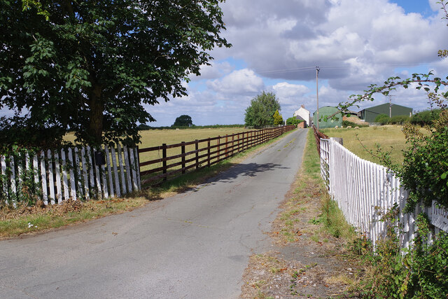
Barby is a small village located in the county of Northamptonshire, England. Situated about 6 miles southeast of Rugby, it lies on the western bank of the River Leam. With a population of around 1,000 residents, Barby offers a charming and peaceful rural setting.

The village features a mix of traditional stone cottages, farmhouses, and more modern houses, creating a picturesque and diverse architectural landscape. The heart of Barby is its village green, a well-maintained open space surrounded by trees and historic buildings. This green serves as a focal point for community events and gatherings throughout the year.

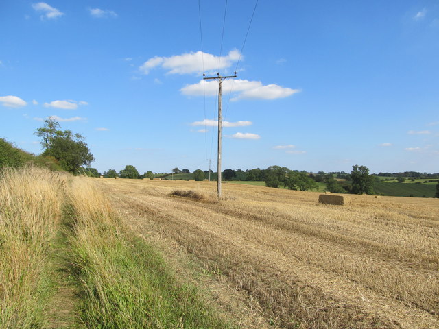
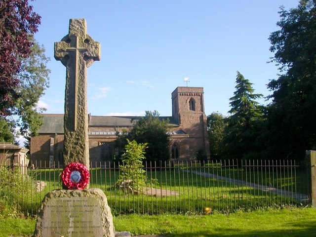
Barby boasts a close-knit community, with various amenities to cater to its residents. These include a local primary school, a village hall, a church, and a pub, providing essential services and fostering a sense of belonging. The village also benefits from beautiful countryside surroundings, with several walking and cycling routes available for residents and visitors to explore.

Despite its small size, Barby enjoys good transportation links. The nearby A45 road connects the village to major towns and cities in the region, including Northampton and Coventry. Additionally, the village is served by regular bus services, providing convenient access to nearby urban areas.

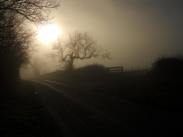
Overall, Barby offers a tranquil and idyllic setting, making it an attractive place for those seeking a peaceful village lifestyle while still enjoying easy access to nearby amenities and transportation links.

If you have any feedback on the listing, please let us know in the comments section below.
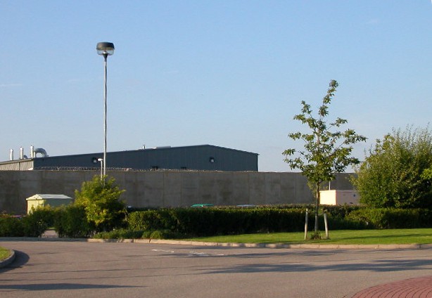
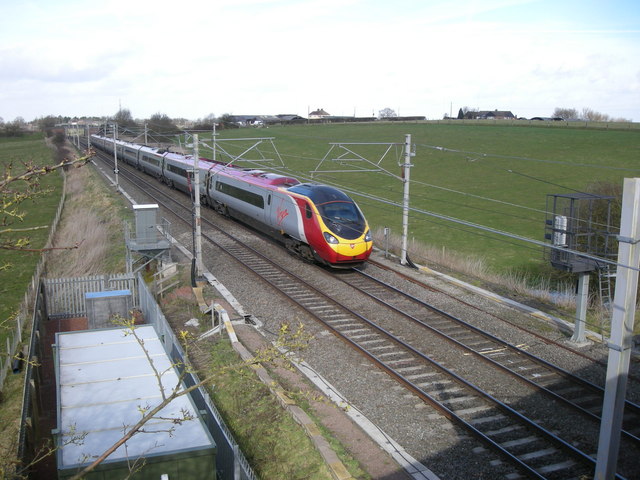
Barby Images

Images are sourced within 2km of 52.328492/-1.205655 or Grid Reference SP5470. Thanks to Geograph Open Source API. All images are credited.

Willoughby Lodge Farm A driveway leads off Longdown Lane to the farm buildings.
Willoughby Lodge Farm
A driveway leads off Longdown Lane to the farm buildings.
Farmland north of Braunston Seen from Longdown Lane, looking across the rolling countryside on the Warwickshire/Northamptonshire border.
Farmland north of Braunston
Seen from Longdown Lane, looking across the rolling countryside on the Warwickshire/Northamptonshire border.
Longdown Lane Longdown Lane connects Barby in Northamptonshire with Willoughby in Warwickshire crossing the county boundary in this view.
Longdown Lane
Longdown Lane connects Barby in Northamptonshire with Willoughby in Warwickshire crossing the county boundary in this view.
Wood Bridge On the Oxford Canal
Wood Bridge
On the Oxford Canal
M45 bridge Over the Oxford Canal.
M45 bridge
Over the Oxford Canal.
Bridge 77 over the Oxford Canal Near Barby.
Bridge 77 over the Oxford Canal
Near Barby.
Barby Moorings On the Oxford Canal.
Barby Moorings
On the Oxford Canal.
Narrowboats on the Barby straight On the Oxford Canal.
Narrowboats on the Barby straight
On the Oxford Canal.
Norman's Bridge On the Oxford Canal.
Norman's Bridge
On the Oxford Canal.
Oxford Canal Near Hillmorton.
Oxford Canal
Near Hillmorton.
M45 motorway just west of the Oxford Canal The M45 motorway was built at the same time as the first stretch of the M1 and opened in 1959.  Its purpose was, in combination with the A45 which continues it, to link the M1 to the cities of the West Midlands; however, the construction of the M6 on a roughly parallel line to the north of this meant that motorway largely took over that role, leaving the M45 little-used.  As a result it remains very much as originally built, with two lanes in each direction and the characteristic original bridges.
M45 motorway just west of the Oxford Canal
The M45 motorway was built at the same time as the first stretch of the M1 and opened in 1959. Its purpose was, in combination with the A45 which continues it, to link the M1 to the cities of the West Midlands; however, the construction of the M6 on a roughly parallel line to the north of this meant that motorway largely took over that role, leaving the M45 little-used. As a result it remains very much as originally built, with two lanes in each direction and the characteristic original bridges.
Barby Hill Footpath through the arable land.
Barby Hill
Footpath through the arable land.
Braunston-Cleves Hill A mixture of dense fog and bright sunshine near Tiltup's Holt Farm
Braunston-Cleves Hill
A mixture of dense fog and bright sunshine near Tiltup's Holt Farm
Braunston-Cleves Hill Standing virtually in the same spot as [<a title="https://www.geograph.org.uk/photo/3290891" href="https://www.geograph.org.uk/photo/3290891">Link</a>] but looking north into sunshine.
Braunston-Cleves Hill
Standing virtually in the same spot as [Link] but looking north into sunshine.
Barby-Chapel Farm Road leading down to the farm.
Barby-Chapel Farm
Road leading down to the farm.
The lane from Braunston to Barby Near the top of Cleve Hill.
The lane from Braunston to Barby
Near the top of Cleve Hill.
Tiltup Holt's Farm Near the top of Cleves Hill.
Tiltup Holt's Farm
Near the top of Cleves Hill.
Willoughby Lodge Farm
Show me another place!

Barby is located at Grid Ref: SP5470 (Lat: 52.328492, Lng: -1.205655)

Unitary Authority: West Northamptonshire

Police Authority: Northamptonshire

What 3 Words

///offers.string.unwound. Near Kilsby, Northamptonshire

Nearby Locations

Barby

Related Wikis

Barby, Northamptonshire

Barby is a village and civil parish about 5 miles (8 km) north of Daventry in Northamptonshire, England. The 2011 Census recorded the parish population...

Barby Storage Reservoir

Barby Storage Reservoir is a reservoir near Barby in Northamptonshire, England, owned and operated by Severn Trent Water. It supplies drinking water to...

Braunston Cleves or Fawcliff

The village of Braunston Cleves or Fawcliff formerly stood north of the village of Braunston in the English county of Northamptonshire at its border with...

Kilsby

Kilsby is a village and civil parish in West Northamptonshire, England. It is situated a short distance south of the border with Warwickshire approximately...

HM Prison Rye Hill

HM Prison Rye Hill is a Category B men's private prison, operated by G4S. Rye Hill has exclusively housed sex offenders since 2014. The prison is next...

Rainsbrook Secure Training Centre

Rainsbrook Secure Training Centre is a secure school and housing unit for children and teenagers between Dunchurch and Barby, south of Rugby, in Warwickshire...

Barby Nortoft

Barby Nortoft is a settlement in the civil parish of Barby, in the English county of Northamptonshire. It is south-east of the town of Rugby, Warwickshire...

HM Prison Onley

HM Prison Onley is a Category C men's prison, operated by His Majesty's Prison Service. The prison is named after the lost village of Onley, which is located...

Nearby Amenities

Located within 500m of 52.328492,-1.205655
Barby
Place: village
Lat/Long: 52.3283727/-1.2049663
Post Box
Collection Times: Mo-Fr 16:15; Sa 11:00
Operator: Royal Mail
Operator Wikidata: Q638098
Post Box Mounting: brick_pillar
Post Box Type: wall
Ref: CV23 8
Royal Cypher: EIIR
Royal Cypher Wikidata: Q33102113
Source: survey
Lat/Long: 52.3288823/-1.2059325
Bus Stop
Bus Shelter (o/s)
Bin: yes
Naptan AtcoCode: 300000488PO
Naptan CommonName: Bus Shelter
Naptan Indicator: o/s
Naptan Landmark: Bus Shelter
Naptan NaptanCode: nthapdwt
Naptan Street: The Green
Public Transport: platform
Shelter: yes
Lat/Long: 52.3287559/-1.2050905
Turning Circle
Lat/Long: 52.3311963/-1.203375
Post Office
Barby Village Stores
Addr City: Rugby
Addr Country: GB
Addr Housenumber: 5
Addr Postcode: CV23 8UA
Addr Street: Rugby Road
Addr Village: Barby
Fhrs Authority: West Northamptonshire
Fhrs Id: 1053318
Fhrs Local Authority Id: PI/000042872
Opening Hours: Mo-Sa 06:30-20:00; Su 08:00-18:00
Opening Hours Post Office: Mo-Fr 09:00-14:30; Sa 09:00-12:30
Ref Pol Id: 14431
Shop: convenience
Source Opening Hours Post Office: pol_branch_list_2018-02
Lat/Long: 52.328808/-1.2060368
Historic: memorial
Lat/Long: 52.3286077/-1.2040378
Give Way
Direction: forward
Lat/Long: 52.3310971/-1.2055072
Give Way
Direction: backward
Lat/Long: 52.3287443/-1.2055951
Give Way
Direction: forward
Lat/Long: 52.328669/-1.2053915
Give Way
Direction: backward
Lat/Long: 52.3285376/-1.2056288
Give Way
Direction: forward
Lat/Long: 52.3273229/-1.2039
Give Way
Direction: backward
Lat/Long: 52.3306865/-1.2021747
Give Way
Direction: backward
Lat/Long: 52.3306147/-1.2021604
Give Way
Direction: backward
Lat/Long: 52.3305591/-1.2033016
Give Way
Direction: backward
Lat/Long: 52.332622/-1.2084588
Bench
Lat/Long: 52.3289459/-1.2054888
Bus Stop
Ware Road (adj)
Naptan AtcoCode: 300000488KR
Naptan CommonName: Ware Road
Naptan Indicator: adj
Naptan Landmark: Ware Road
Naptan NaptanCode: nthapdwm
Naptan Street: Kilsby Road
Public Transport: platform
Lat/Long: 52.3306498/-1.2005863
The data included in this document is from www.openstreetmap.org. The data is made available under ODbL.

Have you been to Barby?

Leave your review of Barby below (or comments, questions and feedback).