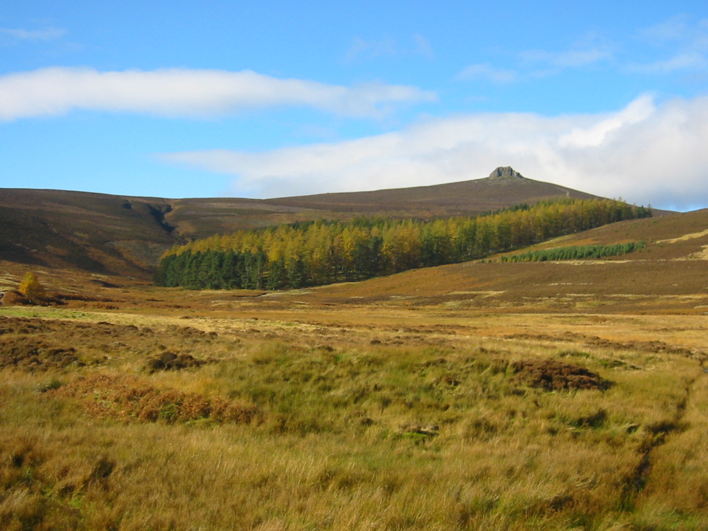
Cock Hill

Hill, Mountain in Kincardineshire

Scotland

Cock Hill

Parting of the paths The left-hand path follows Water of Dye and eventually reaches Glen Esk.   The right-hand path (which I took) heads up to the ridge leading to Mount Battock.
Parting of the paths Credit: Bill Harrison

Cock Hill is a prominent hill located in the county of Kincardineshire, Scotland. With an elevation of approximately 406 meters (1,332 feet), it is categorized as a hill rather than a mountain. It is situated within the Cairngorms National Park and lies to the west of the town of Ballater.

The hill offers stunning panoramic views of the surrounding area, including the picturesque River Dee and the rolling hills of the Cairngorms. It is a popular destination for hikers and outdoor enthusiasts who are looking to enjoy the natural beauty of the Scottish Highlands. The ascent to the summit of Cock Hill is relatively moderate, making it accessible to a wide range of fitness levels.

The hill is covered in heather and scattered with rocky outcrops, adding to its rugged charm. Its slopes are home to a variety of wildlife, including red deer and various bird species. The area is also known for its diverse flora, with wildflowers such as foxgloves and bluebells dotting the landscape during the summer months.

Cock Hill is part of a network of walking trails in the region, allowing visitors to explore the surrounding countryside and enjoy the tranquility of the Scottish Highlands. It provides an excellent opportunity for nature lovers to immerse themselves in the natural beauty and serenity of the area, away from the hustle and bustle of urban life.

If you have any feedback on the listing, please let us know in the comments section below.

Cock Hill Images

Images are sourced within 2km of 56.93918/-2.697587 or Grid Reference NO5783. Thanks to Geograph Open Source API. All images are credited.

Parting of the paths The left-hand path follows Water of Dye and eventually reaches Glen Esk.   The right-hand path (which I took) heads up to the ridge leading to Mount Battock.
Parting of the paths
The left-hand path follows Water of Dye and eventually reaches Glen Esk. The right-hand path (which I took) heads up to the ridge leading to Mount Battock.
By the Burn of Badymicks... ...with Mount Battock in the distance.
By the Burn of Badymicks...
...with Mount Battock in the distance.
The only way is up... ...towards the ridge leading to Mount Battock.
The only way is up...
...towards the ridge leading to Mount Battock.
Path to Clachnaben
Path to Clachnaben
Eroded peat on Lochnawean Hill
Mount Battock Gathering grounds for the Water of Dye on the southern flanks of Mount Battock.
Mount Battock
Gathering grounds for the Water of Dye on the southern flanks of Mount Battock.
Glen Dye View down Glen Dye from Stobie Hillock on the watershed with the North Esk.
Glen Dye
View down Glen Dye from Stobie Hillock on the watershed with the North Esk.
Head of Glen Dye Moorland near the watershed with the North Esk, south of Mount Battock.
Head of Glen Dye
Moorland near the watershed with the North Esk, south of Mount Battock.
Burn of Saughs Evidence of recent flash flooding (5 days earlier). The same storm brought devastation to Alyth.
Burn of Saughs
Evidence of recent flash flooding (5 days earlier). The same storm brought devastation to Alyth.
Remains of a sheep pen Decaying stell in Glen Dye.
Remains of a sheep pen
Decaying stell in Glen Dye.
Water of Saughs Some impressive meanders in  one of the feeders for the Water of Dye.
Water of Saughs
Some impressive meanders in one of the feeders for the Water of Dye.
Moorland on Cock Hill A short rough walk from the road in Glen Dye.
Moorland on Cock Hill
A short rough walk from the road in Glen Dye.
Road, Glen Dye
Road, Glen Dye
Ruined bridge The bridge over the Burn of Badymicks shown here <a href="https://www.geograph.org.uk/photo/417353">NO5883 : Foot bridge and Stable, Glen Dye.</a> has been swept away.
Ruined bridge
The bridge over the Burn of Badymicks shown here NO5883 : Foot bridge and Stable, Glen Dye. has been swept away.
Burn of Badymicks A road follows the burn on to Mount Battock.
Burn of Badymicks
A road follows the burn on to Mount Battock.
Roadworks, Glen Dye Regrading the road up Glen Dye.
Roadworks, Glen Dye
Regrading the road up Glen Dye.
Glen Dye By now the Burn of Badymicks and Burn of Saughs have joined to form the Water of Dye.
Glen Dye
By now the Burn of Badymicks and Burn of Saughs have joined to form the Water of Dye.
Water of Dye The road was built some time ago and has a very well constructed masonry wall protecting it from the river.
Water of Dye
The road was built some time ago and has a very well constructed masonry wall protecting it from the river.
Show me another place!

Cock Hill is located at Grid Ref: NO5783 (Lat: 56.93918, Lng: -2.697587)

Unitary Authority: Aberdeenshire

Police Authority: North East

What 3 Words

///pans.rollover.reputable. Near Aboyne, Aberdeenshire

Nearby Locations

Cock Hill

Related Wikis

Mount Battock

Mount Battock (778 m) is a mountain in the Mounth on the eastern edge of the Scottish Highlands, on the border between Aberdeenshire and Angus. A rounded...

Clachnaben

Clachnaben (archaically "Cloch-na'bain"; Scottish Gaelic: "Clach na Beinne") is a 589-metre hill in Glen Dye, Aberdeenshire, Scotland. It is a distinctive...

Colmeallie stone circle

The Colmeallie stone circle is a recumbent stone circle in Glen Esk, Angus, Scotland. It is located 8 km north of Edzell at Colmeallie Farm, adjacent to...

Millden

Millden is a hamlet, estate and farmstead in Glenesk, Angus, Scotland. It is situated in the upper course of the Glen Esk valley, where the Burn of Turret...

Have you been to Cock Hill?

Leave your review of Cock Hill below (or comments, questions and feedback).