Baudnacauner

Hill, Mountain in Aberdeenshire

Scotland

Baudnacauner

Leggie Burn Catchment of Water of Aven and a view of Peter Hill from the slopes of Mount Battock.
Leggie Burn Credit: Richard Webb

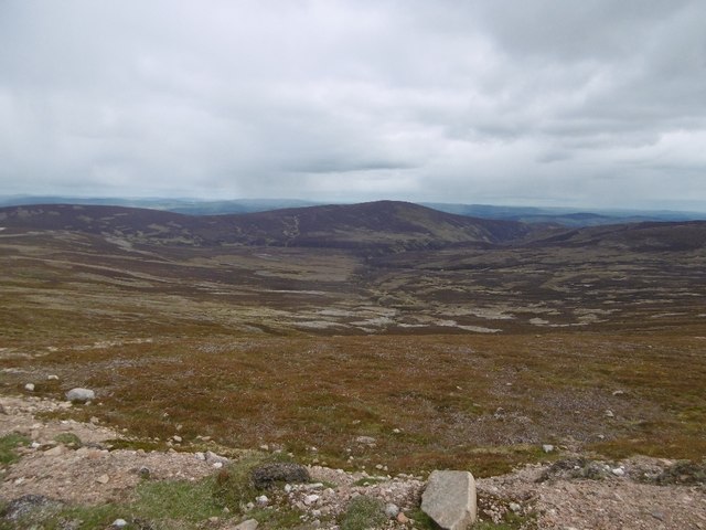
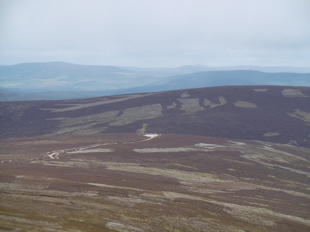
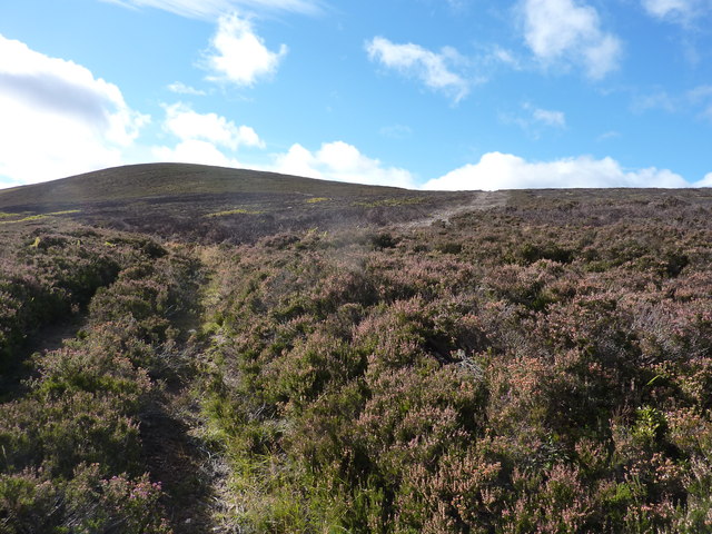
Baudnacauner is a prominent hill located in Aberdeenshire, Scotland. Situated within the Cairngorms National Park, it is part of the Grampian Mountains range. Standing at an elevation of approximately 901 meters (2,956 feet), Baudnacauner offers breathtaking panoramic views of the surrounding landscapes.

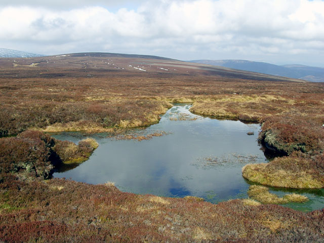
The hill is characterized by its rugged and steep slopes, covered in heather and grasses. Its distinct rock formations, created by millions of years of geological activity, add to its unique charm. Baudnacauner is a popular destination among hikers and outdoor enthusiasts, attracting both locals and tourists alike.

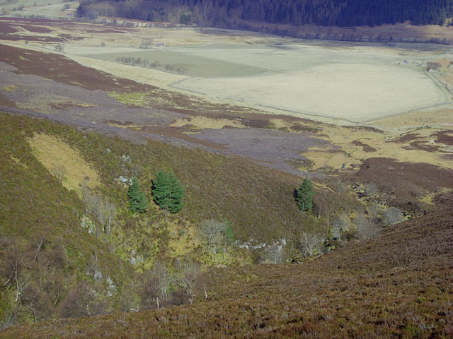
Reaching the summit of Baudnacauner requires a moderate level of fitness and hiking experience. There are various routes available to ascend the hill, each offering its own challenges and rewards. The most common route begins from the small village of Braemar, taking hikers through picturesque valleys and forests before ascending towards the summit.

Wildlife is abundant in the area surrounding Baudnacauner. Visitors may encounter various species of birds, including eagles and ptarmigans, as well as mammals such as deer and mountain hares. The hill is also home to a diverse range of plant life, with wildflowers adding splashes of color to the landscape during the summer months.

Overall, Baudnacauner in Aberdeenshire is a captivating destination for outdoor enthusiasts seeking to immerse themselves in the natural beauty of the Scottish Highlands. Its stunning vistas, challenging trails, and rich biodiversity make it a must-visit for those looking to experience the wonders of this picturesque region.

If you have any feedback on the listing, please let us know in the comments section below.

Baudnacauner Images

Images are sourced within 2km of 56.982631/-2.7340387 or Grid Reference NO5588. Thanks to Geograph Open Source API. All images are credited.

Leggie Burn Catchment of Water of Aven and a view of Peter Hill from the slopes of Mount Battock.
Leggie Burn
Catchment of Water of Aven and a view of Peter Hill from the slopes of Mount Battock.
Cock Hill Looking along to the road end where there was a parked Land Rover.
Cock Hill
Looking along to the road end where there was a parked Land Rover.
Bog Pool These small peaty pools are typical of the blanket bogs that cover these rolling hills
Bog Pool
These small peaty pools are typical of the blanket bogs that cover these rolling hills
Hill Track
Hill Track
Peat Gully
Peat Gully
Head of the Rough Burn A view across the rolling blanket bog that surrounds the headwaters of the Rough Burn.  Cock Hill is visible in the distance.
Head of the Rough Burn
A view across the rolling blanket bog that surrounds the headwaters of the Rough Burn. Cock Hill is visible in the distance.
Bog pool on Baudnacauner White Hill in the distance
Bog pool on Baudnacauner
White Hill in the distance
Rough Burn The lower part of the Rough Burn gorge, with the farmland of Auchabrack beyond
Rough Burn
The lower part of the Rough Burn gorge, with the farmland of Auchabrack beyond
Peat Haggs on White Hill In this area the going gets tough with peat haggs impeding progress in all directions.  Grit from the local granite has been deposited in the depressions.
Peat Haggs on White Hill
In this area the going gets tough with peat haggs impeding progress in all directions. Grit from the local granite has been deposited in the depressions.
Badenhall burn from Glaspits
North-West from Peter Hill A view across the heather and Blaeberry of Peter Hill's north-west slopes towards the Forest of Birse and Carnferg (<a href="https://www.geograph.org.uk/gridref/NO5293">NO5293</a>)
North-West from Peter Hill
A view across the heather and Blaeberry of Peter Hill's north-west slopes towards the Forest of Birse and Carnferg (NO5293)
East of Cock Hill Looking East towards Clachnaben on the far horizon with Baudnacauner in the left middle distance. It is easy to see why so few geosquares have been photographed in this area, because there is so little reward for the effort expended crossing this terrain.
East of Cock Hill
Looking East towards Clachnaben on the far horizon with Baudnacauner in the left middle distance. It is easy to see why so few geosquares have been photographed in this area, because there is so little reward for the effort expended crossing this terrain.
Peat Hagg near Cock Hill Typical of the peat hags found between White Hill and Baudnacauner. They are numerous and make traversing the terrain easier as long as you are heading in the same general direction. If you are not, hard luck!
Peat Hagg near Cock Hill
Typical of the peat hags found between White Hill and Baudnacauner. They are numerous and make traversing the terrain easier as long as you are heading in the same general direction. If you are not, hard luck!
Landslip on new landrover track by the Water of Aven The fence line follows the track all the way to Cock Hill
Landslip on new landrover track by the Water of Aven
The fence line follows the track all the way to Cock Hill
A track heading up through deep heather, south of the River Feugh
On moorland south of the River Feugh, looking across the Glaspits Burn The hill in the background is Baudnacauner
On moorland south of the River Feugh, looking across the Glaspits Burn
The hill in the background is Baudnacauner
Moorland west of the Water of Aven A view towards the upper region of the Water of Aven, flowing between Cock Hill and Baudnacauner.
Moorland west of the Water of Aven
A view towards the upper region of the Water of Aven, flowing between Cock Hill and Baudnacauner.
Water of Aven The upper region of the Water of Aven, flowing eastwards between Baudnacauner and Cock Hill.
Water of Aven
The upper region of the Water of Aven, flowing eastwards between Baudnacauner and Cock Hill.
Show me another place!

Baudnacauner is located at Grid Ref: NO5588 (Lat: 56.982631, Lng: -2.7340387)

Unitary Authority: Aberdeenshire

Police Authority: North East

What 3 Words

///sandbags.garden.beauty. Near Aboyne, Aberdeenshire

Nearby Locations

Baudnacauner

Related Wikis

Forest of Birse

The Forest of Birse is a remote upland area in the upper catchment of the Water of Feugh, which forms the south-western portion of the Parish of Birse...

Mount Battock

Mount Battock (778 m) is a mountain in the Mounth on the eastern edge of the Scottish Highlands, on the border between Aberdeenshire and Angus. A rounded...
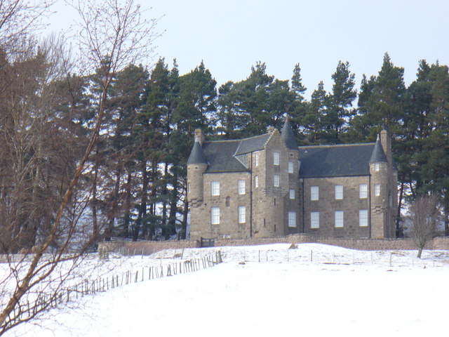
Birse Castle

Birse Castle is located in the Forest of Birse, Aberdeenshire, Scotland. Originally a square tower house, it was rebuilt in the first decade of the 20th...

Clachnaben

Clachnaben (archaically "Cloch-na'bain"; Scottish Gaelic: "Clach na Beinne") is a 589-metre hill in Glen Dye, Aberdeenshire, Scotland. It is a distinctive...

Easter Clune Castle

Easter Clune Castle is a ruined 16th-century tower house, about 6 miles (9.7 km) south-west of Banchory, Aberdeenshire, Scotland, and south of the Water...

Ballogie

Ballogie is a rural community and an estate in the Lower Deeside area of Aberdeenshire, Scotland. Most of Ballogie lies within the parish of Birse, although...

Corsedardar Hill

Corsedardar Hill is a mountain landform in the Grampian Mountains of Aberdeenshire, Scotland. This hill is located in the Lower Deeside region within the...

Finzean

Finzean (; Scottish Gaelic: Fìnnean) is a rural community, electoral polling district, community council area and former ecclesiastical parish, which forms...

Nearby Amenities

Located within 500m of 56.982631,-2.7340387
Baudnacauner
Ele: 574
Natural: peak
Lat/Long: 56.982642/-2.7335772
The data included in this document is from www.openstreetmap.org. The data is made available under ODbL.

Have you been to Baudnacauner?

Leave your review of Baudnacauner below (or comments, questions and feedback).