Carmyllie Hill

Hill, Mountain in Angus

Scotland

Carmyllie Hill

Road (B9127) at Hillhead Farm Looking eastward.
Road (B9127) at Hillhead Farm Credit: Peter Wood

Carmyllie Hill is a prominent hill located in the Angus region of Scotland. Standing at an elevation of approximately 289 meters (948 feet), it offers breathtaking views of the surrounding landscape. Situated near the village of Carmyllie, the hill is easily accessible and attracts numerous visitors throughout the year.

Carmyllie Hill is characterized by its gently sloping terrain, covered with a mixture of grass, heather, and some scattered trees. The hill is part of the larger landscape of the Sidlaw Hills, a range of low hills that stretches across eastern Scotland. It is known for its natural beauty and is a favored spot for hikers, walkers, and nature enthusiasts.

At the top of Carmyllie Hill, visitors can enjoy panoramic views of the Angus countryside, with rolling hills, farmland, and distant mountains visible on clear days. The hill also offers an opportunity to observe local wildlife, including various bird species, rabbits, and deer.

The area surrounding Carmyllie Hill is rich in history and heritage. There are several ancient sites nearby, such as the Carmyllie Cairn, a Neolithic burial mound, and the Normandykes, an Iron Age fort. These sites provide a glimpse into the area's past and add cultural and historical significance to the hill.

Overall, Carmyllie Hill is a captivating destination for those seeking outdoor activities, natural beauty, and a connection to Scotland's rich history. Its accessibility, stunning views, and diverse flora and fauna make it a must-visit location in Angus.

If you have any feedback on the listing, please let us know in the comments section below.

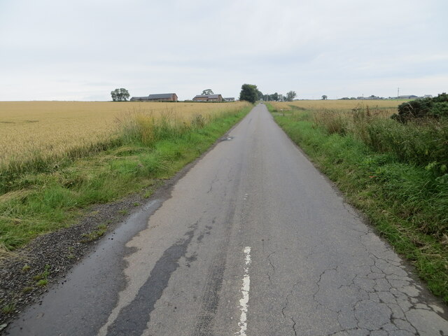
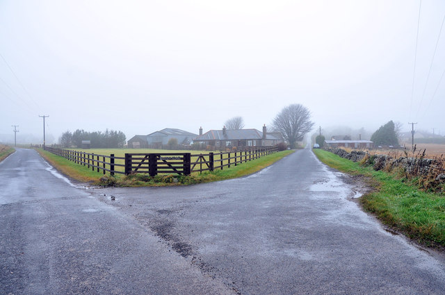
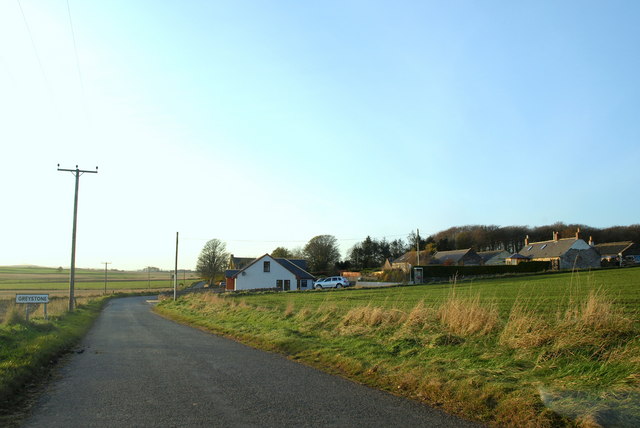
Carmyllie Hill Images

Images are sourced within 2km of 56.582105/-2.7400941 or Grid Reference NO5443. Thanks to Geograph Open Source API. All images are credited.

Road (B9127) at Hillhead Farm Looking eastward.
Road (B9127) at Hillhead Farm
Looking eastward.
Minor road approaching the B961 at Newtonbank Looking eastward.
Minor road approaching the B961 at Newtonbank
Looking eastward.
Carmyllie Church and part of its Burial Ground Viewed from the north.
Carmyllie Church and part of its Burial Ground
Viewed from the north.
Minor road near Carmyllie Hill and Muir-edge Looking northward.
Minor road near Carmyllie Hill and Muir-edge
Looking northward.
Track giving access to Drummygar Looking eastward.
Track giving access to Drummygar
Looking eastward.
Road between Mosston and Burnhead Looking north-eastward.
Road between Mosston and Burnhead
Looking north-eastward.
Road approaching Mosston and Carmyllie Moor Looking north-westward.
Road approaching Mosston and Carmyllie Moor
Looking north-westward.
Burnhead Terrace, Redford Looking north-westward.
Burnhead Terrace, Redford
Looking north-westward.
Ordnance Survey Cut Mark with Bolt This mark and bolt can be found on the wall of Carmyllie Church.
The recorded details give a height of 144.417 metres above sea level. To which the carved +474+ is, I presume, the measurement calculated in feet in the mid 19th century.
For more detail see : <span class="nowrap"><a title="https://www.bench-marks.org.uk/bm163011" rel="nofollow ugc noopener" href="https://www.bench-marks.org.uk/bm163011">Link</a><img style="margin-left:2px;" alt="External link" title="External link - shift click to open in new window" src="https://s1.geograph.org.uk/img/external.png" width="10" height="10"/></span>
Ordnance Survey Cut Mark with Bolt
This mark and bolt can be found on the wall of Carmyllie Church. The recorded details give a height of 144.417 metres above sea level. To which the carved +474+ is, I presume, the measurement calculated in feet in the mid 19th century. For more detail see : LinkExternal link
Carmyllie Church and Graveyard Carmyllie Parish Church has a long and interesting history. A chapel, known as 'Our Lady's Chapel' was situated here in the 16th century, but an earlier 15th century chapel was also located here, built by David Strachan of Carmyllie.

The parish church was originally a rectangular building, aligned east-west and built in 1609. The taller north aisle was built in 1836 to form a T-plan church, and other additions and alterations, notably to the interior, were carried out by James MacLaren in 1874. Some fine interior details have survived, including part of the laird's pew, dated 1657. 
The church sits within a large walled graveyard and alongside the former glebe land, manse and hearse house. The church was built in a variety of materials, with some ashlar sandstone, coursed and squared rubble and tooled surroundings and corner stones (quoins). The roofs are slated. Taken from <span class="nowrap"><a title="http://www.scottishchurches.org.uk/sites/site/id/7726/name/Carmyllie+Parish+Church+Carmyllie+Tayside" rel="nofollow ugc noopener" href="http://www.scottishchurches.org.uk/sites/site/id/7726/name/Carmyllie+Parish+Church+Carmyllie+Tayside">Link</a><img style="margin-left:2px;" alt="External link" title="External link - shift click to open in new window" src="https://s1.geograph.org.uk/img/external.png" width="10" height="10"/></span>
Carmyllie Church and Graveyard
Carmyllie Parish Church has a long and interesting history. A chapel, known as 'Our Lady's Chapel' was situated here in the 16th century, but an earlier 15th century chapel was also located here, built by David Strachan of Carmyllie. The parish church was originally a rectangular building, aligned east-west and built in 1609. The taller north aisle was built in 1836 to form a T-plan church, and other additions and alterations, notably to the interior, were carried out by James MacLaren in 1874. Some fine interior details have survived, including part of the laird's pew, dated 1657. The church sits within a large walled graveyard and alongside the former glebe land, manse and hearse house. The church was built in a variety of materials, with some ashlar sandstone, coursed and squared rubble and tooled surroundings and corner stones (quoins). The roofs are slated. Taken from LinkExternal link
Site of Carmyllie station, 1988 View SW on B961, with the site of the station on the right: terminus of the ex-CR & NBR (Dundee & Arbroath) Joint branch, which ran SE from here to Elliot Junction. The branch was closed to passengers from 2/12/29, but remained for goods until 28/5/65.
Site of Carmyllie station, 1988
View SW on B961, with the site of the station on the right: terminus of the ex-CR & NBR (Dundee & Arbroath) Joint branch, which ran SE from here to Elliot Junction. The branch was closed to passengers from 2/12/29, but remained for goods until 28/5/65.
Road junction at Burnhead
Road past Forehill in the mist
Road across Carmyllie Moor in the mist
Reservoir in the mist at West Hills
B9127 near Carmyllie
Drainage stream near Carmyllie
B9127 past Hillhead Farm
Show me another place!

Carmyllie Hill is located at Grid Ref: NO5443 (Lat: 56.582105, Lng: -2.7400941)

Unitary Authority: Angus

Police Authority: Tayside

What 3 Words

///hours.qualify.lakeside. Near Letham, Angus

Related Wikis

Greystone, Angus

Greystone is a hamlet in Angus, Scotland. It lies between the towns of Carnoustie and Forfar in the parish of Carmyllie. == References ==

Carmyllie

Carmyllie (Gaelic: Càrn Mhoillidh) is a rural parish in Angus, Scotland. It is situated on high ground between Arbroath, on the coast, and the inland county...

Redford, Angus

Redford is a hamlet in the parish of Carmyllie in Angus, Scotland. It is situated on high ground between Arbroath, on the coast, and the inland county...

Carmyllie railway station

Carmyllie railway station served the town of Carmyllie, Angus, Scotland from 1900 to 1965 on the Carmyllie Railway. == History == The station opened on...

Nearby Amenities

Located within 500m of 56.582105,-2.7400941
Bus Stop
Drummygar Road End
Bus: yes
Local Ref: AT
Naptan AtcoCode: 6490IM150
Naptan Bearing: S
Naptan BusStopType: CUS
Naptan CommonName: Drummygar Road End
Naptan Indicator: at
Naptan Landmark: Drummygar
Naptan NaptanCode: 26426754
Naptan Street: Unclassified Road
Naptan Verified: no
Public Transport: platform
Source: naptan_import
Lat/Long: 56.5837937/-2.7331845
Bus Stop
Drummygar
Bus: yes
Naptan AtcoCode: 6490IM151
Naptan Bearing: N
Naptan BusStopType: CUS
Naptan CommonName: Drummygar
Naptan Indicator: opp Road End
Naptan Landmark: Drummygar
Naptan NaptanCode: 26426756
Naptan Verified: no
Public Transport: platform
Source: naptan_import
Lat/Long: 56.5837645/-2.7335747
Post Box
Drive Through: no
Operator: Royal Mail
Lat/Long: 56.581888/-2.7341529
Muiredge
Alt Name: Muir-edge
Place: isolated_dwelling
Lat/Long: 56.5822148/-2.7336722
Carmyllie Hill
Ele: 188
Natural: peak
Lat/Long: 56.5829712/-2.7403884
Mains of Carmyllie
Place: isolated_dwelling
Lat/Long: 56.5785544/-2.7419098
Westcroft Cottages
Place: hamlet
Lat/Long: 56.5802524/-2.7354783
Fairyfold Hillock
Ele: 179
Natural: hill
Place: locality
Lat/Long: 56.5823886/-2.7446298
Power: pole
Lat/Long: 56.5778221/-2.7418892
Power: pole
Lat/Long: 56.5780849/-2.7429755
Power: pole
Lat/Long: 56.5783313/-2.7439894
Power: pole
Lat/Long: 56.5785964/-2.7450544
Power: pole
Lat/Long: 56.5799415/-2.7332572
Power: pole
Lat/Long: 56.5808753/-2.7328014
Power: pole
Lat/Long: 56.5818983/-2.7324521
Power: pole
Lat/Long: 56.5825581/-2.7321975
Power: pole
Lat/Long: 56.5819282/-2.7335842
Power: pole
Lat/Long: 56.5845699/-2.7335522
Power: pole
Lat/Long: 56.5850309/-2.7346748
The data included in this document is from www.openstreetmap.org. The data is made available under ODbL.

Have you been to Carmyllie Hill?

Leave your review of Carmyllie Hill below (or comments, questions and feedback).