Waddelscairn Moor
Hill, Mountain in Berwickshire
Scotland
Waddelscairn Moor
Waddelscairn Moor is a vast expanse of high moorland located in the county of Berwickshire, Scotland. Situated in the southern part of the country, it forms part of the larger Lammermuir Hills range. With an elevation of approximately 477 meters (1,565 feet), Waddelscairn Moor offers breathtaking views of the surrounding countryside.
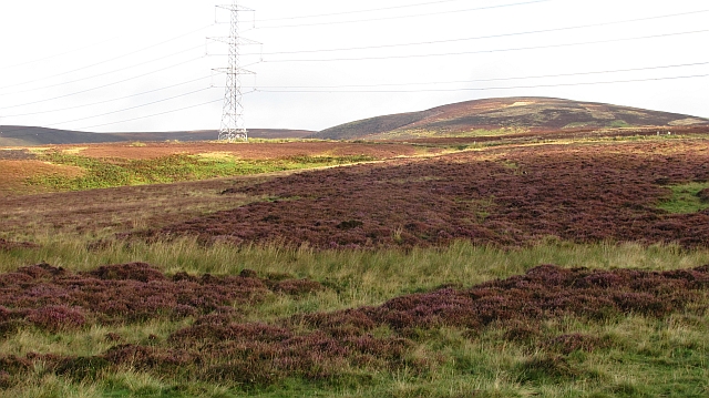
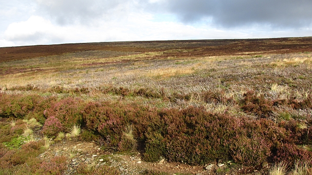
Covered in heather, the moorland is characterized by its rugged and undulating terrain, dotted with numerous hills and small lochs. This wild and remote landscape attracts outdoor enthusiasts, particularly hikers and nature lovers, who appreciate the area's natural beauty and tranquility.
The moor is home to a variety of wildlife, including red grouse, golden plovers, and curlews, which thrive in its open grassy areas. The surrounding hillsides provide habitat for birds of prey such as buzzards and kestrels. Additionally, the moorland is known for its diverse plant life, with species like cotton grass and bog myrtle flourishing in the damp and peaty soil.
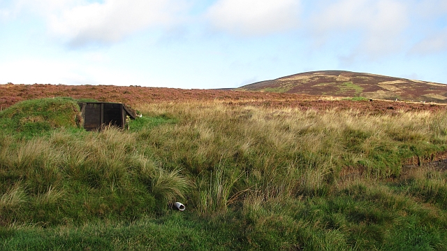
Waddelscairn Moor is accessible via a network of paths and trails, offering opportunities for visitors to explore its unique landscape. However, it is important to note that the terrain can be challenging, and appropriate outdoor gear and navigation skills are recommended.
With its unspoiled natural beauty and rich biodiversity, Waddelscairn Moor is a haven for those seeking solitude and a connection with nature. Whether it's for a leisurely walk or a more challenging hike, this moorland is a must-visit destination for outdoor enthusiasts in Berwickshire.
If you have any feedback on the listing, please let us know in the comments section below.
Waddelscairn Moor Images
Images are sourced within 2km of 55.81531/-2.7307359 or Grid Reference NT5458. Thanks to Geograph Open Source API. All images are credited.


Waddelscairn Moor is located at Grid Ref: NT5458 (Lat: 55.81531, Lng: -2.7307359)
Unitary Authority: The Scottish Borders
Police Authority: The Lothians and Scottish Borders
What 3 Words
///toolkit.subtitle.heave. Near Lauder, Scottish Borders
Nearby Locations
Related Wikis

Lammermuir Hills
The Lammermuirs are a range of hills in southern Scotland, forming a natural boundary between East Lothian and the Borders. The name "Lammermuir" comes...

Hopes Reservoir
Hopes Reservoir is a small reservoir in East Lothian, Scotland, in the Lammermuir Hills. It is located in the parish of Yester, 6 km (3.7 mi) south of...

Carfrae Bastle
Carfrae Bastle is a small ruined tower house about 5 miles (8.0 km) north of Lauder, Scottish Borders, Scotland, near Hillhouse == History == Carfrae Bastle...

Oxton railway station
Oxton railway station served the village of Oxton, Scottish Borders, Scotland, from 1901 to 1958 on the Lauder Light Railway. == History == The station...
Addinston
Addinston is a farming village, off the A697, close to the Carfraemill roundabout, with two hill forts and settlements, in Lauderdale in the Scottish...

Oxton, Scottish Borders
Oxton is a small rural village in the Scottish Borders area of Scotland, just off the A68. It is 4+1⁄2 miles (7 kilometres) north of Lauder, and 20 mi...

Channelkirk
Channelkirk is a parish and community council area in the north-west corner of the historic county of Berwickshire in the Scottish Borders area of Scotland...

Mutiny Stones
The Mutiny Stones are a megalithic monument in the Lammermuir Hills, Scotland.Situated on Byrecleugh Rig, the nearest centre of habitation is at Longformacus...
Nearby Amenities
Located within 500m of 55.81531,-2.7307359Have you been to Waddelscairn Moor?
Leave your review of Waddelscairn Moor below (or comments, questions and feedback).