Craigangower

Hill, Mountain in Angus

Scotland

Craigangower

Craigangower Looking towards Craigangower. New bulldozed track all the way to the summit from Hill of Wirren.
Craigangower Credit: Ben Aslak

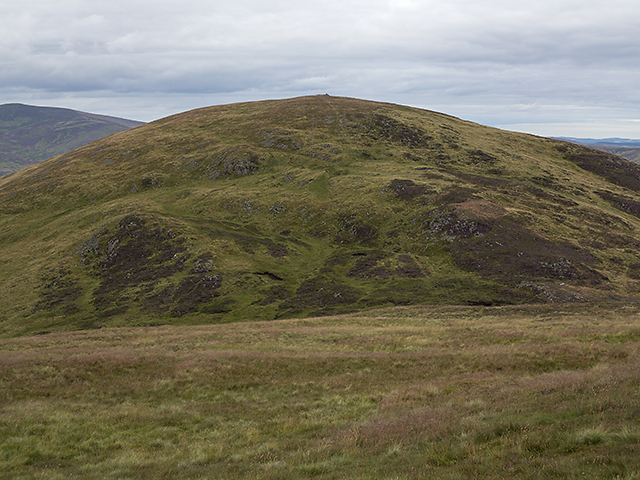
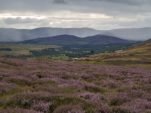
Craigangower is a prominent hill located in the Angus region of Scotland. Standing at an elevation of approximately 1,573 feet (479 meters), it is classified as a Marilyn, which is a hill with a prominence of at least 492 feet (150 meters). The summit of Craigangower offers breathtaking panoramic views of the surrounding countryside, including the beautiful landscapes of Angus and the nearby Glenshee Mountains.

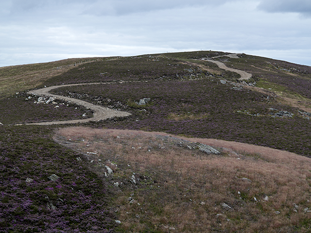
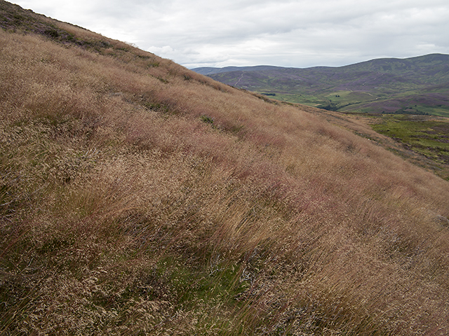
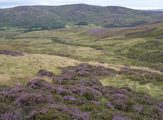
The hill is a popular destination among hikers and outdoor enthusiasts due to its easily accessible trails and stunning scenery. The ascent to the summit is relatively moderate, making it suitable for people of various fitness levels. The main route to Craigangower starts from the village of Kirkton of Glenisla, where a well-marked path leads visitors through a mixture of open moorland, rocky terrain, and heather-covered slopes.

The hill is known for its diverse wildlife, with various species of birds, including golden eagles and peregrine falcons, often spotted soaring above. It is also home to a range of flora, such as heather, bracken, and wildflowers, which add vibrant colors to the landscape during the summer months.

Craigangower is steeped in history, with ancient cairns and standing stones scattered across its slopes. These remnants of the past provide insight into the area's rich cultural heritage and are a source of intrigue for history enthusiasts.

Overall, Craigangower offers a rewarding outdoor experience, combining stunning views, rich biodiversity, and a glimpse into Scotland's fascinating past.

If you have any feedback on the listing, please let us know in the comments section below.

Craigangower Images

Images are sourced within 2km of 56.86751/-2.7573703 or Grid Reference NO5375. Thanks to Geograph Open Source API. All images are credited.

Craigangower Looking towards Craigangower. New bulldozed track all the way to the summit from Hill of Wirren.
Craigangower
Looking towards Craigangower. New bulldozed track all the way to the summit from Hill of Wirren.
Road and butts on Hill of Wirren Looking up Glen Esk towards Mount Keen.
Road and butts on Hill of Wirren
Looking up Glen Esk towards Mount Keen.
View from Craigangower The southern flank of Bulg viewed on a descent from Craigangower - relatively easy walking here on grass and heather.
View from Craigangower
The southern flank of Bulg viewed on a descent from Craigangower - relatively easy walking here on grass and heather.
Craigangower Craigangower, with a newly constructed hill track - these seem to be proliferating in Glen Esk, with construction underway at a number of nearby sites. The name Craigangower derives from Craig nan Gabhar, Hill of the Goats.
Craigangower
Craigangower, with a newly constructed hill track - these seem to be proliferating in Glen Esk, with construction underway at a number of nearby sites. The name Craigangower derives from Craig nan Gabhar, Hill of the Goats.
The Hill of Wirren Hill tracks east of the summit of the Hill of Wirren, with Craigangower and Bulg visible in the distance.
The Hill of Wirren
Hill tracks east of the summit of the Hill of Wirren, with Craigangower and Bulg visible in the distance.
North east of Bulg On the lower north eastern slopes of Bulg, heather gives way to a reddish tinged species of grass - this is of delicate structure such that it is swayed by the slightest breeze.
North east of Bulg
On the lower north eastern slopes of Bulg, heather gives way to a reddish tinged species of grass - this is of delicate structure such that it is swayed by the slightest breeze.
Above the Burn of Holmhead A view from the lower slopes of Bulg, over the course of the Burn of Holmhead, a short tributary of the North Esk barely 3km in length.
Above the Burn of Holmhead
A view from the lower slopes of Bulg, over the course of the Burn of Holmhead, a short tributary of the North Esk barely 3km in length.
Moorland north of Bulg The lower slopes of Bulg, viewed as the weather deteriorates on an August evening. Heavy rain can be seen in the distance, beyond the Maul Monument situated on the Hill of Rowan 7km distant.
Moorland north of Bulg
The lower slopes of Bulg, viewed as the weather deteriorates on an August evening. Heavy rain can be seen in the distance, beyond the Maul Monument situated on the Hill of Rowan 7km distant.
The Slack of Forbie The upper region of the Burn of Forbie between Bulg and Craigangower, marked as the Slack of Forbie on OS mapping. This is the source of the Burn of Forbie, one of many tributaries of the North Esk. Farmland north of Montrose and the North Sea can be seen in the distance.
The Slack of Forbie
The upper region of the Burn of Forbie between Bulg and Craigangower, marked as the Slack of Forbie on OS mapping. This is the source of the Burn of Forbie, one of many tributaries of the North Esk. Farmland north of Montrose and the North Sea can be seen in the distance.
North of the Hill of Wirren Burns draining the hillside north of the Hill of Wirren, viewed in early August with the heather in bloom.
North of the Hill of Wirren
Burns draining the hillside north of the Hill of Wirren, viewed in early August with the heather in bloom.
Craigangower summit area Fencing on the summit of Craigangower, with Bulg visible beyond the Slack of Forbie. The prominent granite tor on the summit of Clachnaben can also be seen on the skyline almost 15km distant.
Craigangower summit area
Fencing on the summit of Craigangower, with Bulg visible beyond the Slack of Forbie. The prominent granite tor on the summit of Clachnaben can also be seen on the skyline almost 15km distant.
North east of the Hill of Wirren Hill tracks leading from the Hill of Wirren to Craigangower, with Bulg also visible (centre left of image).
North east of the Hill of Wirren
Hill tracks leading from the Hill of Wirren to Craigangower, with Bulg also visible (centre left of image).
Summit cairn on Bulg The large cairn on the summit of Bulg, with hills to the north of Glen Esk visible on the skyline.
Summit cairn on Bulg
The large cairn on the summit of Bulg, with hills to the north of Glen Esk visible on the skyline.
Uplands to lowlands A view to the east from the Hill of Wirren - Craigangower ridge. This is the eastern edge of the vast Mounth plateau, where high ground gives way to arable lowlands in the Howe of the Mearns. The contrast between upland and lowland areas can clearly be seen in this image, with purple and green dappled hillsides giving way to a patchwork of forest and farmland, which ends abruptly on the shore of the North Sea.
Uplands to lowlands
A view to the east from the Hill of Wirren - Craigangower ridge. This is the eastern edge of the vast Mounth plateau, where high ground gives way to arable lowlands in the Howe of the Mearns. The contrast between upland and lowland areas can clearly be seen in this image, with purple and green dappled hillsides giving way to a patchwork of forest and farmland, which ends abruptly on the shore of the North Sea.
Trig and view on East Wirren. The eastern top of Hill of Wirren is well placed for views over the lowlands. Dominating the view is Montrose Basin.
Trig and view on East Wirren.
The eastern top of Hill of Wirren is well placed for views over the lowlands. Dominating the view is Montrose Basin.
Heathery Mountainside on East Wirren
Hillside valley The hill in the distance is Craigangower, a subsidiary summit of Hill of Wirren.
Hillside valley
The hill in the distance is Craigangower, a subsidiary summit of Hill of Wirren.
Hill track on Hill of Wirren This track climbs high up the Hill of Wirren
Hill track on Hill of Wirren
This track climbs high up the Hill of Wirren
Show me another place!

Craigangower is located at Grid Ref: NO5375 (Lat: 56.86751, Lng: -2.7573703)

Unitary Authority: Angus

Police Authority: Tayside

What 3 Words

///recruiter.glad.improving. Near Brechin, Angus

Nearby Locations

Craigangower

Related Wikis

Millden

Millden is a hamlet, estate and farmstead in Glenesk, Angus, Scotland. It is situated in the upper course of the Glen Esk valley, where the Burn of Turret...

Colmeallie stone circle

The Colmeallie stone circle is a recumbent stone circle in Glen Esk, Angus, Scotland. It is located 8 km north of Edzell at Colmeallie Farm, adjacent to...

Tarfside

Tarfside is a small hamlet in Angus, Scotland. It is situated in Glen Esk, on the upper course of the River North Esk, around 8 miles north of Edzell,...

Edzell Castle

Edzell Castle is a ruined 16th-century castle, with an early-17th-century walled garden. It is located close to Edzell, and is around 5 miles (8 km) north...

Nearby Amenities

Located within 500m of 56.86751,-2.7573703
Craigangower
Ele: 603
Natural: peak
Lat/Long: 56.8671791/-2.757989
The data included in this document is from www.openstreetmap.org. The data is made available under ODbL.

Have you been to Craigangower?

Leave your review of Craigangower below (or comments, questions and feedback).