Round Knowe

Hill, Mountain in Roxburghshire

Scotland

Round Knowe

Lilliesleaf Parish Church The first church on this site was said to be built in 1110 and replaced in 1430. The present church was built in 1771 and extended in 1883 and 1910 with the addition of a bell tower. This photo was taken at 11.50 on Christmas Day.
Lilliesleaf Parish Church Credit: Walter Baxter

Round Knowe is a prominent hill located in the county of Roxburghshire, Scotland. Sitting at an elevation of 425 meters (1,394 feet), it is considered a relatively low mountain in the region. The hill can be found approximately 5 kilometers northeast of the town of Hawick, and it is part of the wider Cheviot Hills range.

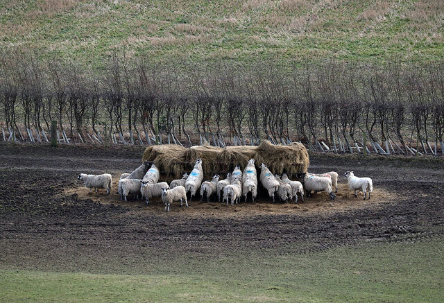
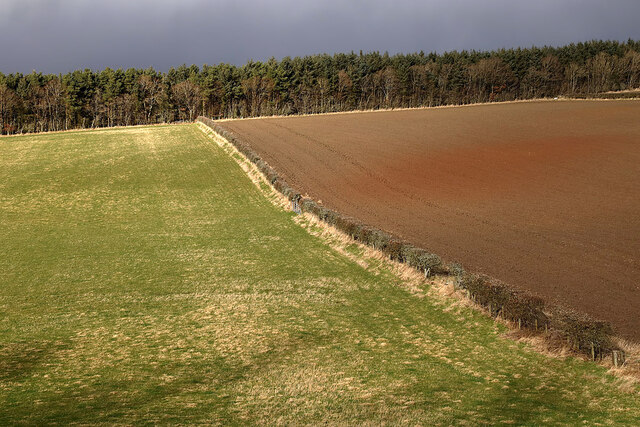
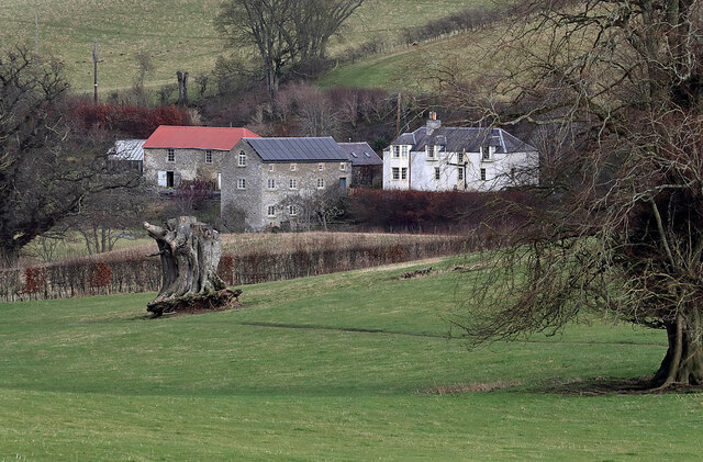
Round Knowe is characterized by its distinct round shape and relatively smooth slopes, which make it easily distinguishable in the landscape. The hill is mostly covered with grass, heather, and patches of shrubs. Its summit offers panoramic views of the surrounding countryside, including the rolling hills, farmlands, and nearby valleys.

The area around Round Knowe is rich in history and heritage. The hill is believed to have been used as a lookout point during ancient times, providing strategic views of the region. There are remnants of an Iron Age hillfort on the southeastern slopes, indicating human occupation in the area dating back thousands of years.

The hill is a popular destination for outdoor enthusiasts and nature lovers. Hiking and walking trails traverse the slopes, allowing visitors to explore the picturesque surroundings. The relatively easy ascent makes Round Knowe accessible to both experienced hikers and beginners. Wildlife such as birds, rabbits, and deer can often be spotted in the area, adding to the allure of the hill.

Overall, Round Knowe stands as a notable feature in Roxburghshire, offering a blend of natural beauty, historical significance, and recreational opportunities for visitors to enjoy.

If you have any feedback on the listing, please let us know in the comments section below.
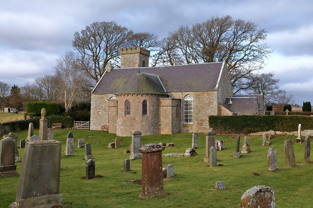
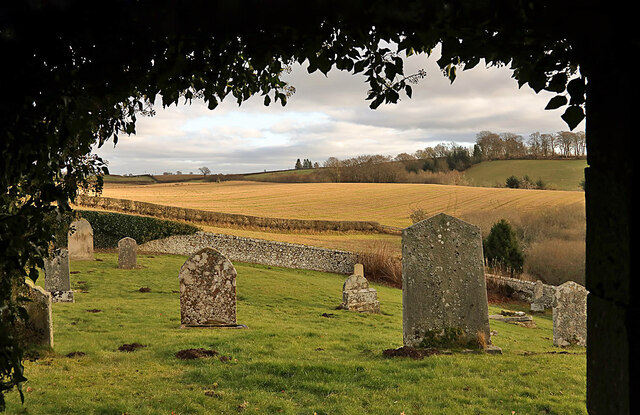
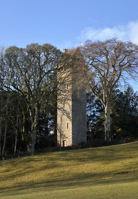
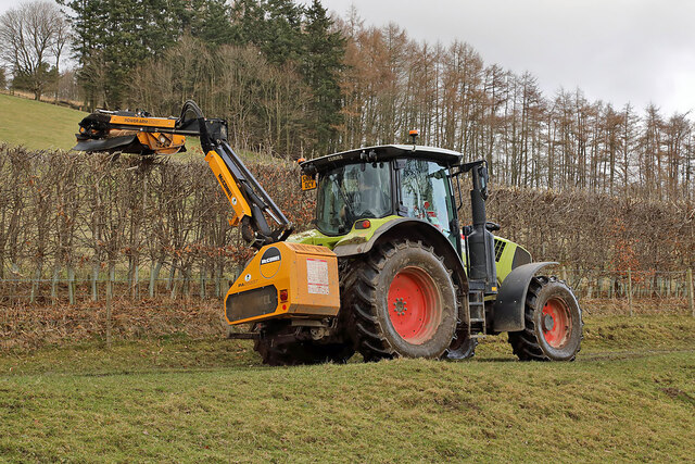
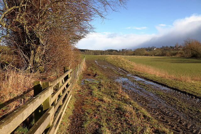
Round Knowe Images

Images are sourced within 2km of 55.52086/-2.7333291 or Grid Reference NT5325. Thanks to Geograph Open Source API. All images are credited.

Lilliesleaf Parish Church The first church on this site was said to be built in 1110 and replaced in 1430. The present church was built in 1771 and extended in 1883 and 1910 with the addition of a bell tower. This photo was taken at 11.50 on Christmas Day.
Lilliesleaf Parish Church
The first church on this site was said to be built in 1110 and replaced in 1430. The present church was built in 1771 and extended in 1883 and 1910 with the addition of a bell tower. This photo was taken at 11.50 on Christmas Day.
Lilliesleaf Churchyard This view of the southeast part of the churchyard was taken from the entrance to the Riddell burial aisle.
Lilliesleaf Churchyard
This view of the southeast part of the churchyard was taken from the entrance to the Riddell burial aisle.
A symbolic gravestone at Lilliesleaf Churchyard The head of the winged soul on this lichen-covered portrait headstone is missing.
A symbolic gravestone at Lilliesleaf Churchyard
The head of the winged soul on this lichen-covered portrait headstone is missing.
The General’s Tower at Riddell This 25m high observation tower, surrounded by trees, was built in memory of the Sprot family on a medieval motte and bailey in 1885 by A. Herbertson & Son for Major-General John Sprot. An internal vertiginous metal spiral staircase in one corner leads to a caphouse and corbelled parapet walkway. For a long distance autumnal view, see <a href="https://www.geograph.org.uk/photo/2142196">NT5224 : The General's Tower at Riddell</a>.
The General’s Tower at Riddell
This 25m high observation tower, surrounded by trees, was built in memory of the Sprot family on a medieval motte and bailey in 1885 by A. Herbertson & Son for Major-General John Sprot. An internal vertiginous metal spiral staircase in one corner leads to a caphouse and corbelled parapet walkway. For a long distance autumnal view, see NT5224 : The General's Tower at Riddell.
Sheep at Riddell This winter feeding station is by a farm track.
Sheep at Riddell
This winter feeding station is by a farm track.
The caphouse on the General’s Tower at Riddell The caphouse and corbelled parapet walkway can be accessed by an internal vertiginous metal spiral staircase. For a wider view of the 25m high tower, see <a href="https://www.geograph.org.uk/photo/7098037">NT5224 : The General’s Tower at Riddell</a>.
The caphouse on the General’s Tower at Riddell
The caphouse and corbelled parapet walkway can be accessed by an internal vertiginous metal spiral staircase. For a wider view of the 25m high tower, see NT5224 : The General’s Tower at Riddell.
A crest above the entrance door to the general’s Tower The crest features a heron, three fish and a boar’s head. The initials J. S. stand for Major-General John Sprot who commissioned the tower. For a view of the tower, see <a href="https://www.geograph.org.uk/photo/7098037">NT5224 : The General’s Tower at Riddell</a>.
A crest above the entrance door to the general’s Tower
The crest features a heron, three fish and a boar’s head. The initials J. S. stand for Major-General John Sprot who commissioned the tower. For a view of the tower, see NT5224 : The General’s Tower at Riddell.
Mixed farmland at Lilliesleaf The fields were viewed from the B6400 opposite Lilliesleaf Parish Church.
Mixed farmland at Lilliesleaf
The fields were viewed from the B6400 opposite Lilliesleaf Parish Church.
An old Riddell milepost The milepost is in the southeast edge of a strip wood by a farm track. For some historical information, see <a href="https://www.geograph.org.uk/photo/6814513">NT5225 : Old milepost</a>.
An old Riddell milepost
The milepost is in the southeast edge of a strip wood by a farm track. For some historical information, see NT5225 : Old milepost.
The Sprot family mausoleum This small mortuary chapel surrounded by a locked iron railed enclosure is situated about 80m south of the General’s Tower on the Riddell Estate. Three window tablets are inscribed with details of Sprot family members.
The Sprot family mausoleum
This small mortuary chapel surrounded by a locked iron railed enclosure is situated about 80m south of the General’s Tower on the Riddell Estate. Three window tablets are inscribed with details of Sprot family members.
A window tablet on the Sprot family mausoleum The inscription reads:-

IN
THIS VAULT REST
THE REMAINS OF
JAMES LEWIS BOYD SPROT,
WHO DIED AT SCHOOL
AT EALING NEAR LONDON,
25TH APRIL 1857 AGED 13 YEARS.
THIRD SON OF MARK SPROT,
OF RIDDELL, ROXBURGHSHIRE.
ALSO
MARK GEORGE SPROT,
CAPTAIN OF THE 93RD HIGHLANDERS
SECOND SON ON MARK SPROT,
WHO AFTER A LONG ILLNESS
DEPARTED THIS LIFE AT THE
HOTEL BYRON, LAKE GENEVA
ON 16TH SEPTEMBER 1853
AGED 28 YEARS.
ALSO
EDWARD WILLIAM SPROT,
OF DRYGRANGE
FOURTH SON OF MARK SPROT
WHO DIED AT DRYGRANGE
1ST FEBRUARY 1898
AGED 52 YEARS
AND IS BURIED AT MELROSE.

For a wider view of the mausoleum, see <a href="https://www.geograph.org.uk/photo/7098055">NT5224 : The Sprot family mausoleum</a>.
A window tablet on the Sprot family mausoleum
The inscription reads:- IN THIS VAULT REST THE REMAINS OF JAMES LEWIS BOYD SPROT, WHO DIED AT SCHOOL AT EALING NEAR LONDON, 25TH APRIL 1857 AGED 13 YEARS. THIRD SON OF MARK SPROT, OF RIDDELL, ROXBURGHSHIRE. ALSO MARK GEORGE SPROT, CAPTAIN OF THE 93RD HIGHLANDERS SECOND SON ON MARK SPROT, WHO AFTER A LONG ILLNESS DEPARTED THIS LIFE AT THE HOTEL BYRON, LAKE GENEVA ON 16TH SEPTEMBER 1853 AGED 28 YEARS. ALSO EDWARD WILLIAM SPROT, OF DRYGRANGE FOURTH SON OF MARK SPROT WHO DIED AT DRYGRANGE 1ST FEBRUARY 1898 AGED 52 YEARS AND IS BURIED AT MELROSE. For a wider view of the mausoleum, see NT5224 : The Sprot family mausoleum.
A window tablet on the Sprot family mausoleum The inscription reads:-

IN
THIS VAULT REST
THE REMAINS OF
ELIZABETH,
THE BELOVED WIFE OF MARK SPROT,
RIDDELL, AND ELDEST DAUGHTER OF
JOHN SHEWELL OF CLAPHAM COMMON
WHO DIED SUDDENLY AT EDINBURGH
MUCH REGRETTED 9TH FEBY 1871
AGED 60 YEARS.
ALSO
MARK SPROT ESQR OF RIDDELL
WHO DIED AT EDINBURGH
21ST NOVEMBER 1883,
AGED 82 YEARS.
ALSO
LIEUT. GENERAL JOHN SPROT,
OF RIDDELL,
ELDEST SON OF MARK SPROT,
OF RIDDELL,
LATE 83RD FOOT AND 91ST HIGHLANDERS
WHO DIED AT RIDDELL
19TH MARCH 1907
AGED 77 YEARS.

For a wider view of the mausoleum, see <a href="https://www.geograph.org.uk/photo/7098055">NT5224 : The Sprot family mausoleum</a>.
A window tablet on the Sprot family mausoleum
The inscription reads:- IN THIS VAULT REST THE REMAINS OF ELIZABETH, THE BELOVED WIFE OF MARK SPROT, RIDDELL, AND ELDEST DAUGHTER OF JOHN SHEWELL OF CLAPHAM COMMON WHO DIED SUDDENLY AT EDINBURGH MUCH REGRETTED 9TH FEBY 1871 AGED 60 YEARS. ALSO MARK SPROT ESQR OF RIDDELL WHO DIED AT EDINBURGH 21ST NOVEMBER 1883, AGED 82 YEARS. ALSO LIEUT. GENERAL JOHN SPROT, OF RIDDELL, ELDEST SON OF MARK SPROT, OF RIDDELL, LATE 83RD FOOT AND 91ST HIGHLANDERS WHO DIED AT RIDDELL 19TH MARCH 1907 AGED 77 YEARS. For a wider view of the mausoleum, see NT5224 : The Sprot family mausoleum.
A window tablet on the Sprot family mausoleum The inscription reads:-

IN
THIS VAULT REST
THE REMAINS OF
GEORGINA MARY SPROT,
THE BELOVED WIFE OF 
COLONEL JAMES SPROT,
ASST ADJUT GENERAL FOR SCOTLAND
AND THIRD DAUGHTER OF
HENRY E. SURTEES ESQR OF REDWORTH
HALL & CO DURHAM & DANE END & HERTS
WHO DIED AT EDINBURGH
16TH MARCH 1876 AGED 27 YEARS.
ALSO
IN MEMORY OF HER INFANT DAUGHTERS
LOUISE SPROT,
WHO DIED AT FORT GEORGE 1873
AND IS BURRIED AT ARDERSEER
GEORGIE CAROLINE SPROT,
WHO DIED AT EDINBURGH 1876
AND WHOSE REMAINS LIE IN THIS VAULT
ALSO
CECELIA ELIZABETH SPROT
THE BELOVED WIFE OF
COLONEL J. SPROT OF RIDDELL,
AND DAUGHTER OF THE
REVD. WILLIAM BLAKE DOVETON
OF CORSTON SOMERSET
WHO DIED AT EASTBOURNE
8TH JUNE 1884 AGED 32 YEARS.

For a wider view of the mausoleum, see <a href="https://www.geograph.org.uk/photo/7098055">NT5224 : The Sprot family mausoleum</a>.
A window tablet on the Sprot family mausoleum
The inscription reads:- IN THIS VAULT REST THE REMAINS OF GEORGINA MARY SPROT, THE BELOVED WIFE OF COLONEL JAMES SPROT, ASST ADJUT GENERAL FOR SCOTLAND AND THIRD DAUGHTER OF HENRY E. SURTEES ESQR OF REDWORTH HALL & CO DURHAM & DANE END & HERTS WHO DIED AT EDINBURGH 16TH MARCH 1876 AGED 27 YEARS. ALSO IN MEMORY OF HER INFANT DAUGHTERS LOUISE SPROT, WHO DIED AT FORT GEORGE 1873 AND IS BURRIED AT ARDERSEER GEORGIE CAROLINE SPROT, WHO DIED AT EDINBURGH 1876 AND WHOSE REMAINS LIE IN THIS VAULT ALSO CECELIA ELIZABETH SPROT THE BELOVED WIFE OF COLONEL J. SPROT OF RIDDELL, AND DAUGHTER OF THE REVD. WILLIAM BLAKE DOVETON OF CORSTON SOMERSET WHO DIED AT EASTBOURNE 8TH JUNE 1884 AGED 32 YEARS. For a wider view of the mausoleum, see NT5224 : The Sprot family mausoleum.
Hedge trimming on the Riddell Estate
Riddell Mill This is the site of a former watermill.
Riddell Mill
This is the site of a former watermill.
A farm track on the Riddell Estate The ground was saturated after periods of heavy rain.
A farm track on the Riddell Estate
The ground was saturated after periods of heavy rain.
A gravestone detail at Lilliesleaf This is the top part of an 18th century wall monument gravestone in an enclosure at Lilliesleaf Parish Churchyard. The portrait figure represents the deceased holding a book to show religious devotion, while the menacing figure on the left is a symbol of mortality, a crown-wearing skeleton, the King of Terrors, holding an hourglass and a dart. It was difficult to make anything out on the inscription below.
There is an almost identical stone at Roberton Cemetery <a href="https://www.geograph.org.uk/photo/2551444">NT4314 : A gravestone detail at Roberton</a>.
A gravestone detail at Lilliesleaf
This is the top part of an 18th century wall monument gravestone in an enclosure at Lilliesleaf Parish Churchyard. The portrait figure represents the deceased holding a book to show religious devotion, while the menacing figure on the left is a symbol of mortality, a crown-wearing skeleton, the King of Terrors, holding an hourglass and a dart. It was difficult to make anything out on the inscription below. There is an almost identical stone at Roberton Cemetery NT4314 : A gravestone detail at Roberton.
A crest and Celtic cross detail at the Sprot Mausoleum For a view of the mausoleum, see <a href="https://www.geograph.org.uk/photo/7098055">NT5224 : The Sprot family mausoleum</a>.
A crest and Celtic cross detail at the Sprot Mausoleum
For a view of the mausoleum, see NT5224 : The Sprot family mausoleum.
Show me another place!

Round Knowe is located at Grid Ref: NT5325 (Lat: 55.52086, Lng: -2.7333291)

Unitary Authority: The Scottish Borders

Police Authority: The Lothians and Scottish Borders

What 3 Words

///wheels.eggplants.eased. Near Selkirk, Scottish Borders

Related Wikis

Lilliesleaf

Lilliesleaf is a small village and civil parish 7 miles (11 km) south east of Selkirk in the Roxburghshire area of Scottish Borders of Scotland. Other...

Lothian and Borders

Lothian and Borders is an area in Scotland consisting of the East Lothian, City of Edinburgh, Midlothian, West Lothian council areas (collectively known...

Old Belses

Old Belses is a village by the Ale Water, in the Parish of Ancrum, in the Scottish Borders of Scotland, in the historic county of Roxburghshire. Other...

Belses

Belses is a village on the Ale Water, in the Scottish Borders area of Scotland the former Selkirkshire. It is situated close to Old Belses, and lies south...

Belses railway station

Belses railway station served the village of Belses, Scottish Borders, Scotland from 1849 to 1969 on the Waverley Route. == History == The station opened...

Castle Holydean

Holydean Castle (pronounced "hollydeen") was a castle sited near Melrose in Bowden, 1.25 miles SW of the village, in the Scottish Borders region of Scotland...

Bowismiln

Bowismiln is a village in the Scottish Borders area of Scotland. == See also == List of places in the Scottish Borders List of places in Scotland ��2...

Hassendean railway station

Hassendean railway station served the village of Hassendean, Scottish Borders, Scotland from 1850 to 1969 on the Waverley Route. == History == The station...

Nearby Amenities

Located within 500m of 55.52086,-2.7333291
Post Box
Brand: Royal Mail
Brand Wikidata: Q638098
Brand Wikipedia: en:Royal Mail
Check Date: 2022-02-24
Operator: Royal Mail
Operator Wikidata: Q638098
Post Box Mounting: pier
Post Box Type: lamp
Ref: TD6 88
Royal Cypher: scottish_crown
Lat/Long: 55.5181463/-2.7376561
Booth: K6
Covered: booth
Man Made: telephone_box
Note: booth present but no phone
Removed Amenity: telephone
Source: survey
Lat/Long: 55.5183235/-2.7370759
Power: pole
Lat/Long: 55.5190896/-2.7397501
Power: pole
Lat/Long: 55.5197971/-2.7390196
Power: pole
Lat/Long: 55.5205737/-2.7383834
Power: pole
Lat/Long: 55.5214281/-2.7377369
Power: pole
Lat/Long: 55.5222666/-2.7370752
Power: pole
Lat/Long: 55.5232736/-2.7360241
Power: pole
Lat/Long: 55.5243685/-2.7350748
Power: pole
Lat/Long: 55.5236698/-2.7385386
Power: pole
Lat/Long: 55.5233961/-2.7381492
Power: pole
Lat/Long: 55.5231094/-2.7378387
Bench
Backrest: yes
Material: wood
Lat/Long: 55.5181067/-2.7378327
The data included in this document is from www.openstreetmap.org. The data is made available under ODbL.

Have you been to Round Knowe?

Leave your review of Round Knowe below (or comments, questions and feedback).