Beacon Hill

Hill, Mountain in Cheshire

England

Beacon Hill

Red Lane, Frodsham
Red Lane, Frodsham Credit: Richard Webb

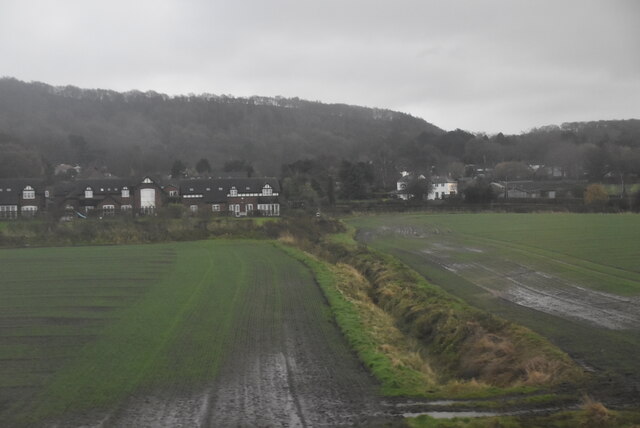
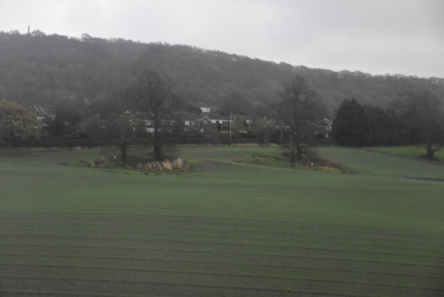
Beacon Hill is a prominent landmark situated in Cheshire, England. As its name suggests, it is a hill that rises to an elevation of 345 feet (105 meters) above sea level, making it one of the highest points in the surrounding area. Located near the village of Audlem, Beacon Hill offers breathtaking panoramic views of the Cheshire Plain and the neighboring counties of Shropshire and Staffordshire.

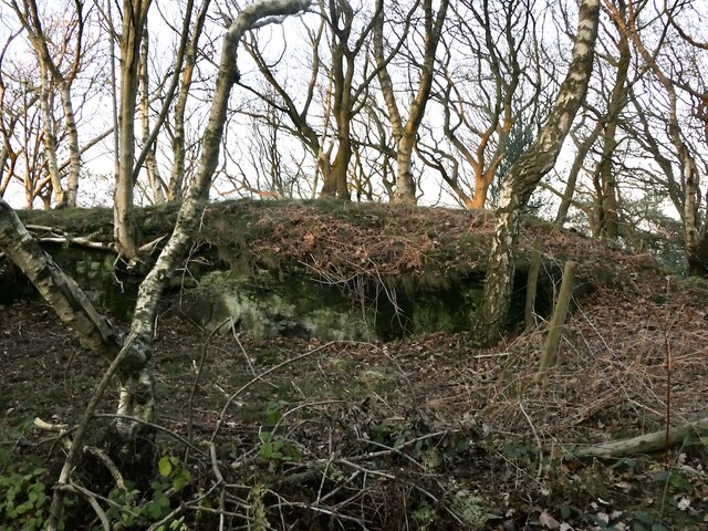
The hill is characterized by its distinctive conical shape and is covered in lush greenery, primarily consisting of grass and scattered trees. It is a popular destination for outdoor enthusiasts, attracting hikers, walkers, and nature lovers. There are several well-maintained footpaths that lead to the summit, providing visitors with a chance to explore the surrounding countryside and appreciate the diverse flora and fauna.

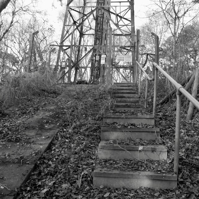
At the top of Beacon Hill, there is an ancient beacon site that dates back to the Roman era. Historically, beacons were used as a means of communication, relaying messages across long distances. Today, the beacon serves as a reminder of the area's rich history and heritage.

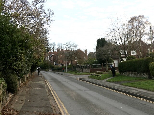
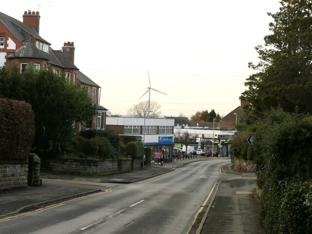
The hill is also known for its association with Audlem Village. During the annual Audlem Festival of Transport, vintage vehicles can be seen ascending Beacon Hill, adding to its charm and appeal. The hill is easily accessible by road, with nearby parking available for those who wish to make the ascent.

Overall, Beacon Hill in Cheshire is a picturesque and historically significant hill, offering visitors a chance to enjoy stunning views, explore the outdoors, and connect with the region's past.

If you have any feedback on the listing, please let us know in the comments section below.

Beacon Hill Images

Images are sourced within 2km of 53.284785/-2.7219105 or Grid Reference SJ5176. Thanks to Geograph Open Source API. All images are credited.

Red Lane, Frodsham
Red Lane, Frodsham
Red Lane, Frodsham
Red Lane, Frodsham
Steps, Beacon Hill
Steps, Beacon Hill
Beacon Hill summit
Beacon Hill summit
Haydan Mews
Haydan Mews
Barn, Hatley Farm
Barn, Hatley Farm
Farmland, Frodsham
Farmland, Frodsham
A56 near Frodsham
A56 near Frodsham
A56 in Frodsham
A56 in Frodsham
Old Milestone by A56, Howey Lane junction opposite Netherton Hall PH The Milestone is located on grass on the East of the road.  Parish of Frodsham (Vale Royal District). Cast iron post, Cast iron CCC1898 design, erected by the County Council in the 19th Century. An earlier photograph can be found here: <span class="nowrap"><a title="http://www.flickr.com/photos/mals_uk_buses/5237354947" rel="nofollow ugc noopener" href="http://www.flickr.com/photos/mals_uk_buses/5237354947">Link</a><img style="margin-left:2px;" alt="External link" title="External link - shift click to open in new window" src="https://s1.geograph.org.uk/img/external.png" width="10" height="10"/></span> 

Inscription reads:-  
HELSBY / 2 MILES / DUNHAM HILL 4 / CHESTER 10 : : FRODSHAM / 1 MILE / WARRINGTON 10: : CHESHIRE / 1898 / COUNTY COUNCIL  : : W H SMITH & CO / MAKER / WHITCHURCH  

Milestone Society National ID: CH_CHWA10
Old Milestone by A56, Howey Lane junction opposite Netherton Hall PH
The Milestone is located on grass on the East of the road.  Parish of Frodsham (Vale Royal District). Cast iron post, Cast iron CCC1898 design, erected by the County Council in the 19th Century. An earlier photograph can be found here: LinkExternal link  Inscription reads:- HELSBY / 2 MILES / DUNHAM HILL 4 / CHESTER 10 : : FRODSHAM / 1 MILE / WARRINGTON 10: : CHESHIRE / 1898 / COUNTY COUNCIL : : W H SMITH & CO / MAKER / WHITCHURCH Milestone Society National ID: CH_CHWA10
Castle Park House. Frodsham Rebuilt in the 1850s, probably by T.M. Penson, for a Warrington manufacturer.
Its grounds are a public park and the house is at least partly used as council offices.
Castle Park House. Frodsham
Rebuilt in the 1850s, probably by T.M. Penson, for a Warrington manufacturer. Its grounds are a public park and the house is at least partly used as council offices.
52 Main Street, Frodsham Not large, but making quite a statement with its pedimented corps-de-logis connected by curved links to wings. Grade II listed.
52 Main Street, Frodsham
Not large, but making quite a statement with its pedimented corps-de-logis connected by curved links to wings. Grade II listed.
Queen's Head, Frodsham The pub probably dates from the C17th but was refronted in the early C19th. Grade II listed.
Queen's Head, Frodsham
The pub probably dates from the C17th but was refronted in the early C19th. Grade II listed.
2-4 High Street, Frodsham A pair of mid-C18th houses in the local vernacular. Quoins and wedge lintels. Grade II listed.
No. 4 was Amore, a restaurant and bar, but it went out of business a few years after this photo.
2-4 High Street, Frodsham
A pair of mid-C18th houses in the local vernacular. Quoins and wedge lintels. Grade II listed. No. 4 was Amore, a restaurant and bar, but it went out of business a few years after this photo.
The Bear's Paw, Frodsham Fine old sandstone pub built in 1632 but much restored by Douglas & Minshull in 1903-04. Grade II listed.
The Bear's Paw, Frodsham
Fine old sandstone pub built in 1632 but much restored by Douglas & Minshull in 1903-04. Grade II listed.
117 Main Street, Frodsham "The best later building" in town, an early C20th bank by William & Segar Owen.
At the time a branch of Natwest Bank, but it closed a year or so after this photo.
117 Main Street, Frodsham
"The best later building" in town, an early C20th bank by William & Segar Owen. At the time a branch of Natwest Bank, but it closed a year or so after this photo.
59 Main Street, Frodsham Good five-bay house built around 1830. The Frodsham Society has affixed a plaque which states that it may have been built for Robert Wainwright Ashley, a prominent local lawyer. Grade II listed.
59 Main Street, Frodsham
Good five-bay house built around 1830. The Frodsham Society has affixed a plaque which states that it may have been built for Robert Wainwright Ashley, a prominent local lawyer. Grade II listed.
Show me another place!

Beacon Hill is located at Grid Ref: SJ5176 (Lat: 53.284785, Lng: -2.7219105)

Unitary Authority: Cheshire West and Chester

Police Authority: Cheshire

What 3 Words

///lame.incisions.blues. Near Frodsham, Cheshire

Related Wikis

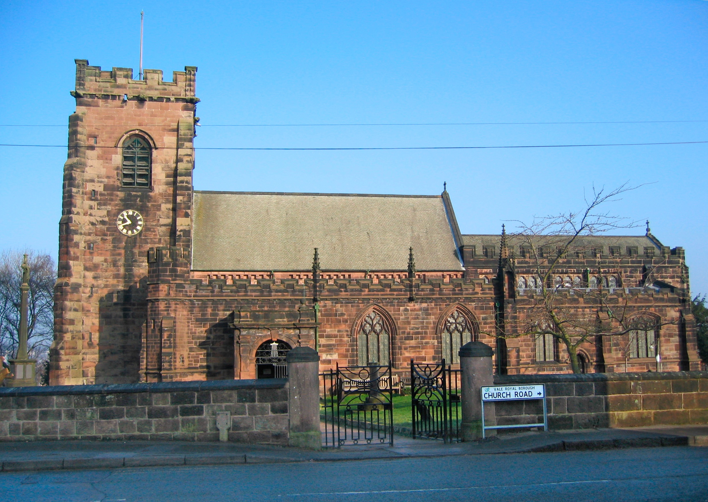
St Laurence's Church, Frodsham

St Laurence's Church is in Church Road, Frodsham, Cheshire, England. The church stands, not in the centre of the town, but in the elevated area of Overton...
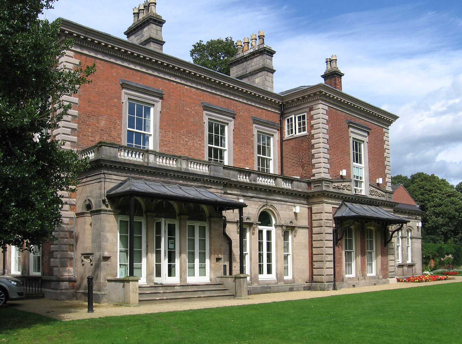
Castle Park House

Castle Park House is a former country house surrounded by extensive grounds in the market town of Frodsham in Cheshire, England. It is reputedly built...
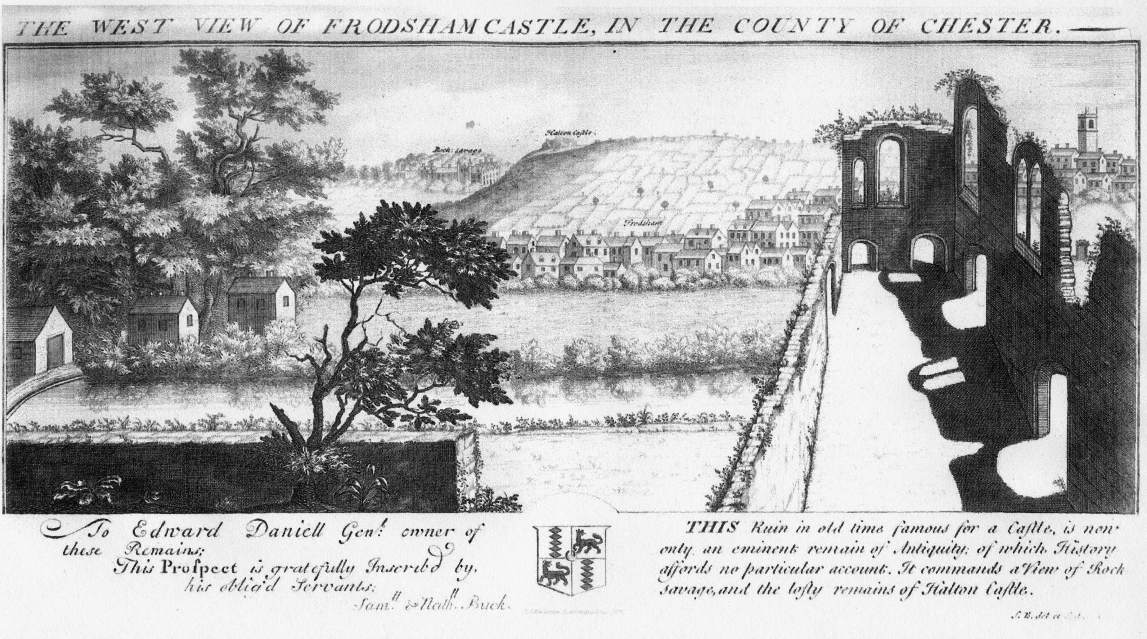
Frodsham Castle

Frodsham Castle was in the market town of Frodsham, Cheshire, England (grid reference SJ514775). Initially it served a military purpose, it then became...

Frodsham School

Frodsham School was a designated specialist science and technology college in the town of Frodsham, Cheshire, England. The school closed in the summer...

Frodsham

Frodsham is a market town, civil parish, and electoral ward in the unitary authority of Cheshire West and Chester and the ceremonial county of Cheshire...

Frodsham railway station

Frodsham railway station serves the town of Frodsham, Cheshire, England. The station is managed by Transport for Wales. It was opened along with the line...

Bear's Paw Hotel, Frodsham

The Bear's Paw Hotel is in Main Street, Frodsham, Cheshire, England. It is recorded in the National Heritage List for England as a designated Grade II...
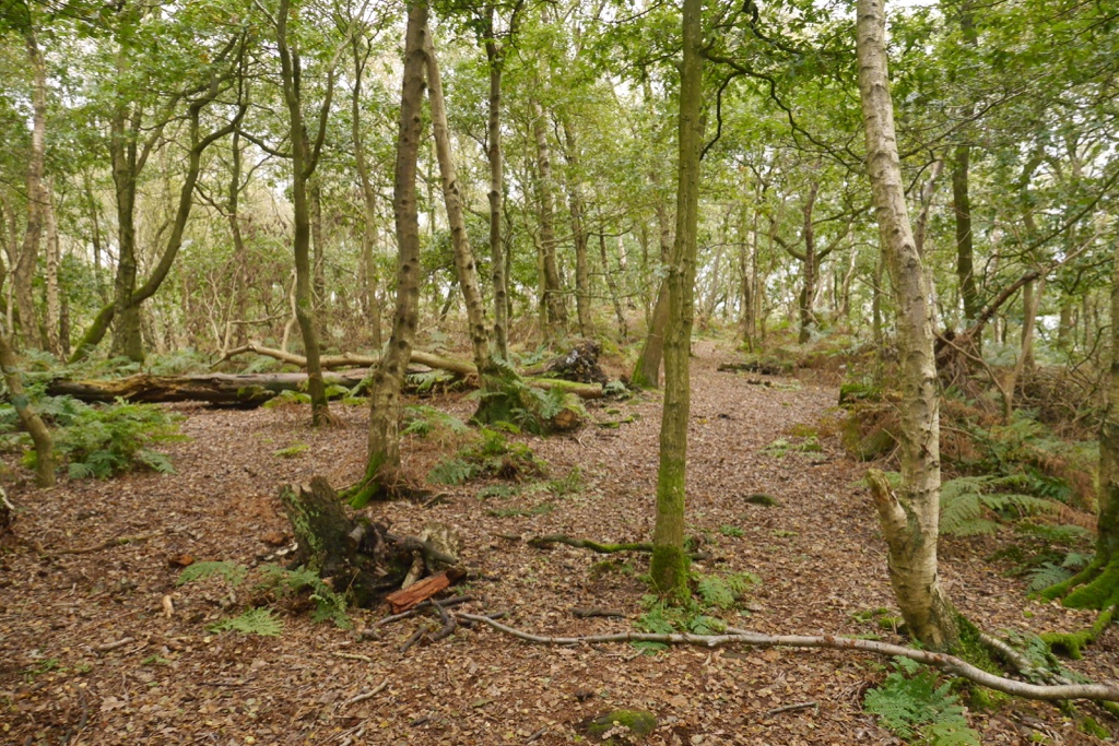
Woodhouse hill fort

Woodhouse hill fort is an Iron Age hillfort between Frodsham and Helsby in Cheshire, England. It lies at the northern end of the Mid Cheshire Ridge. Woodhouse...

Nearby Amenities

Located within 500m of 53.284785,-2.7219105
Parking
380:020
Lat/Long: 53.2861926/-2.7227154
Turning Circle
Lat/Long: 53.2845639/-2.7159375
Frodsham War Memorial
Historic: memorial
Memorial: obelisk
Tourism: viewpoint
War Memorial: yes
Wikidata: Q26545122
Lat/Long: 53.2881893/-2.7251444
Pub
Belle Monte Hotel
Addr City: Frodsham
Addr Country: GB
Addr Postcode: WA6 6BJ
Addr Street: Bellemonte Road
Fhrs Id: 1064658
Lat/Long: 53.2869659/-2.7207791
Bus Stop
Overton, Hillside Road / Elm Rise (Hail & Ride)
Bus: yes
Naptan AtcoCode: 0610VR472
Naptan Bearing: NW
Naptan BusStopType: HAR
Naptan CommonName: Elm Rise
Naptan Crossing: Elm Rise
Naptan Indicator: cnr
Naptan Landmark: Elm Rise
Naptan LocalityName: Overton
Naptan NaptanCode: chwpwda
Naptan ShortCommonName: Elm Rise
Naptan Street: Hillside Road
Naptan Verified: no
Public Transport: platform
Source: naptan_import
Lat/Long: 53.2881353/-2.7177817
Barrier: stile
Foot: yes
Lat/Long: 53.2847451/-2.720096
Overton Village Stores
Addr City: Frodsham
Addr Country: GB
Addr Housenumber: 73
Addr Postcode: WA6 6AH
Addr Street: Hillside Road
Addr Village: Overton
Fhrs Id: 314802
Shop: convenience
Lat/Long: 53.2890375/-2.7200745
Man Made: mast
Source: survey
Lat/Long: 53.2844087/-2.7223306
Man Made: mast
Source: survey
Lat/Long: 53.2847631/-2.7220854
Frodsham Hill
Natural: peak
Lat/Long: 53.288227/-2.7250934
Post Box
Collection Times: Mo-Fr 16:00; Sa 10:00
Post Box Design: type_n
Post Box Type: lamp
Ref: WA6 201
Lat/Long: 53.2891312/-2.7200051
Post Box
Post Box Type: wall
Ref: WA6 26
Royal Cypher: EIIR
Royal Cypher Wikidata: Q33102113
Lat/Long: 53.2869818/-2.7204622
Mersey View
Information: map
Map Type: toposcope
Tourism: viewpoint
Lat/Long: 53.2881126/-2.7252747
Golf: pin
Lat/Long: 53.2826127/-2.7263907
Golf: pin
Lat/Long: 53.2847083/-2.7277275
Golf: pin
Lat/Long: 53.2820952/-2.7244445
Golf: pin
Lat/Long: 53.2814994/-2.7222318
Golf: pin
Lat/Long: 53.2809275/-2.722056
Golf: pin
Lat/Long: 53.2839715/-2.7283567
Frodsham AAOR
Access: private
Building: yes
Bunker Type: command
Military: bunker
Note: Former Frodsham AAOR
Website: https://www.subbrit.org.uk/sites/frodsham-aaor/
Lat/Long: 53.2841323/-2.7219484
The Beacons
Place: locality
Lat/Long: 53.2844696/-2.7213955
Bus Stop
Overton, Bellemonte Road / Forest Hills Hotel (Hail & Ride)
Bus: yes
Naptan AtcoCode: 0610VR19292
Naptan Bearing: NE
Naptan BusStopType: HAR
Naptan CommonName: Forest Hills Hotel
Naptan Indicator: o/s
Naptan Landmark: Hotel
Naptan LocalityName: Overton
Naptan NaptanCode: chwadtmj
Naptan ShortCommonName: Forest Hills Hotel
Naptan Street: Bellemonte Road
Public Transport: platform
Source: naptan_import
Lat/Long: 53.285855/-2.723594
Bus Stop
Overton, Bellemonte Road / Greenacres (Hail & Ride)
Bus: yes
Naptan AtcoCode: 0610VR19294
Naptan Bearing: S
Naptan BusStopType: HAR
Naptan CommonName: Greenacres
Naptan Crossing: Greenacres
Naptan Indicator: cnr
Naptan Landmark: Bellemonte Road
Naptan LocalityName: Overton
Naptan NaptanCode: chwadtmt
Naptan ShortCommonName: Greenacres
Naptan Street: Bellemonte Road
Public Transport: platform
Source: naptan_import
Lat/Long: 53.2864124/-2.7182
The data included in this document is from www.openstreetmap.org. The data is made available under ODbL.

Have you been to Beacon Hill?

Leave your review of Beacon Hill below (or comments, questions and feedback).