Berry Cairn

Hill, Mountain in Angus

Scotland

Berry Cairn

The road into Glen Lethnot A short way into the glen with the rounded hills of the Mounth ahead. The wooded area as shown on the OS map has been much reduced by clear felling.
The road into Glen Lethnot Credit: Gordon Hatton

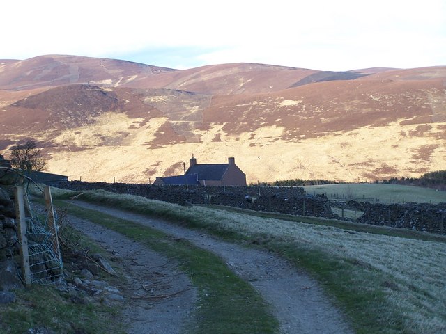
Berry Cairn is a prominent hill located in the county of Angus, Scotland. Situated near the village of Edzell, it forms part of the scenic landscape of the Grampian Mountains. With an elevation of 479 meters (1,572 feet), it offers stunning panoramic views of the surrounding countryside.

The hill is easily accessible, with a well-marked footpath leading to its summit. The path begins at a car park near Edzell, and the ascent is relatively moderate, making it suitable for hikers of various abilities. The walk takes approximately two to three hours to complete, depending on the pace and weather conditions.

At the top of Berry Cairn, visitors are rewarded with breathtaking vistas of the rolling Angus countryside, stretching as far as the eye can see. On a clear day, it is possible to spot landmarks such as the Montrose Basin, the North Sea, and even the Grampian Mountains in the distance.

Berry Cairn is also known for its rich wildlife. The hill is home to a variety of bird species, including peregrine falcons, kestrels, and various songbirds. It is not uncommon to glimpse deer and other small mammals during the hike.

Overall, Berry Cairn is a popular destination for outdoor enthusiasts seeking a scenic and rewarding hike. Its accessibility, stunning views, and abundant wildlife make it a must-visit location for those exploring the Angus region of Scotland.

If you have any feedback on the listing, please let us know in the comments section below.

Berry Cairn Images

Images are sourced within 2km of 56.800832/-2.8019711 or Grid Reference NO5167. Thanks to Geograph Open Source API. All images are credited.

The road into Glen Lethnot A short way into the glen with the rounded hills of the Mounth ahead. The wooded area as shown on the OS map has been much reduced by clear felling.
The road into Glen Lethnot
A short way into the glen with the rounded hills of the Mounth ahead. The wooded area as shown on the OS map has been much reduced by clear felling.
The Old Man, Trusta, Angus Grouse moorland on the West (foreground) and East (background) sides of the Differin Burn, which runs South (right). The slight saddle on the skyline separates Putney Maol to the North (left) and The Old Man to the South (right). Not to be confused with Old Man in the adjacent km square to the Southwest <a href="https://www.geograph.org.uk/gridref/NO4866">NO4866</a>.
The Old Man, Trusta, Angus
Grouse moorland on the West (foreground) and East (background) sides of the Differin Burn, which runs South (right). The slight saddle on the skyline separates Putney Maol to the North (left) and The Old Man to the South (right). Not to be confused with Old Man in the adjacent km square to the Southwest NO4866.
Nathro Lodge
Nathro Lodge
One side of Nathro Hill and Nathro Lodge
A view from the slopes of Putney Maol with Nathro Hill  covered in trees
A view from the slopes of Putney Maol with Nathro Hill covered in trees
Rough grazing at the start of Glen Lethnot
Rough Grazing, Sheep and Large Erratic Boulder. The end of the Shank of Ledmanie in the background
Rough Grazing, Sheep and Large Erratic Boulder.
The end of the Shank of Ledmanie in the background
A Pink Cottage in Glen Lethnot A lot of the buildings in this glen are painted pink and I have been told it makes it easier to find the building in bad weather.
A Pink Cottage in Glen Lethnot
A lot of the buildings in this glen are painted pink and I have been told it makes it easier to find the building in bad weather.
Fields and Track The Caterthuns in the distance
Fields and Track
The Caterthuns in the distance
Looking east along the edge of the forestry plantation.
The view north from the slopes of Peat Hill.
Forestry plantation near Tilyarblet. The photo is taken looking to ESE with the hills of the Caterthuns in the background.
Forestry plantation near Tilyarblet.
The photo is taken looking to ESE with the hills of the Caterthuns in the background.
A farm track bridge over the burn with a forestry plantation behind
Nathro Farm with Craig Narb in the background The picture was taken just before sunset and so the foreground is very dark.
Nathro Farm with Craig Narb in the background
The picture was taken just before sunset and so the foreground is very dark.
Ford as a landrover track passes over a burn.
View NNE down the burn with the Hill of Wirren in the background.
Peat Hill trig
Peat Hill trig
Show me another place!

Berry Cairn is located at Grid Ref: NO5167 (Lat: 56.800832, Lng: -2.8019711)

Unitary Authority: Angus

Police Authority: Tayside

What 3 Words

///headlines.spoiler.amounting. Near Brechin, Angus

Nearby Locations

Berry Cairn

Related Wikis

Menmuir

Menmuir is a parish in the county of Angus in Scotland. Kirkton of Menmuir consists of only three houses (the Old Schoolhouse, the Manse, the Old Inn)...

Caterthun

Caterthun, or the Caterthuns, is a ridge of hills near the city of Brechin in Angus, Scotland. The Caterthuns are notable for being the site of two Iron...

Auchnacree

Auchnacree is an estate in Angus, Scotland, five miles north of Forfar.In 1921 the estate overseer, Mr Frank Rae, discovered what is now called the Auchnacree...

Angus (UK Parliament constituency)

Angus is a county constituency of the House of Commons of the Parliament of the United Kingdom (at Westminster). It elects one Member of Parliament (MP...

Edzell Castle

Edzell Castle is a ruined 16th-century castle, with an early-17th-century walled garden. It is located close to Edzell, and is around 5 miles (8 km) north...

Careston railway station

Careston railway station served the hamlet of Careston, Angus, Scotland, from 1895 to 1964 on the Forfar and Brechin Railway. == History == The station...
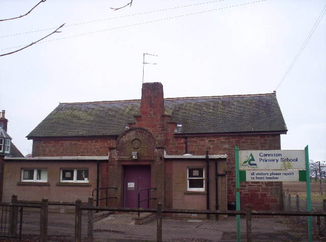
Careston

Careston is a hamlet in Angus, Scotland that is in the parish of the same name, 5 miles west of Brechin. The parish and hamlet supposedly took their name...

Noranside

Noranside is a hamlet in Angus, Scotland, located at 56° 44' 0" North, 2° 52' 0" West,. The prison HMP Noranside was operated there from 1966 to 2011....

Nearby Amenities

Located within 500m of 56.800832,-2.8019711
Berry Cairn
Ele: 436
Natural: peak
Lat/Long: 56.8006905/-2.8015094
The data included in this document is from www.openstreetmap.org. The data is made available under ODbL.

Have you been to Berry Cairn?

Leave your review of Berry Cairn below (or comments, questions and feedback).