Beggarside Hill

Hill, Mountain in Westmorland South Lakeland

England

Beggarside Hill

On Viver Lane Viewed where the lane passes below the West Coast main railway line on a fine April afternoon.
On Viver Lane Credit: Mary and Angus Hogg

Beggarside Hill is a prominent hill located in Westmorland, a historic county in the northwestern region of England. Rising to an elevation of approximately 580 meters (1,903 feet), it is classified as a hill rather than a mountain.

Situated within the picturesque Lake District National Park, Beggarside Hill offers stunning panoramic views of the surrounding countryside. Its location near the village of Beggarside contributes to its name, which is derived from the nearby settlement. The hill is easily accessible by foot, with several hiking trails leading to its summit, making it a popular destination for outdoor enthusiasts and nature lovers.

The terrain of Beggarside Hill is characterized by grassy slopes and rocky outcrops, providing a diverse landscape for visitors to explore. Its relatively modest height allows for a relatively easy ascent, although caution is advised due to the occasionally steep gradients and changeable weather conditions typical of the region.

The hill is also home to a variety of flora and fauna, including heather, bilberry bushes, and occasional sightings of birds of prey such as buzzards and kestrels. Due to its location within a designated national park, Beggarside Hill is protected and its natural beauty preserved.

Overall, Beggarside Hill offers a rewarding experience for those seeking outdoor adventure and a chance to immerse themselves in the natural beauty of the Lake District. Its accessibility and breathtaking views make it a must-visit location for both locals and tourists alike.

If you have any feedback on the listing, please let us know in the comments section below.

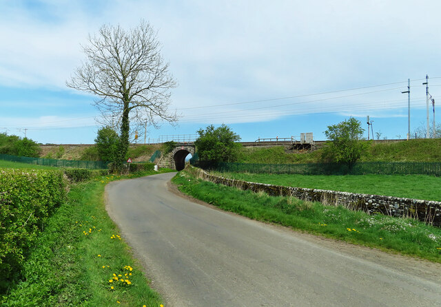
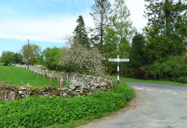
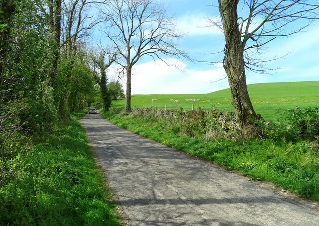
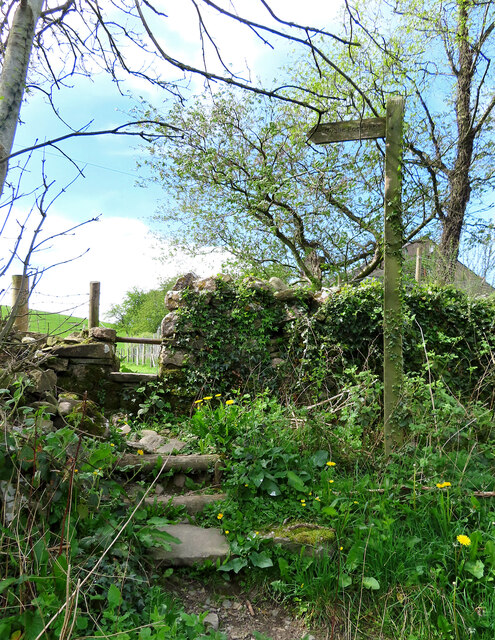
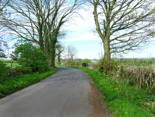
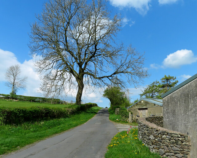
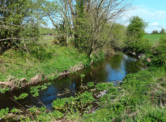
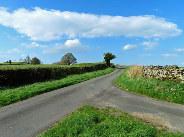
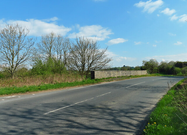
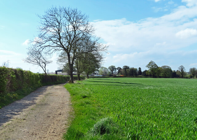
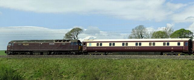
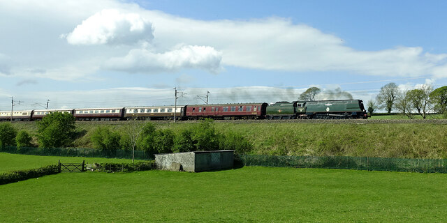
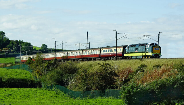
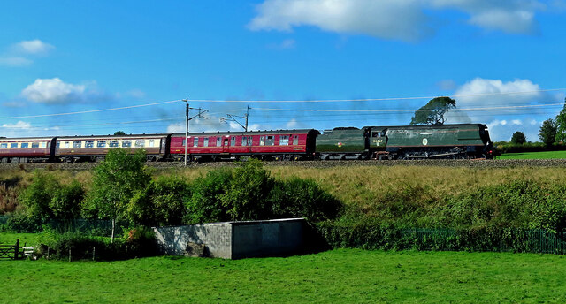
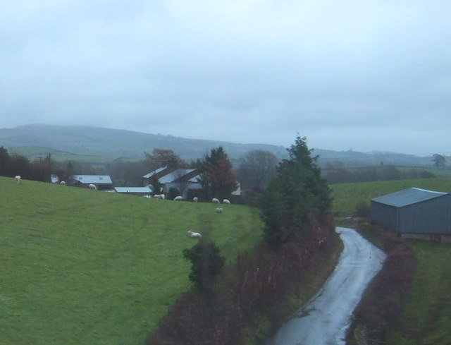
Beggarside Hill Images

Images are sourced within 2km of 54.238281/-2.7574226 or Grid Reference SD5082. Thanks to Geograph Open Source API. All images are credited.

On Viver Lane Viewed where the lane passes below the West Coast main railway line on a fine April afternoon.
On Viver Lane
Viewed where the lane passes below the West Coast main railway line on a fine April afternoon.
Heading for Hincaster Viewed from the bridge that crosses a disused railway line on a bright April afternoon.
Heading for Hincaster
Viewed from the bridge that crosses a disused railway line on a bright April afternoon.
This way to Kendal The bridge crosses a disused railway line.
This way to Kendal
The bridge crosses a disused railway line.
Junction near Hincaster Turn left here for Hincaster or right for Woodhouse and Milnthorpe.
Junction near Hincaster
Turn left here for Hincaster or right for Woodhouse and Milnthorpe.
Towards Leasgill This road leads to Leasgill and then connects with the A6.
Towards Leasgill
This road leads to Leasgill and then connects with the A6.
Footpath near Hincaster The roadside start of this path, one of many in the area.
Footpath near Hincaster
The roadside start of this path, one of many in the area.
This way to Hincaster A quiet country road leading to Hincaster village. Roadside dandelions add a splash of spring colour to the scene.
This way to Hincaster
A quiet country road leading to Hincaster village. Roadside dandelions add a splash of spring colour to the scene.
Deepthwaite view Viewed at the farm while climbing up from Stainton Beck on a bright April morning.
Deepthwaite view
Viewed at the farm while climbing up from Stainton Beck on a bright April morning.
Stainton Beck Viewed on the corner of the square on a bright April morning.
Stainton Beck
Viewed on the corner of the square on a bright April morning.
This way to Rowell This minor road leads to Rowell Farm and then continues to the A6 at Milnthorpe.
This way to Rowell
This minor road leads to Rowell Farm and then continues to the A6 at Milnthorpe.
Rowell Bridge Rowell Bridge takes the B6385 over Stainton Beck.
Rowell Bridge
Rowell Bridge takes the B6385 over Stainton Beck.
Milton Moor Located on the B6385 to the north-east of Milnthorpe.
Milton Moor
Located on the B6385 to the north-east of Milnthorpe.
Milton Moor view A busy farm on a busy road viewed from a nearby footpath.
Milton Moor view
A busy farm on a busy road viewed from a nearby footpath.
Towards Kidside There's public access by foot along the track to Kidside Farm.
Towards Kidside
There's public access by foot along the track to Kidside Farm.
Alnwick Castle goes north Locomotive 57316 “Alnwick Castle” acted as the support engine for the Great Britain XIV Railtour in April 2022. The class 57 diesel engines were remanufactured from redundant class 47s around 1998.
Alnwick Castle goes north
Locomotive 57316 “Alnwick Castle” acted as the support engine for the Great Britain XIV Railtour in April 2022. The class 57 diesel engines were remanufactured from redundant class 47s around 1998.
Tangmere hauls the GB XIV Railtour Locomotive 34067 “Tangmere” is a Battle of Britain class engine named after RAF Tangmere. Rail enthusiasts nicknamed the class “Spam Cans” because of its unusual shape. Viewed heading north on the main West Coast line for the Great Britain XIV Railtour in April 2022. The whole train was gleaming in the spring sunshine.
Tangmere hauls the GB XIV Railtour
Locomotive 34067 “Tangmere” is a Battle of Britain class engine named after RAF Tangmere. Rail enthusiasts nicknamed the class “Spam Cans” because of its unusual shape. Viewed heading north on the main West Coast line for the Great Britain XIV Railtour in April 2022. The whole train was gleaming in the spring sunshine.
Royal Scots Grey The newly-refurbished D9000 Royal Scots Grey led the rescheduled Deltic Delight rail tour on 24 September. Photographed on the north-bound leg near Deepthwaite.
Royal Scots Grey
The newly-refurbished D9000 Royal Scots Grey led the rescheduled Deltic Delight rail tour on 24 September. Photographed on the north-bound leg near Deepthwaite.
Tangmere heads north Battle of Britain class locomotive 34067 “Tangmere” heading north on a steam special tour on 24 September.
Tangmere heads north
Battle of Britain class locomotive 34067 “Tangmere” heading north on a steam special tour on 24 September.
Show me another place!

Beggarside Hill is located at Grid Ref: SD5082 (Lat: 54.238281, Lng: -2.7574226)

Administrative County: Cumbria

District: South Lakeland

Police Authority: Cumbria

What 3 Words

///weekend.standard.sprinting. Near Milnthorpe, Cumbria

Nearby Locations

Beggarside Hill

Related Wikis

Heversham railway station

Heversham railway station served the village of Heversham, near Carnforth, with trains to Kendal and Grange over Sands along the Hincaster branch line...

Ackenthwaite

Ackenthwaite is a hamlet in Cumbria, England. In the past (14th century) the spelling for the name of this place was Astenthwhate.Ackenthwaite has a postbox...

Deepthwaite

Deepthwaite is a hamlet in Cumbria, England. == References ==

Milnthorpe railway station

Milnthorpe railway station served the village of Milnthorpe, in the historical county of Westmorland, England, from 1846 to 1968 on the Lancaster and Carlisle...

Heversham

Heversham is a village and civil parish in the Westmorland and Furness unitary authority area of Cumbria, England. In the 2001 census the parish had a...

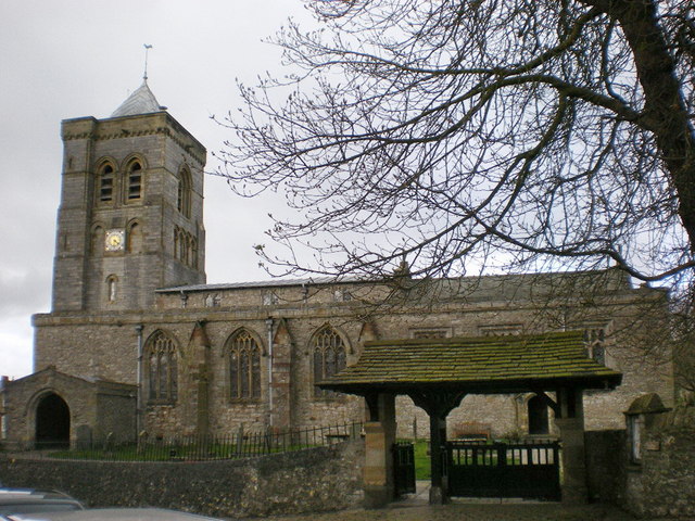
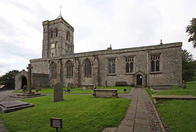
St Peter's Church, Heversham

St Peter's Church is in the village of Heversham, Cumbria, England. It is an active Anglican parish church in the deanery of Kendal, the archdeaconry of...

Dallam School

Dallam School is a mixed, 11-18 secondary school with academy status, located in Milnthorpe, Cumbria, England. It was founded in 1984 through the merger...

St Thomas' Church, Milnthorpe

St Thomas' Church is in the village of Milnthorpe, Cumbria, England. It is an active Anglican parish church in the deanery of Kendal, the archdeaconry...

Nearby Amenities

Located within 500m of 54.238281,-2.7574226
Passing Place
Lat/Long: 54.2423874/-2.7544903
Barrier: stile
Lat/Long: 54.2350155/-2.7554675
Barrier: stile
Lat/Long: 54.241484/-2.7608546
Barrier: stile
Material: stone
Stile: squeezer
Lat/Long: 54.2388278/-2.7632774
Barrier: stile
Material: wood
Stile: ladder
Lat/Long: 54.2388688/-2.7639005
Power: pole
Lat/Long: 54.237257/-2.7634858
Power: pole
Lat/Long: 54.2379088/-2.7617092
Give Way
Direction: forward
Lat/Long: 54.2401074/-2.7545735
Power: pole
Lat/Long: 54.236292/-2.7609713
Power: pole
Lat/Long: 54.2358643/-2.7598872
Power: pole
Lat/Long: 54.2352536/-2.7583166
Power: pole
Lat/Long: 54.2347236/-2.7569563
Power: pole
Lat/Long: 54.2347886/-2.7556227
Power: pole
Switch: yes
Lat/Long: 54.2354238/-2.7546003
Power: pole
Lat/Long: 54.2360548/-2.7535881
Power: pole
Lat/Long: 54.2366615/-2.7526167
Power: pole
Transformer: yes
Lat/Long: 54.2368846/-2.7515335
Power: pole
Lat/Long: 54.2367628/-2.7622084
Barrier: entrance
Lat/Long: 54.2352598/-2.7587639
Barrier: entrance
Lat/Long: 54.2351695/-2.7594757
Barrier: entrance
Lat/Long: 54.2350199/-2.7606107
Barrier: entrance
Lat/Long: 54.2350485/-2.7604502
Barrier: entrance
Lat/Long: 54.2348508/-2.7607823
Information: guidepost
Tourism: information
Lat/Long: 54.2343476/-2.7567129
Barrier: entrance
Lat/Long: 54.234361/-2.7587511
Barrier: entrance
Lat/Long: 54.2348306/-2.7608262
Beggarside Hill
Natural: peak
Lat/Long: 54.2380571/-2.7575017
Barrier: entrance
Lat/Long: 54.2346815/-2.7554054
Barrier: entrance
Lat/Long: 54.2351876/-2.7550362
Information: guidepost
Tourism: information
Lat/Long: 54.2351828/-2.7560581
Give Way
Direction: backward
Lat/Long: 54.2389109/-2.7543895
Natural: wood
Lat/Long: 54.2341401/-2.7562811
Power: pole
Lat/Long: 54.2341503/-2.7562051
Power: pole
Lat/Long: 54.2344493/-2.7559184
Information: guidepost
Tourism: information
Lat/Long: 54.2371693/-2.7516618
Generator Method: solar_thermal
Generator Orientation: south
Generator Output Hot Water: yes
Generator Solar Modules: 2
Generator Source: solar
Generator Type: solar_thermal_collector
Location: roof
Power: generator
Lat/Long: 54.2368776/-2.7508645
Generator Method: photovoltaic
Generator Orientation: south_west
Generator Output Electricity: yes
Generator Solar Modules: 14
Generator Source: solar
Generator Type: solar_photovoltaic_panel
Location: roof
Power: generator
Lat/Long: 54.2383155/-2.761132
Generator Method: photovoltaic
Generator Orientation: south_west
Generator Output Electricity: yes
Generator Solar Modules: 16
Generator Source: solar
Generator Type: solar_photovoltaic_panel
Location: roof
Power: generator
Lat/Long: 54.2382963/-2.7610428
Generator Method: photovoltaic
Generator Orientation: south_west
Generator Output Electricity: yes
Generator Solar Modules: 16
Generator Source: solar
Generator Type: solar_photovoltaic_panel
Location: roof
Power: generator
Lat/Long: 54.2382675/-2.7609194
The data included in this document is from www.openstreetmap.org. The data is made available under ODbL.

Have you been to Beggarside Hill?

Leave your review of Beggarside Hill below (or comments, questions and feedback).