Brunt Tongue
Hill, Mountain in Westmorland Eden
England
Brunt Tongue

Brunt Tongue is a prominent hill located in the district of Westmorland, England. It is part of the stunning landscape of the Lake District National Park, renowned for its natural beauty and outdoor recreational opportunities. Rising to an elevation of approximately 1,500 feet (457 meters), Brunt Tongue offers visitors breathtaking panoramic views of the surrounding valleys, lakes, and mountains.
The hill is characterized by its steep slopes and rocky terrain, making it a popular destination for hikers and mountaineers seeking a challenging ascent. Its location within the Lake District also means that it is frequently explored by nature enthusiasts and birdwatchers, attracted to the diverse flora and fauna that thrive in this region.
Brunt Tongue is situated near the picturesque town of Ambleside, which serves as a convenient base for those looking to explore the area. The hill is easily accessible via a network of well-marked hiking trails, providing visitors with the opportunity to experience the beauty of the Lake District firsthand.
While the ascent can be physically demanding, the reward is well worth the effort. At the summit, visitors are treated to stunning vistas of rolling hills, shimmering lakes, and majestic peaks, including the iconic Lake Windermere. On a clear day, it is even possible to see as far as the Irish Sea.
Whether you are seeking an adrenaline-fueled adventure or simply looking to immerse yourself in the tranquility of nature, Brunt Tongue offers an unforgettable experience in the heart of the Lake District.
If you have any feedback on the listing, please let us know in the comments section below.
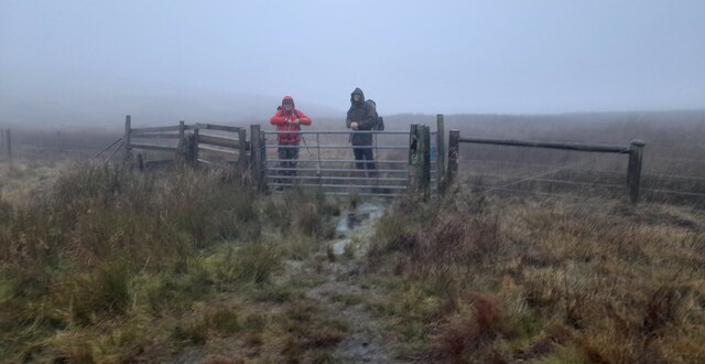
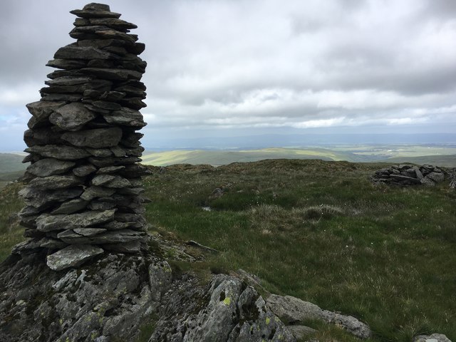
Brunt Tongue Images
Images are sourced within 2km of 54.476071/-2.7697276 or Grid Reference NY5009. Thanks to Geograph Open Source API. All images are credited.


Brunt Tongue is located at Grid Ref: NY5009 (Lat: 54.476071, Lng: -2.7697276)
Administrative County: Cumbria
District: Eden
Police Authority: Cumbria
What 3 Words
///loosens.originate.warp. Near Shap, Cumbria
Nearby Locations
Related Wikis

Howes (fell)
Howes is a subsidiary summit of Branstree in the English Lake District, south east of Selside Pike in Cumbria. It is the subject of a chapter of Wainwright...

Tarn Crag (Far Eastern Fells)
Tarn Crag is a fell in the English Lake District. It stands to the east of Longsleddale in the Far Eastern Fells. == Topography == North of Sadgill, the...

Grey Crag
Grey Crag is a fell in the English Lake District. It stands to the east of Longsleddale in the Far Eastern Fells. == Topography == North of Sadgill, the...

Selside Pike
Selside Pike or Selside is a fell in the English Lake District. It stands between the valleys of Mardale and Swindale in the Far Eastern Fells. == Topography... ==

Branstree
Branstree is a fell in the Far Eastern part of the English Lake District. It overlooks the valley of Mardale and Haweswater Reservoir. == Topography... ==

Mosedale Beck (Swindale)
Mosedale Beck is a stream in Cumbria, England, which runs between Tarn Crag and Branstree, flowing north to join Swindale Beck at Swindale Head; Swindale...

Seat Robert
Seat Robert is a hill in the east of the English Lake District, south west of Shap, Cumbria. It is the subject of a chapter of Wainwright's book The Outlying...

Kentmere Pike
Kentmere Pike is a fell in the English Lake District, rising between the valleys of Kentmere and Longsleddale. It is the highpoint on the ridge between...
Nearby Amenities
Located within 500m of 54.476071,-2.7697276Have you been to Brunt Tongue?
Leave your review of Brunt Tongue below (or comments, questions and feedback).