Green Hill

Hill, Mountain in Dorset

England

Green Hill

Uploders: Crown Inn and cottage By the T-junction in the centre of the village; see also <a href="https://www.geograph.org.uk/photo/7360457">SY5093 : Bungalow, Uploders</a>. Fairly obvious where I am headed.
Uploders: Crown Inn and cottage Credit: Derek Harper

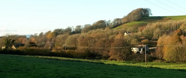
Green Hill is a prominent landmark located in the county of Dorset, England. Situated in the southwestern part of the county, it is part of the Dorset Downs, a range of chalk hills that form a picturesque landscape. Green Hill is renowned for its natural beauty and is a popular destination for outdoor enthusiasts, nature lovers, and hikers.

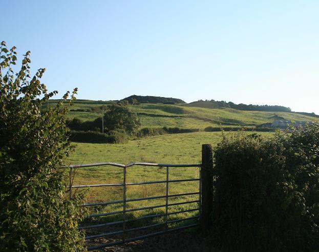
Rising to an elevation of approximately 259 meters (850 feet), Green Hill offers breathtaking panoramic views of the surrounding countryside. The hill is characterized by its gently sloping sides, covered in lush green grass and dotted with patches of vibrant wildflowers, especially during the summer months. The landscape is a haven for a variety of wildlife, including rabbits, foxes, and numerous bird species.

The summit of Green Hill is accessible via several footpaths and trails, providing visitors with opportunities to explore and enjoy the stunning scenery. The hill is also a popular spot for paragliding and kite flying, as the open expanse of the summit offers ideal conditions for such activities.

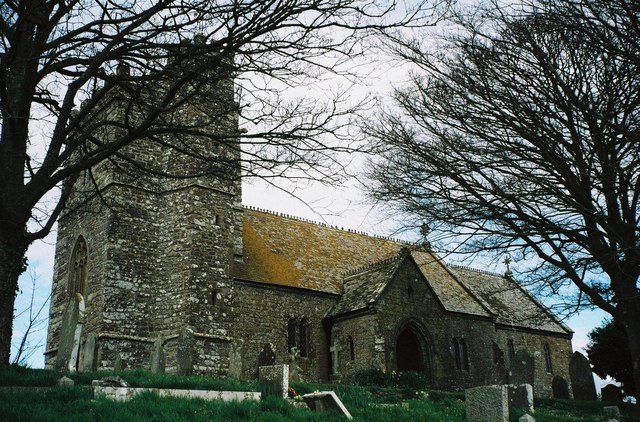
Green Hill is steeped in history and is home to several ancient burial mounds, known as barrows, which date back to the Neolithic period. These archaeological features add to the cultural significance of the hill and attract historians and archaeology enthusiasts.

Overall, Green Hill in Dorset is a captivating natural landmark that offers visitors a chance to immerse themselves in the beauty of the countryside, explore its rich history, and enjoy a range of outdoor activities.

If you have any feedback on the listing, please let us know in the comments section below.
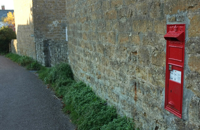
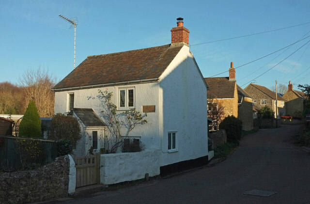
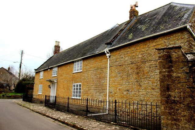
Green Hill Images

Images are sourced within 2km of 50.731373/-2.7174612 or Grid Reference SY4992. Thanks to Geograph Open Source API. All images are credited.

Uploders: Crown Inn and cottage By the T-junction in the centre of the village; see also <a href="https://www.geograph.org.uk/photo/7360457">SY5093 : Bungalow, Uploders</a>. Fairly obvious where I am headed.
Uploders: Crown Inn and cottage
By the T-junction in the centre of the village; see also SY5093 : Bungalow, Uploders. Fairly obvious where I am headed.
Bungalow, Uploders An intriguing little timber-framed bungalow at the junction where <a href="https://www.geograph.org.uk/photo/7360445">SY5093 : Uploders: Crown Inn and cottage</a> was taken. NCN2 turns left at the signpost.
Bungalow, Uploders
An intriguing little timber-framed bungalow at the junction where SY5093 : Uploders: Crown Inn and cottage was taken. NCN2 turns left at the signpost.
Postbox, Uploders Victorian postbox DT6 9 is shown at <a title="https://www.geograph.org.uk/search.php?i=171075133" href="https://www.geograph.org.uk/search.php?i=171075133">Link</a> .
Postbox, Uploders
Victorian postbox DT6 9 is shown at Link .
Halfway Copse Seen from the road at the western edge of Uploders. The copse overlooks the meeting of the Asker valley (foreground, with trees along the course of the river) with the Mappercombe valley.
Halfway Copse
Seen from the road at the western edge of Uploders. The copse overlooks the meeting of the Asker valley (foreground, with trees along the course of the river) with the Mappercombe valley.
Village street, Uploders From the junction with Home farm Close. The nearest house, a holiday cottage, is named "Knight's Pightle".
Village street, Uploders
From the junction with Home farm Close. The nearest house, a holiday cottage, is named "Knight's Pightle".
Flooded Track Milvers Lane Milvers lane runs north from Bennetts Hill Farm to Burbitts Lane. This section often gets very wet after heavy rain.
Flooded Track Milvers Lane
Milvers lane runs north from Bennetts Hill Farm to Burbitts Lane. This section often gets very wet after heavy rain.
Milvers Lane This track is often flooded in wet weather where it passes through some farm buildings housing stock over winter.
Milvers Lane
This track is often flooded in wet weather where it passes through some farm buildings housing stock over winter.
Lee Lane This is the northern end of Lee Lane just before it reaches Stepps Farm which is in the next grid square SY4894
Lee Lane
This is the northern end of Lee Lane just before it reaches Stepps Farm which is in the next grid square SY4894
Home Farm Bradpole Home Farm is situated on Caley Way close to the junction with Forsters Lane. The farmhouse is built of inferior oolite on a plinth of Forest Marble. See also <a href="https://www.geograph.org.uk/photo/7061215">SY4894 : Home Farm Bradpole (Detail)</a>
Home Farm Bradpole
Home Farm is situated on Caley Way close to the junction with Forsters Lane. The farmhouse is built of inferior oolite on a plinth of Forest Marble. See also SY4894 : Home Farm Bradpole (Detail)
Home Farm Bradpole (Detail) This shows the stone construction of the farm house located on Caley Way. It is Inferior Oolite on a plinth of Forest Marble. The inferior oolite may have come from quarries at Allington and the Forest Marble is almost certainly Bothenhampton stone (or Baunton Stone as it was known as locally) from the quarries at Bothenhampton. The forest marble was used on the lower courses because of its low permeability to water. See also <a href="https://www.geograph.org.uk/photo/7061204">SY4894 : Home Farm Bradpole</a>
Home Farm Bradpole (Detail)
This shows the stone construction of the farm house located on Caley Way. It is Inferior Oolite on a plinth of Forest Marble. The inferior oolite may have come from quarries at Allington and the Forest Marble is almost certainly Bothenhampton stone (or Baunton Stone as it was known as locally) from the quarries at Bothenhampton. The forest marble was used on the lower courses because of its low permeability to water. See also SY4894 : Home Farm Bradpole
Asker valley at Loders Looking left from <a href="https://www.geograph.org.uk/photo/7360721">SY5094 : Halfway Copse</a>. Most of the village of Loders is hidden by trees. Above is Waddon Copse on Waddon Hill.
Asker valley at Loders
Looking left from SY5094 : Halfway Copse. Most of the village of Loders is hidden by trees. Above is Waddon Copse on Waddon Hill.
St Martin's, Shipton Gorge, Dorset
St. Martin's, Shipton Gorge, Dorset
St. Mary Magdalene, Loders, Dorset
St. Mary's, Walditch, Dorset
Show me another place!

Green Hill is located at Grid Ref: SY4992 (Lat: 50.731373, Lng: -2.7174612)

Unitary Authority: Dorset

Police Authority: Dorset

What 3 Words

///stems.capers.sugars. Near Bridport, Dorset

Related Wikis

Godderthorne Hundred

Godderthorne Hundred was a hundred in the county of Dorset, England, containing the following parishes: Allington Shipton Gorge Walditch == See also... ==

Walditch

Walditch is a small village and former civil parish, now in the parish of Bothenhampton, in the Dorset district, in the ceremonial county of Dorset, England...

Shipton Gorge

Shipton Gorge is a village and civil parish in southwest Dorset, England, 3 miles (4.8 km) east of Bridport. Dorset County Council's 2013 mid-year estimate...

Shipton Hill Settlement

The Shipton Hill Settlement is an archaeological site, a defended settlement of the Iron Age, near Shipton Gorge in Dorset, England. It is a scheduled...

Uploders

Uploders is a small village in Dorset, England. It consists mainly of houses, and has a pub, the Crown, a Grade II listed Methodist chapel and a playing...

Loders and Bothenhampton Liberty

Loders and Bothenhampton Liberty was a liberty in the county of Dorset, England, containing the following parishes: Bothenhampton Loders == See also... ==

Loders

Loders is a village and civil parish in the English county of Dorset. It lies 2 miles (3.2 km) north-east of the town of Bridport. It is a linear village...

Alan Rice-Oxley

Lieutenant Alan Rice-Oxley (1 July 1896 – 21 July 1961) was a British pilot during World War I. He became a flying ace in 1918, credited with six aerial...

Nearby Amenities

Located within 500m of 50.731373,-2.7174612
Parking
Lat/Long: 50.7333631/-2.7216119
Bus Stop
Shipton Gorge Turn
Bench: no
Bin: no
Bus: yes
Lit: no
Naptan AtcoCode: 1200DOB20460
Naptan Bearing: W
Naptan CommonName: Shipton Gorge Turn
Naptan Indicator: W-bound
Naptan NaptanCode: doradtdg
Naptan Verified: no
Public Transport: platform
Shelter: no
Tactile Paving: no
Lat/Long: 50.7325747/-2.7189692
Bus Stop
Shipton Gorge Turn
Bench: no
Bin: no
Bus: yes
Lit: no
Naptan AtcoCode: 1200DOB20520
Naptan Bearing: SE
Naptan CommonName: Shipton Gorge Road
Naptan Indicator: SE-bound
Naptan NaptanCode: doradtda
Naptan Street: Dorchester Road
Naptan Verified: no
Public Transport: platform
Shelter: no
Tactile Paving: no
Lat/Long: 50.7327659/-2.719223
Eldon Hill
Natural: peak
Lat/Long: 50.7312269/-2.7225315
Power: pole
Source: bing
Transformer: distribution
Lat/Long: 50.7303572/-2.7160612
Power: pole
Source: bing
Lat/Long: 50.7304293/-2.7150272
Power: pole
Source: bing
Lat/Long: 50.7304913/-2.7137813
Man Made: antenna
Lat/Long: 50.7322849/-2.7146557
Power: pole
Source: bing
Lat/Long: 50.7324106/-2.7116422
Power: pole
Source: bing
Lat/Long: 50.729909/-2.7125502
Material: wood
Power: pole
Source: bing
Transformer: distribution
Lat/Long: 50.7274251/-2.7161349
The data included in this document is from www.openstreetmap.org. The data is made available under ODbL.

Have you been to Green Hill?

Leave your review of Green Hill below (or comments, questions and feedback).