Blackberry Hill

Hill, Mountain in Westmorland South Lakeland

England

Blackberry Hill

Lakeland Wildlife Oasis A scary, eye-catching sight on the A6.
Lakeland Wildlife Oasis Credit: Mary and Angus Hogg

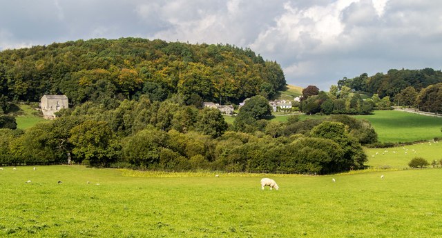
Blackberry Hill is a prominent hill located in the region of Westmorland, situated in the county of Cumbria, England. With an elevation of approximately 1,280 feet (390 meters), it forms part of the picturesque landscape of the Lake District National Park.

This hill is well-known for its breathtaking panoramic views, as it offers a commanding perspective of the surrounding countryside. From the summit, visitors can marvel at the rolling hills, lush green valleys, and sparkling waters of the nearby lakes. On clear days, it is even possible to catch a glimpse of the awe-inspiring peaks of the Lake District, including the famous Helvellyn and Scafell Pike.

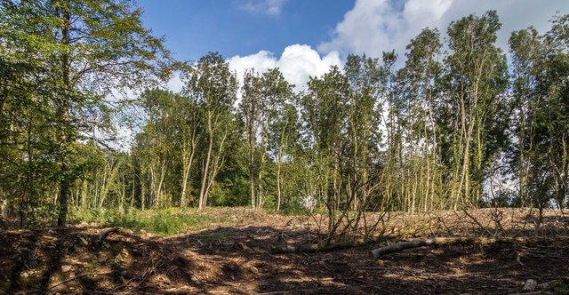
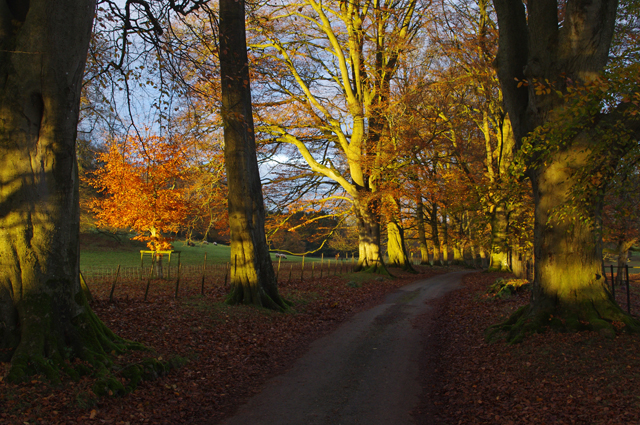
Blackberry Hill is a popular destination for outdoor enthusiasts and nature lovers. It offers a variety of walking and hiking trails, catering to different skill levels. The routes take visitors through enchanting woodland areas, where they can spot a wide array of flora and fauna. In particular, the hill is named after the abundance of blackberry bushes that can be found along the paths during the autumn months, providing a sweet treat for those who venture there.

The hill is easily accessible, with several public footpaths leading up to the summit. It is advisable to wear appropriate footwear and carry provisions, as there are limited facilities available in the immediate vicinity. Nevertheless, the serene and untouched natural beauty of Blackberry Hill makes it a truly remarkable destination for those seeking solace in the heart of the Lake District.

If you have any feedback on the listing, please let us know in the comments section below.

Blackberry Hill Images

Images are sourced within 2km of 54.204127/-2.7773713 or Grid Reference SD4978. Thanks to Geograph Open Source API. All images are credited.

Lakeland Wildlife Oasis A scary, eye-catching sight on the A6.
Lakeland Wildlife Oasis
A scary, eye-catching sight on the A6.
Farm sheds near Beetham These sheds lie to the south of the River Bela.
Farm sheds near Beetham
These sheds lie to the south of the River Bela.
On the A6 The M6 takes most of the traffic away from the old trunk road which makes it less stressful to use.
On the A6
The M6 takes most of the traffic away from the old trunk road which makes it less stressful to use.
Crossroads at Hale This is where Pye’s Bridge Lane joins the A6 near Beetham.
Crossroads at Hale
This is where Pye’s Bridge Lane joins the A6 near Beetham.
Pye’s Bridge The bridge crosses Holme Beck.
Pye’s Bridge
The bridge crosses Holme Beck.
A6 near Hale
A6 near Hale
A6 The junction of Paradise Lane with the A6.
A6
The junction of Paradise Lane with the A6.
Haverbrack
Haverbrack
Wray Cottages Visible after the felling of trees.
Wray Cottages
Visible after the felling of trees.
Limestone outcrop, Haverbrack Bank Like all the hills in the AONB, the bank is composed of carboniferous limestone. Although there are no great pavements or exposures to be seen, it's a pleasant place to wander around on a fine Spring day. Mercifully, the huge Sandside Quarry is not visible from here (screened by the trees on the left). No doubt it will be audible on a working day. Views north over the Kent estuary to the Lakeland fells, Howgills and Dales fells are exceptionally good.
Limestone outcrop, Haverbrack Bank
Like all the hills in the AONB, the bank is composed of carboniferous limestone. Although there are no great pavements or exposures to be seen, it's a pleasant place to wander around on a fine Spring day. Mercifully, the huge Sandside Quarry is not visible from here (screened by the trees on the left). No doubt it will be audible on a working day. Views north over the Kent estuary to the Lakeland fells, Howgills and Dales fells are exceptionally good.
Spring lamb, Spring snow A lamb reclines in warm Spring sunshine whilst overnight snow has briefly whitened the fells of the Yorkshire Dales. Curiously, the higher Lakeland fells were unaffected, possibly due to their closer proximity to the sea.
Spring lamb, Spring snow
A lamb reclines in warm Spring sunshine whilst overnight snow has briefly whitened the fells of the Yorkshire Dales. Curiously, the higher Lakeland fells were unaffected, possibly due to their closer proximity to the sea.
The Deer Shed, Dallam Park The fallow deer that inhabit The Park <a href="https://www.geograph.org.uk/photo/4585838">SD4980 : Fallow deer in The Park, Dallam Tower</a> were nowhere to be seen today.
The Deer Shed, Dallam Park
The fallow deer that inhabit The Park SD4980 : Fallow deer in The Park, Dallam Tower were nowhere to be seen today.
Relaxing in The Park A recently arrived resident of The Park gets some sleep in the warm Spring sunshine. It's obviously hard work running and jumping about all morning.
Relaxing in The Park
A recently arrived resident of The Park gets some sleep in the warm Spring sunshine. It's obviously hard work running and jumping about all morning.
Possible ruined lime kiln, woods west of Haverbrack At first I thought that this hole just west of the footpath might be a natural cave or mine working. A peek inside revealed rough masonry which I took to be the remnants of an old kiln.
Possible ruined lime kiln, woods west of Haverbrack
At first I thought that this hole just west of the footpath might be a natural cave or mine working. A peek inside revealed rough masonry which I took to be the remnants of an old kiln.
Public footpath at Beetham Leading to The Deer Park.
Public footpath at Beetham
Leading to The Deer Park.
Dallam Park View from beneath a mature sycamore on the south side of the park.
Dallam Park
View from beneath a mature sycamore on the south side of the park.
Dallam Park The southern end of the road through the park passes down an avenue of trees. Here, some of the trees are lit by the low late autumn sun.
Dallam Park
The southern end of the road through the park passes down an avenue of trees. Here, some of the trees are lit by the low late autumn sun.
Dallam Park The southern end of the road through the park passes down an avenue of trees. Here, some of the trees are lit by the low late autumn sun.
Dallam Park
The southern end of the road through the park passes down an avenue of trees. Here, some of the trees are lit by the low late autumn sun.
Show me another place!

Blackberry Hill is located at Grid Ref: SD4978 (Lat: 54.204127, Lng: -2.7773713)

Administrative County: Cumbria

District: South Lakeland

Police Authority: Cumbria

What 3 Words

///rigs.meanwhile.vague. Near Milnthorpe, Cumbria

Related Wikis

Slack Head

Slack Head, sometimes written Slackhead, is a hamlet near Beetham, South Lakeland, Cumbria, England. It is in Beetham civil parish. It is a purely residential...

Storth

Storth is a village near Arnside in Cumbria, England, situated near the border with Lancashire. It is in the historic county of Westmorland. The village...

Beetham

Beetham is a village and civil parish in the South Lakeland district, in Cumbria, England, situated on the border with Lancashire, 6 miles (10 km) north...

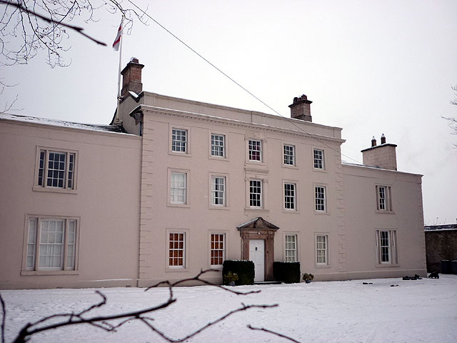
Ashton House, Cumbria

Ashton House is a large country house in Beetham in Cumbria. It is a Grade II* listed building. == History == The house was built in 1678 probably for...

St Michael's Church, Beetham

St Michael's Church is in the village of Beetham, Cumbria, England. It is an active Anglican parish church in the deanery of Kendal, the archdeaconry of...
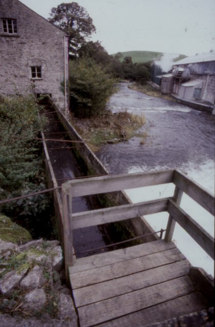
Heron Corn Mill

The Heron Corn Mill is a working 18th-century water mill on the River Bela at Beetham, Cumbria, England. The mill and its mill race are Grade II* listed...

Hale, Cumbria

Hale is a hamlet near Beetham in the south of Cumbria, England. It lies on the A6 road, between Carnforth to the south and Milnthorpe to the north. It...

Dog Hole Cave

Dog Hole Cave is an archaeologically significant cave near Storth, Cumbria, England. Other names for the cave include Haverbrack Bank Pot, Haverbrack Dog...

Related Videos

Underlaid Wood

Country Walking Adventure.

Beetham village, the deer park 🦌, the fairy steps and the ancient water corn mill

Beetham village in South West of Cumbria: the deer park, the fairy steps and the ancient corn water mill. Hike with me in this place ...

Leather Travel Wallet

Showing one of my recent commissions. Completely made by hand by myself in England from European leather. You can order ...

2013 Swift Bordeaux at Silver Ridge Holiday Park (SOLD)

Discover holiday home ownership at our peaceful Silver Ridge park. Simply call 01524 701508 for more details.

Nearby Amenities

Located within 500m of 54.204127,-2.7773713
Post Box
Collection Times: Mo-Fr 15:45; Sa 10:30
Drive Through: no
Post Box Type: lamp
Ref: LA7 248
Lat/Long: 54.2024309/-2.7791642
Barrier: stile
Lat/Long: 54.2040212/-2.7705333
Bus Stop
Slack Head (N bound)
Bus: yes
Local Ref: AT
Naptan AtcoCode: 090079063594
Naptan Bearing: NE
Naptan BusStopType: CUS
Naptan CommonName: Slack Head (N bound)
Naptan Indicator: at
Naptan Landmark: junction to nursery
Naptan NaptanCode: cumdgpjd
Naptan Street: Leighton Beck Road
Naptan Verified: no
Public Transport: platform
Source: naptan_import
Lat/Long: 54.2053663/-2.7772674
Bus Stop
Slack Head (S bound)
Bus: yes
Naptan AtcoCode: 090079063595
Naptan Bearing: SW
Naptan BusStopType: CUS
Naptan CommonName: Slack Head (S bound)
Naptan Indicator: opp
Naptan Landmark: junction to nursery
Naptan NaptanCode: cumdgpjg
Naptan Street: Leighton Beck Road
Naptan Verified: no
Public Transport: platform
Source: naptan_import
Lat/Long: 54.2051618/-2.7769263
Barrier: stile
Source: Recent walk, GPS and photos
Lat/Long: 54.2082382/-2.7789819
Barrier: stile
Lat/Long: 54.2056495/-2.7759963
Barrier: stile
Lat/Long: 54.2056956/-2.776253
Slack Head
Place: hamlet
Wikidata: Q20128089
Lat/Long: 54.201644/-2.7815195
Give Way
Direction: forward
Lat/Long: 54.2023962/-2.7793466
Give Way
Direction: forward
Lat/Long: 54.203297/-2.7784044
Power: pole
Lat/Long: 54.2047981/-2.771277
Power: pole
Lat/Long: 54.2052883/-2.7733877
Power: pole
Lat/Long: 54.2057722/-2.7754669
Power: pole
Lat/Long: 54.2060409/-2.7732965
Power: pole
Lat/Long: 54.2070621/-2.7731633
Whinscar Plantation
Natural: wood
Lat/Long: 54.2052655/-2.7813179
Information: guidepost
Tourism: information
Lat/Long: 54.2009959/-2.7766897
Information: guidepost
Tourism: information
Lat/Long: 54.2040184/-2.7705774
Power: pole
Lat/Long: 54.206506/-2.7764281
Power: pole
Lat/Long: 54.2069325/-2.7770145
Power: pole
Lat/Long: 54.2083467/-2.7790642
The data included in this document is from www.openstreetmap.org. The data is made available under ODbL.

Have you been to Blackberry Hill?

Leave your review of Blackberry Hill below (or comments, questions and feedback).