Ilford

Settlement in Somerset South Somerset

England

Ilford

Stocklinch Ottersey church Remote from its village
Stocklinch Ottersey church Credit: Martin Bodman

Ilford is a small village located in the county of Somerset, England. It is situated approximately 4 miles north of the town of Ilminster and lies within the South Somerset district. With a population of around 600 residents, Ilford is a close-knit community that offers a tranquil and picturesque setting.

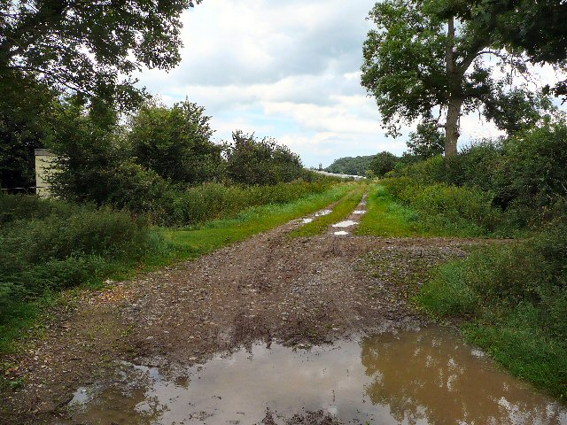
The village is known for its charming countryside, rolling hills, and beautiful landscapes, making it a popular destination for nature lovers and hikers. Ilford is surrounded by farmland and agricultural fields, adding to its rural appeal.

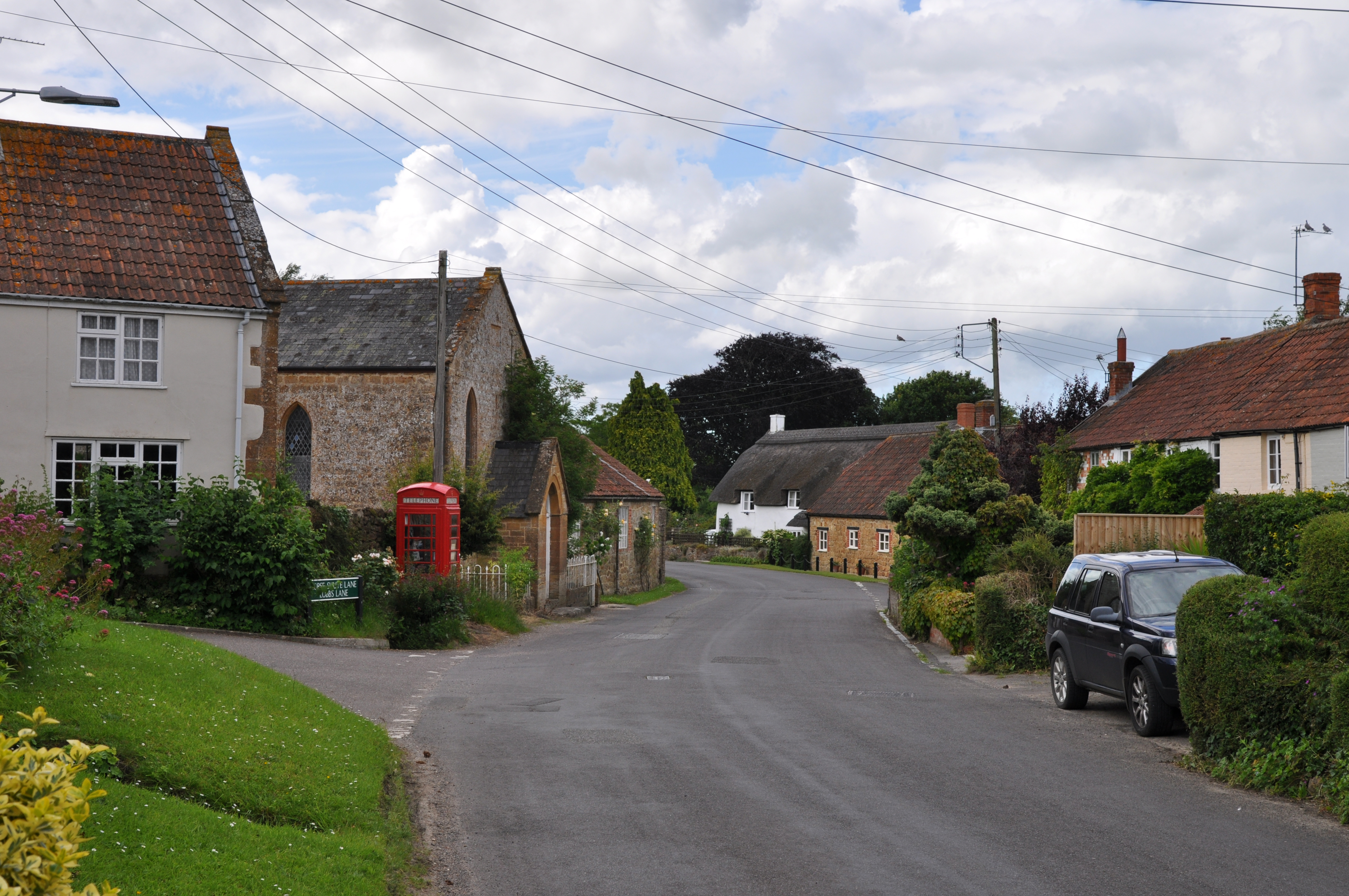
Despite its small size, Ilford offers a range of amenities for its residents. The village has a local pub, The Anchor Inn, which serves as a social hub and gathering place for both locals and visitors. Additionally, there is a primary school, providing education for young children in the area.

Ilford's location also provides easy access to nearby towns and cities. The A303 road runs close by, connecting the village to larger urban centers such as Exeter and London. The village is also well-connected by public transportation, with regular bus services linking it to surrounding areas.

Overall, Ilford, Somerset, offers a peaceful and idyllic countryside retreat, while still providing convenient access to amenities and nearby towns. Its natural beauty and sense of community make it an appealing place to live or visit for those seeking a quieter and more relaxed lifestyle.

If you have any feedback on the listing, please let us know in the comments section below.

Ilford Images

Images are sourced within 2km of 50.954983/-2.904614 or Grid Reference ST3617. Thanks to Geograph Open Source API. All images are credited.

Stocklinch Ottersey church Remote from its village
Stocklinch Ottersey church
Remote from its village
Puckington: Gummer’s Lane A track and public footpath to Stocklinch. Possibly an old way as it defines the parish boundary with Stocklinch. Looking south east
Puckington: Gummer’s Lane
A track and public footpath to Stocklinch. Possibly an old way as it defines the parish boundary with Stocklinch. Looking south east
Ilton: drainage channel On the river Isle flood plain near Ilford Bridge. In north Somerset this channel would be called a rhine. Looking south east
Ilton: drainage channel
On the river Isle flood plain near Ilford Bridge. In north Somerset this channel would be called a rhine. Looking south east
St Andrews Church Puckington A lovely church set well back from the road, easily missed.
St Andrews Church Puckington
A lovely church set well back from the road, easily missed.
St Andrews Church Puckington
Church Notice Board Puckington
Manor Farmhouse Puckington Manor Farmhouse Puckington adjacent to the church, was possibly the vicarage at one time
Manor Farmhouse Puckington
Manor Farmhouse Puckington adjacent to the church, was possibly the vicarage at one time
Former chapel, Cad Green, Ilton The chapel is now a private residence.
Former chapel, Cad Green, Ilton
The chapel is now a private residence.
Crossroads at Cad Green The buildings on the right are the former chapel, next to which can be seen the end of a thatched cottage.
Crossroads at Cad Green
The buildings on the right are the former chapel, next to which can be seen the end of a thatched cottage.
Thatched house Wisteria is the creeper of choice for Somerset houses.  This is a typical old Somerset house that has grown lengthways along the roadside.
Thatched house
Wisteria is the creeper of choice for Somerset houses. This is a typical old Somerset house that has grown lengthways along the roadside.
Gazelle helicopter approaching Merryfield airfield Flying in from the east, an Army Air Corps Gazelle helicopter approaches the main runway at Merryfield during a large military exercise. This view, looking roughly ESE, shows open fields on the other side of the road from the airfield.
Gazelle helicopter approaching Merryfield airfield
Flying in from the east, an Army Air Corps Gazelle helicopter approaches the main runway at Merryfield during a large military exercise. This view, looking roughly ESE, shows open fields on the other side of the road from the airfield.
South Bradon Farm
South Bradon Farm
Lane past South Bradon Farm
Farm track near North Bradon.
Eames Mill The River Isle approaches the weir at the mill; the millhouse can be seen between the riverside willows and alders. The pink flower on the right is Himalayan Balsam.
Eames Mill
The River Isle approaches the weir at the mill; the millhouse can be seen between the riverside willows and alders. The pink flower on the right is Himalayan Balsam.
Ashwell Farm from Mill Lane Some of the outbuildings at Ashwell Farm have been turned into Ashwell Business Park. Here, it is seen across a field from the lane leading to Eames Mill.
Ashwell Farm from Mill Lane
Some of the outbuildings at Ashwell Farm have been turned into Ashwell Business Park. Here, it is seen across a field from the lane leading to Eames Mill.
Parsonage Barn From the bridge carrying the lane between Whitelackington and Stocklinch across the A303 Ilminster by-pass. Behind is the broad flat valley of the River Isle.
Parsonage Barn
From the bridge carrying the lane between Whitelackington and Stocklinch across the A303 Ilminster by-pass. Behind is the broad flat valley of the River Isle.
Field near Puckington Level land north of Puckington Hill. Reeds in the hedgerow indicate the dampness, although the ditch across the path was dry. The line of low trees marks Clay Lane, an old track. Taken from (the difficult to use) footpath L24/1.
Field near Puckington
Level land north of Puckington Hill. Reeds in the hedgerow indicate the dampness, although the ditch across the path was dry. The line of low trees marks Clay Lane, an old track. Taken from (the difficult to use) footpath L24/1.
Show me another place!

Ilford is located at Grid Ref: ST3617 (Lat: 50.954983, Lng: -2.904614)

Administrative County: Somerset

District: South Somerset

Police Authority: Avon and Somerset

What 3 Words

///squaring.heightens.thundered. Near Ilminster, Somerset

Nearby Locations

Way, Old Ilford Old Way

Related Wikis

Ilton

Ilton is a village and civil parish in Somerset, England, situated 8 miles (12.9 km) south-east of Taunton, and 2 miles (3.2 km) north of Ilminster in...

Puckington

Puckington is a village and civil parish, situated 10 miles (16 km) south-east of Taunton and 10 miles (16 km) west of Yeovil in the South Somerset district...

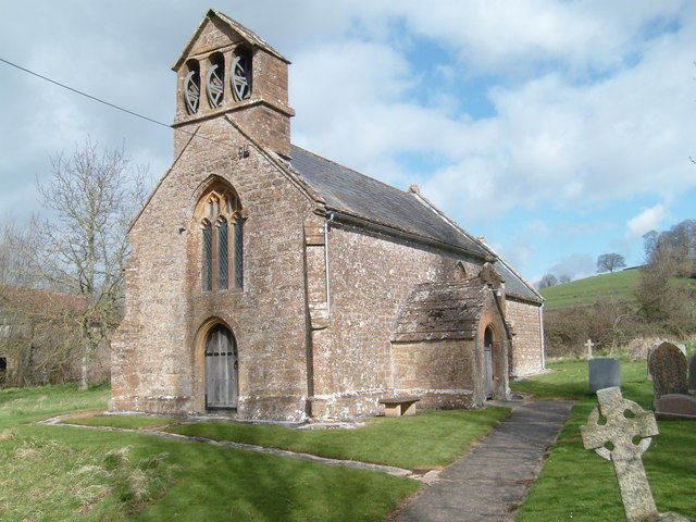
Church of St Andrew, Puckington

The Anglican Church of St Andrew in Puckington, Somerset, England, was built in the 13th century. It is a Grade II* listed building. == History == The...

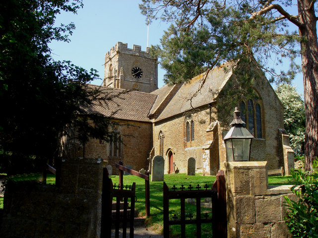
Church of St Peter, Ilton

The Anglican Church of St Peter in Ilton, Somerset, England was built in the 14th century, incorporating fragments from 12th and 13th. It is a Grade II...

Stocklinch

Stocklinch is a village and civil parish 3.5 miles (6 km) north-east of Ilminster in the South Somerset district of Somerset, England. == History == The...

Dillington House

Dillington House is a residential adult education college near Ilminster in the parish of Whitelackington, Somerset, England. The present house, which...

Barrington, Somerset

Barrington is a village and civil parish, situated 10 miles (16.1 km) south east of Taunton and 10 miles (16.1 km) west of Yeovil in Somerset, England...

1945 Broadway Consolidated Liberator crash

The 1945 Broadway Consolidated Liberator crash occurred on 22 November 1945 when a Royal Air Force Consolidated Liberator C Mk VIII transport crashed shortly...

Nearby Amenities

Located within 500m of 50.954983,-2.904614
Post Box
Operator: Royal Mail
Operator Wikidata: Q638098
Post Box Type: lamp
Ref: TA19 282
Royal Cypher: EIIR
Royal Cypher Wikidata: Q33102113
Lat/Long: 50.9509722/-2.9074893
Ilford
Place: hamlet
Lat/Long: 50.9550847/-2.9050466
Ilford farm
Building: yes
Lat/Long: 50.954042/-2.9063829
Power: pole
Source: bing
Lat/Long: 50.9549294/-2.9035999
Power: pole
Source: bing
Lat/Long: 50.9533284/-2.9046392
Power: pole
Source: bing
Lat/Long: 50.953734/-2.9028891
Power: pole
Source: bing
Lat/Long: 50.9543262/-2.903337
Power: pole
Source: bing
Lat/Long: 50.9525047/-2.9017881
Power: pole
Source: bing
Lat/Long: 50.9529643/-2.9023057
Power: pole
Source: bing
Lat/Long: 50.9549682/-2.8976735
Power: pole
Source: bing
Lat/Long: 50.954659/-2.898953
Power: pole
Source: bing
Lat/Long: 50.9543701/-2.9001814
Power: pole
Source: bing
Lat/Long: 50.9540795/-2.901434
Power: pole
Source: bing
Lat/Long: 50.9534856/-2.9026879
Power: pole
Source: bing
Lat/Long: 50.9513785/-2.9070707
Power: pole
Source: bing
Lat/Long: 50.95204/-2.9072289
Power: pole
Source: bing
Lat/Long: 50.9532127/-2.9062566
Power: pole
Source: bing
Lat/Long: 50.9531468/-2.907477
Power: pole
Source: bing
Lat/Long: 50.9530606/-2.9089442
Power: pole
Source: bing
Lat/Long: 50.9529761/-2.9102826
The data included in this document is from www.openstreetmap.org. The data is made available under ODbL.

Have you been to Ilford?

Leave your review of Ilford below (or comments, questions and feedback).