The Pike

Hill, Mountain in Roxburghshire

Scotland

The Pike

Summit trig pillar, Penchrise Pen Looking from this 439m summit to the twin summits of Maiden Paps (510m) and part of the extensive forest plantations in this area of the Borders. 'Pen' is from the old Welsh language once spoken in southern Scotland, describing a distinctive peak, and the name is still in use in these parts. The concrete blocks were probably from a structure connected with the Stobs Military Camp to the north.
Summit trig pillar, Penchrise Pen Credit: Jim Barton

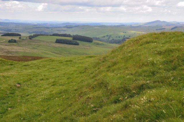
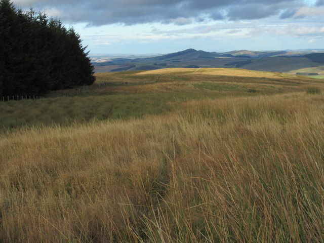
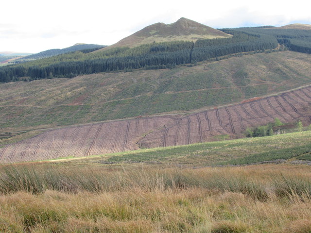
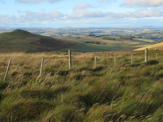
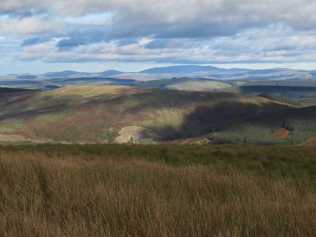
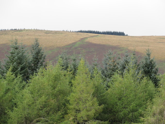
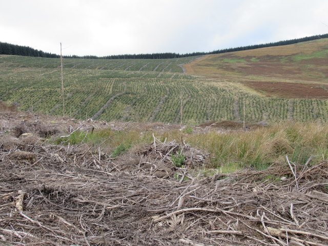
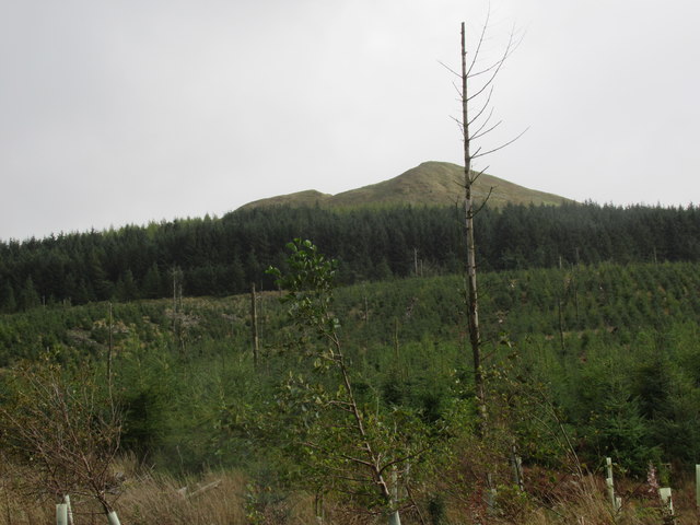
The Pike is a prominent hill located in the county of Roxburghshire, Scotland. It is part of the Moorfoot Hills range, which stretches across the southern uplands of the country. Standing at an elevation of 500 meters (1,640 feet), The Pike offers breathtaking panoramic views of the surrounding countryside.

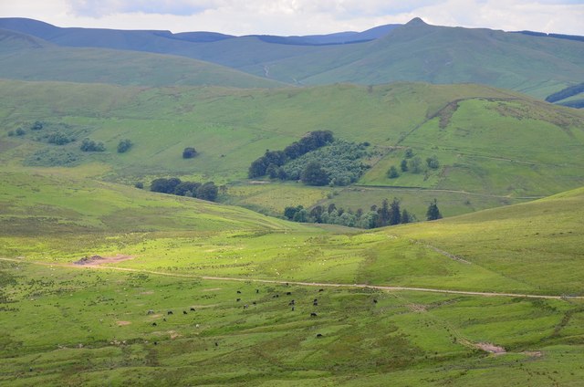
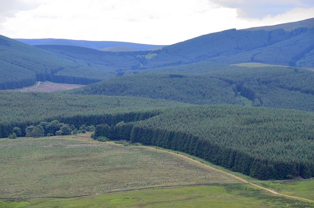
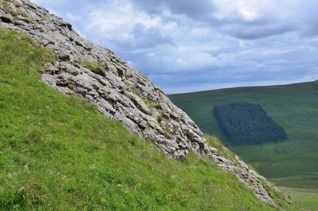
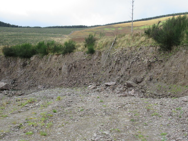
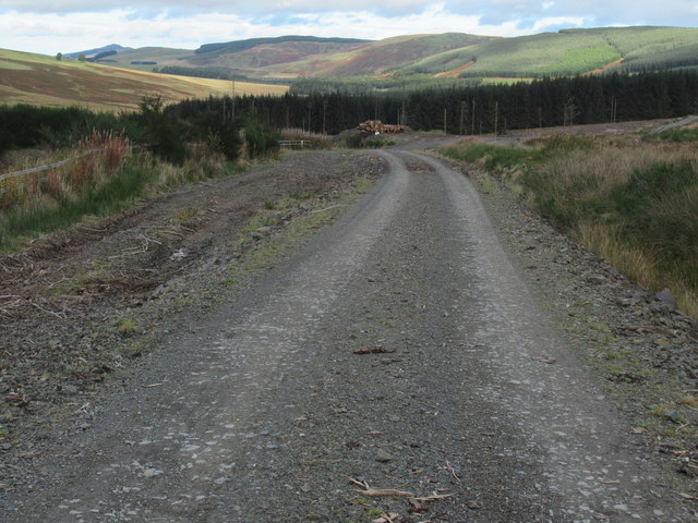
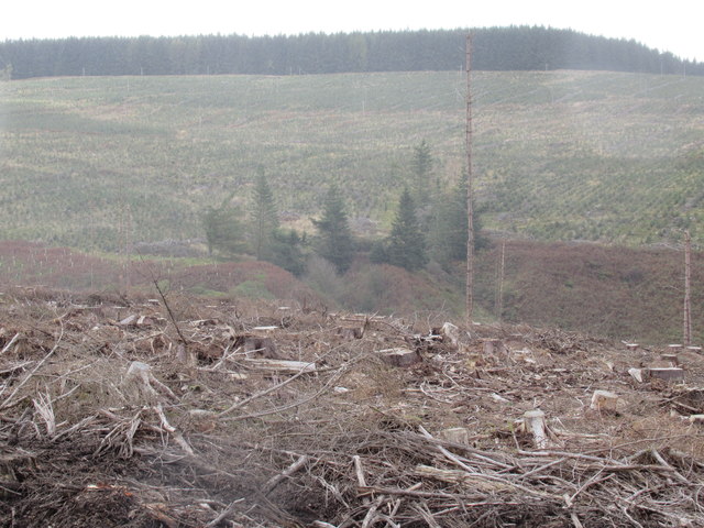
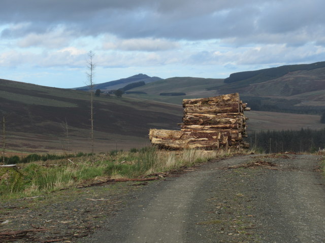
The hill is characterized by its steep slopes and rugged terrain, making it a popular destination for hikers, nature enthusiasts, and photographers. Its strategic location provides visitors with an excellent vantage point to appreciate the picturesque landscape of Roxburghshire, with rolling hills, lush green meadows, and winding rivers visible from its summit.

Access to The Pike is relatively easy, with several well-marked trails leading to the top. The most popular route begins at the village of Heriot, where hikers can follow a well-maintained path that gradually ascends towards the hill's peak. Along the way, they may encounter a variety of wildlife, including deer, rabbits, and various bird species.

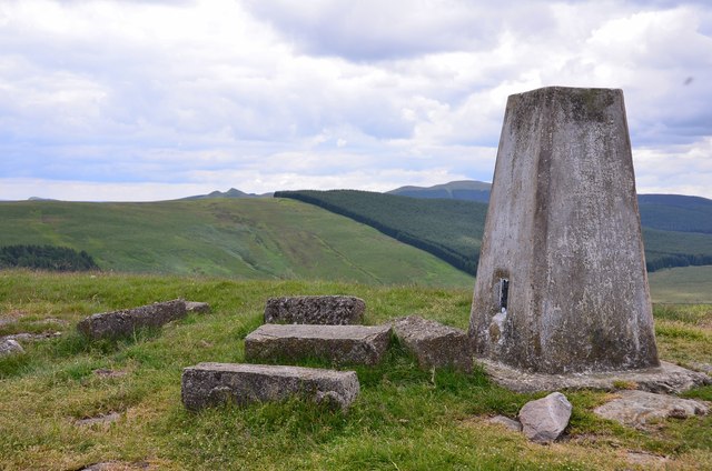
The Pike holds historical significance as well, as it is believed to have been used as a lookout point during ancient times. Archaeological surveys have revealed remnants of stone structures on its slopes, suggesting that it may have been a fortified site or an early settlement.

Whether exploring its natural beauty, enjoying the peacefulness of the countryside, or delving into its historical roots, The Pike offers a rewarding experience for all who visit.

If you have any feedback on the listing, please let us know in the comments section below.

The Pike Images

Images are sourced within 2km of 55.330542/-2.8003942 or Grid Reference NT4904. Thanks to Geograph Open Source API. All images are credited.

Summit trig pillar, Penchrise Pen Looking from this 439m summit to the twin summits of Maiden Paps (510m) and part of the extensive forest plantations in this area of the Borders. 'Pen' is from the old Welsh language once spoken in southern Scotland, describing a distinctive peak, and the name is still in use in these parts. The concrete blocks were probably from a structure connected with the Stobs Military Camp to the north.
Summit trig pillar, Penchrise Pen
Looking from this 439m summit to the twin summits of Maiden Paps (510m) and part of the extensive forest plantations in this area of the Borders. 'Pen' is from the old Welsh language once spoken in southern Scotland, describing a distinctive peak, and the name is still in use in these parts. The concrete blocks were probably from a structure connected with the Stobs Military Camp to the north.
Southwest from Penchrise Pen Looking across the broad ridge crossed by the track heading for the forest plantations at Hawk Hass to the peak of Skelfhill Pen (532m), another of the several prominent summits of resistant igneous rocks dating from the early Carboniferous period. On the intermediate ridge in the centre is Brae Plantation.
Southwest from Penchrise Pen
Looking across the broad ridge crossed by the track heading for the forest plantations at Hawk Hass to the peak of Skelfhill Pen (532m), another of the several prominent summits of resistant igneous rocks dating from the early Carboniferous period. On the intermediate ridge in the centre is Brae Plantation.
Forestry around Peelbraehope This view from the summit of Penchrise Pen shows just a small part of the forestry plantations in this area. Left of centre is the clearing at Peelbraehope (see <a href="https://www.geograph.org.uk/photo/671029">NT4804 : Peelbraehope</a>) with the track from Barns to Hawkhass coming in from the lower right.
Forestry around Peelbraehope
This view from the summit of Penchrise Pen shows just a small part of the forestry plantations in this area. Left of centre is the clearing at Peelbraehope (see NT4804 : Peelbraehope) with the track from Barns to Hawkhass coming in from the lower right.
Rock outcrop on Penchrise Pen Igneous rocks play a major part in the landscape here, with volcanic plugs, necks and lava flows having helped shape the topography we now see. The chapter entitled 'Volcanoes of the steamy wetlands' explains more in 'Death of an Ocean' by E Clarkson and B Upton, Dunedin Edinburgh, 2010.
The shelter belt in the background is Burnt Craig Wood below Stirkcleuch Height.
Rock outcrop on Penchrise Pen
Igneous rocks play a major part in the landscape here, with volcanic plugs, necks and lava flows having helped shape the topography we now see. The chapter entitled 'Volcanoes of the steamy wetlands' explains more in 'Death of an Ocean' by E Clarkson and B Upton, Dunedin Edinburgh, 2010. The shelter belt in the background is Burnt Craig Wood below Stirkcleuch Height.
Hill fort ramparts on Penchrise Pen Near the summit, looking NNE over Newton Hill to Rubers Law in the distance, right.
Hill fort ramparts on Penchrise Pen
Near the summit, looking NNE over Newton Hill to Rubers Law in the distance, right.
View north-east from The Pike  near Hawick Nine years on and the weather is the only thing that has changed - for the better I hasten to add! Ruberslaw in mid shot on the far side of which is a wild-camping facility.
View north-east from The Pike near Hawick
Nine years on and the weather is the only thing that has changed - for the better I hasten to add! Ruberslaw in mid shot on the far side of which is a wild-camping facility.
Recent view of forest edge north of Maiden Paps near Hawick Recent clearfell and not so obvious close by, re-planted clearfell.
Recent view of forest edge north of Maiden Paps near Hawick
Recent clearfell and not so obvious close by, re-planted clearfell.
View north off Stirkcleugh Height near Hawick The Eildons in view distantly top right.
View north off Stirkcleugh Height near Hawick
The Eildons in view distantly top right.
View east-north-east from The Pike near Hawick A clear view of Cheviot.
View east-north-east from The Pike near Hawick
A clear view of Cheviot.
Catrail on The Pike near Hawick
Disused quarry in forestry south of Hawick Hawick Path signs are dotted around to aid navigation though in clearfell the problem is not so great.
Disused quarry in forestry south of Hawick
Hawick Path signs are dotted around to aid navigation though in clearfell the problem is not so great.
Another part of a disused quarry in forestry south of Hawick
Clearfell and re-planting near The Pike south of Hawick
Re-planted lower slopes of Maiden Paps near Hawick
Forest road beneath Maiden Paps south of Hawick
Untouched wee neuk amid commercial forestry south of Hawick A passing light shower created a filter - largely unwanted!
Untouched wee neuk amid commercial forestry south of Hawick
A passing light shower created a filter - largely unwanted!
Log pile with a view near Stennishope south of Hawick
Standing dead tree below Maiden Paps near Hawick I don't know whether these are chance remnants or whether left on purpose as bird roosts.
Standing dead tree below Maiden Paps near Hawick
I don't know whether these are chance remnants or whether left on purpose as bird roosts.
Show me another place!

The Pike is located at Grid Ref: NT4904 (Lat: 55.330542, Lng: -2.8003942)

Unitary Authority: The Scottish Borders

Police Authority: The Lothians and Scottish Borders

What 3 Words

///guidebook.motivator.backward. Near Teviothead, Scottish Borders

Nearby Locations

Singley Brae The Pike

Related Wikis

Maiden Paps (Hawick)

The Maiden Paps are twin hills near Hawick, in the Scottish Borders of the south east of Scotland, so named because they have the shape of human breasts...

Shankend

Shankend Manor was a sixteenth-century mansion located some six miles (ten kilometres) south of Hawick, close to Whitrope Siding in Scotland. It was constructed...

Shankend railway station

Shankend railway station served the hamlet of Shankend, Scottish Borders, Scotland from 1862 to 1969 on the Border Union Railway. == History == The station...
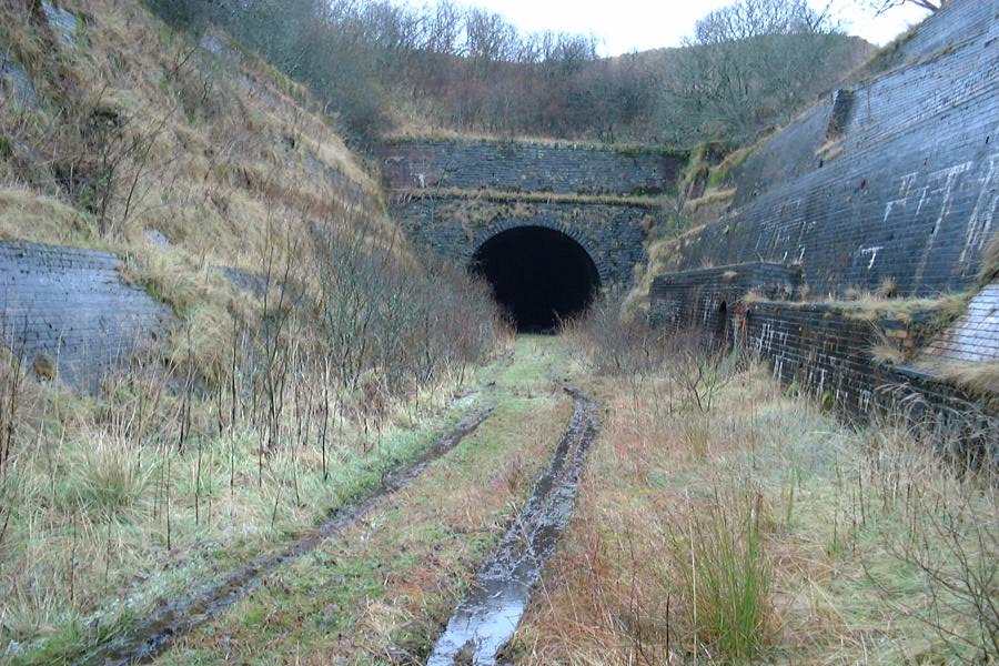
Whitrope Tunnel

The Whitrope Tunnel is a disused railway tunnel in the Scottish Borders, situated 12 miles (19 km) south of Hawick on the Waverley Route, close to Whitrope...

Nearby Amenities

Located within 500m of 55.330542,-2.8003942
Singley Brae
Place: locality
Lat/Long: 55.328925/-2.7949002
Catrail Edge
Place: locality
Lat/Long: 55.3293447/-2.8021376
The Pike
Ele: 463
Natural: peak
Lat/Long: 55.330683/-2.8002036
The data included in this document is from www.openstreetmap.org. The data is made available under ODbL.

Have you been to The Pike?

Leave your review of The Pike below (or comments, questions and feedback).