Barber Booth

Settlement in Derbyshire High Peak

England

Barber Booth

Mam Tor from above Blue John Cavern
Mam Tor from above Blue John Cavern Credit: Colin Park

Barber Booth is a small hamlet located in the Peak District National Park in Derbyshire, England. Situated in the Hope Valley, it is nestled between the picturesque villages of Edale and Castleton. The hamlet gets its name from the nearby Barber Booth Farm, which has been a prominent feature in the area for many years.

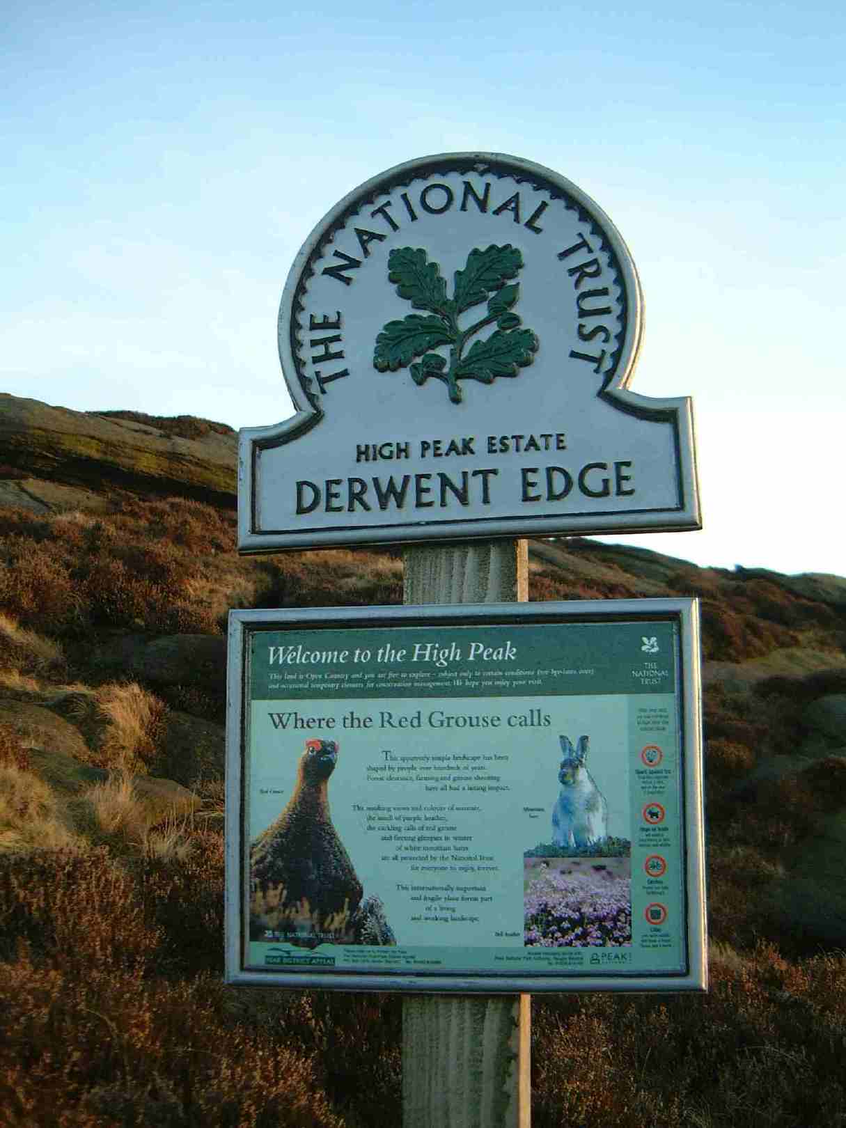
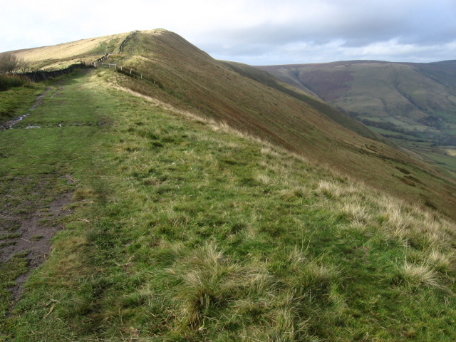
The surrounding landscape of Barber Booth is breathtaking, with rolling hills, rugged moorland, and stunning limestone formations. It offers a haven for outdoor enthusiasts, with an array of walking, hiking, and cycling opportunities. The famous Pennine Way, a long-distance footpath, passes through the hamlet, attracting hikers from all over the world.

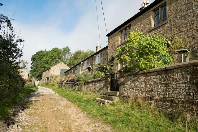
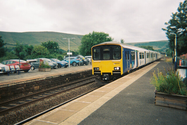
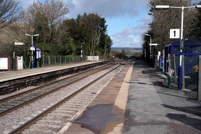
Barber Booth itself consists of a handful of traditional stone houses, creating a charming and tranquil atmosphere. While it is a small settlement, it is well-connected to nearby towns and villages, making it a convenient base for exploring the wider area.

Nature lovers will be delighted by the diverse wildlife that can be found in the vicinity of Barber Booth, including rare bird species and wildflowers. The area is also rich in history, with remnants of ancient settlements and lead mining activity.

Overall, Barber Booth is a hidden gem within the Peak District National Park, offering visitors a peaceful retreat in a stunning natural setting. Whether it's for a leisurely stroll, an adrenaline-fueled adventure, or a peaceful getaway, this hamlet has something to offer everyone.

If you have any feedback on the listing, please let us know in the comments section below.

Barber Booth Images

Images are sourced within 2km of 53.359583/-1.828973 or Grid Reference SK1184. Thanks to Geograph Open Source API. All images are credited.

Mam Tor from above Blue John Cavern
Path descending northeast from Mam Tor
The Pennine Way at Lee Farm Passing through the National Trust owned Lee Farm on the Pennine Way.
The Pennine Way at Lee Farm
Passing through the National Trust owned Lee Farm on the Pennine Way.
Row of buildings at Lee House Farm in 1993 A barn or store shed and two houses at the farm which is passed by the Pennine Way.
Row of buildings at Lee House Farm in 1993
A barn or store shed and two houses at the farm which is passed by the Pennine Way.
Edale Valley Looking back to Edale the Pennine Way can be seen to the left of the River Noe, this is the first mile or two for many hikers on the long trek to Kirk Yetholm.
Edale Valley
Looking back to Edale the Pennine Way can be seen to the left of the River Noe, this is the first mile or two for many hikers on the long trek to Kirk Yetholm.
Gate and wall below Grindslow Knoll Reflected in a large puddle
Gate and wall below Grindslow Knoll
Reflected in a large puddle
Train pulling into Edale station Train to Sheffield stopping in Edale.
Train pulling into Edale station
Train to Sheffield stopping in Edale.
Path up to Rushup Edge A pleasant walk along the top of the ridge.
Path up to Rushup Edge
A pleasant walk along the top of the ridge.
The southern side of Rushup Edge Eldon Hill is to the left and Sparrowpit to the right.
The southern side of Rushup Edge
Eldon Hill is to the left and Sparrowpit to the right.
Path on Rushup Edge A steady climb up the ridge to Lord's Seat.
Path on Rushup Edge
A steady climb up the ridge to Lord's Seat.
The summit plateau of Lord's Seat The top is fairly featureless but there are good views from the edge of the plateau.
The summit plateau of Lord's Seat
The top is fairly featureless but there are good views from the edge of the plateau.
Segregation on Rushup Edge The footpath continues straight on, but the bridleway takes a parallel route to the right. This will hopefully prevent erosion of the footpath.
Segregation on Rushup Edge
The footpath continues straight on, but the bridleway takes a parallel route to the right. This will hopefully prevent erosion of the footpath.
Path off Rushup Edge The western end of the edge is a gentle descent as the moorland broadens out.
Path off Rushup Edge
The western end of the edge is a gentle descent as the moorland broadens out.
Chapel Gate A track running obliquely down the hillside towards Edale.
Chapel Gate
A track running obliquely down the hillside towards Edale.
Whitemoor Clough This shows the various streams running off Rushup Edge into the clough.
Whitemoor Clough
This shows the various streams running off Rushup Edge into the clough.
Stream crossing Chapel Gate One of numerous streams which run off the side of Rushup Edge into Edale.
Stream crossing Chapel Gate
One of numerous streams which run off the side of Rushup Edge into Edale.
Chapel Gate Near the bottom of this track's descent into Edale.
Chapel Gate
Near the bottom of this track's descent into Edale.
Grazing land in Edale Looking down on cattle grazing from Chapel Gate.
Grazing land in Edale
Looking down on cattle grazing from Chapel Gate.
Show me another place!

Barber Booth is located at Grid Ref: SK1184 (Lat: 53.359583, Lng: -1.828973)

Administrative County: Derbyshire

District: High Peak

Police Authority: Derbyshire

What 3 Words

///slept.enclosing.gravitate. Near High Peak, Derbyshire

Nearby Locations

Barber Booth

Related Wikis

Nearby Amenities

Located within 500m of 53.359583,-1.828973
Barber Booth
Created By: Potlatch 0.10b
Place: hamlet
Source Name: local knowledge
Wikidata: Q104708148
Lat/Long: 53.3595739/-1.8311532
Post Box
Brand: Royal Mail
Brand Wikidata: Q638098
Operator: Royal Mail
Operator Wikidata: Q638098
Ref: S33 153
Lat/Long: 53.359772/-1.8306897
Place Of Worship
Edale Methodist Chapel
Denomination: methodist
Religion: christian
Wikidata: Q26388882
Lat/Long: 53.3599985/-1.8315936
Bench
Lat/Long: 53.3592924/-1.8312482
Information: guidepost
Operator: Peak & Northern Footpaths Society
Ref: 22
Tourism: information
Lat/Long: 53.3589768/-1.8311252
Barrier: stile
Material: wood
Source: survey;gps
Stile: stepover
Lat/Long: 53.3585536/-1.8232751
Barrier: stile
Material: wood
Source: survey;gps
Stile: stepover
Lat/Long: 53.3587854/-1.8287073
Barrier: entrance
Source: survey;gps
Lat/Long: 53.3588029/-1.8294774
Bus Stop
Bus: yes
Naptan AtcoCode: 1000DBBC4477
Naptan NaptanCode: dbsgwjga
Public Transport: platform
Lat/Long: 53.3594965/-1.8307388
Barrier: stile
Material: stone
Source: survey;gps
Stile: squeezer
Lat/Long: 53.3626604/-1.8268563
Barrier: stile
Material: wood
Source: survey;gps
Stile: stepover
Lat/Long: 53.359184/-1.8339017
Power: pole
Lat/Long: 53.3565405/-1.8340623
Power: pole
Lat/Long: 53.3566389/-1.8325147
Power: pole
Lat/Long: 53.356747/-1.8310261
Power: pole
Lat/Long: 53.3569183/-1.8299264
Power: pole
Lat/Long: 53.3570895/-1.8288589
Power: pole
Lat/Long: 53.3574321/-1.8278503
Power: pole
Lat/Long: 53.3578931/-1.82652
Power: pole
Lat/Long: 53.3582277/-1.8255302
Power: pole
Lat/Long: 53.3587359/-1.8257368
Power: pole
Lat/Long: 53.3592674/-1.8259433
Power: pole
Lat/Long: 53.3599317/-1.8262142
Power: pole
Lat/Long: 53.360127/-1.8262906
Power: pole
Lat/Long: 53.360638/-1.8268432
Power: pole
Lat/Long: 53.3609321/-1.827157
Power: pole
Lat/Long: 53.3613139/-1.8275526
Power: pole
Lat/Long: 53.361694/-1.8279603
Power: pole
Lat/Long: 53.3619353/-1.8282212
Power: pole
Lat/Long: 53.3619817/-1.8282701
Power: pole
Lat/Long: 53.3622318/-1.8285598
Power: pole
Lat/Long: 53.3626224/-1.8272589
Power: pole
Lat/Long: 53.3630137/-1.8260372
Power: pole
Lat/Long: 53.3593506/-1.8250649
Power: pole
Lat/Long: 53.3594947/-1.823713
Power: pole
Lat/Long: 53.3595843/-1.8228386
Man Made: water_tap
Lat/Long: 53.3615821/-1.8246209
The data included in this document is from www.openstreetmap.org. The data is made available under ODbL.

Have you been to Barber Booth?

Leave your review of Barber Booth below (or comments, questions and feedback).