Pim Hill

Hill, Mountain in Shropshire

England

Pim Hill

Mast on the hilltop above Webscott The stile is now redundant but the woodland edge gives a view to the mast on the crown of this little hillock.
Mast on the hilltop above Webscott Credit: Jeremy Bolwell

Pim Hill is a prominent natural feature located in Shropshire, England. It is classified as a hill rather than a mountain, with an elevation of approximately 309 meters (1,014 feet) above sea level. The hill is situated near the village of Harmer Hill, about 11 kilometers (7 miles) north of the county town of Shrewsbury.

Pim Hill is known for its picturesque and rolling landscape, characterized by lush green meadows and fertile farmland. It offers breathtaking panoramic views of the surrounding countryside, making it a popular destination for hikers, nature enthusiasts, and photographers. On a clear day, it is possible to see the distant peaks of the Welsh mountains to the west.

The hill is covered in a mix of grasses, heathers, and various wildflowers, providing ample habitat for a diverse range of wildlife. It is home to a variety of bird species, including kestrels, buzzards, and skylarks, which can often be seen soaring above the hill. Additionally, small mammals such as rabbits, voles, and shrews can be found within its borders.

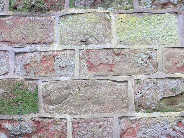
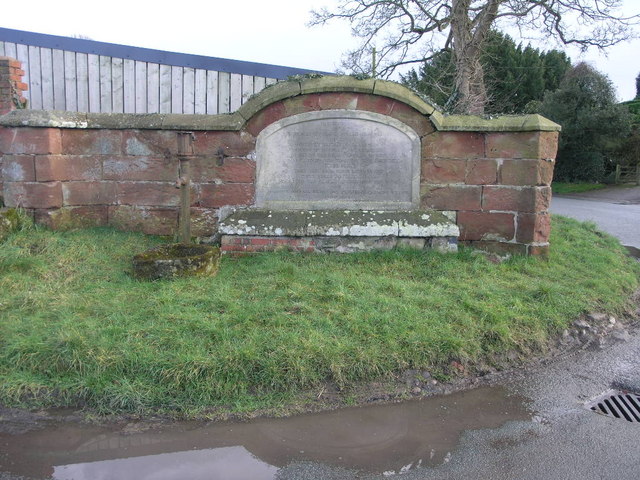
Pim Hill has historical significance as well, with evidence of human habitation dating back to ancient times. Archaeological discoveries indicate that the area was once occupied by Celtic tribes and later influenced by Roman settlement. The hill is also dotted with remnants of old quarries, which were once a source of sandstone for local construction.

Overall, Pim Hill is a beautiful and culturally rich natural landmark, offering both recreational opportunities and a glimpse into the region's history.

If you have any feedback on the listing, please let us know in the comments section below.

Pim Hill Images

Images are sourced within 2km of 52.785699/-2.7621348 or Grid Reference SJ4821. Thanks to Geograph Open Source API. All images are credited.

Mast on the hilltop above Webscott The stile is now redundant but the woodland edge gives a view to the mast on the crown of this little hillock.
Mast on the hilltop above Webscott
The stile is now redundant but the woodland edge gives a view to the mast on the crown of this little hillock.
The Nest, Webscott This lovely individual residence is called 'The Nest' and seems to have always been someone's pride and joy. It's built into or abutting the rockface behind it and its elevated position gives it pleasant south facing views. It seems to have been extended but maybe started out as a quarry manager's cottage? Who knows?
The Nest, Webscott
This lovely individual residence is called 'The Nest' and seems to have always been someone's pride and joy. It's built into or abutting the rockface behind it and its elevated position gives it pleasant south facing views. It seems to have been extended but maybe started out as a quarry manager's cottage? Who knows?
Rock cut path below 'The Nest', Webscott This access path has been quarried from the solid sandstone. Nice.
Rock cut path below 'The Nest', Webscott
This access path has been quarried from the solid sandstone. Nice.
Part of Merrington Lane between Webscott and Merrington A long, direct but slightly winding lane running between the two old villages.
Part of Merrington Lane between Webscott and Merrington
A long, direct but slightly winding lane running between the two old villages.
Farm building at Merrington Lane Farm, near Merrington I wonder if this building is still used as intended? I don't recall seeing another single structure like this one.
Farm building at Merrington Lane Farm, near Merrington
I wonder if this building is still used as intended? I don't recall seeing another single structure like this one.
The old village pump, Merrington The pump handle has long since disappeared but the pump still stands here on a junction.
The old village pump, Merrington
The pump handle has long since disappeared but the pump still stands here on a junction.
Stone plaque at Merrington village pump Worded from an era very different to the present era it reads;
                  'To the memory of
         Robert Aglionby Slaney and Elizabth Slaney
                      his wife
            Formerly Elizabeth Muckleton
          heiress of Walford and Merrington
      The first of their many efforts to benefit 
      their neighbours was to cause this deep well 
                     to be sunk.
           They rest from their labours and
             their works do follow them.
       This pump was placed to complete the work
                         by
   Thomas Campbell Eyton and Elizabeth Frances Eyton
                     June 1864'.
A time when even access to clean water was of vital importance to the locals. Something that present generations take absolutely for granted.
Stone plaque at Merrington village pump
Worded from an era very different to the present era it reads; 'To the memory of Robert Aglionby Slaney and Elizabth Slaney his wife Formerly Elizabeth Muckleton heiress of Walford and Merrington The first of their many efforts to benefit their neighbours was to cause this deep well to be sunk. They rest from their labours and their works do follow them. This pump was placed to complete the work by Thomas Campbell Eyton and Elizabeth Frances Eyton June 1864'. A time when even access to clean water was of vital importance to the locals. Something that present generations take absolutely for granted.
Wooden viewing stage over a pool in Merrington I think it may be for fishing or just viewing the pool and its wildlife.
Wooden viewing stage over a pool in Merrington
I think it may be for fishing or just viewing the pool and its wildlife.
Roadside strip, Shotton Lane A narrow holly rich woodland.
Roadside strip, Shotton Lane
A narrow holly rich woodland.
Shotton Lane South of Harmer Hill.
Shotton Lane
South of Harmer Hill.
Wall, Shotton Hall Dressed Permian sandstone block.
Wall, Shotton Hall
Dressed Permian sandstone block.
Newton Meadows Cottages from B5476
B5476 approaching Harmer Hill
Approaching A528 at Harmer Hill
Premier Inn at Harmer Hill
Crossroads north of Shawell Cottages
View northwards from a lay-by beside the Shrewsbury to Ellesmere road A view towards Ellesmere near Pim Hill. 

The tree caught my eye - the one that looks like a Grand National jockey and his horse about to leap a fence.
View northwards from a lay-by beside the Shrewsbury to Ellesmere road
A view towards Ellesmere near Pim Hill. The tree caught my eye - the one that looks like a Grand National jockey and his horse about to leap a fence.
On the Shrewsbury to Ellesmere road near Pim Hill Is it just me, or does this tree resemble a human form? I see a jockey complete with hat and his mount's neck curving in front of him.
On the Shrewsbury to Ellesmere road near Pim Hill
Is it just me, or does this tree resemble a human form? I see a jockey complete with hat and his mount's neck curving in front of him.
Show me another place!

Pim Hill is located at Grid Ref: SJ4821 (Lat: 52.785699, Lng: -2.7621348)

Unitary Authority: Shropshire

Police Authority: West Mercia

What 3 Words

///fools.newsstand.develops. Near Clive, Shropshire

Nearby Locations

Pim Hill

Related Wikis

Harmer Hill

Harmer Hill is a village in Shropshire, England located on the A528 south of Wem and north of Shrewsbury. The name Harmer comes from the two words "hare...

Merrington, Shropshire

Merrington is a small village in Shropshire, England. It is situated to the north of the larger village of Bomere Heath and lies in the parish of Pimhill...

St Martin's Church, Preston Gubbals

St Martin's Church is a redundant Anglican church in the village of Preston Gubbals, Shropshire, England. It is recorded in the National Heritage List...

Preston Gubbals

Preston Gubbalds is a small village and former civil parish, now in the parish of Pimhill, in the Shropshire district, in the ceremonial county of Shropshire...

Nearby Amenities

Located within 500m of 52.785699,-2.7621348
Pim Hill
Ele: 163
Natural: peak
Lat/Long: 52.7859164/-2.7621023
Foot: designated
Ford: yes
Lat/Long: 52.785517/-2.7686788
Power: pole
Lat/Long: 52.7846971/-2.7555542
Power: pole
Lat/Long: 52.7850502/-2.7556429
Pimhill Farm Shop
Addr Housename: Pimhill Farm Shop
Organic: only
Shop: farm
Lat/Long: 52.7856954/-2.7550653
The data included in this document is from www.openstreetmap.org. The data is made available under ODbL.

Have you been to Pim Hill?

Leave your review of Pim Hill below (or comments, questions and feedback).