Hill of Cat
Hill, Mountain in Angus
Scotland
Hill of Cat

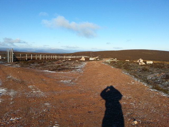
The Hill of Cat is a prominent hill located in the Angus region of Scotland. With an elevation of 592 meters (1,942 feet), it is considered a significant landmark in the area. The hill is situated near the village of Glen Doll and is part of the Grampian Mountains.
The Hill of Cat offers breathtaking views of the surrounding landscape, including the beautiful Glen Doll Forest, which is home to a diverse range of flora and fauna. The hill is known for its rugged terrain, with steep slopes and rocky outcrops, making it a popular destination for hillwalkers and outdoor enthusiasts.
At the summit of the Hill of Cat, there is a trig point, a concrete pillar used in geodetic surveys, which marks the highest point of the hill. On clear days, visitors can enjoy panoramic views of the Angus Glens, the Cairngorms National Park, and even glimpses of the North Sea in the distance.
The Hill of Cat is also a haven for wildlife, with sightings of red deer, mountain hares, and various bird species being common. The hill is particularly renowned for its population of golden eagles, which can often be spotted soaring in the skies above.
Access to the Hill of Cat is relatively straightforward, with several well-marked paths leading to the summit. However, due to the steep nature of the terrain, it is recommended that visitors have a reasonable level of fitness and wear appropriate footwear. Overall, the Hill of Cat offers a challenging yet rewarding experience for those seeking to explore the natural beauty of the Angus region.
If you have any feedback on the listing, please let us know in the comments section below.
Hill of Cat Images
Images are sourced within 2km of 56.972839/-2.8490922 or Grid Reference NO4887. Thanks to Geograph Open Source API. All images are credited.


Hill of Cat is located at Grid Ref: NO4887 (Lat: 56.972839, Lng: -2.8490922)
Unitary Authority: Angus
Police Authority: Tayside
What 3 Words
///remains.tweaked.aced. Near Aboyne, Aberdeenshire
Nearby Locations
Related Wikis
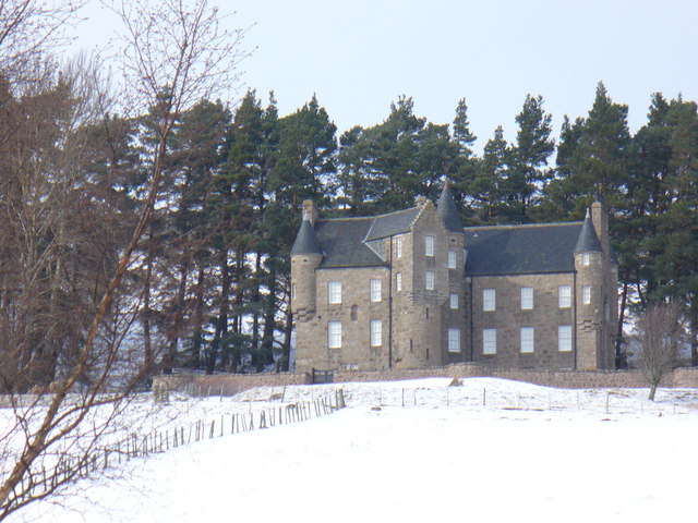
Birse Castle
Birse Castle is located in the Forest of Birse, Aberdeenshire, Scotland. Originally a square tower house, it was rebuilt in the first decade of the 20th...

Forest of Birse
The Forest of Birse is a remote upland area in the upper catchment of the Water of Feugh, which forms the south-western portion of the Parish of Birse...

Mount Battock
Mount Battock (778 m) is a mountain in the Mounth on the eastern edge of the Scottish Highlands, on the border between Aberdeenshire and Angus. A rounded...

Glen Mark
Glen Mark is a glen in northern Angus, eastern Scotland, through which the Water of Mark flows. Near the mouth of the glen, at Auchronie, the Water of...

Mount Keen
Mount Keen (Scottish Gaelic: Monadh Caoin) is a 939-metre-high (3,081 ft) mountain in Scotland and the most easterly Munro. It can be accessed from several...

Tarfside
Tarfside is a small hamlet in Angus, Scotland. It is situated in Glen Esk, on the upper course of the River North Esk, around 8 miles north of Edzell,...

Invermark Castle
Invermark Castle is an oblong tower house dating from the 16th century, at the east of Loch Lee, Angus, Scotland. It is near the head of Glen Esk. ��2...

Invermark Lodge
Invermark Lodge is a hunting lodge which was built near Invermark Castle in 1852 for John Ramsay, 13th Earl of Dalhousie. It is now a listed building...
Nearby Amenities
Located within 500m of 56.972839,-2.8490922Have you been to Hill of Cat?
Leave your review of Hill of Cat below (or comments, questions and feedback).