Llanishen Hill

Hill, Mountain in Monmouthshire

Wales

Llanishen Hill

Sunrise over Ty-mawr Seen on the way to the office in Bristol.
Sunrise over Ty-mawr Credit: Philip Pankhurst

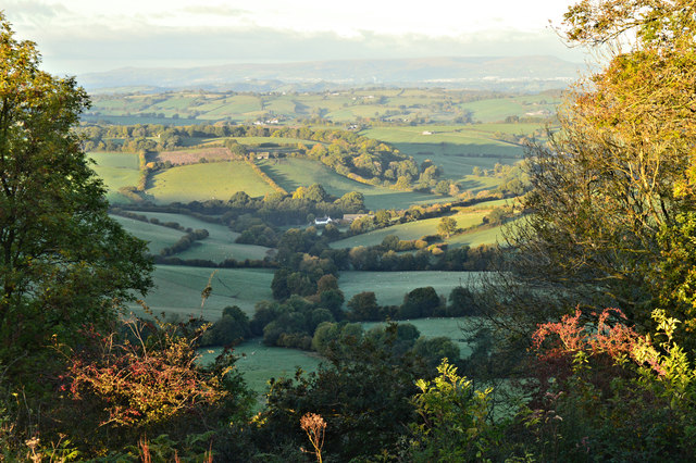
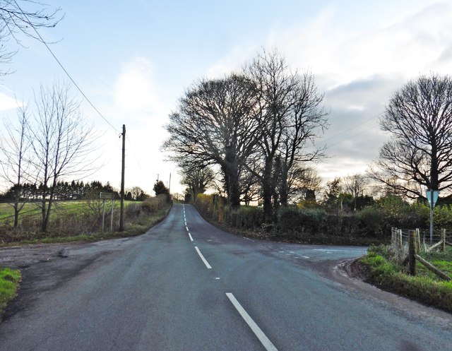
Llanishen Hill is a prominent hill located in Monmouthshire, Wales. Rising 400 feet above sea level, it offers breathtaking panoramic views of the surrounding countryside and is a popular destination for walkers, hikers, and nature enthusiasts.

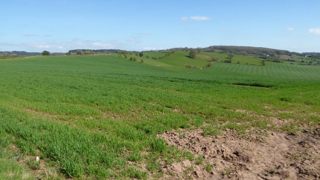
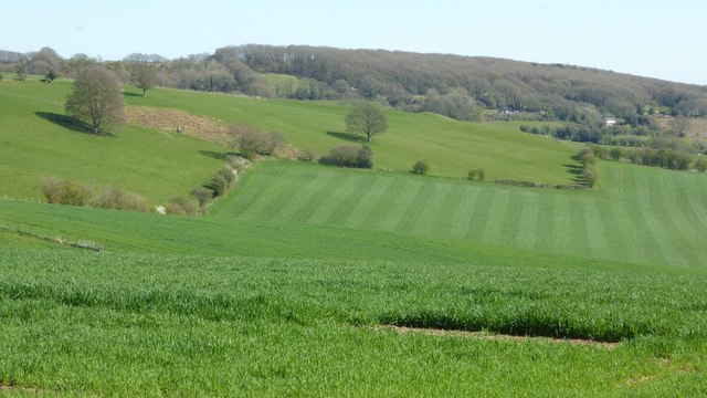
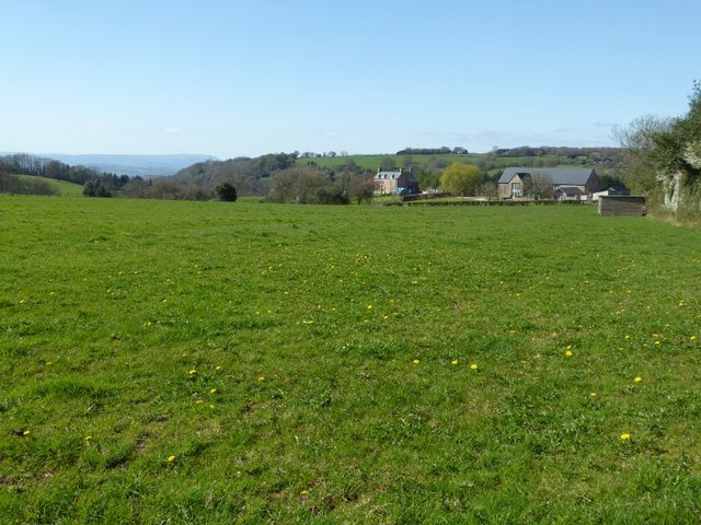
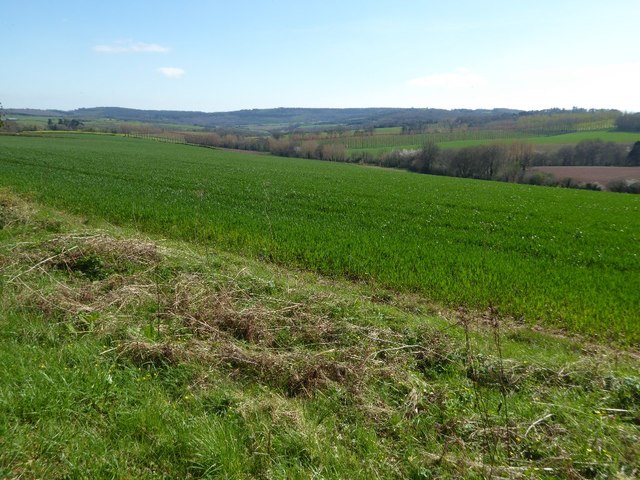
Situated near the village of Llanishen, the hill is characterized by its rolling green slopes and diverse wildlife. The area is known for its rich biodiversity, with a variety of plant and animal species calling it home. The hill is covered in lush grasslands, scattered with patches of woodland, and dotted with wildflowers during the summer months.

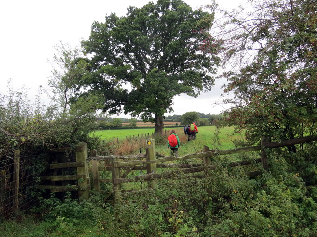
Llanishen Hill is crisscrossed by a network of footpaths and trails, allowing visitors to explore its natural beauty at their own pace. The hill's summit provides a vantage point from which one can enjoy stunning views of the nearby Wye Valley, the Brecon Beacons National Park, and even as far as the Black Mountains on a clear day.

In addition to its natural attractions, Llanishen Hill also holds historical significance. The remains of an Iron Age hillfort can be found on its slopes, providing evidence of human habitation dating back thousands of years. This archaeological site serves as a reminder of the area's ancient past and adds to the hill's allure.

Overall, Llanishen Hill is a picturesque and historically significant destination in Monmouthshire. Its combination of natural beauty, wildlife, and historical remains make it a must-visit location for those seeking outdoor adventures or a peaceful escape surrounded by nature.

If you have any feedback on the listing, please let us know in the comments section below.

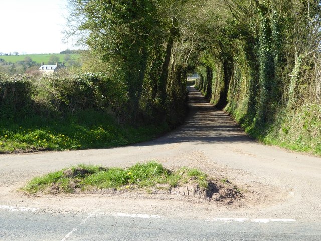
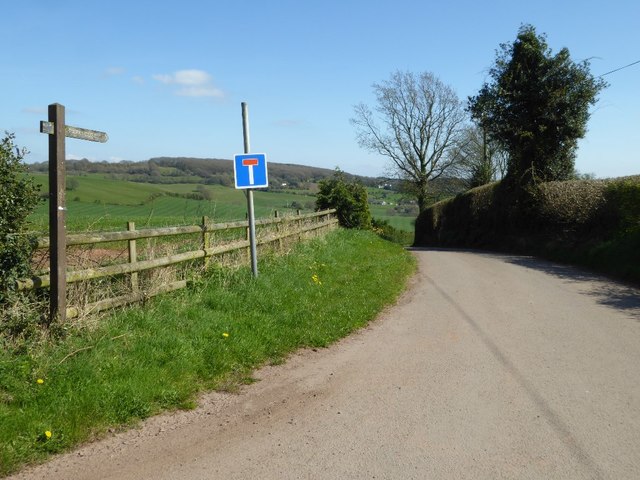
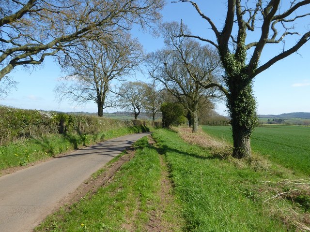
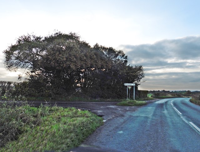
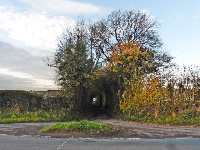
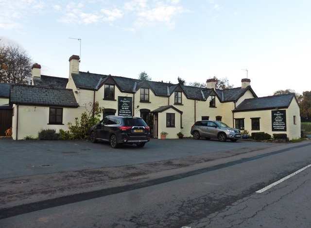
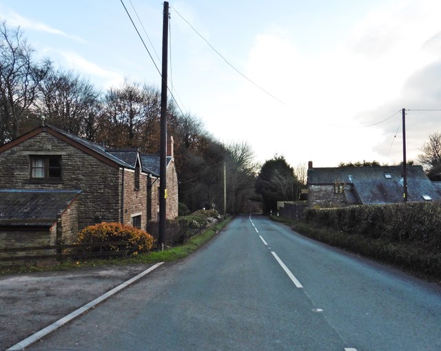
Llanishen Hill Images

Images are sourced within 2km of 51.723353/-2.7581341 or Grid Reference SO4703. Thanks to Geograph Open Source API. All images are credited.

Sunrise over Ty-mawr Seen on the way to the office in Bristol.
Sunrise over Ty-mawr
Seen on the way to the office in Bristol.
Arable land near Hygga Arable land north of Hygga near Llanishen.
Arable land near Hygga
Arable land north of Hygga near Llanishen.
Farmland near Llanishen Farmland to the north-east of Llanishen viewed from the B4293.  On the high ground to the left the OS map indicates it was the site of a hill fort.  The field in the centre with the stripes like a lawn has probably either just been rolled or been chain harrowed.
Farmland near Llanishen
Farmland to the north-east of Llanishen viewed from the B4293. On the high ground to the left the OS map indicates it was the site of a hill fort. The field in the centre with the stripes like a lawn has probably either just been rolled or been chain harrowed.
View to Pant-glâs View to Pant-glâs from the B4293.
View to Pant-glâs
View to Pant-glâs from the B4293.
Road to Pant-glâs Road off the B4293 to Pant-glâs.
Road to Pant-glâs
Road off the B4293 to Pant-glâs.
Road to Hygga No through road giving access to Hygga.
Road to Hygga
No through road giving access to Hygga.
Tree-lined road Tree-lined road between and Llanishen and Trelleck Grange.
Tree-lined road
Tree-lined road between and Llanishen and Trelleck Grange.
Arable land near Trelleck Grange Arable land between Trelleck Grange and Llanishen.
Arable land near Trelleck Grange
Arable land between Trelleck Grange and Llanishen.
Turning for Cross Lane
Lane to Pant-glas
Lane to Pant-glas
The Carpenters Arms, Llanishen
The B4293 on Star Hill
Turning for Raglan
Turning for Raglan
I gyfeiriad Pantglas / In the direction of Pantglas Cerddwyr yn dilyn llwybr cyhoeddus ger anhedd-dy o'r enw Pantglas.

Walkers following a public footpath near a property known as Pantglas (trans. green hollow).
I gyfeiriad Pantglas / In the direction of Pantglas
Cerddwyr yn dilyn llwybr cyhoeddus ger anhedd-dy o'r enw Pantglas. Walkers following a public footpath near a property known as Pantglas (trans. green hollow).
Tuag at Ffarm Hygga / Towards Hygga Farm Cerddwyr yn agosau at Ffarm Hygga.

Walkers approaching Hygga Farm.
Tuag at Ffarm Hygga / Towards Hygga Farm
Cerddwyr yn agosau at Ffarm Hygga. Walkers approaching Hygga Farm.
Ger Ffarm Hygga / Near Hygga Farm Cerddwyr yn dilyn llwybr ceffyl ger Ffarm Hygga.


Walkers following a bridleway near Hygga Farm.
Ger Ffarm Hygga / Near Hygga Farm
Cerddwyr yn dilyn llwybr ceffyl ger Ffarm Hygga. Walkers following a bridleway near Hygga Farm.
Dilyn trac gwlyb / Following a wet track Cerddwyr yn dilyn llwybr ceffyl gwlyb.


Walkers following a wet bridleway.
Dilyn trac gwlyb / Following a wet track
Cerddwyr yn dilyn llwybr ceffyl gwlyb. Walkers following a wet bridleway.
The Carpenters Arms, Llanishen Free House and restaurant beside the B4293 at Llanishen
The Carpenters Arms, Llanishen
Free House and restaurant beside the B4293 at Llanishen
Show me another place!

Llanishen Hill is located at Grid Ref: SO4703 (Lat: 51.723353, Lng: -2.7581341)

Unitary Authority: Monmouthshire

Police Authority: Gwent

What 3 Words

///carry.types.array. Near Tintern, Monmouthshire

Related Wikis

Llanishen, Monmouthshire

Llanishen (Welsh: Llanisien) is a village in Monmouthshire, southeast Wales, United Kingdom. It is located 7 miles (11 km) southwest of Monmouth and 3...

Hygga House Dovecote, Trellech

The Dovecote, Hygga, Trellech, Monmouthshire is a late 16th-century dovecote, in an unusually complete state of preservation. Part of the service buildings...

Cross at Croes Llwyd Farm, Raglan

The Cross at Croes Llwyd Farm, Raglan, Monmouthshire is a medieval cross which indicated a boundary of the Lordship of Raglan. As a rare medieval survival...

Pant-glas Farmhouse, Llanishen, Monmouthshire

Pant-glas Farmhouse and its associated barn at Llanishen, Trellech, Monmouthshire date from the early 16th and 17th centuries respectively and are both...

Nearby Amenities

Located within 500m of 51.723353,-2.7581341
Llanishen
Is In: Monmouthshire
Name Cy: Llanisien
Place: village
Source: NPE
Source Name: Wikipedia
Wikidata: Q6661628
Lat/Long: 51.7258964/-2.7607648
Direction: 215
Generator Method: photovoltaic
Generator Output Electricity: yes
Generator Solar Modules: 6
Generator Source: solar
Generator Type: solar_photovoltaic_panel
Location: roof
Power: generator
Lat/Long: 51.7221343/-2.760665
Direction: 215
Generator Method: photovoltaic
Generator Output Electricity: yes
Generator Solar Modules: 8
Generator Source: solar
Generator Type: solar_photovoltaic_panel
Location: roof
Power: generator
Lat/Long: 51.7221119/-2.760608
Direction: 145
Generator Method: photovoltaic
Generator Output Electricity: yes
Generator Solar Modules: 10
Generator Source: solar
Generator Type: solar_photovoltaic_panel
Location: roof
Power: generator
Lat/Long: 51.724757/-2.7578151
Direction: SW
Generator Method: photovoltaic
Generator Output Electricity: yes
Generator Solar Modules: 16
Generator Source: solar
Generator Type: solar_photovoltaic_panel
Location: roof
Power: generator
Lat/Long: 51.7256475/-2.7556479
Direction: 125
Generator Method: photovoltaic
Generator Output Electricity: yes
Generator Solar Modules: 16
Generator Source: solar
Generator Type: solar_photovoltaic_panel
Location: roof
Power: generator
Lat/Long: 51.7253368/-2.7568737
Direction: 95
Generator Method: photovoltaic
Generator Output Electricity: yes
Generator Solar Modules: 8
Generator Source: solar
Generator Type: solar_photovoltaic_panel
Location: roof
Power: generator
Lat/Long: 51.725061/-2.7574262
Direction: S
Generator Method: photovoltaic
Generator Output Electricity: yes
Generator Solar Modules: 8
Generator Source: solar
Generator Type: solar_photovoltaic_panel
Location: roof
Power: generator
Lat/Long: 51.724958/-2.7593467
Direction: SW
Generator Method: photovoltaic
Generator Output Electricity: yes
Generator Solar Modules: 6
Generator Source: solar
Generator Type: solar_photovoltaic_panel
Location: roof
Power: generator
Lat/Long: 51.7258934/-2.762859
Direction: SW
Generator Method: photovoltaic
Generator Output Electricity: yes
Generator Solar Modules: 8
Generator Source: solar
Generator Type: solar_photovoltaic_panel
Location: roof
Power: generator
Lat/Long: 51.7259782/-2.7631272
Direction: SW
Generator Method: photovoltaic
Generator Output Electricity: yes
Generator Solar Modules: 8
Generator Source: solar
Generator Type: solar_photovoltaic_panel
Location: roof
Power: generator
Lat/Long: 51.7261634/-2.7634987
Direction: SW
Generator Method: photovoltaic
Generator Output Electricity: yes
Generator Solar Modules: 4
Generator Source: solar
Generator Type: solar_photovoltaic_panel
Location: roof
Power: generator
Lat/Long: 51.7262498/-2.7636234
Direction: SW
Generator Method: photovoltaic
Generator Output Electricity: yes
Generator Solar Modules: 2
Generator Source: solar
Generator Type: solar_photovoltaic_panel
Location: roof
Power: generator
Lat/Long: 51.7261821/-2.7635306
The data included in this document is from www.openstreetmap.org. The data is made available under ODbL.

Have you been to Llanishen Hill?

Leave your review of Llanishen Hill below (or comments, questions and feedback).