Rye Hill

Hill, Mountain in Cumberland Eden

England

Rye Hill

Petterilbank Bridge and ford Why is the deep, rough ford still in use? There's a perfectly good bridge to the side.
Petterilbank Bridge and ford Credit: Andrew Smith

Rye Hill is a prominent hill located in the county of Cumberland, England. It is part of the Lake District National Park, a renowned area of natural beauty. With an elevation of 596 meters (1,955 feet), Rye Hill is classified as a mountain and provides panoramic views of the surrounding landscape.

The hill is situated near the village of Wasdale Head, which lies in the valley of Wasdale, home to England's deepest lake, Wastwater. Rye Hill is a popular destination for hikers and climbers due to its challenging terrain and breathtaking vistas. The ascent to the summit can be accomplished by various routes, each offering a different level of difficulty.

The hill's terrain is characterized by rugged slopes, rocky outcrops, and steep gradients. The summit of Rye Hill is marked by a cairn, a man-made pile of stones used as a navigational aid. On clear days, the views from the top extend across the surrounding fells, including Scafell Pike, the highest peak in England.

The area surrounding Rye Hill is rich in wildlife, with a diverse range of flora and fauna. Visitors may encounter species such as red deer, mountain goats, and various birds of prey. The surrounding valleys also offer opportunities for fishing, boating, and other outdoor activities.

Rye Hill is a notable landmark within the Lake District, attracting outdoor enthusiasts and nature lovers from near and far. Its natural beauty, challenging terrain, and stunning views make it a must-visit destination for those exploring the region.

If you have any feedback on the listing, please let us know in the comments section below.
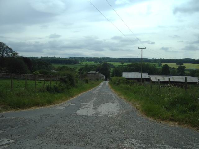
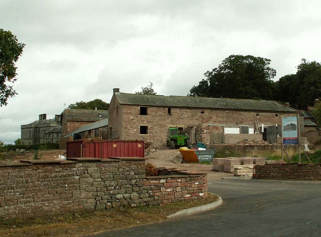
Rye Hill Images

Images are sourced within 2km of 54.770448/-2.8232451 or Grid Reference NY4742. Thanks to Geograph Open Source API. All images are credited.

Petterilbank Bridge and ford Why is the deep, rough ford still in use? There's a perfectly good bridge to the side.
Petterilbank Bridge and ford
Why is the deep, rough ford still in use? There's a perfectly good bridge to the side.
A6 junction This minor road on the east side of the A6 goes to Lazonby
A6 junction
This minor road on the east side of the A6 goes to Lazonby
Calthwaite Bridge Road bridge spanning the River Petteril
Calthwaite Bridge
Road bridge spanning the River Petteril
All Saints Church, Calthwaite, In the Parish of Hesket-in-the-Forest
Road junction The side road off the Calthwaite to Burthwaite road drops down through the trees, under the M6 and then on to High Hesket
Road junction
The side road off the Calthwaite to Burthwaite road drops down through the trees, under the M6 and then on to High Hesket
The Elephant The 1940 map tells us that it was once the Elephant Inn, there is no sign of that today, in fact it has the look of a well to do farmhouse.
The Elephant
The 1940 map tells us that it was once the Elephant Inn, there is no sign of that today, in fact it has the look of a well to do farmhouse.
Entrance to Petteril Grange
M6 Taken from the bridge on the access road to Wood Oaks Mill looking NW
M6
Taken from the bridge on the access road to Wood Oaks Mill looking NW
The Road to Petteril Green
The Road to Troughfoot
Blackrack Bridge There are two Blackrack Bridges over the Blackrack Beck, this is the one on the A6
Blackrack Bridge
There are two Blackrack Bridges over the Blackrack Beck, this is the one on the A6
Shops I would say that this building has been converted from a garage/car showroom because with the coming of the M6, passing trade would have disappeared.
Shops
I would say that this building has been converted from a garage/car showroom because with the coming of the M6, passing trade would have disappeared.
Harrington Ling Farm
Milk Churn Stand Milk stand at the entrance to Ling House
Milk Churn Stand
Milk stand at the entrance to Ling House
Ling House
Ling House
The Globe Inn, Calthwaite
Calthwaite Hall Lodge
Calthwaite - barn conversion in progress The grey building (rear left) is Calthwaite Hall, a Gothic mansion built in the 1830's.
Calthwaite - barn conversion in progress
The grey building (rear left) is Calthwaite Hall, a Gothic mansion built in the 1830's.
Show me another place!

Rye Hill is located at Grid Ref: NY4742 (Lat: 54.770448, Lng: -2.8232451)

Administrative County: Cumbria

District: Eden

Police Authority: Cumbria

What 3 Words

///sprains.sentences.submerge. Near Penrith, Cumbria

Related Wikis

Hesket, Cumbria

Hesket (also Hesket-in-the-Forest) is a large civil parish in the Eden District of Cumbria, England, on the main A6 between Carlisle and Penrith. At the...

Calthwaite railway station

Calthwaite railway station in Hesket parish, was situated on the Lancaster and Carlisle Railway (the West Coast Main Line) between Carlisle and Penrith...
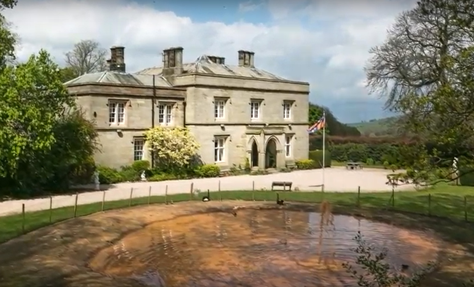
Calthwaite Hall

Calthwaite Hall, near Penrith in Cumbria, England, is a house of historical significance and is Grade II listed on the National Heritage List for England...

Calthwaite

Calthwaite is a small village in rural Cumbria, England, situated between the small market town of Penrith and the larger city of Carlisle. It is within...

Nearby Amenities

Located within 500m of 54.770448,-2.8232451
Petterill Green
Place: hamlet
Lat/Long: 54.7726512/-2.8166735
Power: pole
Lat/Long: 54.7700054/-2.8299309
Power: pole
Lat/Long: 54.7672105/-2.818797
Power: pole
Lat/Long: 54.7671393/-2.8202564
The data included in this document is from www.openstreetmap.org. The data is made available under ODbL.

Have you been to Rye Hill?

Leave your review of Rye Hill below (or comments, questions and feedback).