Pisgah Hill
Hill, Mountain in Roxburghshire
Scotland
Pisgah Hill

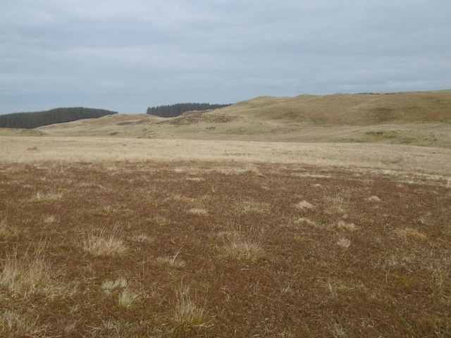
Pisgah Hill is a prominent hill located in the Scottish county of Roxburghshire. Standing at an elevation of 618 meters (2028 feet), it offers stunning panoramic views of the surrounding countryside and the Cheviot Hills to the south. The hill is a popular destination for hikers, offering a challenging but rewarding climb with well-maintained walking paths leading to the summit.
Pisgah Hill is known for its diverse flora and fauna, with heather-covered slopes, mature woodlands, and open grasslands providing habitats for a variety of wildlife species. Birdwatchers may be able to spot buzzards, kestrels, and other birds of prey soaring overhead, while lucky visitors may catch a glimpse of red squirrels or roe deer in the surrounding forests.
The hill is steeped in history, with ancient hill forts and burial mounds scattered throughout the area, offering a glimpse into the region's past. Visitors to Pisgah Hill can explore these archaeological sites while enjoying the natural beauty of the Scottish countryside. Overall, Pisgah Hill is a must-visit destination for outdoor enthusiasts and history buffs alike.
If you have any feedback on the listing, please let us know in the comments section below.
Pisgah Hill Images
Images are sourced within 2km of 55.439542/-2.8572883 or Grid Reference NT4516. Thanks to Geograph Open Source API. All images are credited.


Pisgah Hill is located at Grid Ref: NT4516 (Lat: 55.439542, Lng: -2.8572883)
Unitary Authority: The Scottish Borders
Police Authority: The Lothians and Scottish Borders
What 3 Words
///spike.impressed.turkeys. Near Hawick, Scottish Borders
Nearby Locations
Related Wikis

Harden Castle
Harden Castle is a 16th century tower house, about 3.5 miles (5.6 km) west of Hawick, Scottish Borders. It is alternatively known as Harden House or Harden...

Borthwick Water
The Borthwick Water (Border Scots: Borthwick Witter) is a river in the Scottish Borders area of Scotland, and a tributary of the River Teviot. The Aithouse...

Roberton, Scottish Borders
Roberton is a small village in the Scottish Borders area of Scotland, on the B711 and near to the A7, 5 miles (8 kilometres) from Hawick, 22 mi (35 km...
Wilton Dean
Wilton Dean is a village in the Scottish Borders area of Scotland, on the Cala Burn, and close to the River Teviot. Along with Stirches and...
Nearby Amenities
Located within 500m of 55.439542,-2.8572883Have you been to Pisgah Hill?
Leave your review of Pisgah Hill below (or comments, questions and feedback).