Hartside Hill
Hill, Mountain in Berwickshire
Scotland
Hartside Hill
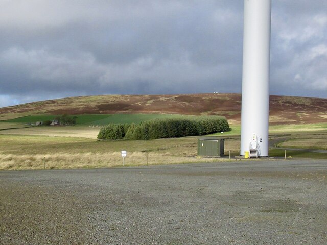
Hartside Hill is a prominent natural feature located in Berwickshire, Scotland. Situated in the southeastern part of the country, it is a notable hill that forms part of the wider Cheviot Hills range. With an elevation of approximately 450 meters (1,480 feet), Hartside Hill offers breathtaking panoramic views of the surrounding landscape.
The hill is predominantly covered in heather and grass, giving it a picturesque appearance, especially during the summer months when the hills are dotted with vibrant wildflowers. Its slopes are gently undulating, making it a relatively easy hike for outdoor enthusiasts of all levels.
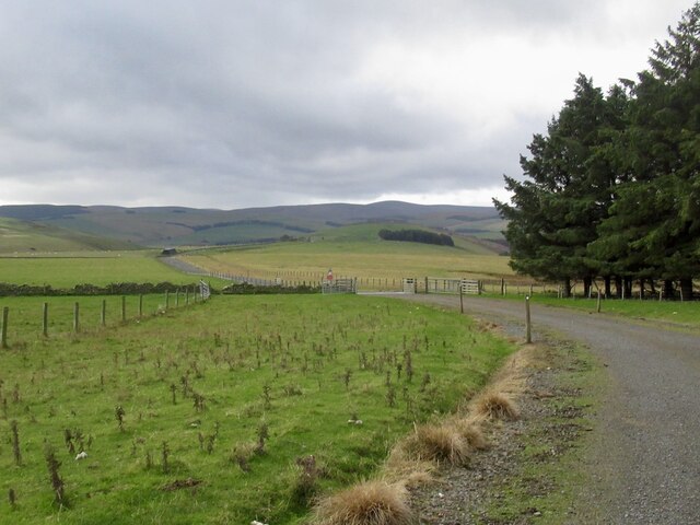
Hartside Hill is a popular destination for walkers and hikers who are drawn to its natural beauty and the opportunity to explore the surrounding area. The gentle slopes and well-defined paths make it an ideal location for those seeking a leisurely stroll or a more challenging hike.
The hill is also home to a diverse range of wildlife, including various species of birds, mammals, and insects. Nature enthusiasts can spot birds of prey such as buzzards and kestrels soaring above, while occasional sightings of deer and rabbits add to the charm of the area.
Accessible from nearby villages and towns, Hartside Hill offers visitors a chance to immerse themselves in the tranquility of the countryside. Whether it's a peaceful walk, a family picnic, or simply enjoying the stunning views, Hartside Hill is a destination that appeals to both nature lovers and those seeking a break from the hustle and bustle of everyday life.
If you have any feedback on the listing, please let us know in the comments section below.
Hartside Hill Images
Images are sourced within 2km of 55.778702/-2.8816847 or Grid Reference NT4454. Thanks to Geograph Open Source API. All images are credited.

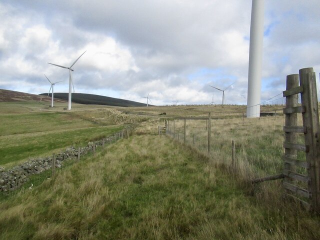
![Forestry on Hartside Hill With turbines of the Toddleburn [R] and Dun Law [L] Wind Farms. Lauderdale is in the distance.](https://s3.geograph.org.uk/geophotos/05/61/42/5614227_0bbed7e8.jpg)


Hartside Hill is located at Grid Ref: NT4454 (Lat: 55.778702, Lng: -2.8816847)
Unitary Authority: The Scottish Borders
Police Authority: The Lothians and Scottish Borders
What 3 Words
///tilt.golden.haunts. Near Lauder, Scottish Borders
Nearby Locations
Related Wikis

Channelkirk
Channelkirk is a parish and community council area in the north-west corner of the historic county of Berwickshire in the Scottish Borders area of Scotland...

Halltree
Halltree is a hamlet in the Scottish Borders. == Etymology == The etymology of Halltree is debated, but the second element is likely to be a Cumbric word...

Soutra Aisle
Soutra Aisle, (the present structure lies just within the boundary of the Scottish Borders from Midlothian) not far from Fala, is the remains of the House...

Borders Railway
The Borders Railway connects the city of Edinburgh with Galashiels and Tweedbank in the Scottish Borders. The railway follows most of the alignment of...
Nearby Amenities
Located within 500m of 55.778702,-2.8816847Have you been to Hartside Hill?
Leave your review of Hartside Hill below (or comments, questions and feedback).