Slai na Gour

Hill, Mountain in Aberdeenshire

Scotland

Slai na Gour

Cairn on a mound At first I thought this was the summit of Creag na Slice with a cairn on it but I still had to ascend 40m to get to the summit.  This cairn is on a slight mound near the edge of the planting in Glen Tanar forest
Cairn on a mound Credit: Liz Gray

Slai na Gour is a prominent hill located in Aberdeenshire, Scotland. Situated in the eastern part of the region, it forms a notable feature of the local landscape. With an elevation of approximately 564 meters (1,850 feet), it is considered a mountain by Scottish standards and offers stunning panoramic views of the surrounding area.

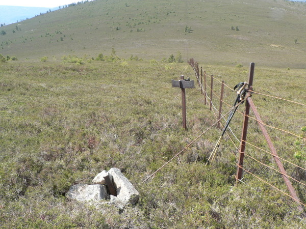
The hill is characterized by its rugged and rocky terrain, which provides a challenging yet rewarding hiking experience for outdoor enthusiasts. Its slopes are covered in heather, grasses, and scattered boulders, creating a picturesque scene throughout the year. The summit of Slai na Gour is often shrouded in mist, adding an air of mystery to the hill.

From the top, visitors can enjoy breathtaking vistas of the Aberdeenshire countryside. On a clear day, the views extend as far as the North Sea, with glimpses of the nearby towns and villages dotting the landscape. The hill is also a haven for wildlife, with various bird species, including golden eagles and peregrine falcons, often spotted soaring above.

Access to Slai na Gour is relatively straightforward, with several well-marked trails leading to the summit. However, caution is advised as the weather conditions can change rapidly, especially during the winter months when the hill may be covered in snow and ice.

Overall, Slai na Gour offers a rewarding outdoor experience for nature lovers and hikers alike. With its stunning views and diverse wildlife, it is a must-visit destination for those exploring the Aberdeenshire region.

If you have any feedback on the listing, please let us know in the comments section below.

Slai na Gour Images

Images are sourced within 2km of 57.045405/-2.9146644 or Grid Reference NO4495. Thanks to Geograph Open Source API. All images are credited.

Cairn on a mound At first I thought this was the summit of Creag na Slice with a cairn on it but I still had to ascend 40m to get to the summit.  This cairn is on a slight mound near the edge of the planting in Glen Tanar forest
Cairn on a mound
At first I thought this was the summit of Creag na Slice with a cairn on it but I still had to ascend 40m to get to the summit. This cairn is on a slight mound near the edge of the planting in Glen Tanar forest
Moorland track The track was not marked on the map I was using, it was mostly a narrow walking track between Black Craig & Craigrae Beg, this is the point where the track widened suggesting it is used by estate vehicles, but it does not appear to be used very often
Moorland track
The track was not marked on the map I was using, it was mostly a narrow walking track between Black Craig & Craigrae Beg, this is the point where the track widened suggesting it is used by estate vehicles, but it does not appear to be used very often
Trig Pillar A trig pillar on the summit of Creag na Slice, at 406m, an unclassified summit on the Glen Tanar estate
Trig Pillar
A trig pillar on the summit of Creag na Slice, at 406m, an unclassified summit on the Glen Tanar estate
A lone tree The high glen between Creag na Slice & Slai na Gour.  On a hot dry day like today there is very little shelter.  A lot of birdsong as I suspect this is a place not bothered by humans very often, and a roe deer sighting.
A lone tree
The high glen between Creag na Slice & Slai na Gour. On a hot dry day like today there is very little shelter. A lot of birdsong as I suspect this is a place not bothered by humans very often, and a roe deer sighting.
A high Glen A wide baren & trackless glen between Creag na Slice & Slai na Gour.  Mount Keen is one of the hills in the background
A high Glen
A wide baren & trackless glen between Creag na Slice & Slai na Gour. Mount Keen is one of the hills in the background
Signpost on a hillside An old metal signpost? with no destination and a boundary fence which makes route finding from Slai na Gour to Glack Craig very easy.  Easy walking on short heather with only a few scattered pine trees.
Signpost on a hillside
An old metal signpost? with no destination and a boundary fence which makes route finding from Slai na Gour to Glack Craig very easy. Easy walking on short heather with only a few scattered pine trees.
Cairn or sculpture An inspired use of rocks & stones on Black Craig.  Black Craig being classified as a Highland 5 summit.
Cairn or sculpture
An inspired use of rocks & stones on Black Craig. Black Craig being classified as a Highland 5 summit.
Slai na Gour Slai na Gour summit cairn at 486m.  Easy walking over short heather on an almost trackless hillside.
Slai na Gour
Slai na Gour summit cairn at 486m. Easy walking over short heather on an almost trackless hillside.
River Dee near Haugh A wide quiet reach of the River Dee.
River Dee near Haugh
A wide quiet reach of the River Dee.
Cottages near Deecastle The maps seem to label this row of cottages as Chapel House.
Cottages near Deecastle
The maps seem to label this row of cottages as Chapel House.
Birch and Bracken Vegetation typical of the open woodlands of Deeside.
Birch and Bracken
Vegetation typical of the open woodlands of Deeside.
Moorland Edge Scrubby vegetation gives way to moorland further up the hill.
Moorland Edge
Scrubby vegetation gives way to moorland further up the hill.
Not Creag na Slice The ridge is an outlier of Creag na Slice, which is out of sight to the left.
Not Creag na Slice
The ridge is an outlier of Creag na Slice, which is out of sight to the left.
Purple Heather This, early in September, is the best time of year to see the heather at its best and most colourful.
Purple Heather
This, early in September, is the best time of year to see the heather at its best and most colourful.
Track by the Water of Tanar The track gives access to the Mounth for deer stalking and grouse shooting.
Track by the Water of Tanar
The track gives access to the Mounth for deer stalking and grouse shooting.
The Glen Tanar track The track gives access to the Mounth for deer stalking and grouse shooting.
The Glen Tanar track
The track gives access to the Mounth for deer stalking and grouse shooting.
Stone slabs in the Water of Tanar
Road up Glen Tanar The pale log under the granny pine is used as a seat and is well polished.
Road up Glen Tanar
The pale log under the granny pine is used as a seat and is well polished.
Show me another place!

Slai na Gour is located at Grid Ref: NO4495 (Lat: 57.045405, Lng: -2.9146644)

Unitary Authority: Aberdeenshire

Police Authority: North East

What 3 Words

///pushy.trackers.transmitted. Near Ballater, Aberdeenshire

Nearby Locations

Slai na Gour

Related Wikis

Dee Castle

Dee Castle was a 15th-century castle, about 5 miles (8.0 km) east of Ballater, Aberdeenshire, Scotland, and south of the River Dee.It may be known alternatively...

Muir of Dinnet

Muir of Dinnet is a national nature reserve (NNR) situated close to the village of Dinnet in Aberdeenshire, Scotland. The reserve extends 1166 hectares...

Glen Tanar

Glen Tanar (Scottish Gaelic: Gleann Tanar) is a glen in Aberdeenshire, eastern Scotland, through which the Water of Tanar flows. Near the mouth of the...

Cambus O'May railway station

Cambus O'May railway station or Cambus O'May Halt, served Aberdeenshire, Scotland from 1876 to 1966 on the Deeside Railway. It was intended to serve the...

Nearby Amenities

Located within 500m of 57.045405,-2.9146644
Slai na Gour
Ele: 486
Natural: peak
Lat/Long: 57.0447017/-2.9152418
The data included in this document is from www.openstreetmap.org. The data is made available under ODbL.

Have you been to Slai na Gour?

Leave your review of Slai na Gour below (or comments, questions and feedback).