Kapleston Hill

Hill, Mountain in Dumfriesshire

Scotland

Kapleston Hill

Trig point, Roan Fell At the southern (not highest) end of the hills large rounded summit area.
Trig point, Roan Fell Credit: Callum Black

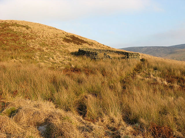
Kapleston Hill, located in Dumfriesshire, Scotland, is a prominent hill that offers breathtaking views of the surrounding countryside. Standing at an elevation of approximately 377 meters (1,237 feet), it is considered to be an excellent destination for hikers and nature enthusiasts.

The hill is characterized by its picturesque landscape, featuring lush greenery, rolling hills, and scattered clusters of trees. Its slopes are covered with a variety of vegetation, including heather, grasses, and wildflowers, which create a vibrant and colorful environment during the warmer months.

The ascent to the summit of Kapleston Hill is relatively moderate, making it accessible to people of various fitness levels. The well-defined paths and trails make navigation easy, ensuring a pleasant and enjoyable hiking experience. Along the way, visitors may encounter various species of birds and other wildlife, adding to the charm and natural beauty of the area.

From the top of Kapleston Hill, one can admire panoramic views of the surrounding countryside, including the nearby towns and villages. On clear days, the hill offers stunning vistas of the rolling hills, distant mountains, and the meandering rivers that snake through the landscape.

Kapleston Hill is a popular destination for outdoor activities such as hiking, picnicking, and birdwatching. Its serene and tranquil atmosphere provides a perfect escape from the hustle and bustle of everyday life, allowing visitors to connect with nature and unwind.

If you have any feedback on the listing, please let us know in the comments section below.

Kapleston Hill Images

Images are sourced within 2km of 55.223856/-2.8756107 or Grid Reference NY4492. Thanks to Geograph Open Source API. All images are credited.

Trig point, Roan Fell At the southern (not highest) end of the hills large rounded summit area.
Trig point, Roan Fell
At the southern (not highest) end of the hills large rounded summit area.
Rough path, Millstone Edge A rough path cuts the corner towards Millstone Edge. The Landrover track is visible in the distance.
Rough path, Millstone Edge
A rough path cuts the corner towards Millstone Edge. The Landrover track is visible in the distance.
"Construction site" Keep out sign on the summit of Roan Fell. Work appears to be underway to stabilise the peat bogs.
"Construction site"
Keep out sign on the summit of Roan Fell. Work appears to be underway to stabilise the peat bogs.
Flooded track Flooded track, presumably as a result of the nearby attempts to stabilise and repair the peat bog.
Flooded track
Flooded track, presumably as a result of the nearby attempts to stabilise and repair the peat bog.
Roan Fell Climbed from road to north passed the pack of hounds at Twislehope and good track to Hartsgarth Fell but then it is a damp trudge to the summit.
Name: Roan Fell
Hill number: 1918
Height: 568m / 1864ft
Area: 28B: The River Tweed to the English Border
Class: Ma,5D
Grid ref: NY 45173 93110
Summit feature: cairn by fence
Drop: 256m
Col: 312m  NY437978
Roan Fell
Climbed from road to north passed the pack of hounds at Twislehope and good track to Hartsgarth Fell but then it is a damp trudge to the summit. Name: Roan Fell Hill number: 1918 Height: 568m / 1864ft Area: 28B: The River Tweed to the English Border Class: Ma,5D Grid ref: NY 45173 93110 Summit feature: cairn by fence Drop: 256m Col: 312m NY437978
Fence extending north from Roan Fell Roan Fell is a moorland hill and a Marilyn. The distant hills are Cauldcleuch Head and Greatmoor Hill.
Fence extending north from Roan Fell
Roan Fell is a moorland hill and a Marilyn. The distant hills are Cauldcleuch Head and Greatmoor Hill.
Heather moorland with trig point of Roan Fell Although this triangulation column is known to the OS as Roan Fell it's some distance from the summit of that hill; there's even intervening higher ground at Millstone Edge between the two locations. The view beyond the pillar is generally to the north-west.
Heather moorland with trig point of Roan Fell
Although this triangulation column is known to the OS as Roan Fell it's some distance from the summit of that hill; there's even intervening higher ground at Millstone Edge between the two locations. The view beyond the pillar is generally to the north-west.
Summit of Roan Fell Sandstone hill with big bogs and many midges...
Summit of Roan Fell
Sandstone hill with big bogs and many midges...
A fence on Hartsgarth Fell Fine January weather on this high moorland hill.
A fence on Hartsgarth Fell
Fine January weather on this high moorland hill.
Grain Head On high moorland in lovely winter conditions looking over Grain Head towards Wetherhorn Hill and Cockplay Hill.
Grain Head
On high moorland in lovely winter conditions looking over Grain Head towards Wetherhorn Hill and Cockplay Hill.
Rough grazing on Watch Hill Rough grazing to the northeast of the summit for some sheep and feral goats. The conical hill on the skyline centre left is Comb Hill.
Rough grazing on Watch Hill
Rough grazing to the northeast of the summit for some sheep and feral goats. The conical hill on the skyline centre left is Comb Hill.
The trig point at Millstone Edge At 560m with a flush bracket number S7990. The true summit of Millstone Edge is 450m to the northeast of the trig point at 561m.
The trig point at Millstone Edge
At 560m with a flush bracket number S7990. The true summit of Millstone Edge is 450m to the northeast of the trig point at 561m.
Boggy ground at Millstone Edge A wet area with grasses and peathags in this heather moorland terrain, viewed in early September. Dragonflies were out by the small pools.
Boggy ground at Millstone Edge
A wet area with grasses and peathags in this heather moorland terrain, viewed in early September. Dragonflies were out by the small pools.
Roan Fell Flow An area of heather moorland, peathags and rough grazing for hill sheep and feral goats. Viewed from Millstone Edge.
Roan Fell Flow
An area of heather moorland, peathags and rough grazing for hill sheep and feral goats. Viewed from Millstone Edge.
Moorland between Watch Hill and Millstone Edge The fence running towards Millstone Edge in the distance is a district boundary fence. To the left of the fence is Dumfriesshire while to the right is Scottish Borders.
Moorland between Watch Hill and Millstone Edge
The fence running towards Millstone Edge in the distance is a district boundary fence. To the left of the fence is Dumfriesshire while to the right is Scottish Borders.
Grouse moorland at Blackgate Rig
A fence on Millstone Edge Just over 150m to go to the trig point at <a href="https://www.geograph.org.uk/photo/548148">NY4492 : The trig point at Millstone Edge</a>.
A fence on Millstone Edge
Just over 150m to go to the trig point at NY4492 : The trig point at Millstone Edge.
Sheepfold at Mid Height
Show me another place!

Kapleston Hill is located at Grid Ref: NY4492 (Lat: 55.223856, Lng: -2.8756107)

Unitary Authority: Dumfries and Galloway

Police Authority: Dumfries and Galloway

What 3 Words

///tiger.pampered.army. Near Langholm, Dumfries & Galloway

Nearby Locations

Kapleston Hill

Related Wikis

Dinley

Dinley is a hamlet in the Scottish Borders through which Hermitage Water flows. == Etymology == The first element, din, seems to be the Cumbric word for...

Newcastleton railway station

Newcastleton railway station served the village of Newcastleton, Scottish Borders, Scotland from 1862 to 1969 on the Border Union Railway. == History... ==

Unthank, Dumfries and Galloway

Unthank is a village in Dumfries and Galloway, Scotland. == References == The geographic coordinates are from the Ordnance Survey.

Newcastleton

Newcastleton, also called Copshaw Holm, is a village in Liddesdale, the Scottish Borders, a few miles from the border with England, on the Liddel Water...

Nearby Amenities

Located within 500m of 55.223856,-2.8756107
Kaplestone Hill
Place: locality
Lat/Long: 55.2257405/-2.8745553
The data included in this document is from www.openstreetmap.org. The data is made available under ODbL.

Have you been to Kapleston Hill?

Leave your review of Kapleston Hill below (or comments, questions and feedback).