Cockplay Hill

Hill, Mountain in Roxburghshire

Scotland

Cockplay Hill

Rough grazing on Geordie's Hill This is near the summit of the hill looking over to Stob Fell.
Rough grazing on Geordie's Hill Credit: Walter Baxter

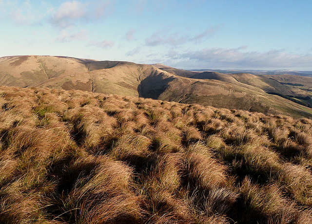
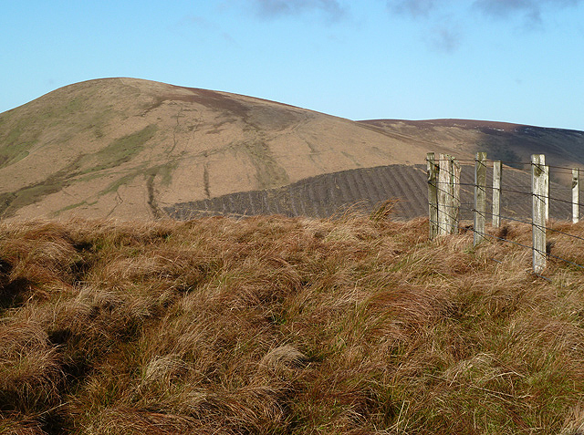
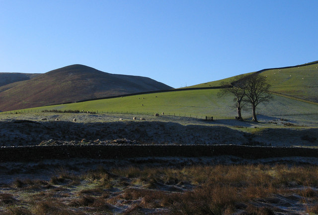
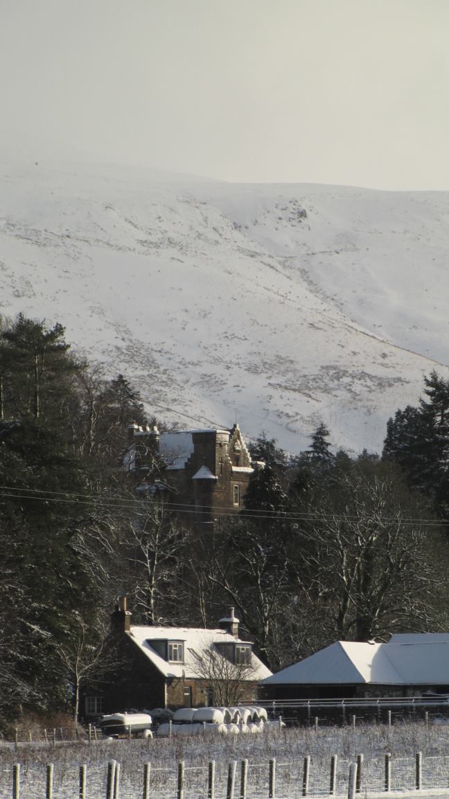
Cockplay Hill, located in Roxburghshire, Scotland, is a prominent hill/mountain that stands at an elevation of 375 meters (1,230 feet) above sea level. Situated near the village of Newcastleton, it is a popular destination for outdoor enthusiasts, nature lovers, and hikers.

The hill boasts stunning panoramic views of the surrounding countryside, including the picturesque Liddesdale Valley and the Cheviot Hills to the south. On a clear day, visitors can even catch a glimpse of the Scottish borders and the Northumberland National Park in England. The diverse landscape of Cockplay Hill ranges from heather-clad slopes to rocky outcrops, providing a varied and challenging terrain for those looking to explore.

The hill is easily accessible via well-marked footpaths, making it an ideal spot for a leisurely stroll or a more adventurous hike. It is also a popular location for birdwatching, with a wide range of bird species calling the area home, including buzzards, kestrels, and peregrine falcons. Additionally, Cockplay Hill is home to an abundance of wildlife, including hares, rabbits, and roe deer.

Surrounded by natural beauty and offering a tranquil escape from the hustle and bustle of daily life, Cockplay Hill is a must-visit destination for anyone seeking to immerse themselves in the stunning Scottish countryside. Whether you are an avid hiker, a nature enthusiast, or simply looking for a peaceful retreat, Cockplay Hill has something to offer to all who venture to its summit.

If you have any feedback on the listing, please let us know in the comments section below.

Cockplay Hill Images

Images are sourced within 2km of 55.248208/-2.8818561 or Grid Reference NY4495. Thanks to Geograph Open Source API. All images are credited.

Rough grazing on Geordie's Hill This is near the summit of the hill looking over to Stob Fell.
Rough grazing on Geordie's Hill
This is near the summit of the hill looking over to Stob Fell.
A building at Twislehope Hope This former shepherd’s cottage by the Twislehope Burn is now used as a storage building by the local farmer.
A building at Twislehope Hope
This former shepherd’s cottage by the Twislehope Burn is now used as a storage building by the local farmer.
An old building at Twislehope Hope This former shepherd’s cottage by the Twislehope Burn is now used as a storage building by the local farmer. For a wider view of the building, see <a href="https://www.geograph.org.uk/photo/3258891">NY4395 : A building at Twislehope Hope</a>.
An old building at Twislehope Hope
This former shepherd’s cottage by the Twislehope Burn is now used as a storage building by the local farmer. For a wider view of the building, see NY4395 : A building at Twislehope Hope.
A detail on the building at Twislehope Hope A rusting cast iron hopper head on the right is the remnant of a rain water downpipe system while the cast iron pipe on the left is a vent pipe that would have served a toilet. This former shepherd’s cottage is now used as a storage building by the local farmer. For a wider view of the building, see <a href="https://www.geograph.org.uk/photo/3258891">NY4395 : A building at Twislehope Hope</a>.
A detail on the building at Twislehope Hope
A rusting cast iron hopper head on the right is the remnant of a rain water downpipe system while the cast iron pipe on the left is a vent pipe that would have served a toilet. This former shepherd’s cottage is now used as a storage building by the local farmer. For a wider view of the building, see NY4395 : A building at Twislehope Hope.
A building at Twislehope Hope This former shepherd’s cottage by the Twislehope Burn is now used as a storage building by the local farmer. For a wider view of the building, see <a href="https://www.geograph.org.uk/photo/3258891">NY4395 : A building at Twislehope Hope</a>.
A building at Twislehope Hope
This former shepherd’s cottage by the Twislehope Burn is now used as a storage building by the local farmer. For a wider view of the building, see NY4395 : A building at Twislehope Hope.
A timber safe lintel at Twislehope Hope In old traditional stone-built buildings timber lintels were often used behind an outer stone lintel to support stonework over door and window openings. Sometimes these wooden beams are riddled with woodworm and can look anything but safe. For a view of the building by the Twislehope Burn, see <a href="https://www.geograph.org.uk/photo/3258891">NY4395 : A building at Twislehope Hope</a>.
A timber safe lintel at Twislehope Hope
In old traditional stone-built buildings timber lintels were often used behind an outer stone lintel to support stonework over door and window openings. Sometimes these wooden beams are riddled with woodworm and can look anything but safe. For a view of the building by the Twislehope Burn, see NY4395 : A building at Twislehope Hope.
Guile Sike Sheep are grazing on the lower western slopes of Dog Knowe at Guile Sike. The two fir trees are an unusual sight in an area of rounded grassy hills.
Guile Sike
Sheep are grazing on the lower western slopes of Dog Knowe at Guile Sike. The two fir trees are an unusual sight in an area of rounded grassy hills.
Dog Knowe The photographer is at the 365m summit of this small hill above Twislehope Hope with Din Fell in the background centre right. The hills in this area are grazed by sheep.
Dog Knowe
The photographer is at the 365m summit of this small hill above Twislehope Hope with Din Fell in the background centre right. The hills in this area are grazed by sheep.
Geordie's Hill This is at the summit area of the hill looking over to Tudhope Hill.
Geordie's Hill
This is at the summit area of the hill looking over to Tudhope Hill.
Field beside the Twislehope Burn The field is on the foot of the east ridge of Geordie's Hill and has according to OS mapping an ancient settlement within, or partly within it. Cockplay Hill lies at the left side of the image in the valley of the Twislehope Burn.
Field beside the Twislehope Burn
The field is on the foot of the east ridge of Geordie's Hill and has according to OS mapping an ancient settlement within, or partly within it. Cockplay Hill lies at the left side of the image in the valley of the Twislehope Burn.
Slope north of Haregrain Rig A view north-west from an estate road on Haregrain Rig has the deeply shadowed valley of Caulker Grain at the left side of the image with Ewe Hill rising above it to the right.
Slope north of Haregrain Rig
A view north-west from an estate road on Haregrain Rig has the deeply shadowed valley of Caulker Grain at the left side of the image with Ewe Hill rising above it to the right.
View towards Twislehope In common with many burns in the Southern Uplands, trees have been planted near the water to help water quality.
View towards Twislehope
In common with many burns in the Southern Uplands, trees have been planted near the water to help water quality.
Hermitage road Passing Twislehope.
Hermitage road
Passing Twislehope.
Billhope Burn Under Geordie's Hill.
Billhope Burn
Under Geordie's Hill.
Coomb Shank Ridge off Geordie's Hill in the upper reaches of the Hermitage Water.
Coomb Shank
Ridge off Geordie's Hill in the upper reaches of the Hermitage Water.
Bilhope Burn
Bilhope Burn
Sheepfold by the Bilhope Burn
Fence boundary Geordie's Hill This view looks towards Elison Fell.
Fence boundary Geordie's Hill
This view looks towards Elison Fell.
Show me another place!

Cockplay Hill is located at Grid Ref: NY4495 (Lat: 55.248208, Lng: -2.8818561)

Unitary Authority: The Scottish Borders

Police Authority: The Lothians and Scottish Borders

What 3 Words

///uttering.sprouted.flood. Near Teviothead, Scottish Borders

Related Wikis

Nearby Amenities

Located within 500m of 55.248208,-2.8818561
Wetherhorn Hill
Ele: 522
Natural: peak
Lat/Long: 55.2446376/-2.8865531
Ford: yes
Lat/Long: 55.2469613/-2.8751786
Cockplay Hill
Ele: 477
Natural: peak
Lat/Long: 55.2484201/-2.8803592
Ford: yes
Lat/Long: 55.2451767/-2.8767332
The data included in this document is from www.openstreetmap.org. The data is made available under ODbL.

Have you been to Cockplay Hill?

Leave your review of Cockplay Hill below (or comments, questions and feedback).