Kiln Brae

Downs, Moorland in Roxburghshire

Scotland

Kiln Brae

Bridge Over Billhope Burn
Bridge Over Billhope Burn Credit: Alan Reid

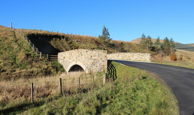
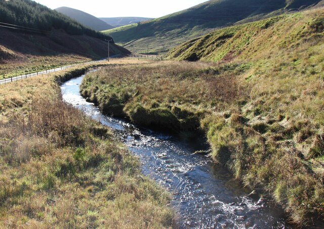
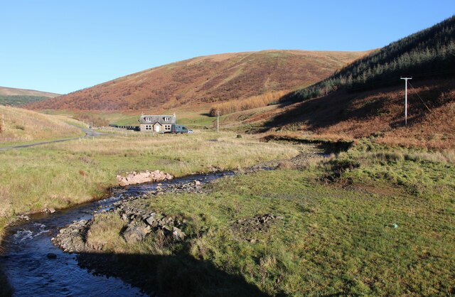
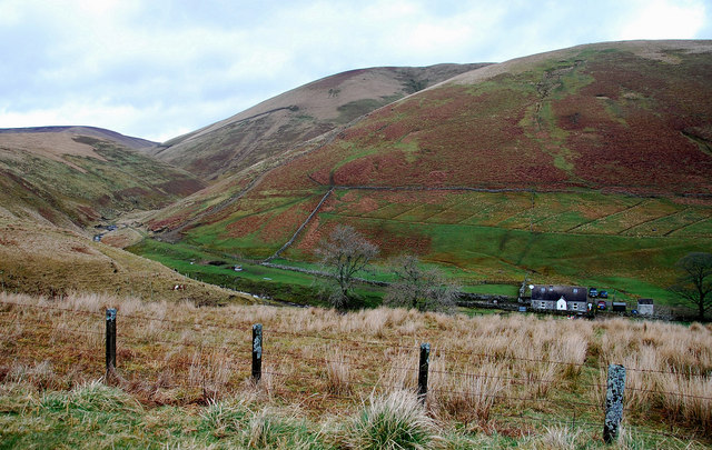
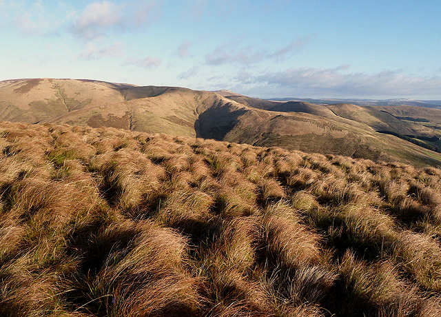
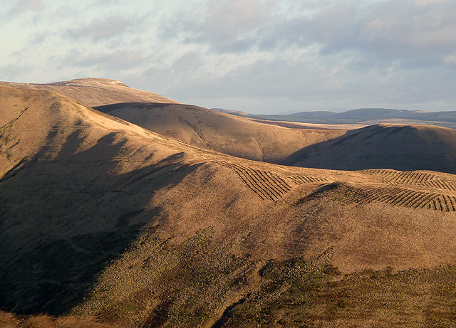
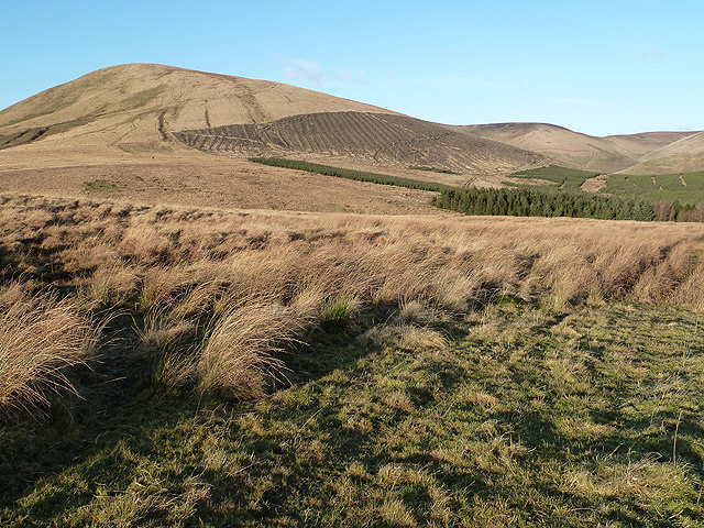
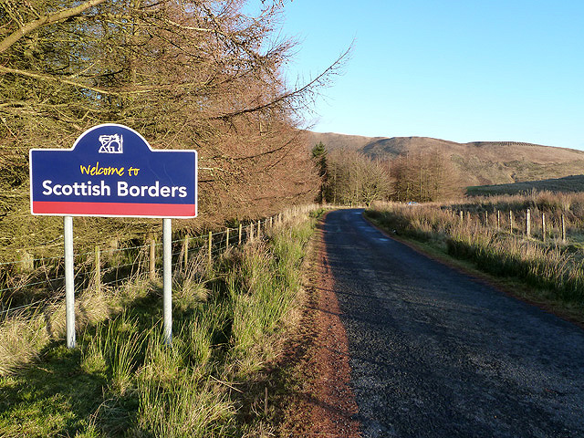
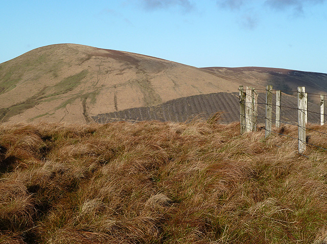
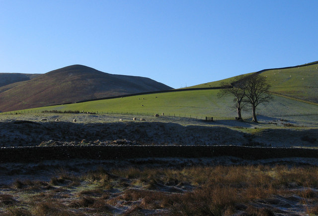
Kiln Brae is a picturesque area located in Roxburghshire, Scotland. Situated amidst the stunning Downs and Moorland landscapes, this region offers breathtaking views and natural beauty. The area is renowned for its tranquil atmosphere, making it an ideal destination for nature lovers and those seeking peace and relaxation.

The landscape of Kiln Brae is characterized by rolling hills covered in lush greenery. The Downs provide a gentle undulating terrain, while the Moorland showcases wild, open spaces. The combination of these two distinct terrains creates a unique and diverse environment, attracting a wide variety of flora and fauna.

Visitors to Kiln Brae can expect to be surrounded by an abundance of wildlife. The area is home to a range of bird species, including curlews, lapwings, and pheasants. Nature enthusiasts will also find various mammals, such as hares and roe deer, roaming freely in these unspoiled surroundings.

Hiking and walking are popular activities in Kiln Brae, with numerous trails and paths available for exploration. These routes offer panoramic views of the surrounding countryside, providing an opportunity to appreciate the natural beauty of the area up close. The tranquility and peacefulness of Kiln Brae make it an ideal spot for picnics and outdoor leisure activities.

In summary, Kiln Brae in Roxburghshire offers a stunning combination of Downs and Moorland landscapes, providing a haven for nature lovers. With its diverse wildlife, breathtaking views, and peaceful atmosphere, this region is a must-visit destination for those seeking a true escape into nature.

If you have any feedback on the listing, please let us know in the comments section below.

Kiln Brae Images

Images are sourced within 2km of 55.253937/-2.8761935 or Grid Reference NY4495. Thanks to Geograph Open Source API. All images are credited.

Bridge Over Billhope Burn
Billhope Burn Road leads to Hermitage.
Billhope Burn
Road leads to Hermitage.
Billhope Burn and cottage
Billhope Burn Cottage tucked away under the slopes of Stob Fell and beside Billhope Burn.
Pretty location. Good track takes you north on to the fells to Pennygant Hill and Cauldcleugh Head,(619 m), which is classed as a Graham.
Billhope Burn
Cottage tucked away under the slopes of Stob Fell and beside Billhope Burn. Pretty location. Good track takes you north on to the fells to Pennygant Hill and Cauldcleugh Head,(619 m), which is classed as a Graham.
Rough grazing on Geordie's Hill This is near the summit of the hill looking over to Stob Fell.
Rough grazing on Geordie's Hill
This is near the summit of the hill looking over to Stob Fell.
New forestry planting on Stob-cleuch Edge This was viewed from Geordie’s Hill in early December.
New forestry planting on Stob-cleuch Edge
This was viewed from Geordie’s Hill in early December.
A building at Twislehope Hope This former shepherd’s cottage by the Twislehope Burn is now used as a storage building by the local farmer.
A building at Twislehope Hope
This former shepherd’s cottage by the Twislehope Burn is now used as a storage building by the local farmer.
An old building at Twislehope Hope This former shepherd’s cottage by the Twislehope Burn is now used as a storage building by the local farmer. For a wider view of the building, see <a href="https://www.geograph.org.uk/photo/3258891">NY4395 : A building at Twislehope Hope</a>.
An old building at Twislehope Hope
This former shepherd’s cottage by the Twislehope Burn is now used as a storage building by the local farmer. For a wider view of the building, see NY4395 : A building at Twislehope Hope.
A detail on the building at Twislehope Hope A rusting cast iron hopper head on the right is the remnant of a rain water downpipe system while the cast iron pipe on the left is a vent pipe that would have served a toilet. This former shepherd’s cottage is now used as a storage building by the local farmer. For a wider view of the building, see <a href="https://www.geograph.org.uk/photo/3258891">NY4395 : A building at Twislehope Hope</a>.
A detail on the building at Twislehope Hope
A rusting cast iron hopper head on the right is the remnant of a rain water downpipe system while the cast iron pipe on the left is a vent pipe that would have served a toilet. This former shepherd’s cottage is now used as a storage building by the local farmer. For a wider view of the building, see NY4395 : A building at Twislehope Hope.
A building at Twislehope Hope This former shepherd’s cottage by the Twislehope Burn is now used as a storage building by the local farmer. For a wider view of the building, see <a href="https://www.geograph.org.uk/photo/3258891">NY4395 : A building at Twislehope Hope</a>.
A building at Twislehope Hope
This former shepherd’s cottage by the Twislehope Burn is now used as a storage building by the local farmer. For a wider view of the building, see NY4395 : A building at Twislehope Hope.
A timber safe lintel at Twislehope Hope In old traditional stone-built buildings timber lintels were often used behind an outer stone lintel to support stonework over door and window openings. Sometimes these wooden beams are riddled with woodworm and can look anything but safe. For a view of the building by the Twislehope Burn, see <a href="https://www.geograph.org.uk/photo/3258891">NY4395 : A building at Twislehope Hope</a>.
A timber safe lintel at Twislehope Hope
In old traditional stone-built buildings timber lintels were often used behind an outer stone lintel to support stonework over door and window openings. Sometimes these wooden beams are riddled with woodworm and can look anything but safe. For a view of the building by the Twislehope Burn, see NY4395 : A building at Twislehope Hope.
Guile Sike Sheep are grazing on the lower western slopes of Dog Knowe at Guile Sike. The two fir trees are an unusual sight in an area of rounded grassy hills.
Guile Sike
Sheep are grazing on the lower western slopes of Dog Knowe at Guile Sike. The two fir trees are an unusual sight in an area of rounded grassy hills.
Dog Knowe The photographer is at the 365m summit of this small hill above Twislehope Hope with Din Fell in the background centre right. The hills in this area are grazed by sheep.
Dog Knowe
The photographer is at the 365m summit of this small hill above Twislehope Hope with Din Fell in the background centre right. The hills in this area are grazed by sheep.
Carewood Rig An area of rough grazing with Tudhope Hill in the background to the left.
Carewood Rig
An area of rough grazing with Tudhope Hill in the background to the left.
Welcome to Scottish Borders This sign is by the minor road from Fiddleton at the A7 to Hermitage at the B6399. The plantation on the left is at Billhope Hass.
Welcome to Scottish Borders
This sign is by the minor road from Fiddleton at the A7 to Hermitage at the B6399. The plantation on the left is at Billhope Hass.
Geordie's Hill This is at the summit area of the hill looking over to Tudhope Hill.
Geordie's Hill
This is at the summit area of the hill looking over to Tudhope Hill.
Field beside the Twislehope Burn The field is on the foot of the east ridge of Geordie's Hill and has according to OS mapping an ancient settlement within, or partly within it. Cockplay Hill lies at the left side of the image in the valley of the Twislehope Burn.
Field beside the Twislehope Burn
The field is on the foot of the east ridge of Geordie's Hill and has according to OS mapping an ancient settlement within, or partly within it. Cockplay Hill lies at the left side of the image in the valley of the Twislehope Burn.
Slope north of Haregrain Rig A view north-west from an estate road on Haregrain Rig has the deeply shadowed valley of Caulker Grain at the left side of the image with Ewe Hill rising above it to the right.
Slope north of Haregrain Rig
A view north-west from an estate road on Haregrain Rig has the deeply shadowed valley of Caulker Grain at the left side of the image with Ewe Hill rising above it to the right.
Show me another place!

Kiln Brae is located at Grid Ref: NY4495 (Lat: 55.253937, Lng: -2.8761935)

Unitary Authority: The Scottish Borders

Police Authority: The Lothians and Scottish Borders

What 3 Words

///threaded.discouraged.vibes. Near Teviothead, Scottish Borders

Related Wikis

Dinley

Dinley is a hamlet in the Scottish Borders through which Hermitage Water flows. == Etymology == The first element, din, seems to be the Cumbric word for...

Cauldcleuch Head

Cauldcleuch Head is a hill in an unnamed range of Roxburghshire hills north of Langholm, part of the Southern Uplands of Scotland. The highest hill in...

Hermitage Castle

Hermitage Castle is a semi-ruined castle in the border region of Scotland. It is under the care of Historic Scotland. The castle has a reputation, both...

Unthank, Dumfries and Galloway

Unthank is a village in Dumfries and Galloway, Scotland. == References == The geographic coordinates are from the Ordnance Survey.

Related Videos

Christmas Sale | Secret Santa Gifts 2021 Collection | Annova

Christmas is a magical time of the year. In fact, it is not just one day, but the festivity runs the whole month. The time when family ...

Rebrand Launch Video | New Website | Rebrand Launch Video | Annova Biz

For years, Annova has partner up with top brands, To provide the best to their customers In Health Care In Personal Care and ...

Gift Ideas For Friendship Day | Friendship Day 2021 | Friendship Day Gifts | Friendship Day Special

Having a good friend is a blessing, and this friendship it's a perfect time to Thank that Friend for ALWAYS BEING THERE !! With a ...

Nearby Amenities

Located within 500m of 55.253937,-2.8761935
Twislehope
Place: hamlet
Lat/Long: 55.2560434/-2.8712294
Ford: yes
Lat/Long: 55.2559095/-2.8772733
Ford: yes
Lat/Long: 55.2527094/-2.8735502
Kiln Brae
Place: locality
Lat/Long: 55.2542555/-2.8741257
Ford: yes
Lat/Long: 55.2554668/-2.8725558
Power: pole
Lat/Long: 55.2568013/-2.8705242
Power: pole
Lat/Long: 55.256317/-2.8714976
Power: pole
Lat/Long: 55.2566326/-2.8723705
The data included in this document is from www.openstreetmap.org. The data is made available under ODbL.

Have you been to Kiln Brae?

Leave your review of Kiln Brae below (or comments, questions and feedback).