Chester Hill

Hill, Mountain in Fife

Scotland

Chester Hill

Bus stop on Boat Road
Bus stop on Boat Road Credit: Mark Anderson

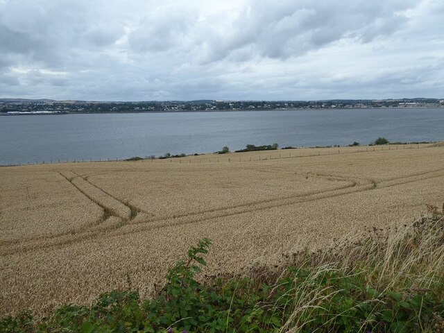
Chester Hill is a prominent hill located in the county of Fife, Scotland. It is situated near the village of Chester, about 5 miles northeast of the town of Cupar. Rising to an elevation of approximately 287 meters (941 feet), it offers breathtaking panoramic views of the surrounding countryside.

Chester Hill is primarily composed of sandstone, which gives it a distinct reddish hue. Its slopes are covered with heather, grasses, and scattered patches of woodland, creating a picturesque landscape. The hill is a popular destination for hikers, nature enthusiasts, and photographers, who are drawn to its natural beauty and tranquility.

At the summit of Chester Hill, there is a trig point that acts as a marker for surveying purposes. This point offers a commanding view of the Fife coastline, as well as the neighboring hills of East Lomond and West Lomond. On a clear day, one can even catch a glimpse of the famous Forth Rail Bridge in the distance.

The hill is home to a variety of wildlife, including birds such as buzzards, kestrels, and pheasants. The surrounding fields and hedgerows provide habitat for rabbits, foxes, and other small mammals. Additionally, the hill serves as a wonderful spot for birdwatching, with many different species being spotted throughout the year.

Overall, Chester Hill is a natural gem in the heart of Fife, offering both recreational opportunities and a chance to immerse oneself in the beauty of Scotland's countryside.

If you have any feedback on the listing, please let us know in the comments section below.

Chester Hill Images

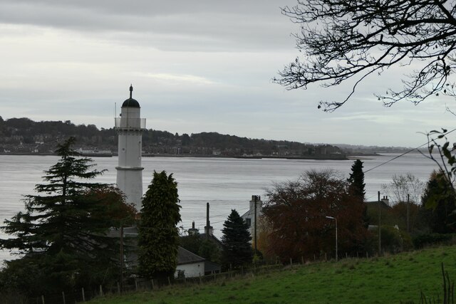
Images are sourced within 2km of 56.437581/-2.915646 or Grid Reference NO4327. Thanks to Geograph Open Source API. All images are credited.

Bus stop on Boat Road
Cut Bench Mark, Tay Street junction with William Street Bench Mark Database: <span class="nowrap"><a title="https://www.bench-marks.org.uk/bm157793" rel="nofollow ugc noopener" href="https://www.bench-marks.org.uk/bm157793">Link</a><img style="margin-left:2px;" alt="External link" title="External link - shift click to open in new window" src="https://s1.geograph.org.uk/img/external.png" width="10" height="10"/></span>
Cut Bench Mark, Tay Street junction with William Street
Bench Mark Database: LinkExternal link
William Street viewed from Tay Street There is a cut bench mark on the corner of the wall to the left of the photograph and a closer view can be seen here: <a href="https://www.geograph.org.uk/photo/6999161">NO4228 : Cut Bench Mark, Tay Street junction with William Street</a>.
William Street viewed from Tay Street
There is a cut bench mark on the corner of the wall to the left of the photograph and a closer view can be seen here: NO4228 : Cut Bench Mark, Tay Street junction with William Street.
Newport Bowling Club, Newport on Tay
The Tay Road Bridge Walking on the Tay Road Bridge towards Dundee.
The Tay Road Bridge
Walking on the Tay Road Bridge towards Dundee.
Access ramp to the central walkway on the Tay Road Bridge The central walkway is reserved for cyclists and pedestrians and serves as part of National Cycle Network route 1. At the south end, the walkway is accessed by ramp, but at the north end it is by lift or stairs. The roundabout on the A92 can be seen beyond.
Access ramp to the central walkway on the Tay Road Bridge
The central walkway is reserved for cyclists and pedestrians and serves as part of National Cycle Network route 1. At the south end, the walkway is accessed by ramp, but at the north end it is by lift or stairs. The roundabout on the A92 can be seen beyond.
Memorial at the Tay Road Bridge car park Memorial to the five men who died during the construction of the Forth Road Bridge. Although still a hazardous occupation, Health and Safety regulations ensure a much lower casualty rate on civil engineering projects than once held - compare with the 73 men who died during the construction of the Forth (Rail) Bridge <a href="https://www.geograph.org.uk/photo/2961837">NT1380 : Forth Bridge Memorial</a>.
Memorial at the Tay Road Bridge car park
Memorial to the five men who died during the construction of the Forth Road Bridge. Although still a hazardous occupation, Health and Safety regulations ensure a much lower casualty rate on civil engineering projects than once held - compare with the 73 men who died during the construction of the Forth (Rail) Bridge NT1380 : Forth Bridge Memorial.
Sculpture at the Tay Road Bridge The sculpture "Distant perspectives, perspective distance" stands beside the B946 where it passes under the south end of the Tay Road Bridge.
Sculpture at the Tay Road Bridge
The sculpture "Distant perspectives, perspective distance" stands beside the B946 where it passes under the south end of the Tay Road Bridge.
Cycle path near the Tay Road Bridge At this point both the National Cycle Network route 1 and the Fife Coastal Path run on the footway beside the B946 between the Tay Road Bridge and Tayport, giving fine views of the Firth of Tay.
Cycle path near the Tay Road Bridge
At this point both the National Cycle Network route 1 and the Fife Coastal Path run on the footway beside the B946 between the Tay Road Bridge and Tayport, giving fine views of the Firth of Tay.
Hillside above the Firth of Tay A mast for a TV relay station in the middle distance, the Tay Road Bridge beyond.
Hillside above the Firth of Tay
A mast for a TV relay station in the middle distance, the Tay Road Bridge beyond.
Field of wheat above the Firth of Tay
Walkers and cyclist on path above Tayport At this point both National Cycle Network route 1 and the Fife Coastal Path follow the track of an old railway leading down from the Tay Road Bridge into Tayport.
Walkers and cyclist on path above Tayport
At this point both National Cycle Network route 1 and the Fife Coastal Path follow the track of an old railway leading down from the Tay Road Bridge into Tayport.
Stile, North Hill There is a deer fence here.
Stile, North Hill
There is a deer fence here.
Track, North Hill
Track, North Hill
Taj Home food delivery business near Forgan Roundabout
Taj
Home food delivery business near Forgan Roundabout
West Lighthouse on Firth of Tay Taken from the Fife Coastal Path.
West Lighthouse on Firth of Tay
Taken from the Fife Coastal Path.
Tay Road Bridge "The Tay Road Bridge is 2250m in length and spans the estuary of the river Tay between Dundee and Newport-on-Tay. The bridge was designed by William A Fairhurst and took three years to build between 1963 and 1966 at a cost of £4.8m. The main contractor was Duncan Logan (Contractors) Ltd of Muir of Ord.

The main structure comprises 42 spans the majority of which are 55m in length increasing to 76.3m at the four navigation channels and reducing to 24.4m at the Dundee end.

The roadway comprises dual carriageways 6.7m wide with a 3m wide central walkway/cycleway and rises at a gradient of 1 in 81 from a height of 9.7m above sea level at the Dundee end to 38m at the Fife end to provide clearance at the navigation channels.

Concrete piers in the river support twin concrete columns of parabolic shape that vary in height from 5.5m at the Dundee end to 30.5m at the Fife end. The twin columns support twin hollow steel box girders 3.65m wide and 3m deep, which in turn support a 300mm thick composite concrete slab carrying the roadway.

At the Dundee end of the main structure traffic was collected and discharged via four elevated curved and spiral reinforced concrete ramps supported on concrete columns with a total elevated length of approximately 500m."

(The above information is from <span class="nowrap"><a title="https://www.tayroadbridge.co.uk/about/history" rel="nofollow ugc noopener" href="https://www.tayroadbridge.co.uk/about/history">Link</a><img style="margin-left:2px;" alt="External link" title="External link - shift click to open in new window" src="https://s1.geograph.org.uk/img/external.png" width="10" height="10"/></span> accessed 8th June 2022)
Tay Road Bridge
"The Tay Road Bridge is 2250m in length and spans the estuary of the river Tay between Dundee and Newport-on-Tay. The bridge was designed by William A Fairhurst and took three years to build between 1963 and 1966 at a cost of £4.8m. The main contractor was Duncan Logan (Contractors) Ltd of Muir of Ord. The main structure comprises 42 spans the majority of which are 55m in length increasing to 76.3m at the four navigation channels and reducing to 24.4m at the Dundee end. The roadway comprises dual carriageways 6.7m wide with a 3m wide central walkway/cycleway and rises at a gradient of 1 in 81 from a height of 9.7m above sea level at the Dundee end to 38m at the Fife end to provide clearance at the navigation channels. Concrete piers in the river support twin concrete columns of parabolic shape that vary in height from 5.5m at the Dundee end to 30.5m at the Fife end. The twin columns support twin hollow steel box girders 3.65m wide and 3m deep, which in turn support a 300mm thick composite concrete slab carrying the roadway. At the Dundee end of the main structure traffic was collected and discharged via four elevated curved and spiral reinforced concrete ramps supported on concrete columns with a total elevated length of approximately 500m." (The above information is from LinkExternal link accessed 8th June 2022)
Show me another place!

Chester Hill is located at Grid Ref: NO4327 (Lat: 56.437581, Lng: -2.915646)

Unitary Authority: Fife

Police Authority: Fife

What 3 Words

///skinny.clutches.lame. Near Newport-on-Tay, Fife

Nearby Locations

Chester Hill

Related Wikis

Newport-on-Tay East railway station

Newport-on-Tay East railway station formerly served the town of Newport-on-Tay, Fife, Scotland. The station closed in 1969. == Tayport branch == Newport...

Newport-on-Tay

Newport-on-Tay is a town in the north-east of Fife in Scotland. The Fife Coastal Path passes through Newport-on-Tay. The area itself has views of the two...

Forgan (Fife)

Forgan is a civil parish in the Scottish county of Fife. It extends 4 miles in length along the north coast of Fife and is at the southern mouth of the...

Newport-on-Tay West railway station

Newport-on-Tay West railway station served the town of Newport-on-Tay, Fife, Scotland, from 1879 to 1969 on the Newport Railway. == History == The station...

Nearby Amenities

Located within 500m of 56.437581,-2.915646
Barrier: stile
Lat/Long: 56.4343916/-2.9187971
Hermit's Cave
Natural: cave_entrance
Lat/Long: 56.4406988/-2.9120589
Power: pole
Lat/Long: 56.4399919/-2.9214533
Power: pole
Lat/Long: 56.439371/-2.9212968
Power: pole
Lat/Long: 56.4382279/-2.9188237
Power: pole
Lat/Long: 56.4385673/-2.9197091
Power: pole
Lat/Long: 56.4371469/-2.9164237
Power: pole
Lat/Long: 56.4367135/-2.9155017
Power: pole
Lat/Long: 56.4361627/-2.9146718
Power: pole
Lat/Long: 56.4357625/-2.9140878
Power: pole
Lat/Long: 56.4349163/-2.913925
Power: pole
Lat/Long: 56.4340719/-2.9137569
Power: pole
Lat/Long: 56.4332725/-2.9136029
Power: pole
Lat/Long: 56.4360213/-2.9225742
Power: pole
Lat/Long: 56.4363014/-2.921778
Power: pole
Lat/Long: 56.4366113/-2.9208883
Power: pole
Lat/Long: 56.4369172/-2.9200267
Power: pole
Lat/Long: 56.4373422/-2.9188233
Power: pole
Lat/Long: 56.4377398/-2.9176358
The data included in this document is from www.openstreetmap.org. The data is made available under ODbL.

Have you been to Chester Hill?

Leave your review of Chester Hill below (or comments, questions and feedback).